

Surf Forecasts:

La Zurda surf forecast from 21 Jul 2026:
- Best quality surf: Sunday 26 Jul, 1AM (local time) - 1.5ft (0.5m), 19s period, S swell with cross-offshore winds.
- Most powerful swell: Sunday 26 Jul, 1AM (local time) - 1.5ft (0.5m), 19s period, S swell with 192 kJ wave energy.
- Next surfable swell (1★+): Tuesday 21 Jul, 7AM (local time) - 1ft (0.3m), 12s period with S swell.
Best Forecast Surf Conditions for La Zurda this week:
The surf forecast for La Zurda over the next 16 days: The first swell (rated 1 star or higher) is forecast to arrive on Tuesday (Jul 21) at 7AM. The primary swell is predicted to be 0.3m and 12s period with a secondary swell of 0.3m and 7s. The wind is predicted to be glassy as the swell arrives.
The most powerful waves expected at La Zurda in the next 16 days are 0.5m 19s and forecast to arrive on Sunday (Jul 26) at 1AM. Winds are predicted to be cross-offshore at the time the swell arrives. The largest open ocean swell (not directed at the beach) is 0.4m 3s period and expected on Saturday (Jul 25) at 4AM.
| Wave Type | Time (EST) & Date | Wave Height & Period |
|---|---|---|
| Next good surf (1 star+) | 7AM (Tue 21st Jul) | 1ft (0.3m) 12s |
| Best Surf | 1AM (Sun 26th Jul) | 1.5ft (0.5m) 19s |
| Most Powerful | 1AM (Sun 26th Jul) | 1.5ft (0.5m) 19s |
Table - best surf conditions forecast for La Zurda over the next 16 days.
The Lowdown
Alright folks, Rusty here. Let’s get real about this stretch.
First thing you need to know: the surf window is pretty much a write-off for the first few days. We’re looking at tiny, weak waves with poor surf conditions and scores to match. You’ll be sitting on a flat, glassy lake for the start of the run. Don’t even bother checking the beach until Thursday, 24 July.
That Thursday morning, the 24th, things start to flicker. La Zurda, a reef break for advanced surfers, finally sees a pulse of energy. The swell direction is out of the SSE, with a 1 foot wave and a very long period of 24 seconds. That’s serious groundswell, and it’s hitting the exposed reef, so expect long lines and longer waits between sets. The combined energy is moderate, hitting 118 (moderate energy). The wind is glassy, 3 mph from the NNW, which is offshore for this spot. It’s not big, but it’s clean. The water temperature is about average for the time of year, nothing wild.
Friday 25 July morning is a step up. The swell bumps to 1 feet from the SSE, with a period of 21 seconds, still that long-period groundswell. The combined energy is 179 (moderate energy). Again, glassy conditions with a light westerly breeze. This is the best on offer in the first week. It’s still small, but for a reef break with that kind of period and clean wind, it’s a genuine standout. The crowd factor is “sometimes,” so you might have company, but it’s not a zoo.
From Saturday 26 July through to the end of the month, the swell stays in the 1 foot to 2 foot range, mostly from the S or SSE, with periods dropping from 19 seconds to 15 seconds. The combined energy fluctuates but stays in the moderate range, peaking at 199 (moderate energy) on Tuesday 28 July afternoon. Winds are mostly offshore or glassy, keeping things clean. It’s surfable, but very ordinary. The energy is there, but the wave height is holding us back.
The first week of August sees a similar story. The 4th of August Tuesday morning shows a 1 foot, 14-second period swell from the S, with combined energy of 111 (moderate energy) and glassy conditions. The afternoon of the 4th jumps to 2 feet from the SSW, 13-second period, with combined energy of 188 (moderate energy). That’s the best of the back half. Still small, but clean.
The 5th of August Wednesday morning, the last entry, shows 1 feet, 12-second period from the S, with offshore winds and clean conditions. The energy is weak at 60 (weak energy). It’s a quiet finish.
The highlight here is honest: the 1 foot, 21-second period swell on Friday 25 July morning. It’s the cleanest, most promising session in the whole run. The long period means the reef will handle it well, and the glassy offshore wind will make it look like a postcard. Just don’t expect to get pitted.
Rusty out.
Short Range ForecastHeavy rain (total 67mm), heaviest during Thu afternoon. Warm (max 28°C on Tue morning, min 23°C on Thu afternoon). Wind will be generally light. | Days 4-6 Weather SummaryHeavy rain (total 36mm), heaviest during Sun afternoon. Warm (max 29°C on Sat morning, min 24°C on Thu night). Wind will be generally light. | ||||||||||||||||||||
Tuesday 21 | Wednesday 22 | Thursday 23 | Friday 24 | Saturday 25 | Sunday 26 | Monday 27 | |||||||||||||||
AM | PM | Night | AM | PM | Night | AM | PM | Night | AM | PM | Night | AM | PM | Night | AM | PM | Night | AM | PM | Night | |
Swell Height Map |  |  |  | 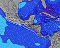 | 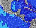 | 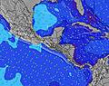 | 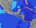 | ||||||||||||||
Wave Height (m) Direction Period (s) | S 12 | S 13 | S 12 | S 13 | S 11 | S 12 | S 11 | S 26 | S 26 | SSE 24 | SSE 24 | SSE 22 | SSE 21 | SSE 21 | S 19 | SSE 19 | S 19 | SSE 18 | S 18 | SSE 19 | S 19 |
Wave Graph | |||||||||||||||||||||
25 | 14 | 26 | 13 | 23 | 11 | 10 | 13 | 53 | 108 | 108 | 91 | 153 | 89 | 192 | 125 | 109 | 104 | 104 | 124 | 114 | |
Wind (km/h) | |||||||||||||||||||||
Wind State on-shore cross-onshore cross-shore cross-offshore off-shore glassy | glassy | glassy | cross-off | cross-off | glassy | cross-off | cross-off | glassy | cross-off | glassy | cross-off | off | glassy | glassy | cross-off | cross-off | off | cross-off | cross-off | off | glassy |
High Tide | 9:01AM4.40m | 9:29PM3.95m | 9:50AM4.13m | 10:24PM3.71m | 10:44AM3.90m | 11:24PM3.55m | 11:43AM3.77m | 00:29AM3.50m | 12:44PM3.74m | 1:31AM3.56m | 1:42PM3.82m | 2:26AM3.71m | 2:34PM3.97m | 3:13AM3.91m | |||||||
Low Tide | 3:13PM1.00m | 3:26AM1.20m | 4:06PM1.21m | 4:20AM1.46m | 5:06PM1.36m | 5:22AM1.62m | 6:11PM1.41m | 6:29AM1.66m | 7:14PM1.34m | 7:32AM1.59m | 8:08PM1.19m | 8:25AM1.44m | 8:56PM1.01m | ||||||||
6:07 | — | — | 6:07 | — | — | 6:07 | — | — | 6:07 | — | — | 6:07 | — | — | 6:07 | — | — | 6:07 | — | — | |
— | 6:40 | — | — | 6:40 | — | — | 6:40 | — | — | 6:40 | — | — | 6:40 | — | — | 6:39 | — | — | 6:39 | — | |
mm | 1 | 14 | 2 | 9 | 13 | 3 | 9 | 15 | — | 1 | 4 | 8 | 1 | 7 | — | 7 | 8 | 2 | 5 | 32 | 6 |
Temp °C | 28 | 27 | 25 | 28 | 27 | 25 | 25 | 24 | 24 | 28 | 26 | 25 | 29 | 28 | 25 | 28 | 27 | 25 | 28 | 25 | 24 |
Feels °C | 32 | 32 | 29 | 31 | 32 | 29 | 29 | 28 | 28 | 32 | 30 | 29 | 33 | 33 | 29 | 32 | 31 | 29 | 31 | 29 | 28 |
Swell 1 Height (m) Direction Period (s) | S 12 | S 13 | S 12 | S 13 | S 11 | S 12 | S 11 | S 10 | SSW 7 | SSW 6 | S 7 | SSE 22 | SSE 21 | SSE 21 | S 19 | SSE 19 | S 19 | SSE 18 | S 18 | SSE 19 | S 19 |
25 | 14 | 26 | 13 | 23 | 11 | 10 | 7 | 9 | 8 | 8 | 91 | 153 | 89 | 192 | 125 | 109 | 104 | 104 | 124 | 114 | |
Swell 2 Height (m) Direction Period (s) | S 6 | S 6 | S 6 | S 11 | S 6 | S 6 | S 6 | S 13 | S 26 | SSE 24 | SSE 24 | S 7 | S 11 | S 8 | S 11 | S 11 | S 7 | SSW 6 | SSW 6 | S 6 | S 9 |
7 | 3 | 3 | 9 | 3 | 3 | 1 | 3 | 53 | 108 | 108 | 8 | 21 | 10 | 21 | 20 | 8 | 8 | 7 | 3 | 7 | |
Swell 3 Height (m) Direction Period (s) | S 15 | S 11 | — | S 6 | S 21 | S 20 | S 19 | S 26 | S 13 | S 10 | S 12 | S 12 | S 16 | S 11 | S 15 | S 14 | S 10 | S 10 | S 10 | S 10 | S 12 |
4 | 9 | — | 3 | 9 | 7 | 7 | 13 | 3 | 2 | 11 | 3 | 5 | 10 | 4 | 4 | 8 | 8 | 8 | 7 | 12 | |
Wind waves Height (m) Direction Period (s) | — | — | — | NW 3 | — | — | — | — | — | NNW 3 | — | — | — | — | — | — | — | — | NNW 2 | — | NW 3 |
— | — | — | 1 | — | — | — | — | — | 2 | — | — | — | — | — | — | — | — | 1 | — | 2 | |
Nearest Offshore or Glassy | |||||||||||||||||||||
Distance (km) | 64 | 69 | 62 | 69 | 290 | 62 | 175 | 62 | 0 | 0 | 0 | 0 | 0 | 0 | 0 | 0 | 0 | 0 | 0 | 0 | 0 |
Best forecast wave conditions in Gulf of Panama | |||||||||||||||||||||
Best forecast wave conditions in Panama | |||||||||||||||||||||
Header Global | |||||||||||||||||||||
- Map Icons:
 Break
Break Live Wave Height (m)
 Live Wind Speed (km/h)
 Surf Rating (10 Max)
 Ocean Swells (m)
- Wind Speed (km/h)


FREE! Surf-Forecast.com widget for your website
The surf report / weather widget below is available to embed on third party websites free of charge and provides a summary of our La Zurda surf forecast. Simply grab the html code snippet that we provide and paste it into your own site. You can choose your preferred language and metric/imperial units for the surf forecast feed to suit users of your site. Click here to get the code.
Information about the La Zurda Surf forecast
The above surf forecast table for La Zurda provides essential information for determining whether the surfing conditions will be good over the next 16 days. A general guide to surfing at La Zurda can be found by selecting the local surf guide option on the grey menu. Our La Zurda surf forecast is unique since it includes wave energy (power) that defines the real feel of the surf rather than just the height or the period. If you surf the same spot (La Zurda) regularly then make a mental note of the wave energy from the surf forecast table each time you go. Very soon you may start to choose your surf days based on the wave energy alone combined with our forecast of favourable offshore wind conditions. Our star ratings will help here and of course you will also find the usual wave height and period predictions on our surf forecasts as well as a full break down of the swell components under our advanced users option (to reveal that, click the little Einstein character under the tide times).
Further information to help with frequently asked questions about our surf forecast for La Zurda may be found under the help tab on the top menu and also by moving your mouse over the question marks on the surf forecast table itself. Please always bear in mind that the forecast is for near-shore open water and local factors at each surf break influence the actual breaking wave height, such as the beach / reef profile, water depths offshore and shelter.
La Zurda is 2 km (1 miles) from the city of Panama. If you plan a holiday in Gulf of Panama, look for hotels and other accommodation in Panama. Panama has rooms for a wide range of budgets as well as car hire and transport links.
 Nearest