

Surf Forecasts:

Quatro-Once (411) surf forecast from 3 Aug 2026:
- Best quality surf: Friday 7 Aug, 10AM (local time) - 3.5ft (1.1m), 13s period, SW swell with glassy winds.
- Most powerful swell: Saturday 8 Aug, 1PM (local time) - 4.5ft (1.4m), 16s period, SSW swell with 945 kJ wave energy.
- Next surfable swell (1★+): Monday 3 Aug, 10AM (local time) - 2ft (0.6m), 14s period with SW swell.
Best Forecast Surf Conditions for Quatro-Once (411) this week:
The surf forecast for Quatro-Once (411) over the next 16 days: The first swell (rated 1 star or higher) is forecast to arrive on Monday (Aug 03) at 10AM. The primary swell is predicted to be 0.6m and 14s period with a secondary swell of 0.8m and 8s. The wind is predicted to be glassy as the swell arrives.
The most powerful waves expected at Quatro-Once (411) in the next 16 days are 1.4m 16s and forecast to arrive on Saturday (Aug 08) at 1PM. Winds are predicted to be cross-offshore at the time the swell arrives. The largest open ocean swell (not directed at the beach) is 0.6m 4s period and expected on Sunday (Aug 09) at 7PM.
| Wave Type | Time (EST) & Date | Wave Height & Period |
|---|---|---|
| Next good surf (1 star+) | 10AM (Mon 3rd Aug) | 2ft (0.6m) 14s |
| Best Surf | 10AM (Fri 7th Aug) | 3.5ft (1.1m) 13s |
| Most Powerful | 1PM (Sat 8th Aug) | 4.5ft (1.4m) 16s |
Table - best surf conditions forecast for Quatro-Once (411) over the next 16 days.
The Lowdown
Alright folks, Rusty here. Let’s get into it.
The next 16 days are looking pretty good for Quatro-Once (411). This is a consistent point break that’s exposed to the swell, so it handles a lot of what the ocean throws at it. The water temp is about average for this time of year, so nothing weird there.
The first real action is Monday morning, August 3rd. We’re looking at glassy, slight air conditions with a 2ft swell from the southwest, period 14 seconds. That’s a long-period groundswell, so the waves will have some push and shape, but it’s not huge. The combined energy is moderate (312). It’s a slow start, but the wind is dead calm, so it’s clean.
Tuesday morning, August 4th, is a real standout. It’s glassy with zero wind, a 3ft swell from the south-southwest, period 9 seconds, and combined energy of 279 (moderate). That’s the best early call. The swell is small but the conditions are perfect. It’s a beginner-friendly wave, so it’s a great morning for a longboard or a funboard.
Friday morning, August 7th, is the next big one. The swell jumps to 4ft from the southwest, period 13 seconds, and the combined energy hits 648 (strong). The wind is glassy from the east-northeast. This is a serious session. The waves will have real power, and the lineup should be clean. The crowd is listed as “sometimes,” so you might have a few others out, but it won’t be packed.
Saturday, August 8th, keeps the run going. The morning is 4ft from the southwest, period 16 seconds, combined energy 823 (strong). The wind is cross-off, so it’s clean. The afternoon is even better: 4ft from the south-southwest, period 15 seconds, combined energy 791 (strong), and the wind goes glassy. That’s a top-tier afternoon. The swell direction matches the optimum (SSW), and the period is long enough to give you proper lines down the point. This is the best on offer in the whole outlook.
Sunday, August 9th, is still very good. The morning is 4ft from the southwest, period 14 seconds, combined energy 638 (strong), with glassy wind. The afternoon holds up too, with 4ft and clean conditions.
The second week settles into a more consistent, smaller pattern. From Monday, August 10th, through to Sunday, August 17th, you’ll see waves between 2ft and 4ft, mostly from the southwest or south-southwest. The periods are long, often 14 to 18 seconds, so the energy is there. The wind is usually offshore, cross-off, or glassy, so the surf stays clean. The combined energy is mostly in the strong range (350-834). It’s a solid run of fun, rideable waves, especially for a point break.
The last day in the forecast, Tuesday morning, August 18th, is a nice closer: 4ft from the south-southwest, period 14 seconds, combined energy 519 (strong), and glassy wind. That’s a good way to finish.
Overall, the highlight is the Saturday afternoon on August 8th. Head out then and you’ll be smiling.
Stay safe, Rusty.
Short Range ForecastHeavy rain (total 54mm), heaviest during Wed afternoon. Warm (max 29°C on Mon morning, min 24°C on Wed afternoon). Wind will be generally light. | Days 4-6 Weather SummaryLight rain (total 9mm), mostly falling on Fri night. Warm (max 30°C on Fri morning, min 25°C on Wed night). Wind will be generally light. | ||||||||||||||||||||
Monday 3 | Tuesday 4 | Wednesday 5 | Thursday 6 | Friday 7 | Saturday 8 | Sunday 9 | |||||||||||||||
AM | PM | Night | AM | PM | Night | AM | PM | Night | AM | PM | Night | AM | PM | Night | AM | PM | Night | AM | PM | Night | |
Swell Height Map |  |  |  | 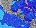 | 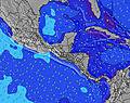 | 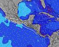 | 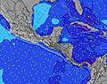 | ||||||||||||||
Wave Height (m) Direction Period (s) | SW 14 | SW 11 | SSW 10 | SSW 9 | SSW 8 | SSW 8 | SSW 7 | SW 15 | SSW 13 | SSW 15 | SSW 11 | SSW 13 | SW 13 | SW 17 | SSW 16 | SW 16 | SSW 15 | SW 14 | SW 14 | SW 14 | SW 13 |
Wave Graph | |||||||||||||||||||||
158 | 126 | 208 | 139 | 91 | 147 | 62 | 59 | 120 | 84 | 140 | 225 | 394 | 439 | 447 | 580 | 791 | 614 | 606 | 456 | 400 | |
Wind (km/h) | |||||||||||||||||||||
Wind State on-shore cross-onshore cross-shore cross-offshore off-shore glassy | glassy | glassy | cross | glassy | on | cross | cross-off | cross-off | cross-on | glassy | cross | glassy | glassy | cross | glassy | cross-off | glassy | cross-on | glassy | cross-off | off |
High Tide | 6:36AM3.35m | 6:51PM3.10m | 7:13AM3.32m | 7:32PM3.00m | 7:53AM3.25m | 8:19PM2.88m | 8:41AM3.15m | 9:16PM2.76m | 9:40AM3.05m | 10:26PM2.68m | 10:50AM2.99m | 11:45PM2.70m | 12:07PM3.02m | 1:02AM2.86m | |||||||
Low Tide | 12:50PM0.56m | 00:57AM0.53m | 1:30PM0.59m | 1:37AM0.64m | 2:16PM0.64m | 2:24AM0.76m | 3:10PM0.71m | 3:20AM0.88m | 4:14PM0.75m | 4:30AM0.97m | 5:27PM0.74m | 5:48AM0.96m | 6:40PM0.63m | ||||||||
6:15 | — | — | 6:15 | — | — | 6:15 | — | — | 6:15 | — | — | 6:15 | — | — | 6:15 | — | — | 6:15 | — | — | |
— | 6:39 | — | — | 6:39 | — | — | 6:39 | — | — | 6:39 | — | — | 6:38 | — | — | 6:38 | — | — | 6:38 | — | |
mm | 7 | 4 | 8 | 6 | 4 | 5 | 8 | 9 | — | — | 1 | — | 1 | — | 3 | 4 | — | 11 | 6 | 3 | — |
Temp °C | 29 | 29 | 27 | 28 | 28 | 27 | 27 | 24 | 25 | 28 | 28 | 26 | 30 | 30 | 27 | 29 | 29 | 27 | 27 | 26 | 26 |
Feels °C | 33 | 34 | 31 | 32 | 32 | 31 | 31 | 28 | 29 | 32 | 32 | 30 | 33 | 34 | 31 | 32 | 34 | 32 | 31 | 30 | 29 |
Swell 1 Height (m) Direction Period (s) | SSW 8 | SSW 8 | SSW 10 | SSW 9 | SSW 8 | SSW 8 | SSW 7 | SSW 7 | SW 6 | SW 6 | SSW 11 | SSW 13 | SW 13 | SSW 12 | SSW 16 | SW 16 | SSW 15 | SW 14 | SW 14 | SW 14 | SW 13 |
69 | 73 | 208 | 139 | 91 | 147 | 62 | 59 | 47 | 39 | 138 | 225 | 394 | 268 | 447 | 580 | 791 | 614 | 606 | 456 | 400 | |
Swell 2 Height (m) Direction Period (s) | SW 14 | SW 11 | SW 13 | SW 13 | SSW 9 | SW 12 | SW 12 | SSW 9 | SSW 13 | SSW 15 | SSW 14 | SSW 10 | SW 18 | SW 17 | SSW 12 | SSW 12 | — | SW 24 | SSW 18 | SSW 18 | SSW 22 |
158 | 126 | 85 | 130 | 35 | 74 | 52 | 35 | 120 | 84 | 140 | 97 | 252 | 439 | 251 | 243 | — | 22 | 32 | 31 | 46 | |
Swell 3 Height (m) Direction Period (s) | SSW 11 | SW 16 | SW 16 | SW 16 | SW 12 | S 14 | SSW 9 | SW 15 | SSW 9 | SSW 12 | SW 12 | SW 18 | S 11 | WSW 6 | WSW 6 | — | — | SW 24 | — | NE 4 | SSW 22 |
85 | 66 | 41 | 10 | 53 | 15 | 32 | 54 | 17 | 45 | 72 | 168 | 2 | 6 | 3 | — | — | 22 | — | 3 | 46 | |
Wind waves Height (m) Direction Period (s) | — | — | WSW 3 | — | — | — | — | — | W 4 | — | — | — | — | — | — | — | — | — | — | NE 4 | NE 4 |
— | — | 1 | — | — | — | — | — | 6 | — | — | — | — | — | — | — | — | — | — | 9 | 4 | |
Nearest Offshore or Glassy | |||||||||||||||||||||
Distance (km) | 0 | 0 | 16 | 0 | 286 | 3 | 0 | 0 | 50 | 0 | 288 | 0 | 0 | 56 | 0 | 0 | 0 | 12 | 0 | 0 | 0 |
Best forecast wave conditions in Gulf of Panama | |||||||||||||||||||||
Best forecast wave conditions in Panama | |||||||||||||||||||||
Header Global | |||||||||||||||||||||
- Map Icons:
 Break
Break Live Wave Height (m)
 Live Wind Speed (km/h)
 Surf Rating (10 Max)
 Ocean Swells (m)
- Wind Speed (km/h)
Latest Updates


FREE! Surf-Forecast.com widget for your website
The surf report / weather widget below is available to embed on third party websites free of charge and provides a summary of our Quatro-Once (411) surf forecast. Simply grab the html code snippet that we provide and paste it into your own site. You can choose your preferred language and metric/imperial units for the surf forecast feed to suit users of your site. Click here to get the code.
Information about the Quatro-Once (411) Surf forecast
The above surf forecast table for Quatro-Once (411) provides essential information for determining whether the surfing conditions will be good over the next 16 days. A general guide to surfing at Quatro-Once (411) can be found by selecting the local surf guide option on the grey menu. Our Quatro-Once (411) surf forecast is unique since it includes wave energy (power) that defines the real feel of the surf rather than just the height or the period. If you surf the same spot (Quatro-Once (411)) regularly then make a mental note of the wave energy from the surf forecast table each time you go. Very soon you may start to choose your surf days based on the wave energy alone combined with our forecast of favourable offshore wind conditions. Our star ratings will help here and of course you will also find the usual wave height and period predictions on our surf forecasts as well as a full break down of the swell components under our advanced users option (to reveal that, click the little Einstein character under the tide times).
Further information to help with frequently asked questions about our surf forecast for Quatro-Once (411) may be found under the help tab on the top menu and also by moving your mouse over the question marks on the surf forecast table itself. Please always bear in mind that the forecast is for near-shore open water and local factors at each surf break influence the actual breaking wave height, such as the beach / reef profile, water depths offshore and shelter.
 Nearest