

Surf Forecasts:

Playa Bruja surf forecast from 30 Jul 2026:
- Best quality surf: Thursday 30 Jul, 7AM (local time) - 3.5ft (1.1m), 13s period, SW swell with cross-offshore winds.
- Most powerful swell: Thursday 30 Jul, 7AM (local time) - 3.5ft (1.1m), 13s period, SW swell with 451 kJ wave energy.
- Next surfable swell (1★+): Thursday 30 Jul, 7AM (local time) - 3.5ft (1.1m), 13s period with SW swell.
Best Forecast Surf Conditions for Playa Bruja this week:
The surf forecast for Playa Bruja over the next 16 days: The first swell (rated 1 star or higher) is forecast to arrive on Thursday (Jul 30) at 7AM. The primary swell is predicted to be 1.1m and 13s period with a secondary swell of 0.1m and 9s. The wind is predicted to be cross-offshore as the swell arrives.
The most powerful waves expected at Playa Bruja in the next 16 days are 1.1m 13s and forecast to arrive on Thursday (Jul 30) at 7AM. Winds are predicted to be cross-offshore at the time the swell arrives. The largest open ocean swell (not directed at the beach) is 1.1m 6s period and expected on Friday (Jul 31) at 7AM.
| Wave Type | Time (-05) & Date | Wave Height & Period |
|---|---|---|
| Next good surf (1 star+) | 7AM (Thu 30th Jul) | 3.5ft (1.1m) 13s |
| Best Surf | 7AM (Thu 30th Jul) | 3.5ft (1.1m) 13s |
| Most Powerful | 7AM (Thu 30th Jul) | 3.5ft (1.1m) 13s |
Table - best surf conditions forecast for Playa Bruja over the next 16 days.
The Lowdown
Alright, folks, Rusty here again. Let’s break down what’s happening at Playa Bruja in feet and Fahrenheit.
First up, we’ve got a solid window on Thursday morning, July 30th. Playa Bruja will see a 4ft swell from the southwest, with a nice 13-second period. The wind is light and cross-offshore, which is a dream for a reef break. The water temp is about normal for this time of year, nothing unusual. The surf is clean and the energy is there at 447 (moderate energy). This is the best session of the first week.
After that morning, the wind shifts onshore and the swell fades. From Thursday afternoon through Friday, and all the way into the start of August, the conditions turn poor. For about a week, from Thursday afternoon through to Wednesday, August 5th, you’re looking at small, weak, and choppy surf. Most of the time it’s under 2ft with messy cross-on winds. It’s a real lull. Not worth the effort.
There’s a little tease on Monday morning, August 3rd, with a clean 2ft, but it’s tiny and the energy is weak (171). Not enough to get the heart pumping.
Things start to look up again on Thursday morning, August 6th. The swell picks back up to 3ft from the southwest, with a 13-second period. The energy is moderate (337), and the conditions are just light cross-shore, which is okay but nothing special.
Then we get to the real standout. Saturday morning, August 8th. Playa Bruja gets a 4ft swell from the southwest, but the period jumps to 14 seconds and the energy is strong at 524. The wind is light and cross-offshore, making for clean, well-shaped waves. This is the best bet in the whole forecast. The reef will handle that longer period just fine. Get there early though, because the afternoon turns into a mess.
Sunday, August 9th through to the end of the outlook on Friday, August 14th sees a steady drop-off. Swell hangs around 2ft to 3ft, but the wind is mostly cross-on or onshore. The energy stays moderate but the conditions are poor to marginal. There’s a couple of clean, light breeze sessions, like Monday morning the 10th, but it’s only 2ft. Not much to get excited about.
Rusty out.
Short Range ForecastMostly dry. Warm (max 26°C on Thu morning, min 24°C on Wed night). Wind will be generally light. | Days 4-6 Weather SummarySome drizzle, heaviest during Sun night. Warm (max 26°C on Tue morning, min 23°C on Sun night). Wind will be generally light. | ||||||||||||||||||||
Thursday 30 | Friday 31 | Saturday 1 | Sunday 2 | Monday 3 | Tuesday 4 | Wednesday 5 | |||||||||||||||
AM | PM | Night | AM | PM | Night | AM | PM | Night | AM | PM | Night | AM | PM | Night | AM | PM | Night | AM | PM | Night | |
Swell Height Map | 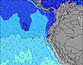 | 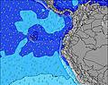 | 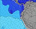 | 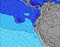 | 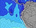 | 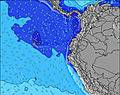 | 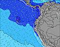 | ||||||||||||||
Wave Height (m) Direction Period (s) | SW 13 | WSW 13 | WSW 13 | SW 12 | SW 12 | SW 12 | SW 12 | SW 11 | SW 12 | SW 11 | WSW 14 | WSW 13 | WSW 13 | WSW 13 | WSW 12 | WSW 12 | WSW 12 | SW 13 | SW 12 | SW 12 | WSW 14 |
Wave Graph | |||||||||||||||||||||
444 | 295 | 277 | 227 | 227 | 147 | 140 | 103 | 272 | 101 | 129 | 156 | 98 | 106 | 101 | 56 | 55 | 235 | 118 | 116 | 131 | |
Wind (km/h) | |||||||||||||||||||||
Wind State on-shore cross-onshore cross-shore cross-offshore off-shore glassy | cross-off | cross | cross-off | cross | cross-on | cross | cross-on | cross-on | cross | cross | cross-on | cross-off | cross-off | cross-on | cross-off | cross | cross-on | cross-off | cross | cross-on | cross-on |
High Tide | 4:29AM2.13m | 4:27PM2.06m | 5:02AM2.20m | 5:03PM2.08m | 5:34AM2.24m | 5:38PM2.08m | 6:06AM2.26m | 6:15PM2.06m | 6:39AM2.25m | 6:54PM2.02m | 7:14AM2.20m | 7:37PM1.95m | 7:55AM2.13m | 8:28PM1.88m | |||||||
Low Tide | 10:33AM0.54m | 10:42PM0.25m | 11:08AM0.49m | 11:15PM0.25m | 11:43AM0.46m | 11:48PM0.29m | 12:18PM0.43m | 00:21AM0.35m | 12:54PM0.43m | 00:58AM0.42m | 1:34PM0.43m | 1:38AM0.51m | 2:20PM0.46m | 2:27AM0.62m | |||||||
6:28 | — | — | 6:28 | — | — | 6:28 | — | — | 6:28 | — | — | 6:28 | — | — | 6:28 | — | — | 6:26 | — | — | |
— | 6:30 | — | — | 6:30 | — | — | 6:30 | — | — | 6:30 | — | — | 6:30 | — | — | 6:30 | — | — | 6:30 | — | |
mm | — | — | — | — | — | — | — | — | — | — | — | 1 | — | — | — | — | — | — | — | — | — |
Temp °C | 26 | 26 | 24 | 26 | 26 | 24 | 26 | 25 | 24 | 24 | 24 | 24 | 25 | 25 | 24 | 26 | 25 | 24 | 26 | 25 | 24 |
Feels °C | 27 | 28 | 26 | 27 | 28 | 26 | 28 | 26 | 26 | 26 | 25 | 26 | 27 | 26 | 26 | 27 | 26 | 26 | 27 | 26 | 26 |
Swell 1 Height (m) Direction Period (s) | SW 13 | WSW 13 | WSW 13 | SW 12 | SW 6 | SW 12 | SSW 6 | SW 6 | WSW 15 | SW 11 | SW 11 | WSW 13 | WSW 13 | WSW 13 | WSW 12 | SSW 6 | SSW 6 | SW 13 | SW 12 | SW 12 | WSW 14 |
444 | 295 | 277 | 227 | 54 | 147 | 71 | 40 | 85 | 101 | 92 | 156 | 98 | 106 | 101 | 20 | 21 | 235 | 118 | 116 | 131 | |
Swell 2 Height (m) Direction Period (s) | NW 8 | NW 8 | NW 8 | SW 18 | SW 12 | WSW 16 | SW 12 | SW 11 | WNW 11 | WSW 15 | WSW 14 | WNW 10 | SW 10 | SW 10 | WNW 11 | WSW 12 | WSW 12 | NW 10 | SSW 5 | SW 20 | SW 18 |
3 | 3 | 3 | 13 | 227 | 27 | 140 | 103 | 12 | 84 | 129 | 10 | 61 | 34 | 11 | 56 | 55 | 4 | 9 | 16 | 53 | |
Swell 3 Height (m) Direction Period (s) | — | — | — | W 8 | NW 11 | NW 10 | WSW 16 | WSW 16 | N 5 | WNW 11 | WNW 11 | — | WNW 11 | WNW 11 | NW 11 | SW 9 | SW 9 | — | SSW 7 | NW 9 | NW 9 |
— | — | — | 1 | 5 | 4 | 51 | 99 | 1 | 12 | 12 | — | 12 | 12 | 4 | 13 | 12 | — | 4 | 3 | 3 | |
Wind waves Height (m) Direction Period (s) | SSW 5 | SSW 5 | SSW 5 | SSW 6 | — | SW 6 | — | — | SW 12 | SW 6 | SW 6 | SW 10 | SSW 5 | SW 6 | SW 9 | — | SW 7 | SSW 7 | — | SW 5 | SW 11 |
14 | 15 | 28 | 80 | — | 37 | — | — | 272 | 42 | 43 | 110 | 19 | 26 | 65 | — | 42 | 32 | — | 6 | 73 | |
Nearest Offshore or Glassy | |||||||||||||||||||||
Distance (km) | 0 | 1022 | 0 | 89 | 1187 | 36 | 36 | 905 | 192 | 200 | 1022 | 0 | 0 | 747 | 0 | 36 | 705 | 0 | 36 | 747 | 36 |
Best forecast wave conditions in Guayas | |||||||||||||||||||||
Best forecast wave conditions in Ecuador | |||||||||||||||||||||
Header Global | |||||||||||||||||||||
- Map Icons:
 Break
Break Live Wave Height (m)
 Live Wind Speed (km/h)
 Surf Rating (10 Max)
 Ocean Swells (m)
- Wind Speed (km/h)
Latest Updates


FREE! Surf-Forecast.com widget for your website
The surf report / weather widget below is available to embed on third party websites free of charge and provides a summary of our Playa Bruja surf forecast. Simply grab the html code snippet that we provide and paste it into your own site. You can choose your preferred language and metric/imperial units for the surf forecast feed to suit users of your site. Click here to get the code.
Information about the Playa Bruja Surf forecast
The above surf forecast table for Playa Bruja provides essential information for determining whether the surfing conditions will be good over the next 16 days. A general guide to surfing at Playa Bruja can be found by selecting the local surf guide option on the grey menu. Our Playa Bruja surf forecast is unique since it includes wave energy (power) that defines the real feel of the surf rather than just the height or the period. If you surf the same spot (Playa Bruja) regularly then make a mental note of the wave energy from the surf forecast table each time you go. Very soon you may start to choose your surf days based on the wave energy alone combined with our forecast of favourable offshore wind conditions. Our star ratings will help here and of course you will also find the usual wave height and period predictions on our surf forecasts as well as a full break down of the swell components under our advanced users option (to reveal that, click the little Einstein character under the tide times).
Further information to help with frequently asked questions about our surf forecast for Playa Bruja may be found under the help tab on the top menu and also by moving your mouse over the question marks on the surf forecast table itself. Please always bear in mind that the forecast is for near-shore open water and local factors at each surf break influence the actual breaking wave height, such as the beach / reef profile, water depths offshore and shelter.
Playa Bruja is 34 km (21 miles) from the city of Santa Elena. If you plan a holiday in Guayas, look for hotels and other accommodation in Santa Elena. Santa Elena has rooms for a wide range of budgets as well as car hire and transport links.
 Nearest