

Surf Forecasts:

Punta Blanca surf forecast from 10 Jul 2026:
- Best quality surf: Friday 10 Jul, 4AM (local time) - 2.5ft (0.8m), 15s period, SW swell with cross-offshore winds.
- Most powerful swell: Friday 10 Jul, 7PM (local time) - 3.5ft (1.1m), 15s period, SW swell with 512 kJ wave energy.
- Next surfable swell (1★+): Friday 10 Jul, 4AM (local time) - 2.5ft (0.8m), 15s period with SW swell.
Best Forecast Surf Conditions for Punta Blanca this week:
The surf forecast for Punta Blanca over the next 16 days: The first swell (rated 1 star or higher) is forecast to arrive on Friday (Jul 10) at 4AM. The primary swell is predicted to be 0.8m and 15s period. The wind is predicted to be cross-offshore as the swell arrives.
The most powerful waves expected at Punta Blanca in the next 16 days are 1.1m 15s and forecast to arrive on Friday (Jul 10) at 7PM. Winds are predicted to be cross-shore at the time the swell arrives. The largest open ocean swell (not directed at the beach) is 0.7m 6s period and expected on Friday (Jul 10) at 1AM.
| Wave Type | Time (-05) & Date | Wave Height & Period |
|---|---|---|
| Next good surf (1 star+) | 4AM (Fri 10th Jul) | 2.5ft (0.8m) 15s |
| Best Surf | 4AM (Fri 10th Jul) | 2.5ft (0.8m) 15s |
| Most Powerful | 7PM (Fri 10th Jul) | 3.5ft (1.1m) 15s |
Table - best surf conditions forecast for Punta Blanca over the next 16 days.
Alright folks, Rusty here. Let’s get into it.
First up, we’re looking at Punta Blanca (reef break). The water is sitting at a warm 78°F, which is much warmer than normal for this time of year – a solid 7°F above the long-term average. That’s a rare treat, so you’ll be surfing in a bath.
The next 16 days are a bit of a mixed bag. The early part of the outlook is a bit of a struggle. The swell is small, mostly around 2ft to 3ft from the SW, and the winds are often cross or cross-onshore, which keeps things choppy and messy. There’s a lot of “marginal” or “poor” conditions flagged, especially in the afternoons when the wind picks up. The combined swell energy is mostly in the low to mid hundreds, which is weak to moderate – you’ll be scratching for bumps.
The first real standout sneaks in on Saturday, July 11th during the morning session. The wind swings light cross-offshore from the SSW at only 6 mph, which cleans things right up. The swell is a modest 3ft from the SW with a decent 14-second period, giving it some proper groundswell push. The combined energy is moderate (348). That’s a clean, glassy window for a reef break, and the long period will give you some nice, solid lines. For a beginner-friendly spot, this is the pick of the early run.
There’s a long gap of washing machine conditions and afternoon chop after that. The mornings remain mostly “marginal” with light cross-shore wind ripples, but nothing to get excited about.
Then, looking way out, Thursday, July 23rd morning shapes up as another promising moment. Again, we get a cross-offshore wind from the SSW at 9 mph, and the swell bumps up to 4ft from the SW with an 11-second period. The combined energy jumps to 393, which is a nice step up in power. The forecast says “clean,” and for a reef break, that light-offshore wind and solid waist-to-chest high swell is the best of the long-range window. Just keep in mind this is a week and a half away, so it’s a promising prospect but not a lock.
The rest of the second week drifts off into smaller, weaker swells and onshore winds. No other sessions are worth setting an alarm for.
Bottom line: The best on offer is the clean, glassy Saturday morning, July 11th at Punta Blanca, with a runner-up potential on Thursday, July 23rd morning. Everything else is a wait-and-see game.
Rusty.
Short Range ForecastMostly dry. Warm (max 25°C on Fri morning, min 23°C on Thu afternoon). Wind will be generally light. | Days 5-7 Weather SummarySome drizzle, heaviest during Sun night. Warm (max 26°C on Tue morning, min 23°C on Sun afternoon). Wind will be generally light. | ||||||||||||||||||||
Thu 9 | Friday 10 | Saturday 11 | Sunday 12 | Monday 13 | Tuesday 14 | Wednesday 15 | |||||||||||||||
PM | Night | AM | PM | Night | AM | PM | Night | AM | PM | Night | AM | PM | Night | AM | PM | Night | AM | PM | Night | AM | |
Swell Height Map |  | 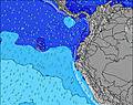 | 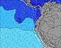 | 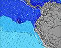 | 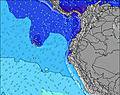 | 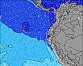 | 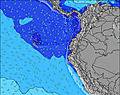 | 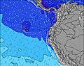 | |||||||||||||
Wave Height (m) Direction Period (s) | SW 15 | SW 14 | SW 16 | SW 16 | SW 14 | SW 14 | SW 14 | SW 13 | SW 13 | SW 14 | SW 14 | SW 13 | SW 13 | SW 13 | SW 14 | SW 14 | SW 16 | SW 13 | SW 13 | SW 14 | SW 14 |
Wave Graph | |||||||||||||||||||||
305 | 203 | 421 | 474 | 350 | 341 | 336 | 212 | 208 | 221 | 184 | 176 | 173 | 173 | 195 | 203 | 291 | 212 | 295 | 308 | 331 | |
Wind (km/h) | |||||||||||||||||||||
Wind State on-shore cross-onshore cross-shore cross-offshore off-shore glassy | cross-on | cross | cross | cross-on | cross | cross-off | cross-on | cross-off | cross | cross-on | glassy | cross | cross | cross-off | cross | cross | cross-off | cross | cross-on | cross-off | cross |
High Tide | 11:12PM1.78m | 11:23AM2.00m | 00:23AM1.86m | 12:31PM2.04m | 1:30AM1.99m | 1:36PM2.11m | 2:31AM2.13m | 2:36PM2.19m | 3:26AM2.28m | 3:32PM2.26m | 4:18AM2.40m | 4:24PM2.30m | 5:07AM2.47m | ||||||||
Low Tide | 4:53PM0.50m | 5:06AM0.71m | 5:59PM0.42m | 6:20AM0.68m | 7:04PM0.30m | 7:30AM0.59m | 8:05PM0.18m | 8:34AM0.49m | 9:01PM0.06m | 9:32AM0.38m | 9:53PM-0.03m | 10:25AM0.30m | 10:43PM-0.06m | 11:16AM0.26m | |||||||
— | — | 6:28 | — | — | 6:28 | — | — | 6:28 | — | — | 6:28 | — | — | 6:28 | — | — | 6:28 | — | — | 6:28 | |
6:28 | — | — | 6:28 | — | — | 6:28 | — | — | 6:28 | — | — | 6:29 | — | — | 6:29 | — | — | 6:29 | — | 6:29 | |
mm | — | — | — | — | — | — | — | — | — | — | 1 | — | — | — | — | — | — | — | — | — | — |
Temp °C | 24 | 23 | 25 | 24 | 23 | 25 | 25 | 23 | 25 | 25 | 23 | 25 | 25 | 23 | 26 | 25 | 23 | 25 | 25 | 23 | 26 |
Feels °C | 25 | 25 | 26 | 24 | 24 | 25 | 26 | 25 | 27 | 26 | 26 | 26 | 26 | 25 | 27 | 25 | 25 | 26 | 26 | 24 | 26 |
Swell 1 Height (m) Direction Period (s) | SW 15 | SW 14 | SW 16 | SW 16 | SW 14 | SW 14 | SW 14 | SW 13 | SW 13 | SW 14 | SW 14 | SW 13 | SW 13 | SW 13 | SW 14 | SW 14 | SW 16 | SW 13 | SW 13 | SW 14 | SW 14 |
305 | 203 | 421 | 474 | 350 | 341 | 336 | 212 | 208 | 221 | 184 | 176 | 173 | 173 | 195 | 203 | 291 | 212 | 295 | 308 | 331 | |
Swell 2 Height (m) Direction Period (s) | N 6 | SW 6 | SSW 5 | NW 15 | W 14 | SSW 5 | SW 5 | S 18 | SSW 4 | SSW 5 | SW 5 | WSW 19 | WSW 19 | WSW 18 | WSW 18 | NW 12 | NW 12 | SSW 5 | NW 11 | NW 11 | SSW 5 |
1 | 33 | 19 | 8 | 4 | 18 | 13 | 6 | 7 | 9 | 5 | 37 | 36 | 31 | 31 | 6 | 5 | 13 | 5 | 5 | 9 | |
Swell 3 Height (m) Direction Period (s) | W 16 | SW 18 | N 10 | — | N 8 | NW 14 | NW 14 | NW 14 | SSW 16 | SW 21 | WSW 20 | SW 16 | SW 16 | NW 12 | NW 12 | SW 18 | N 6 | NW 11 | SW 21 | SW 20 | SW 20 |
5 | 150 | 2 | — | 1 | 7 | 7 | 7 | 25 | 18 | 38 | 10 | 10 | 6 | 6 | 12 | 1 | 5 | 18 | 16 | 15 | |
Wind waves Height (m) Direction Period (s) | SW 5 | — | — | SW 5 | SW 5 | — | — | SSW 6 | — | — | — | SW 5 | SW 5 | SW 4 | SSW 4 | SSW 4 | SSW 4 | — | SW 5 | SW 5 | — |
29 | — | — | 20 | 23 | — | — | 12 | — | — | — | 6 | 6 | 4 | 7 | 7 | 11 | — | 18 | 23 | — | |
Nearest Offshore or Glassy | |||||||||||||||||||||
Distance (km) | 961 | 20 | 20 | 730 | 131 | 0 | 20 | 0 | 10 | 1041 | 0 | 7 | 687 | 0 | 10 | 995 | 0 | 163 | 687 | 0 | 20 |
Best forecast wave conditions in Guayas | |||||||||||||||||||||
Best forecast wave conditions in Ecuador | |||||||||||||||||||||
Header Global | |||||||||||||||||||||
- Map Icons:
 Break
Break Live Wave Height (m)
 Live Wind Speed (km/h)
 Surf Rating (10 Max)
 Ocean Swells (m)
- Wind Speed (km/h)


FREE! Surf-Forecast.com widget for your website
The surf report / weather widget below is available to embed on third party websites free of charge and provides a summary of our Punta Blanca surf forecast. Simply grab the html code snippet that we provide and paste it into your own site. You can choose your preferred language and metric/imperial units for the surf forecast feed to suit users of your site. Click here to get the code.
Information about the Punta Blanca Surf forecast
The above surf forecast table for Punta Blanca provides essential information for determining whether the surfing conditions will be good over the next 16 days. A general guide to surfing at Punta Blanca can be found by selecting the local surf guide option on the grey menu. Our Punta Blanca surf forecast is unique since it includes wave energy (power) that defines the real feel of the surf rather than just the height or the period. If you surf the same spot (Punta Blanca) regularly then make a mental note of the wave energy from the surf forecast table each time you go. Very soon you may start to choose your surf days based on the wave energy alone combined with our forecast of favourable offshore wind conditions. Our star ratings will help here and of course you will also find the usual wave height and period predictions on our surf forecasts as well as a full break down of the swell components under our advanced users option (to reveal that, click the little Einstein character under the tide times).
Further information to help with frequently asked questions about our surf forecast for Punta Blanca may be found under the help tab on the top menu and also by moving your mouse over the question marks on the surf forecast table itself. Please always bear in mind that the forecast is for near-shore open water and local factors at each surf break influence the actual breaking wave height, such as the beach / reef profile, water depths offshore and shelter.
Punta Blanca is 16 km (10 miles) from the city of Santa Elena. If you plan a holiday in Guayas, look for hotels and other accommodation in Santa Elena. Santa Elena has rooms for a wide range of budgets as well as car hire and transport links.
 Nearest