

Surf Forecasts:

Guiones surf forecast from 2 Aug 2026:
- Best quality surf: Friday 7 Aug, 9AM (local time) - 2ft (0.6m), 18s period, SW swell with cross-offshore winds.
- Most powerful swell: Saturday 8 Aug, 3PM (local time) - 3.5ft (1.1m), 15s period, SW swell with 509 kJ wave energy.
- Next surfable swell (1★+): Sunday 2 Aug, 9PM (local time) - 2ft (0.6m), 14s period with SW swell.
Best Forecast Surf Conditions for Guiones this week:
The surf forecast for Guiones over the next 16 days: The first swell (rated 1 star or higher) is forecast to arrive on Sunday (Aug 02) at 9PM. The primary swell is predicted to be 0.6m and 14s period with a secondary swell of 0.6m and 12s. The wind is predicted to be cross-offshore as the swell arrives.
The most powerful waves expected at Guiones in the next 16 days are 1.1m 15s and forecast to arrive on Saturday (Aug 08) at 3PM. Winds are predicted to be cross-onshore at the time the swell arrives. The largest open ocean swell (not directed at the beach) is 0.1m 5s period and expected on Thursday (Aug 06) at 12AM.
| Wave Type | Time (CST) & Date | Wave Height & Period |
|---|---|---|
| Next good surf (1 star+) | 9PM (Sun 2nd Aug) | 2ft (0.6m) 14s |
| Best Surf | 9AM (Fri 7th Aug) | 2ft (0.6m) 18s |
| Most Powerful | 3PM (Sat 8th Aug) | 3.5ft (1.1m) 15s |
Table - best surf conditions forecast for Guiones over the next 16 days.
The Lowdown
Alright, this is Rusty, checking in with the local outlook for Guiones. It’s a classic setup for this time of year – we’ve got a long run of small, clean windows lining up, bookended by some serious pulse later on. The water is sitting at a balmy 86°F, which is a good 4° warmer than usual for the start of August, so you can leave the wetsuit at home.
The forecast kicks off Sunday morning, August 2nd, with a clean 2ft SW groundswell. The period is a long 15 seconds, giving those waves some real shape and push, and with a light offshore breeze, Guiones will be looking tidy. The combined energy is moderate at 280, so it’s not a day for power, but for a beginner-friendly spot that’s consistent, it’s a lovely way to start.
Monday morning, August 3rd, is a repeat: 2ft SW, 14-second period, with a light cross-offshore breeze. It’s clean, it’s easy, and it’s surfable. The afternoons get a bit messy with a cross-on wind, so mornings are the key.
Wednesday morning, August 5th, is a special treat. The wind goes glassy, dead calm, and those 3ft SSW waves will be like velvet. It’s a tiny window, but if you’re there at dawn, you’ll be smiling.
Heading into the second week, the real standout is the Friday morning, August 14th. The swell jumps to 3ft from the SW, but the period is a very long 18 seconds, and the combined energy rockets up to 714 – that’s moderate to strong energy. With a clean offshore breeze, this is the best paddling ease and wave quality of the whole period. The swell direction is straight out of the WNW optimum for Guiones, so it’s going to line up perfectly.
Saturday morning, August 15th, is another cracker: 4ft SW, 16-second period, offshore wind, and that energy is still strong at 837. Sunday morning, August 16th, sees 3ft SW with a glassy wind and 735 energy. That’s a triple-header of really, really good surf.
Just a heads-up: the 4ft marks on the 15th and 17th are still perfectly fine for intermediates, but if you’re a beginner, those bigger, long-period lines on the 14th and 15th might feel a bit more challenging. The sets will be clean and well-spaced, but there’s a bit more oomph behind them.
The entire run is consistent, so there’s no dead gap. Just keep your eyes on the morning windows. The long-range stuff on the 14th and 15th is what we’re all waiting for.
Rusty, signing off.
Short Range ForecastModerate rain (total 11mm), heaviest on Mon afternoon. Warm (max 30°C on Tue morning, min 26°C on Sun night). Wind will be generally light. | Days 4-6 Weather SummaryHeavy rain (total 41mm), heaviest during Thu night. Warm (max 29°C on Wed morning, min 24°C on Thu night). Wind will be generally light. | ||||||||||||||||||||
Sunday 2 | Monday 3 | Tuesday 4 | Wednesday 5 | Thursday 6 | Friday 7 | Saturday 8 | |||||||||||||||
AM | PM | Night | AM | PM | Night | AM | PM | Night | AM | PM | Night | AM | PM | Night | AM | PM | Night | AM | PM | Night | |
Swell Height Map |  |  |  | 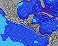 | 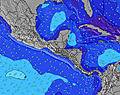 |  | 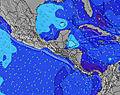 | ||||||||||||||
Wave Height (m) Direction Period (s) | SW 15 | SW 15 | SW 14 | SW 14 | SW 13 | SW 13 | SSW 8 | SSW 8 | SSW 8 | SSW 8 | SSW 8 | SSW 8 | SW 14 | SW 13 | SW 13 | SW 18 | SW 17 | SW 16 | SSW 16 | SW 15 | SW 15 |
Wave Graph | |||||||||||||||||||||
137 | 171 | 167 | 155 | 212 | 91 | 112 | 112 | 109 | 81 | 85 | 85 | 123 | 113 | 212 | 252 | 305 | 376 | 441 | 509 | 309 | |
Wind (km/h) | |||||||||||||||||||||
Wind State on-shore cross-onshore cross-shore cross-offshore off-shore glassy | off | cross-on | cross-off | cross-off | cross-on | glassy | cross-off | cross-on | off | glassy | cross-on | glassy | cross-off | cross-on | off | cross-off | cross-on | cross-off | off | cross-on | off |
High Tide | 5:11PM2.05m | 5:36AM2.16m | 5:49PM2.00m | 6:13AM2.16m | 6:30PM1.93m | 6:55AM2.14m | 7:16PM1.85m | 7:43AM2.10m | 8:11PM1.78m | 8:39AM2.06m | 9:15PM1.73m | 9:45AM2.03m | 10:29PM1.73m | ||||||||
Low Tide | 11:08AM0.38m | 11:19PM0.28m | 11:47AM0.38m | 11:54PM0.32m | 12:29PM0.39m | 00:34AM0.37m | 1:15PM0.41m | 1:19AM0.42m | 2:09PM0.45m | 2:13AM0.48m | 3:11PM0.47m | 3:18AM0.53m | 4:21PM0.46m | ||||||||
5:31 | — | — | 5:31 | — | — | 5:31 | — | — | 5:31 | — | — | 5:33 | — | — | 5:33 | — | — | 5:33 | — | — | |
— | 6:05 | — | — | 6:05 | — | — | 6:04 | — | — | 6:04 | — | — | 6:04 | — | — | 6:02 | — | — | 6:02 | — | |
mm | — | — | 1 | 1 | 3 | 1 | — | 3 | 2 | — | 4 | 11 | 2 | 5 | 14 | — | 4 | 1 | 1 | 7 | — |
Temp °C | 29 | 29 | 28 | 29 | 29 | 27 | 30 | 29 | 27 | 29 | 29 | 27 | 28 | 27 | 26 | 29 | 28 | 26 | 28 | 29 | 26 |
Feels °C | 33 | 32 | 33 | 32 | 32 | 31 | 33 | 32 | 31 | 32 | 33 | 31 | 32 | 30 | 31 | 32 | 32 | 30 | 32 | 33 | 29 |
Swell 1 Height (m) Direction Period (s) | SW 12 | SW 15 | S 7 | S 7 | SW 13 | SSW 7 | SSW 8 | SSW 8 | SSW 8 | SSW 8 | SSW 8 | SSW 8 | SSW 8 | SSW 7 | SW 13 | SW 13 | SW 17 | SW 16 | SSW 16 | SW 15 | SW 15 |
110 | 171 | 36 | 51 | 212 | 91 | 112 | 112 | 109 | 81 | 85 | 85 | 79 | 86 | 212 | 205 | 305 | 376 | 441 | 509 | 309 | |
Swell 2 Height (m) Direction Period (s) | S 7 | SSW 11 | SW 12 | SW 14 | S 7 | SW 13 | SW 12 | SW 12 | SW 12 | SW 12 | SW 12 | SW 14 | SW 14 | SW 13 | S 8 | S 10 | SW 12 | SW 12 | SW 12 | S 9 | SW 11 |
33 | 85 | 118 | 155 | 49 | 82 | 38 | 74 | 73 | 50 | 49 | 74 | 123 | 113 | 55 | 94 | 151 | 144 | 139 | 56 | 101 | |
Swell 3 Height (m) Direction Period (s) | SW 15 | S 7 | SW 14 | WSW 13 | SW 16 | SW 13 | SW 13 | SW 16 | SW 12 | SW 15 | SW 15 | SW 11 | S 13 | S 13 | WSW 7 | SW 18 | S 9 | S 9 | S 8 | SW 6 | S 9 |
137 | 22 | 167 | 69 | 68 | 84 | 44 | 85 | 36 | 54 | 55 | 20 | 30 | 29 | 30 | 252 | 55 | 56 | 51 | 9 | 38 | |
Wind waves Height (m) Direction Period (s) | — | — | — | — | — | — | — | — | — | — | — | N 5 | — | — | — | — | — | — | — | — | — |
— | — | — | — | — | — | — | — | — | — | — | 1 | — | — | — | — | — | — | — | — | — | |
Nearest Offshore or Glassy | |||||||||||||||||||||
Distance (km) | 0 | 39 | 0 | 0 | 39 | 0 | 0 | 39 | 0 | 0 | 245 | 0 | 0 | 39 | 0 | 0 | 95 | 0 | 0 | 31 | 0 |
Best forecast wave conditions in Guanacaste | |||||||||||||||||||||
Best forecast wave conditions in Costa Rica | |||||||||||||||||||||
Header Global | |||||||||||||||||||||
- Map Icons:
 Break
Break Live Wave Height (m)
 Live Wind Speed (km/h)
 Surf Rating (10 Max)
 Ocean Swells (m)
- Wind Speed (km/h)
Latest Updates


FREE! Surf-Forecast.com widget for your website
The surf report / weather widget below is available to embed on third party websites free of charge and provides a summary of our Guiones surf forecast. Simply grab the html code snippet that we provide and paste it into your own site. You can choose your preferred language and metric/imperial units for the surf forecast feed to suit users of your site. Click here to get the code.
Information about the Guiones Surf forecast
The above surf forecast table for Guiones provides essential information for determining whether the surfing conditions will be good over the next 16 days. A general guide to surfing at Guiones can be found by selecting the local surf guide option on the grey menu. Our Guiones surf forecast is unique since it includes wave energy (power) that defines the real feel of the surf rather than just the height or the period. If you surf the same spot (Guiones) regularly then make a mental note of the wave energy from the surf forecast table each time you go. Very soon you may start to choose your surf days based on the wave energy alone combined with our forecast of favourable offshore wind conditions. Our star ratings will help here and of course you will also find the usual wave height and period predictions on our surf forecasts as well as a full break down of the swell components under our advanced users option (to reveal that, click the little Einstein character under the tide times).
Further information to help with frequently asked questions about our surf forecast for Guiones may be found under the help tab on the top menu and also by moving your mouse over the question marks on the surf forecast table itself. Please always bear in mind that the forecast is for near-shore open water and local factors at each surf break influence the actual breaking wave height, such as the beach / reef profile, water depths offshore and shelter.
Guiones is 34 km (21 miles) from Nicoya. If you plan a holiday in Guanacaste, look for hotels and other accommodation in Nicoya. Nicoya has rooms for a wide range of budgets as well as car hire and transport links.
 Nearest