

Surf Forecasts:

Playa Negra surf forecast from 3 Aug 2026:
- Best quality surf: Friday 7 Aug, 12AM (local time) - 2.5ft (0.8m), 13s period, SW swell with cross-offshore winds.
- Most powerful swell: Saturday 8 Aug, 3PM (local time) - 3.5ft (1.1m), 15s period, SW swell with 566 kJ wave energy.
- Next surfable swell (1★+): Sunday 2 Aug, 9PM (local time) - 2ft (0.6m), 14s period with SW swell.
Best Forecast Surf Conditions for Playa Negra this week:
The surf forecast for Playa Negra over the next 16 days: The first swell (rated 1 star or higher) is forecast to arrive on Sunday (Aug 02) at 9PM. The primary swell is predicted to be 0.6m and 14s period with a secondary swell of 0.6m and 12s. The wind is predicted to be offshore as the swell arrives.
The most powerful waves expected at Playa Negra in the next 16 days are 1.1m 15s and forecast to arrive on Saturday (Aug 08) at 3PM. Winds are predicted to be onshore at the time the swell arrives. The largest open ocean swell (not directed at the beach) is 0.9m 8s period and expected on Tuesday (Aug 04) at 6AM.
| Wave Type | Time (CST) & Date | Wave Height & Period |
|---|---|---|
| Next good surf (1 star+) | 9PM (Sun 2nd Aug) | 2ft (0.6m) 14s |
| Best Surf | 12AM (Fri 7th Aug) | 2.5ft (0.8m) 13s |
| Most Powerful | 3PM (Sat 8th Aug) | 3.5ft (1.1m) 15s |
Table - best surf conditions forecast for Playa Negra over the next 16 days.
The Lowdown
Alright folks, Rusty here. Let’s take a good look at what’s lining up for us at Playa Negra.
We’ve got a solid window of surf opening up, but it’s not a non-stop party. The first few days are pretty small and ordinary, with the real action starting to build from Friday the 7th onward. There’s a bit of a lull before that, so don’t get your hopes up too high for the early part of the week.
Right now, the water’s sitting at a toasty 86°, which is a touch warmer than normal for this time of year. You’ll feel that difference.
The standout session is easily Saturday the 15th. We’ve got a clean 4 ft swell from the SW, with a period of 16 seconds, pushing through with strong energy (740). The wind is light and offshore from the ESE, setting up some proper, clean lines. This is the pick of the bunch for advanced surfers – that swell size is a bit too much for beginners.
Another absolute cracker is the Friday afternoon of the 14th. A 4 ft SW swell with a 15-second period, and offshore wind from the ENE (12 mph). The energy is pumping (694) and the conditions are going to be clean and powerful. That’s a great session for the experienced crew.
Don’t sleep on the Sunday morning of the 16th either. The same 4 ft SW swell, clean offshore winds, and strong energy (630). It’s a beautiful way to wrap up the weekend.
The earlier part of the forecast, like Sunday the 2nd and Monday the 3rd, has some small SW swell (2 ft to 3 ft) with a moderate period. The wind is favourable in the mornings, but the energy is low (around 212 to 300), so it’s more of a fun-size, non-critical wave.
There’s a notable run of afternoons from the 3rd to the 6th that get chopped up by onshore SW winds and risk of thunderstorms. Not worth paddling out for those.
From the 7th, things really turn on. The swell builds, periods get longer, and the energy climbs. The Friday morning of the 7th has a 2 ft SSW swell but with a very long 18-second period, pushing a surprising amount of energy (377). Clean and offshore, it’s one to keep an eye on.
The real highlights are end of the first week and into the second. The 8th, 9th, 10th, and 11th all have clean mornings with good swell and offshore or cross-off winds. The Tuesday afternoon of the 11th goes glassy with a 3 ft SW swell and 14-second period, and the energy gets up to 520 – that’s going to be a fun, clean session.
The 14th and 15th are the absolute peak, as I said. The 15th Saturday afternoon is the crown jewel, but the 14th Friday afternoon is a serious contender.
Just remember, this long-range swell is promising, but the further out we go, the less certainty there is. Still, all signs point to a solid run of waves.
Rusty.
Short Range ForecastLight rain (total 6mm), mostly falling on Mon afternoon. Warm (max 32°C on Mon morning, min 25°C on Tue night). Wind will be generally light. | Days 4-6 Weather SummaryHeavy rain (total 39mm), heaviest during Thu night. Warm (max 30°C on Wed morning, min 23°C on Thu night). Wind will be generally light. | ||||||||||||||||||||
Sunday 2 | Monday 3 | Tuesday 4 | Wednesday 5 | Thursday 6 | Friday 7 | Saturday 8 | |||||||||||||||
AM | PM | Night | AM | PM | Night | AM | PM | Night | AM | PM | Night | AM | PM | Night | AM | PM | Night | AM | PM | Night | |
Swell Height Map |  |  |  | 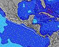 | 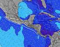 | 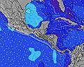 | 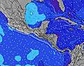 | ||||||||||||||
Wave Height (m) Direction Period (s) | SW 15 | SW 15 | SW 14 | SW 14 | SW 13 | SSW 13 | SW 13 | SSW 8 | SSW 8 | SSW 8 | SSW 8 | SW 14 | SW 14 | SW 13 | SW 13 | SSW 18 | SW 17 | SW 16 | SSW 16 | SW 15 | SW 14 |
Wave Graph | |||||||||||||||||||||
108 | 171 | 167 | 231 | 208 | 111 | 83 | 119 | 109 | 83 | 83 | 74 | 125 | 113 | 212 | 209 | 305 | 376 | 441 | 566 | 305 | |
Wind (km/h) | |||||||||||||||||||||
Wind State on-shore cross-onshore cross-shore cross-offshore off-shore glassy | off | cross | cross-off | cross-off | cross-on | off | cross-off | cross-on | off | cross-off | cross-on | off | glassy | cross-on | cross-off | cross-off | glassy | cross-off | cross-off | on | off |
High Tide | 5:11PM2.26m | 5:37AM2.38m | 5:50PM2.20m | 6:15AM2.39m | 6:30PM2.13m | 6:56AM2.37m | 7:16PM2.04m | 7:44AM2.33m | 8:10PM1.96m | 8:40AM2.28m | 9:14PM1.90m | 9:45AM2.25m | 10:28PM1.90m | ||||||||
Low Tide | 11:08AM0.42m | 11:19PM0.30m | 11:47AM0.42m | 11:55PM0.34m | 12:29PM0.43m | 00:34AM0.39m | 1:15PM0.45m | 1:19AM0.45m | 2:09PM0.49m | 2:12AM0.51m | 3:11PM0.51m | 3:16AM0.57m | 4:20PM0.51m | ||||||||
5:31 | — | — | 5:31 | — | — | 5:33 | — | — | 5:33 | — | — | 5:33 | — | — | 5:33 | — | — | 5:33 | — | — | |
— | 6:06 | — | — | 6:05 | — | — | 6:05 | — | — | 6:05 | — | — | 6:04 | — | — | 6:04 | — | — | 6:04 | — | |
mm | — | — | — | — | 3 | — | — | 2 | 1 | — | 3 | 9 | 2 | 9 | 14 | — | — | 2 | — | 9 | 10 |
Temp °C | 30 | 29 | 28 | 32 | 29 | 27 | 32 | 29 | 27 | 30 | 28 | 27 | 28 | 27 | 24 | 29 | 29 | 27 | 30 | 28 | 26 |
Feels °C | 33 | 33 | 32 | 36 | 32 | 31 | 35 | 32 | 30 | 33 | 31 | 31 | 33 | 29 | 26 | 33 | 34 | 31 | 35 | 32 | 29 |
Swell 1 Height (m) Direction Period (s) | SW 12 | SW 15 | S 7 | SW 14 | SW 13 | S 7 | S 9 | SSW 8 | SSW 8 | SSW 8 | SSW 8 | S 8 | S 8 | SSW 7 | SSW 10 | S 10 | SW 17 | SW 16 | SSW 16 | SW 15 | SW 14 |
108 | 171 | 36 | 231 | 208 | 62 | 122 | 119 | 109 | 83 | 83 | 82 | 74 | 86 | 163 | 125 | 305 | 376 | 441 | 566 | 305 | |
Swell 2 Height (m) Direction Period (s) | S 7 | SSW 11 | SW 14 | S 7 | S 7 | SSW 13 | SW 13 | SW 12 | SW 12 | SW 12 | SW 12 | SW 14 | SW 14 | SW 13 | SW 13 | SW 13 | SW 12 | SW 12 | SW 12 | S 9 | SW 11 |
23 | 85 | 167 | 52 | 49 | 111 | 83 | 73 | 93 | 50 | 49 | 74 | 125 | 113 | 212 | 168 | 151 | 144 | 139 | 53 | 79 | |
Swell 3 Height (m) Direction Period (s) | SW 15 | S 7 | SW 12 | WSW 13 | SW 16 | SW 13 | SW 16 | SW 16 | SW 12 | SW 15 | SW 15 | N 5 | S 13 | S 12 | SW 18 | SSW 18 | S 9 | S 9 | S 8 | NNW 4 | S 9 |
104 | 22 | 116 | 69 | 66 | 84 | 64 | 61 | 22 | 54 | 55 | 4 | 31 | 25 | 159 | 209 | 57 | 55 | 47 | 4 | 38 | |
Wind waves Height (m) Direction Period (s) | NNE 5 | — | — | — | — | — | N 5 | — | NNE 4 | NE 3 | — | — | — | — | — | NNE 3 | — | — | — | — | NNE 5 |
12 | — | — | — | — | — | 1 | — | 6 | 1 | — | — | — | — | — | 6 | — | — | — | — | 12 | |
Nearest Offshore or Glassy | |||||||||||||||||||||
Distance (km) | 0 | 7 | 0 | 0 | 7 | 0 | 0 | 7 | 0 | 0 | 7 | 0 | 0 | 7 | 0 | 0 | 0 | 0 | 0 | 2 | 0 |
Best forecast wave conditions in Guanacaste | |||||||||||||||||||||
Best forecast wave conditions in Costa Rica | |||||||||||||||||||||
Header Global | |||||||||||||||||||||
- Map Icons:
 Break
Break Live Wave Height (m)
 Live Wind Speed (km/h)
 Surf Rating (10 Max)
 Ocean Swells (m)
- Wind Speed (km/h)
Latest Updates


FREE! Surf-Forecast.com widget for your website
The surf report / weather widget below is available to embed on third party websites free of charge and provides a summary of our Playa Negra surf forecast. Simply grab the html code snippet that we provide and paste it into your own site. You can choose your preferred language and metric/imperial units for the surf forecast feed to suit users of your site. Click here to get the code.
Information about the Playa Negra Surf forecast
The above surf forecast table for Playa Negra provides essential information for determining whether the surfing conditions will be good over the next 16 days. A general guide to surfing at Playa Negra can be found by selecting the local surf guide option on the grey menu. Our Playa Negra surf forecast is unique since it includes wave energy (power) that defines the real feel of the surf rather than just the height or the period. If you surf the same spot (Playa Negra) regularly then make a mental note of the wave energy from the surf forecast table each time you go. Very soon you may start to choose your surf days based on the wave energy alone combined with our forecast of favourable offshore wind conditions. Our star ratings will help here and of course you will also find the usual wave height and period predictions on our surf forecasts as well as a full break down of the swell components under our advanced users option (to reveal that, click the little Einstein character under the tide times).
Further information to help with frequently asked questions about our surf forecast for Playa Negra may be found under the help tab on the top menu and also by moving your mouse over the question marks on the surf forecast table itself. Please always bear in mind that the forecast is for near-shore open water and local factors at each surf break influence the actual breaking wave height, such as the beach / reef profile, water depths offshore and shelter.
Playa Negra is 41 km (25 miles) from Nicoya. If you plan a holiday in Guanacaste, look for hotels and other accommodation in Nicoya. Nicoya has rooms for a wide range of budgets as well as car hire and transport links.
 Nearest