

Surf Forecasts:

Tamarindo surf forecast from 1 Aug 2026:
- Best quality surf: Friday 7 Aug, 9PM (local time) - 3ft (0.9m), 16s period, SW swell with offshore winds.
- Most powerful swell: Saturday 8 Aug, 3AM (local time) - 3ft (0.9m), 16s period, SSW swell with 447 kJ wave energy.
- Next surfable swell (1★+): Saturday 1 Aug, 9AM (local time) - 3ft (0.9m), 13s period with SW swell.
Best Forecast Surf Conditions for Tamarindo this week:
The surf forecast for Tamarindo over the next 16 days: The first swell (rated 1 star or higher) is forecast to arrive on Saturday (Aug 01) at 9AM. The primary swell is predicted to be 0.9m and 13s period. The wind is predicted to be offshore as the swell arrives.
The most powerful waves expected at Tamarindo in the next 16 days are 0.9m 16s and forecast to arrive on Saturday (Aug 08) at 3AM. Winds are predicted to be offshore at the time the swell arrives. The largest open ocean swell (not directed at the beach) is 0.8m 7s period and expected on Monday (Aug 03) at 9PM.
| Wave Type | Time (CST) & Date | Wave Height & Period |
|---|---|---|
| Next good surf (1 star+) | 9AM (Sat 1st Aug) | 3ft (0.9m) 13s |
| Best Surf | 9PM (Fri 7th Aug) | 3ft (0.9m) 16s |
| Most Powerful | 3AM (Sat 8th Aug) | 3ft (0.9m) 16s |
Table - best surf conditions forecast for Tamarindo over the next 16 days.
The Lowdown
Alright, let’s get into it. We’re looking at Tamarindo for the next couple of weeks, and it’s a slow burner. The first few days are small, but the consistency is there. The standout window is definitely further out, so don’t rush to the water just yet.
The water is sitting about average for the time of year, nothing out of the ordinary. Tamarindo is a river mouth break, exposed to the swell and it handles a good range of conditions. The optimum swell direction is from the west-northwest, but we’re seeing a lot of southwest and south-southwest swells coming through, so the direction isn’t perfect, but it’s still working.
The first real action starts Saturday morning, August 1, with a 3 ft swell from the southwest, 13-second period and a moderate breeze from the east-northeast keeping it offshore and clean. The combined energy is moderate (265). It’s a beginner-friendly size, and the wind is solid. Saturday afternoon goes glassy, same 3 ft swell, even better conditions. This is a solid, clean start.
Sunday, August 2, the swell drops to 2 ft, and while the morning is clean, the afternoon gets cross-onshore and choppy. Not worth it. Monday, August 3, bounces back to about 3 ft, morning is clean with a cross-offshore breeze, but storm risk spoils the afternoon. Tuesday, August 4, is similar – clean morning, then afternoon gets messy.
Wednesday, August 5, through Thursday, August 6, are small and ordinary. The best of the first week is definitely the Saturday and the clean mornings of Monday and Tuesday, but nothing is firing.
Then we hit Friday, August 7. The morning has a 2 ft swell, but the period jumps to 18 seconds – that’s a long-period groundswell. The combined energy shoots up to 466 (moderate), and the wind is offshore from the east-northeast. This is the first real standout. This long-period swell will be better at the river mouth, and the clean conditions make it a legit window. The afternoon stays glassy with a 2 ft, 17-second swell. This is the best of the first week.
Saturday, August 8, sees the swell bump to 3 ft in the morning, but the wind is a moderate breeze, creating a cross-offshore. The afternoon is where it’s at: 4 ft, 15-second swell from the southwest, offshore wind from the east, and combined energy at 570 (moderate). This is a very good window for a wide range of surfers, though beginners might find the 4 ft a bit punchy.
Sunday, August 9, is a step down, with a 3 ft swell but strong morning winds make it poor. The afternoon is better, still 3 ft but offshore from the east. The next week, from Monday, August 10, through Friday, August 14, is a mix of small, clean mornings and stormy afternoons. The swell stays around 2 ft to 3 ft, with periods varying from 13 to 19 seconds. The Friday afternoon, August 14, stands out with a 2 ft, 19-second swell and offshore wind – very clean but small.
The real standout of the whole run is Saturday, August 15. The morning has a 4 ft swell from the southwest, 17-second period, and combined energy hits 831 (strong). The wind is cross-offshore from the east-northeast, so it’s clean. The afternoon is even better: 4 ft swell, 16-second period, offshore wind from the east, and combined energy at 745 (strong). This is the best of the entire forecast. The size is solid for intermediate and advanced surfers, and the long period will push through nicely. This is the one to circle on the calendar. Sunday, August 16, is still good in the morning with 4 ft and 15-second swell, but the energy is a bit lower.
So, if you’re waiting, the best bets are the Saturday, August 1, for a clean start, Friday, August 7, for the long-period groundswell, and the big one, Saturday, August 15, for the best size and power. The long-range stuff is promising but less certain, so keep an eye on it.
Rusty.
Short Range ForecastLight rain (total 5mm), mostly falling on Mon afternoon. Warm (max 31°C on Sat morning, min 25°C on Sat night). Wind will be generally light. | Days 5-7 Weather SummaryHeavy rain (total 28mm), heaviest during Thu afternoon. Warm (max 31°C on Tue morning, min 25°C on Wed night). Wind will be generally light. | ||||||||||||||||||
Saturday 1 | Sunday 2 | Monday 3 | Tuesday 4 | Wednesday 5 | Thursday 6 | ||||||||||||||
Night | AM | PM | Night | AM | PM | Night | AM | PM | Night | AM | PM | Night | AM | PM | Night | AM | PM | Night | |
Swell Height Map |  |  |  |  | 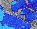 | 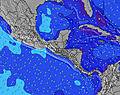 | 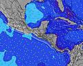 | ||||||||||||
Wave Height (m) Direction Period (s) | SW 13 | SW 13 | SW 13 | SW 12 | SW 15 | SW 15 | SW 14 | SW 14 | SW 13 | SW 13 | SW 13 | SSW 8 | SW 12 | SW 15 | SW 15 | SW 14 | SW 14 | SW 13 | SW 13 |
Wave Graph | |||||||||||||||||||
326 | 238 | 234 | 147 | 108 | 171 | 167 | 231 | 208 | 84 | 108 | 109 | 93 | 69 | 55 | 74 | 125 | 113 | 212 | |
Wind (km/h) | |||||||||||||||||||
Wind State on-shore cross-onshore cross-shore cross-offshore off-shore glassy | cross-off | off | glassy | off | cross-off | cross-on | glassy | cross-off | cross-on | glassy | cross-off | cross-on | cross-off | glassy | on | glassy | off | cross | cross-off |
High Tide | 4:26AM2.30m | 4:34PM2.29m | 5:01AM2.35m | 5:11PM2.25m | 5:36AM2.38m | 5:49PM2.19m | 6:13AM2.38m | 6:30PM2.12m | 6:55AM2.36m | 7:16PM2.04m | 7:43AM2.32m | 8:10PM1.96m | |||||||
Low Tide | 10:11PM0.28m | 10:30AM0.44m | 10:45PM0.29m | 11:08AM0.42m | 11:19PM0.31m | 11:47AM0.42m | 11:54PM0.35m | 12:29PM0.43m | 00:34AM0.40m | 1:15PM0.46m | 1:19AM0.46m | 2:09PM0.49m | 2:13AM0.52m | ||||||
— | 5:31 | — | — | 5:31 | — | — | 5:31 | — | — | 5:31 | — | — | 5:33 | — | — | 5:33 | — | — | |
— | — | 6:06 | — | — | 6:06 | — | — | 6:06 | — | — | 6:05 | — | — | 6:05 | — | — | 6:05 | — | |
mm | — | — | — | — | — | — | 1 | 1 | 3 | 1 | — | 2 | 3 | 1 | 3 | — | 7 | 11 | 4 |
Temp °C | 28 | 31 | 31 | 28 | 31 | 29 | 28 | 30 | 29 | 28 | 31 | 30 | 27 | 29 | 28 | 27 | 29 | 26 | 26 |
Feels °C | 29 | 33 | 34 | 30 | 35 | 31 | 32 | 33 | 32 | 32 | 34 | 33 | 29 | 33 | 31 | 31 | 32 | 28 | 30 |
Swell 1 Height (m) Direction Period (s) | SW 13 | SW 13 | SW 13 | SW 12 | SW 12 | SW 15 | S 7 | SW 14 | SW 13 | S 8 | SSW 8 | SSW 8 | SSW 8 | S 8 | S 8 | S 8 | S 8 | S 8 | SW 13 |
326 | 238 | 234 | 147 | 108 | 171 | 39 | 231 | 208 | 82 | 96 | 109 | 87 | 63 | 63 | 66 | 63 | 60 | 212 | |
Swell 2 Height (m) Direction Period (s) | S 7 | S 12 | N 5 | SW 16 | S 7 | SSW 11 | SW 14 | S 7 | S 7 | SW 13 | SW 13 | SW 12 | SW 12 | SW 12 | SW 12 | SW 14 | SW 14 | SW 13 | SSW 8 |
17 | 72 | 7 | 124 | 23 | 85 | 167 | 54 | 51 | 84 | 108 | 73 | 93 | 69 | 49 | 74 | 125 | 113 | 45 | |
Swell 3 Height (m) Direction Period (s) | WNW 11 | WNW 12 | SW 16 | S 7 | SW 15 | S 7 | SW 12 | WSW 13 | SW 16 | SW 13 | SW 10 | SW 16 | SW 12 | SW 15 | SW 15 | NNE 4 | SW 6 | S 12 | SW 18 |
24 | 27 | 66 | 14 | 104 | 22 | 116 | 69 | 66 | 83 | 15 | 61 | 22 | 54 | 55 | 3 | 6 | 25 | 159 | |
Wind waves Height (m) Direction Period (s) | NNE 5 | NNE 6 | — | NNE 4 | NNE 4 | — | — | — | — | — | N 4 | — | NNE 4 | NE 3 | SW 2 | — | — | SW 6 | NNE 4 |
17 | 18 | — | 7 | 6 | — | — | — | — | — | 1 | — | 5 | 2 | 1 | — | — | 9 | 11 | |
Nearest Offshore or Glassy | |||||||||||||||||||
Distance (km) | 15 | 0 | 0 | 0 | 12 | 8 | 0 | 0 | 8 | 0 | 0 | 8 | 0 | 0 | 8 | 0 | 0 | 233 | 0 |
Best forecast wave conditions in Guanacaste | |||||||||||||||||||
Best forecast wave conditions in Costa Rica | |||||||||||||||||||
Header Global | |||||||||||||||||||
- Map Icons:
 Break
Break Live Wave Height (m)
 Live Wind Speed (km/h)
 Surf Rating (10 Max)
 Ocean Swells (m)
- Wind Speed (km/h)
Latest Updates


FREE! Surf-Forecast.com widget for your website
The surf report / weather widget below is available to embed on third party websites free of charge and provides a summary of our Tamarindo surf forecast. Simply grab the html code snippet that we provide and paste it into your own site. You can choose your preferred language and metric/imperial units for the surf forecast feed to suit users of your site. Click here to get the code.
Information about the Tamarindo Surf forecast
The above surf forecast table for Tamarindo provides essential information for determining whether the surfing conditions will be good over the next 16 days. A general guide to surfing at Tamarindo can be found by selecting the local surf guide option on the grey menu. Our Tamarindo surf forecast is unique since it includes wave energy (power) that defines the real feel of the surf rather than just the height or the period. If you surf the same spot (Tamarindo) regularly then make a mental note of the wave energy from the surf forecast table each time you go. Very soon you may start to choose your surf days based on the wave energy alone combined with our forecast of favourable offshore wind conditions. Our star ratings will help here and of course you will also find the usual wave height and period predictions on our surf forecasts as well as a full break down of the swell components under our advanced users option (to reveal that, click the little Einstein character under the tide times).
Further information to help with frequently asked questions about our surf forecast for Tamarindo may be found under the help tab on the top menu and also by moving your mouse over the question marks on the surf forecast table itself. Please always bear in mind that the forecast is for near-shore open water and local factors at each surf break influence the actual breaking wave height, such as the beach / reef profile, water depths offshore and shelter.
Tamarindo is 46 km (29 miles) from Nicoya. If you plan a holiday in Guanacaste, look for hotels and other accommodation in Nicoya. Nicoya has rooms for a wide range of budgets as well as car hire and transport links.
 Nearest