

Surf Forecasts:

Renaca surf forecast from 27 Jul 2026:
- Best quality surf: Monday 27 Jul, 11PM (local time) - 10ft (3.0m), 13s period, WSW swell with cross-shore winds.
- Most powerful swell: Monday 27 Jul, 11PM (local time) - 10ft (3.0m), 13s period, WSW swell with 2,941 kJ wave energy.
- Next surfable swell (1★+): Monday 27 Jul, 11AM (local time) - 5.5ft (1.7m), 10s period with W swell.
Best Forecast Surf Conditions for Renaca this week:
The surf forecast for Renaca over the next 16 days: The first swell (rated 1 star or higher) is forecast to arrive on Monday (Jul 27) at 11AM. The primary swell is predicted to be 1.7m and 10s period with a secondary swell of 0.9m and 15s. The wind is predicted to be cross-offshore as the swell arrives.
The most powerful waves expected at Renaca in the next 16 days are 3.0m 13s and forecast to arrive on Monday (Jul 27) at 11PM. Winds are predicted to be cross-shore at the time the swell arrives. The largest open ocean swell (not directed at the beach) is 0.8m 6s period and expected on Friday (Jul 31) at 2PM.
| Wave Type | Time (-04) & Date | Wave Height & Period |
|---|---|---|
| Next good surf (1 star+) | 11AM (Mon 27th Jul) | 5.5ft (1.7m) 10s |
| Best Surf | 11PM (Mon 27th Jul) | 10ft (3.0m) 13s |
| Most Powerful | 11PM (Mon 27th Jul) | 10ft (3.0m) 13s |
Table - best surf conditions forecast for Renaca over the next 16 days.
The Lowdown
Alright, grab a coffee. Rusty here, talking about Renaca. It’s a classic exposed beach break that needs a good SW swell and clean wind to work, and we’ve got a bit of a mixed bag coming.
The week starts on Monday the 27th. It’s not a classic, but we’ve got a 6ft W swell rolling in with a 10-second period, moderate energy (974). The wind is a light cross-off from the N and NNW, so the surf is clean. The water is 56°, which is right on average. It’s a start.
The real deal is Tuesday the 28th. The morning sees a 8ft WSW swell with a 12-second period, and the wind goes glassy with a NNW breeze. The energy is strong (1628). This is excellent for experienced surfers, but at 8ft, it’s expert territory. The afternoon stays glassy with a 7ft WSW swell, still packing a punch (1146). This is the best of the first week.
Wednesday the 29th is a beauty. The morning brings a 4ft W swell, 12-second period, and it’s dead calm – glassy. The energy is moderate (551). The afternoon stays glassy with a 4ft WSW swell. If you can get out Wednesday, the conditions will be as clean as it gets.
Thursday the 30th fades. The swell drops to 3ft in the morning, but the wind is a cross-off from the NNW, keeping it clean. It’s small, but rideable. The afternoon picks up to 4ft with a cross-off.
We hit a messy patch from Friday the 31st through the weekend. Friday morning has a 6ft W swell with onshore wind and heavy rain – not good. Friday afternoon looks better with a 5ft W swell and a clean offshore from the ENE. Saturday the 1st of August looks clean with cross-off winds and 4ft to 5ft swells. Sunday the 2nd is a mixed bag; the morning has a 6ft swell and cross-off winds, but the afternoon swings onshore and gets bumpy.
Now the second week. It starts promising but gets tricky. Monday the 3rd is glassy again with a 6ft swell (609 energy). Lovely.
From Tuesday the 4th onwards, the wind turns onshore from the S and SSE, and the swell gets bigger. Tuesday the 4th has a 7ft WSW swell with a 13-second period, but the cross-on wind will make it choppy. Wednesday the 5th is similar with a 6ft, 16-second period groundswell, but again, cross-on wind. The energy is very strong (up to 1907), but the quality drops.
Thursday the 6th and Friday the 7th see a big, powerful SW swell building. Friday morning has an 8ft SW swell with a 13-second period and onshore wind. The energy is massive (2557), but for a beach break like Renaca, that’s a choppy, closed-out mess. This setup looks more interesting for kite surfing than paddle surfing. The wind is onshore, the swell is big and powerful, and the break is a beach.
The weekend of the 8th and 9th is similar. Big SW swell, onshore wind, poor conditions. By Sunday the 9th, the swell drops to 4ft, but the wind is still cross-on.
The very end of the run, Monday the 10th and Tuesday the 11th, looks cleaner. Monday the 10th has a small 3ft, 15-second period groundswell and glassy conditions. Tuesday the 11th has a 4ft W swell with cross-off winds. It’s small, but clean.
The Standout: If you’re an experienced surfer, Tuesday the 28th of July is the pick. 8ft swell, 12-second period, glassy. Wednesday the 29th is the best for all levels, with clean, 4ft waves and zero wind. The long-range stuff from the 4th to the 8th of August is promising for size, but the onshore winds will ruin the quality at this beach break. Keep an eye on it, but don’t hold your breath.
Rusty.
Short Range ForecastLight rain (total 2mm), mostly falling on Mon morning. Very mild (max 16°C on Wed morning, min 13°C on Tue morning). Wind will be generally light. | Days 4-6 Weather SummaryHeavy rain (total 29mm), heaviest during Fri morning. Very mild (max 16°C on Thu afternoon, min 11°C on Fri morning). Mainly fresh winds. | ||||||||||||||||||||
Monday 27 | Tuesday 28 | Wednesday 29 | Thursday 30 | Friday 31 | Saturday 1 | Sunday 2 | |||||||||||||||
AM | PM | Night | AM | PM | Night | AM | PM | Night | AM | PM | Night | AM | PM | Night | AM | PM | Night | AM | PM | Night | |
Swell Height Map | 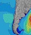 |  |  | 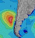 | 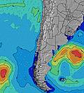 | 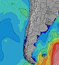 | 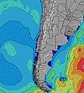 | ||||||||||||||
Wave Height (m) Direction Period (s) | W 10 | W 12 | WSW 13 | WSW 12 | WSW 11 | W 12 | W 12 | WSW 11 | W 11 | WSW 12 | W 11 | WNW 10 | W 10 | W 10 | WSW 10 | WSW 10 | SW 11 | SW 10 | W 9 | W 11 | W 10 |
Wave Graph | |||||||||||||||||||||
584 | 976 | 2810 | 1590 | 1146 | 723 | 464 | 370 | 242 | 189 | 403 | 867 | 640 | 431 | 250 | 325 | 429 | 200 | 461 | 1006 | 783 | |
Wind (km/h) | |||||||||||||||||||||
Wind State on-shore cross-onshore cross-shore cross-offshore off-shore glassy | cross-off | cross-off | glassy | glassy | glassy | cross-on | glassy | glassy | glassy | cross-off | cross-off | cross-off | on | off | cross-off | cross-off | cross-off | glassy | cross-off | on | glassy |
High Tide | 9:10AM1.31m | 9:46PM0.84m | 9:48AM1.37m | 10:19PM0.88m | 10:22AM1.41m | 10:51PM0.91m | 10:55AM1.42m | 11:23PM0.94m | 11:27AM1.41m | 11:56PM0.97m | 11:58AM1.36m | 00:29AM1.01m | 12:30PM1.29m | 1:05AM1.04m | |||||||
Low Tide | 4:00PM0.20m | 3:09AM0.29m | 4:34PM0.16m | 3:46AM0.24m | 5:05PM0.12m | 4:21AM0.21m | 5:35PM0.10m | 4:56AM0.20m | 6:04PM0.10m | 5:32AM0.21m | 6:32PM0.12m | 6:09AM0.24m | 7:00PM0.14m | ||||||||
7:39 | — | — | 7:39 | — | — | 7:39 | — | — | 7:37 | — | — | 7:37 | — | — | 7:35 | — | — | 7:35 | — | — | |
— | 6:05 | — | — | 6:06 | — | — | 6:06 | — | — | 6:07 | — | — | 6:07 | — | — | 6:07 | — | — | 6:08 | — | |
mm | 2 | — | — | — | — | — | — | — | — | — | — | — | 14 | 4 | — | — | — | 11 | — | — | — |
Temp °C | 15 | 15 | 14 | 15 | 15 | 14 | 16 | 16 | 16 | 15 | 16 | 15 | 14 | 14 | 13 | 15 | 15 | 14 | 15 | 17 | 16 |
Feels °C | 14 | 13 | 14 | 15 | 13 | 13 | 16 | 15 | 16 | 12 | 13 | 12 | 10 | 12 | 10 | 13 | 12 | 13 | 13 | 15 | 15 |
Swell 1 Height (m) Direction Period (s) | W 10 | W 12 | WSW 13 | WSW 12 | WSW 11 | W 12 | W 12 | WSW 11 | W 11 | WSW 12 | W 11 | WNW 10 | W 10 | W 10 | WSW 10 | WSW 10 | SW 11 | SW 10 | W 9 | W 11 | W 10 |
584 | 976 | 2810 | 1590 | 1146 | 723 | 464 | 370 | 242 | 189 | 403 | 867 | 640 | 431 | 250 | 325 | 429 | 200 | 461 | 1006 | 783 | |
Swell 2 Height (m) Direction Period (s) | WSW 15 | WSW 14 | SSW 11 | SSW 10 | — | SW 9 | SSW 8 | SSW 8 | WSW 13 | SSW 8 | SSW 7 | SW 18 | WSW 17 | WSW 12 | WNW 9 | SW 12 | NW 9 | W 9 | SW 10 | SW 9 | S 9 |
334 | 602 | 22 | 9 | — | 79 | 44 | 23 | 55 | 6 | 5 | 12 | 27 | 99 | 168 | 295 | 81 | 59 | 45 | 21 | 2 | |
Swell 3 Height (m) Direction Period (s) | SSW 12 | SSW 11 | — | — | — | WSW 16 | WSW 15 | NW 15 | SW 8 | SW 15 | SW 12 | W 18 | WNW 13 | WSW 16 | WSW 12 | NW 9 | W 9 | WNW 8 | NW 12 | — | W 21 |
56 | 50 | — | — | — | 25 | 43 | 8 | 17 | 8 | 5 | 6 | 16 | 51 | 187 | 112 | 81 | 44 | 6 | — | 9 | |
Wind waves Height (m) Direction Period (s) | N 3 | — | — | — | — | — | — | — | — | N 2 | N 4 | — | — | N 6 | — | — | — | N 2 | ENE 3 | — | — |
3 | — | — | — | — | — | — | — | — | 1 | 14 | — | — | 29 | — | — | — | 1 | 1 | — | — | |
Nearest Offshore or Glassy | |||||||||||||||||||||
Distance (km) | 0 | 0 | 3 | 0 | 0 | 3 | 0 | 0 | 0 | 0 | 39 | 39 | 5 | 0 | 0 | 0 | 0 | 0 | 0 | 58 | 0 |
Best forecast wave conditions in Santiago | |||||||||||||||||||||
Best forecast wave conditions in Chile | |||||||||||||||||||||
Header Global | |||||||||||||||||||||
- Map Icons:
 Break
Break Live Wave Height (m)
 Live Wind Speed (km/h)
 Surf Rating (10 Max)
 Ocean Swells (m)
- Wind Speed (km/h)


FREE! Surf-Forecast.com widget for your website
The surf report / weather widget below is available to embed on third party websites free of charge and provides a summary of our Renaca surf forecast. Simply grab the html code snippet that we provide and paste it into your own site. You can choose your preferred language and metric/imperial units for the surf forecast feed to suit users of your site. Click here to get the code.
Information about the Renaca Surf forecast
The above surf forecast table for Renaca provides essential information for determining whether the surfing conditions will be good over the next 16 days. A general guide to surfing at Renaca can be found by selecting the local surf guide option on the grey menu. Our Renaca surf forecast is unique since it includes wave energy (power) that defines the real feel of the surf rather than just the height or the period. If you surf the same spot (Renaca) regularly then make a mental note of the wave energy from the surf forecast table each time you go. Very soon you may start to choose your surf days based on the wave energy alone combined with our forecast of favourable offshore wind conditions. Our star ratings will help here and of course you will also find the usual wave height and period predictions on our surf forecasts as well as a full break down of the swell components under our advanced users option (to reveal that, click the little Einstein character under the tide times).
Further information to help with frequently asked questions about our surf forecast for Renaca may be found under the help tab on the top menu and also by moving your mouse over the question marks on the surf forecast table itself. Please always bear in mind that the forecast is for near-shore open water and local factors at each surf break influence the actual breaking wave height, such as the beach / reef profile, water depths offshore and shelter.
Renaca is 11 km (7 miles) from the city of Vina del Mar. If you plan a holiday in Santiago, look for hotels and other accommodation in Vina del Mar. Vina del Mar has rooms for a wide range of budgets as well as car hire and transport links.
 Nearest