

Surf Forecasts:

Ritoque surf forecast from 3 Aug 2026:
- Best quality surf: Thursday 6 Aug, 5AM (local time) - 10ft (3.0m), 12s period, SW swell with cross-offshore winds.
- Most powerful swell: Sunday 9 Aug, 8PM (local time) - 11ft (3.5m), 16s period, SW swell with 5,578 kJ wave energy.
- Next surfable swell (1★+): Monday 3 Aug, 11AM (local time) - 7.5ft (2.3m), 12s period with WSW swell.
Best Forecast Surf Conditions for Ritoque this week:
The surf forecast for Ritoque over the next 16 days: The first swell (rated 1 star or higher) is forecast to arrive on Monday (Aug 03) at 11AM. The primary swell is predicted to be 2.3m and 12s period with a secondary swell of 0.6m and 10s. The wind is predicted to be glassy as the swell arrives.
The most powerful waves expected at Ritoque in the next 16 days are 3.5m 16s and forecast to arrive on Sunday (Aug 09) at 8PM. Winds are predicted to be cross-shore at the time the swell arrives. The largest open ocean swell (not directed at the beach) is 0.6m 4s period and expected on Sunday (Aug 09) at 8AM.
| Wave Type | Time (-04) & Date | Wave Height & Period |
|---|---|---|
| Next good surf (1 star+) | 11AM (Mon 3rd Aug) | 7.5ft (2.3m) 12s |
| Best Surf | 5AM (Thu 6th Aug) | 10ft (3.0m) 12s |
| Most Powerful | 8PM (Sun 9th Aug) | 11ft (3.5m) 16s |
Table - best surf conditions forecast for Ritoque over the next 16 days.
The Lowdown
Alright, surf’s up, or it’s about to be. Let’s get into it.
We’ve got a solid run of surf on the cards for Ritoque, but it’s not all clean sailing. The opening of the week has some good, clean waves but the ocean’s running a bit warm for the season, a touch above the norm. It’s not crazy, but you’ll notice it.
Monday morning (Aug 3rd) is where you wanna be. Glassy conditions with a WSW swell at 8ft, period of 12 seconds. The energy is solid, a strong 1534. This is proper surf for the experienced crew. The wind is dead off, so it’ll be clean, but it’s a fair size, so leave the foamies at home.
The rest of that day and Tuesday get a bit messy with cross and cross-on winds, making things choppy.
Wednesday morning (Aug 5th) is a bit of a wildcard. We’ve got a clean-ish 7ft swell with an onshore wind, but it’s light. It might be worth a look, but it’s not the standout.
Now, Thursday (Aug 6th) is big. The swell jumps to 10ft, but with a short period of 11 seconds and strong cross-shore winds, this is getting into “too big for the break” territory. It’s got a ton of energy, 2651, but this isn’t a day for most of us. If you’re an expert, it could be a beast, but it’s a serious step up.
After that, things ease off for a day. Friday (Aug 7th) the swell drops to 6ft but the period is a weak 8 seconds and the wind is on it. It’s not great.
The next standout is Saturday morning (Aug 8th) . The swell is back to a fun 6ft from the SW, period of 10 seconds, and we’ve got a cross-offshore wind. The energy is moderate at 1409, but it’s clean. The crowd factor could be a thing here as it's fairly consistent, so get out early.
The following week starts to show some real promise. Sunday morning (Aug 9th) has a bigger 8ft swell but the wind is light cross-on, and the energy is strong at 3046. It’s not perfect, but it’s got power.
Hold on to your hats for Monday (Aug 10th) . We’re back to 10ft of swell, and it’s again flagged as just too big for this break. Unless you’re on a step-up and looking for a beating, it’s a pass.
The middle of the week is small. Tuesday and Wednesday drop right down. Wednesday morning (Aug 12th) is glassy but tiny, 4ft. The long period (16 seconds) on Thursday is interesting, but the size is small and the winds are just okay.
The real gem of this whole forecast is Sunday morning and afternoon (Aug 16th) . It’s a week and a half out, so take it with a grain of salt, but the models are looking clean. We’ve got a 7ft and then 8ft WSW/SW swell with a beautiful 13-14 second period, and it’s glassy. The energy is massive, 1863 and then 3931. This is the one you circle on the calendar. It’s got everything: size, period, and clean conditions. This is the pick of the fortnight.
The run-up to it on Saturday afternoon (Aug 15th) is also looking nice with clean 4ft surf, a good warm-up.
The forecast closes out with some big, powerful surf on Monday and Tuesday (Aug 17-18th) , but at 10-13ft, it’s again just too big for Ritoque to be any fun for most. That’s expert-only territory, and even then, it’s likely a washing machine. For the average surfer, that setup starts to look way more interesting for the kite crew than for paddle surfing.
So, your call: get on it early for the clean stuff, and maybe plan for that Sunday the 16th. Keep it on your radar.
Rusty.
Short Range ForecastModerate rain (total 13mm), heaviest on Wed night. Very mild (max 18°C on Mon afternoon, min 10°C on Wed night). Winds increasing (calm on Mon morning, fresh winds from the SSW by Wed night). | Days 4-6 Weather SummaryMostly dry. Very mild (max 14°C on Thu afternoon, min 8°C on Sat night). Wind will be generally light. | ||||||||||||||||||||
Monday 3 | Tuesday 4 | Wednesday 5 | Thursday 6 | Friday 7 | Saturday 8 | Sunday 9 | |||||||||||||||
AM | PM | Night | AM | PM | Night | AM | PM | Night | AM | PM | Night | AM | PM | Night | AM | PM | Night | AM | PM | Night | |
Swell Height Map |  |  | 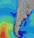 | 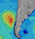 | 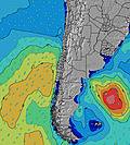 | 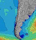 | 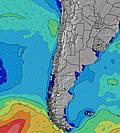 | ||||||||||||||
Wave Height (m) Direction Period (s) | WSW 12 | WSW 12 | WSW 12 | WSW 12 | WSW 12 | WSW 12 | WSW 12 | WSW 11 | WSW 14 | SW 11 | SW 11 | SW 9 | SW 8 | SW 8 | SW 11 | SW 14 | SW 13 | SW 13 | SW 13 | SW 16 | SW 14 |
Wave Graph | |||||||||||||||||||||
1455 | 1200 | 1310 | 1033 | 933 | 694 | 1197 | 926 | 2313 | 2061 | 1767 | 822 | 401 | 346 | 347 | 731 | 2270 | 2147 | 1671 | 1921 | 4436 | |
Wind (km/h) | |||||||||||||||||||||
Wind State on-shore cross-onshore cross-shore cross-offshore off-shore glassy | glassy | cross-on | cross | cross | cross-on | glassy | on | cross-on | off | cross | cross | cross-off | cross-on | cross-on | cross-off | cross-off | cross-on | cross-off | cross-on | cross-on | cross-off |
High Tide | 1:04PM1.20m | 1:44AM1.07m | 1:42PM1.08m | 2:30AM1.09m | 2:30PM0.96m | 3:27AM1.12m | 3:34PM0.84m | 4:38AM1.15m | 5:04PM0.76m | 5:57AM1.22m | 6:42PM0.75m | 7:09AM1.33m | 7:58PM0.80m | ||||||||
Low Tide | 7:29PM0.18m | 7:39AM0.34m | 8:02PM0.23m | 8:39AM0.40m | 8:43PM0.29m | 10:01AM0.43m | 9:37PM0.34m | 11:40AM0.41m | 10:51PM0.36m | 1:09PM0.32m | 00:12AM0.34m | 2:14PM0.21m | 1:23AM0.27m | ||||||||
7:33 | — | — | 7:33 | — | — | 7:33 | — | — | 7:31 | — | — | 7:31 | — | — | 7:30 | — | — | 7:28 | — | — | |
— | 6:09 | — | — | 6:09 | — | — | 6:10 | — | — | 6:12 | — | — | 6:12 | — | — | 6:13 | — | — | 6:14 | — | |
mm | — | — | — | — | — | — | — | — | 13 | — | — | — | — | — | — | — | — | — | — | — | — |
Temp °C | 16 | 18 | 16 | 16 | 16 | 15 | 15 | 15 | 14 | 11 | 14 | 11 | 11 | 12 | 10 | 10 | 11 | 9 | 10 | 11 | 9 |
Feels °C | 16 | 17 | 14 | 15 | 14 | 14 | 14 | 14 | 11 | 7 | 8 | 7 | 7 | 6 | 6 | 8 | 8 | 4 | 7 | 6 | 4 |
Swell 1 Height (m) Direction Period (s) | WSW 12 | WSW 12 | WSW 12 | WSW 12 | WSW 12 | WSW 12 | WSW 12 | WSW 11 | WSW 14 | SW 11 | SW 13 | SW 13 | SW 12 | SW 12 | SW 11 | SW 10 | SW 13 | SW 13 | SW 13 | SW 16 | SW 14 |
1455 | 1200 | 1310 | 1033 | 933 | 694 | 1197 | 926 | 2313 | 2061 | 451 | 382 | 240 | 202 | 347 | 731 | 2270 | 2147 | 1671 | 1895 | 3519 | |
Swell 2 Height (m) Direction Period (s) | SW 10 | SSW 10 | SSW 9 | SW 20 | SW 19 | SW 18 | SW 16 | SW 16 | — | WSW 13 | — | SW 19 | SW 18 | SW 16 | SW 15 | SW 14 | SW 21 | SW 19 | SW 17 | — | — |
79 | 63 | 31 | 61 | 131 | 307 | 326 | 567 | — | 590 | — | 14 | 108 | 165 | 313 | 605 | 116 | 432 | 1172 | — | — | |
Swell 3 Height (m) Direction Period (s) | — | — | SW 20 | NW 12 | NW 13 | NW 11 | NW 12 | NW 12 | — | — | — | — | — | — | SW 24 | SW 22 | — | — | — | — | — |
— | — | 15 | 6 | 6 | 5 | 5 | 6 | — | — | — | — | — | — | 22 | 73 | — | — | — | — | — | |
Wind waves Height (m) Direction Period (s) | — | — | — | SSW 4 | SW 5 | SW 6 | — | — | — | — | SW 11 | SW 9 | SW 8 | SW 8 | — | — | SSW 4 | SSW 6 | SSW 6 | SSW 11 | SW 14 |
— | — | — | 11 | 59 | 61 | — | — | — | — | 1767 | 822 | 401 | 346 | — | — | 30 | 200 | 203 | 1921 | 4436 | |
Nearest Offshore or Glassy | |||||||||||||||||||||
Distance (km) | 0 | 50 | 9 | 9 | 9 | 0 | 184 | 13 | 0 | 9 | 494 | 0 | 9 | 64 | 0 | 0 | 178 | 0 | 9 | 379 | 5 |
Best forecast wave conditions in Santiago | |||||||||||||||||||||
Best forecast wave conditions in Chile | |||||||||||||||||||||
Header Global | |||||||||||||||||||||
- Map Icons:
 Break
Break Live Wave Height (m)
 Live Wind Speed (km/h)
 Surf Rating (10 Max)
 Ocean Swells (m)
- Wind Speed (km/h)
Latest Updates


FREE! Surf-Forecast.com widget for your website
The surf report / weather widget below is available to embed on third party websites free of charge and provides a summary of our Ritoque surf forecast. Simply grab the html code snippet that we provide and paste it into your own site. You can choose your preferred language and metric/imperial units for the surf forecast feed to suit users of your site. Click here to get the code.
Information about the Ritoque Surf forecast
The above surf forecast table for Ritoque provides essential information for determining whether the surfing conditions will be good over the next 16 days. A general guide to surfing at Ritoque can be found by selecting the local surf guide option on the grey menu. Our Ritoque surf forecast is unique since it includes wave energy (power) that defines the real feel of the surf rather than just the height or the period. If you surf the same spot (Ritoque) regularly then make a mental note of the wave energy from the surf forecast table each time you go. Very soon you may start to choose your surf days based on the wave energy alone combined with our forecast of favourable offshore wind conditions. Our star ratings will help here and of course you will also find the usual wave height and period predictions on our surf forecasts as well as a full break down of the swell components under our advanced users option (to reveal that, click the little Einstein character under the tide times).
Further information to help with frequently asked questions about our surf forecast for Ritoque may be found under the help tab on the top menu and also by moving your mouse over the question marks on the surf forecast table itself. Please always bear in mind that the forecast is for near-shore open water and local factors at each surf break influence the actual breaking wave height, such as the beach / reef profile, water depths offshore and shelter.
Ritoque is 6 km (4 miles) from the city of Quintero. If you plan a holiday in Santiago, look for hotels and other accommodation in Quintero. Quintero has rooms for a wide range of budgets as well as car hire and transport links.
 Nearest