

Surf Forecasts:

Out Front surf forecast from 3 Aug 2026:
- Best quality surf: Monday 3 Aug, 11PM (local time) - 5ft (1.6m), 7s period, SSE swell with cross-offshore winds.
- Most powerful swell: Monday 3 Aug, 11AM (local time) - 6ft (1.8m), 8s period, S swell with 397 kJ wave energy.
- Next surfable swell (1★+): Monday 3 Aug, 11PM (local time) - 5ft (1.6m), 7s period with SSE swell.
Best Forecast Surf Conditions for Out Front this week:
The surf forecast for Out Front over the next 16 days: The first swell (rated 1 star or higher) is forecast to arrive on Monday (Aug 03) at 11PM. The primary swell is predicted to be 1.6m and 7s period with a secondary swell of 1.1m and 7s. The wind is predicted to be cross-offshore as the swell arrives.
The most powerful waves expected at Out Front in the next 16 days are 1.8m 8s and forecast to arrive on Monday (Aug 03) at 11AM. Winds are predicted to be cross-shore at the time the swell arrives. The largest open ocean swell (not directed at the beach) is 0.2m 2s period and expected on Monday (Aug 10) at 2AM.
| Wave Type | Time (EDT) & Date | Wave Height & Period |
|---|---|---|
| Next good surf (1 star+) | 11PM (Mon 3rd Aug) | 5ft (1.6m) 7s |
| Best Surf | 11PM (Mon 3rd Aug) | 5ft (1.6m) 7s |
| Most Powerful | 11AM (Mon 3rd Aug) | 6ft (1.8m) 8s |
Table - best surf conditions forecast for Out Front over the next 16 days.
The Lowdown
Alright, grab a coffee and listen up. This is a rough one.
Alright, let’s be straight with you. There’s barely a whisper of surf on the cards for the next 16 days. We’ve got a long, dry spell ahead. The only break on the radar is Out Front, and honestly, it’s just not doing much. For a spot that’s inconsistent at the best of times, this is a real flat patch.
The whole outlook is a struggle. Wave energy is tiny, and the wind is almost never your friend. It’s not until the end of the second week that we see a tiny pulse of energy, but even then, the quality is a write-off.
Let’s break down the grim reality. Monday the 3rd kicks off with a stormy risk and a 6ft south swell, but it’s short-period (8 seconds) and the wind is a strong cross-shore that’s just tearing it up. Poor surf, no doubt. Tuesday through to the weekend is all under 3ft. You’ve got some clean-ish windows on the Wednesday morning (5th) and again on Monday the 10th and Tuesday the 11th with light cross-off winds, but the swell is tiny, around 2ft to 2ft. Not worth paddling out for.
There’s a glimmer on Monday the 17th – a bit more energy pops up with a 4ft swell from the east-northeast. The combined energy finally hits a moderate level (161), but the wind is onshore and light, just enough to put a ripple on it. The period is only 7 seconds, so it won’t have any punch. It’s still rated as poor.
The water temp is sitting at a normal 76°, nothing unusual there.
To be honest, the entire 16-day window is a blank run. This is just one of those periods where the ocean decides to take a nap. If you see a bump in the forecast later, jump on it. For now, you’d be better off tuning the kite, because that’s about the only thing that might get moving in these conditions. The few moments of clean, small surf might be okay for a beginner to get some practice in on a foamie, but there’s no real wave to ride.
Rusty.
Short Range ForecastModerate rain (total 16mm), heaviest on Mon morning. Warm (max 28°C on Mon night, min 24°C on Tue morning). Winds decreasing (fresh winds from the SW on Mon morning, calm by Tue night). | Days 4-6 Weather SummaryLight rain (total 6mm), mostly falling on Thu morning. Warm (max 31°C on Sat afternoon, min 25°C on Fri morning). Winds decreasing (fresh winds from the S on Thu night, calm by Fri night). | ||||||||||||||||||||
Monday 3 | Tuesday 4 | Wednesday 5 | Thursday 6 | Friday 7 | Saturday 8 | Sunday 9 | |||||||||||||||
AM | PM | Night | AM | PM | Night | AM | PM | Night | AM | PM | Night | AM | PM | Night | AM | PM | Night | AM | PM | Night | |
Swell Height Map |  | 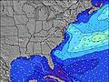 | 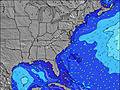 | 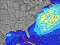 |  | 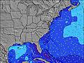 | 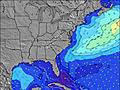 | ||||||||||||||
Wave Height (m) Direction Period (s) | S 8 | SSE 7 | SSE 7 | SSE 7 | SE 7 | SSE 7 | SSE 6 | SSE 6 | S 5 | SSE 6 | SSE 4 | S 6 | S 6 | S 4 | SSE 6 | SSE 8 | SSE 8 | SSE 6 | S 6 | S 6 | SSE 6 |
Wave Graph | |||||||||||||||||||||
397 | 125 | 75 | 31 | 37 | 40 | 26 | 41 | 53 | 35 | 29 | 62 | 64 | 14 | 52 | 63 | 47 | 39 | 18 | 27 | 25 | |
Wind (km/h) | |||||||||||||||||||||
Wind State on-shore cross-onshore cross-shore cross-offshore off-shore glassy | cross | cross-on | glassy | cross | cross | cross-on | cross-off | cross-on | cross | cross-on | cross-on | cross | cross | cross-on | glassy | cross | cross-on | cross | cross | cross-on | cross |
High Tide | 11:49AM1.16m | 00:02AM1.12m | 12:35PM1.19m | 00:54AM1.06m | 1:26PM1.21m | 1:51AM1.02m | 2:22PM1.23m | 2:54AM0.99m | 3:24PM1.25m | 4:04AM0.98m | 4:33PM1.28m | 5:16AM1.01m | 5:42PM1.33m | ||||||||
Low Tide | 6:16PM0.16m | 6:26AM0.04m | 7:06PM0.19m | 7:10AM0.08m | 8:13PM0.21m | 8:07AM0.11m | 9:30PM0.20m | 9:20AM0.13m | 10:42PM0.16m | 10:33AM0.12m | 11:46PM0.09m | 11:39AM0.07m | 00:44AM0.02m | ||||||||
6:05 | — | — | 6:05 | — | — | 6:07 | — | — | 6:07 | — | — | 6:09 | — | — | 6:09 | — | — | 6:11 | — | — | |
— | 8:07 | — | — | 8:07 | — | — | 8:06 | — | — | 8:05 | — | — | 8:04 | — | — | 8:02 | — | — | 8:01 | — | |
mm | 6 | 3 | 3 | — | — | 2 | 2 | — | — | 2 | — | — | — | — | 2 | — | — | 2 | — | — | — |
Temp °C | 26 | 27 | 28 | 25 | 25 | 25 | 25 | 27 | 26 | 27 | 29 | 28 | 28 | 30 | 29 | 28 | 31 | 29 | 28 | 31 | 29 |
Feels °C | 25 | 27 | 30 | 27 | 27 | 28 | 28 | 29 | 26 | 28 | 29 | 27 | 29 | 30 | 30 | 29 | 30 | 29 | 29 | 30 | 28 |
Swell 1 Height (m) Direction Period (s) | SSE 8 | — | SSE 7 | SSE 7 | SE 7 | ENE 5 | SSE 6 | NE 4 | — | E 10 | E 9 | E 9 | S 6 | ESE 8 | E 9 | SSE 8 | E 9 | SSE 6 | S 6 | E 9 | SSE 6 |
191 | — | 75 | 31 | 37 | 5 | 26 | 1 | — | 2 | 2 | 2 | 33 | 6 | 2 | 63 | 2 | 39 | 18 | 2 | 25 | |
Swell 2 Height (m) Direction Period (s) | — | — | E 13 | E 12 | — | ENE 5 | ENE 4 | NE 4 | E 10 | E 9 | E 9 | E 11 | E 9 | E 9 | E 9 | E 9 | E 9 | SE 8 | SE 7 | E 11 | E 8 |
— | — | 4 | 3 | — | 16 | 2 | 1 | 2 | 2 | 2 | 2 | 2 | 2 | 2 | 2 | 2 | 9 | 8 | 2 | 1 | |
Swell 3 Height (m) Direction Period (s) | — | — | — | — | E 8 | E 9 | E 9 | E 8 | — | — | E 11 | — | — | — | — | E 9 | — | — | E 9 | E 11 | — |
— | — | — | — | 1 | 2 | 2 | 1 | — | — | 2 | — | — | — | — | 2 | — | — | 2 | 2 | — | |
Wind waves Height (m) Direction Period (s) | S 8 | SSE 7 | — | ENE 5 | ENE 5 | SSE 7 | S 6 | SSE 6 | S 5 | SSE 6 | SSE 4 | S 6 | S 6 | S 4 | SSE 6 | SSW 5 | SSE 8 | — | — | S 6 | WSW 2 |
397 | 125 | — | 27 | 15 | 40 | 26 | 41 | 53 | 35 | 29 | 62 | 64 | 14 | 52 | 31 | 47 | — | — | 27 | 1 | |
Nearest Offshore or Glassy | |||||||||||||||||||||
Distance (km) | 76 | 70 | 3 | 173 | 122 | 122 | 3 | 76 | 277 | 102 | 490 | 490 | 145 | 271 | 3 | 41 | 85 | 3 | 325 | 101 | 52 |
Best forecast wave conditions in Virginia | |||||||||||||||||||||
Best forecast wave conditions in United States | |||||||||||||||||||||
Header Global | |||||||||||||||||||||
- Map Icons:
 Break
Break Live Wave Height (m)
 Live Wind Speed (km/h)
 Surf Rating (10 Max)
 Ocean Swells (m)
- Wind Speed (km/h)
Latest Updates


FREE! Surf-Forecast.com widget for your website
The surf report / weather widget below is available to embed on third party websites free of charge and provides a summary of our Out Front surf forecast. Simply grab the html code snippet that we provide and paste it into your own site. You can choose your preferred language and metric/imperial units for the surf forecast feed to suit users of your site. Click here to get the code.
Information about the Out Front Surf forecast
The above surf forecast table for Out Front provides essential information for determining whether the surfing conditions will be good over the next 16 days. A general guide to surfing at Out Front can be found by selecting the local surf guide option on the grey menu. Our Out Front surf forecast is unique since it includes wave energy (power) that defines the real feel of the surf rather than just the height or the period. If you surf the same spot (Out Front) regularly then make a mental note of the wave energy from the surf forecast table each time you go. Very soon you may start to choose your surf days based on the wave energy alone combined with our forecast of favourable offshore wind conditions. Our star ratings will help here and of course you will also find the usual wave height and period predictions on our surf forecasts as well as a full break down of the swell components under our advanced users option (to reveal that, click the little Einstein character under the tide times).
Further information to help with frequently asked questions about our surf forecast for Out Front may be found under the help tab on the top menu and also by moving your mouse over the question marks on the surf forecast table itself. Please always bear in mind that the forecast is for near-shore open water and local factors at each surf break influence the actual breaking wave height, such as the beach / reef profile, water depths offshore and shelter.
Out Front is 55 km (34 miles) from Ocean City. If you plan a vacation in Virginia, look for hotels and other accommodation in Ocean City. Ocean City has rooms for a wide range of budgets as well as car hire and transport links.
 Nearest