

Surf Forecasts:

Marataizes surf forecast from 15 Jul 2026:
- Best quality surf: Wednesday 15 Jul, 9PM (local time) - 2.5ft (0.7m), 11s period, ESE swell with cross-offshore winds.
- Most powerful swell: Thursday 16 Jul, 12PM (local time) - 4.5ft (1.3m), 11s period, ESE swell with 404 kJ wave energy.
- Next surfable swell (1★+): Wednesday 15 Jul, 9PM (local time) - 2.5ft (0.7m), 11s period with ESE swell.
Best Forecast Surf Conditions for Marataizes this week:
The surf forecast for Marataizes over the next 16 days: The first swell (rated 1 star or higher) is forecast to arrive on Wednesday (Jul 15) at 9PM. The primary swell is predicted to be 0.7m and 11s period. The wind is predicted to be cross-offshore as the swell arrives.
The most powerful waves expected at Marataizes in the next 16 days are 1.3m 11s and forecast to arrive on Thursday (Jul 16) at 12PM. Winds are predicted to be cross-onshore at the time the swell arrives. The largest open ocean swell (not directed at the beach) is 1.7m 6s period and expected on Tuesday (Jul 21) at 9PM.
| Wave Type | Time (-03) & Date | Wave Height & Period |
|---|---|---|
| Next good surf (1 star+) | 9PM (Wed 15th Jul) | 2.5ft (0.7m) 11s |
| Best Surf | 9PM (Wed 15th Jul) | 2.5ft (0.7m) 11s |
| Most Powerful | 12PM (Thu 16th Jul) | 4.5ft (1.3m) 11s |
Table - best surf conditions forecast for Marataizes over the next 16 days.
The Lowdown
Alright folks, Rusty here. Let’s look at what’s on the cards for our local stretch.
Overall, the pattern for the next 16 days is a long, drawn-out run of pretty ordinary conditions. There’s no real punch to the swell, and the wind is going to be a constant problem. We’ve got a solid 10-day gap from the start where there’s nothing worth paddling out for, and even after that, it’s mostly marginal. The water temp is sitting at 75° at the start, which is basically average for the time of year, so no surprises there.
The only real standout, and I mean the *only* one that gets a mention, is the very end of the run. On the morning of Tuesday, July 28th, we’ll see a glimmer of hope. The swell is only 2ft, but it’s coming from the SSE with a very long 16-second period. That’s proper groundswell energy, and for a spot like Marataizes, that long period stuff can wrap in a little better. The wind is light and cross-off from the NNE, which will keep it clean. The combined energy is a modest 162, so it’s not powerful, but it’s structured. For a protected spot, this could offer a few clean, lined-up waves. It’s a promising little window, but being so far out, don’t lock it in just yet.
Other than that, the rest of the period is a write-off. The afternoons get hammered by a fresh onshore breeze that turns everything into a lumpy mess, and the mornings might be clean but with tiny, weak swells that lack any push. A couple of afternoons, like July 20th and July 28th, see a bit more energy (115 and 617 respectively), but the wind is so bad it’s not worth the paddle. For a break that’s inconsistent by nature, this kind of blank run isn’t that unusual, but it doesn’t make it any less frustrating.
Marataizes is a beginner-friendly zone, but when the swell bumps up to 4ft like on the afternoon of July 16th (combined energy 554), the onshore wind makes it a messy, lumpy mess. That’s more of a kite-surfing setup than a paddle-friendly one.
Rusty.
Short Range ForecastMostly dry. Warm (max 24°C on Sat morning, min 18°C on Wed night). Winds increasing (light winds from the NNW on Wed night, fresh winds from the ENE by Fri afternoon). | Days 5-7 Weather SummaryMostly dry. Warm (max 25°C on Sun morning, min 20°C on Sat night). Winds decreasing (fresh winds from the ENE on Sat afternoon, light winds from the NNE by Tue morning). | ||||||||||||||||||||
Wed 15 | Thursday 16 | Friday 17 | Saturday 18 | Sunday 19 | Monday 20 | Tuesday 21 | |||||||||||||||
PM | Night | AM | PM | Night | AM | PM | Night | AM | PM | Night | AM | PM | Night | AM | PM | Night | AM | PM | Night | AM | |
Swell Height Map |  |  |  |  |  |  | 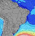 | 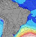 | |||||||||||||
Wave Height (m) Direction Period (s) | SE 11 | ESE 11 | ESE 11 | ESE 11 | ESE 11 | ESE 10 | ESE 10 | ESE 10 | E 7 | E 7 | E 7 | E 7 | E 7 | E 7 | E 7 | E 7 | E 7 | E 7 | E 8 | E 7 | E 7 |
Wave Graph | |||||||||||||||||||||
119 | 99 | 99 | 404 | 117 | 86 | 229 | 41 | 24 | 77 | 48 | 38 | 86 | 51 | 40 | 108 | 54 | 39 | 55 | 48 | 39 | |
Wind (km/h) | |||||||||||||||||||||
Wind State on-shore cross-onshore cross-shore cross-offshore off-shore glassy | cross-on | cross-off | cross-off | cross-on | cross-off | cross-off | cross-on | cross-off | cross-off | cross-on | cross-off | cross-off | cross-on | cross | cross-off | cross-on | cross-off | cross-off | cross | cross-off | cross-off |
High Tide | 4:11PM1.55m | 4:00AM1.62m | 4:51PM1.51m | 4:42AM1.62m | 5:29PM1.45m | 5:24AM1.58m | 6:06PM1.38m | 6:08AM1.49m | 6:45PM1.30m | 6:55AM1.37m | 7:28PM1.23m | 7:51AM1.25m | 8:19PM1.16m | 9:02AM1.15m | |||||||
Low Tide | 10:23PM0.37m | 10:47AM-0.03m | 10:58PM0.39m | 11:27AM0.05m | 11:33PM0.40m | 12:06PM0.16m | 00:09AM0.43m | 12:45PM0.29m | 00:50AM0.47m | 1:25PM0.42m | 1:37AM0.50m | 2:13PM0.54m | 2:39AM0.54m | ||||||||
— | — | 6:20 | — | — | 6:18 | — | — | 6:18 | — | — | 6:18 | — | — | 6:18 | — | — | 6:18 | — | — | 6:18 | |
5:17 | — | — | 5:17 | — | — | 5:19 | — | — | 5:19 | — | — | 5:19 | — | — | 5:20 | — | — | 5:20 | — | 5:20 | |
mm | — | — | — | — | — | — | — | — | — | — | — | — | — | — | — | — | — | — | — | — | — |
Temp °C | 21 | 21 | 22 | 22 | 21 | 23 | 23 | 21 | 24 | 23 | 22 | 25 | 24 | 22 | 25 | 23 | 22 | 24 | 24 | 23 | 25 |
Feels °C | 18 | 19 | 18 | 17 | 19 | 20 | 18 | 19 | 21 | 18 | 20 | 23 | 20 | 19 | 23 | 19 | 20 | 23 | 21 | 21 | 24 |
Swell 1 Height (m) Direction Period (s) | SE 11 | ESE 11 | ESE 11 | ESE 11 | ESE 11 | ESE 10 | ESE 10 | E 6 | E 7 | ESE 10 | E 7 | E 7 | E 16 | E 7 | E 7 | SE 13 | E 7 | E 7 | SE 11 | E 7 | E 7 |
119 | 99 | 99 | 404 | 117 | 86 | 229 | 28 | 24 | 67 | 48 | 38 | 5 | 51 | 40 | 7 | 54 | 39 | 5 | 48 | 39 | |
Swell 2 Height (m) Direction Period (s) | — | — | E 8 | — | — | — | — | ESE 10 | ESE 10 | SE 16 | — | — | SE 13 | E 15 | — | — | — | SE 12 | — | SE 11 | S 11 |
— | — | 1 | — | — | — | — | 41 | 19 | 10 | — | — | 7 | 4 | — | — | — | 6 | — | 5 | 2 | |
Swell 3 Height (m) Direction Period (s) | — | — | — | — | — | — | — | — | — | — | — | — | — | — | — | — | — | — | — | — | — |
— | — | — | — | — | — | — | — | — | — | — | — | — | — | — | — | — | — | — | — | — | |
Wind waves Height (m) Direction Period (s) | — | — | — | ESE 11 | ENE 5 | — | E 10 | ENE 6 | — | E 7 | ENE 7 | — | E 7 | NNE 4 | — | E 7 | ENE 7 | — | E 8 | ENE 6 | — |
— | — | — | 150 | 40 | — | 172 | 98 | — | 77 | 203 | — | 86 | 14 | — | 108 | 256 | — | 55 | 203 | — | |
Nearest Offshore or Glassy | |||||||||||||||||||||
Distance (km) | 95 | 0 | 0 | 95 | 37 | 0 | 282 | 37 | 37 | 95 | 37 | 37 | 95 | 66 | 37 | 108 | 78 | 37 | 161 | 75 | 78 |
Best forecast wave conditions in Espírito Santo | |||||||||||||||||||||
Best forecast wave conditions in Brazil | |||||||||||||||||||||
Header Global | |||||||||||||||||||||
- Map Icons:
 Break
Break Live Wave Height (m)
 Live Wind Speed (km/h)
 Surf Rating (10 Max)
 Ocean Swells (m)
- Wind Speed (km/h)


FREE! Surf-Forecast.com widget for your website
The surf report / weather widget below is available to embed on third party websites free of charge and provides a summary of our Marataizes surf forecast. Simply grab the html code snippet that we provide and paste it into your own site. You can choose your preferred language and metric/imperial units for the surf forecast feed to suit users of your site. Click here to get the code.
Information about the Marataizes Surf forecast
The above surf forecast table for Marataizes provides essential information for determining whether the surfing conditions will be good over the next 16 days. A general guide to surfing at Marataizes can be found by selecting the local surf guide option on the grey menu. Our Marataizes surf forecast is unique since it includes wave energy (power) that defines the real feel of the surf rather than just the height or the period. If you surf the same spot (Marataizes) regularly then make a mental note of the wave energy from the surf forecast table each time you go. Very soon you may start to choose your surf days based on the wave energy alone combined with our forecast of favourable offshore wind conditions. Our star ratings will help here and of course you will also find the usual wave height and period predictions on our surf forecasts as well as a full break down of the swell components under our advanced users option (to reveal that, click the little Einstein character under the tide times).
Further information to help with frequently asked questions about our surf forecast for Marataizes may be found under the help tab on the top menu and also by moving your mouse over the question marks on the surf forecast table itself. Please always bear in mind that the forecast is for near-shore open water and local factors at each surf break influence the actual breaking wave height, such as the beach / reef profile, water depths offshore and shelter.
Marataizes is 2 km (1 miles) from Itapemirim. If you plan a holiday in Espírito Santo, look for hotels and other accommodation in Itapemirim. Itapemirim has rooms for a wide range of budgets as well as car hire and transport links.
 Nearest