

Surf Forecasts:

Lori Wilson Park surf forecast from 3 Aug 2026:
- Most powerful swell: Saturday 8 Aug, 5AM (local time) - 4.5ft (1.4m), 8s period, E swell with 247 kJ wave energy.
Best Forecast Surf Conditions for Lori Wilson Park this week:
The most powerful waves expected at Lori Wilson Park in the next 16 days are 1.4m 8s and forecast to arrive on Saturday (Aug 08) at 5AM. Winds are predicted to be cross-onshore at the time the swell arrives.
| Wave Type | Time (EDT) & Date | Wave Height & Period |
|---|---|---|
| Next good surf (1 star+) | - | - |
| Best Surf | - | - |
| Most Powerful | 5AM (Sat 8th Aug) | 4.5ft (1.4m) 8s |
Table - best surf conditions forecast for Lori Wilson Park over the next 16 days.
The Lowdown
Alright folks, Rusty here. Let’s be straight with you – this stretch of the Cocoa Beach area is lookin’ pretty flat and sad for the next 16 days. We’ve got a solid run of nothing much to get excited about.
Right now, through Monday the 3rd of August, we’re staring at tiny, weak leftovers. Lori Wilson Park is seeing a feeble 1 ft of swell from the ESE, with a short period of 8 seconds and a combined energy of only 20 (weak). The water is a warm 84°F with no anomaly – about average for this time of year. The wind is a cross-offshore from the SW, so the surface is clean, but there’s just no power to work with. It’s a flat spell.
Tuesday the 4th and Wednesday the 5th are more of the same – 2 ft to 1 ft of windswell, periods dropping to 7 seconds, and energy barely ticking up to 44 at best. The wind flips onshore from the E on Wednesday, messing up what little shape there is. Thursday the 6th stays small with a risk of thunderstorms adding to the misery.
Friday the 7th of August shows a little spike: the swell bumps to 4 ft in the morning, hitting 5 ft in the afternoon with the period still a short 7 seconds, but the combined energy jumps to 376 (moderate). The problem? The wind is straight onshore from the E at 9-12 mph, making it a choppy, bumpy mess. The surf quality is still poor. This setup is more interesting for kite surfing than paddle surfing if you’re into that.
Saturday the 8th and Sunday the 9th are messy with onshore winds and dropping swell, back to 3 ft or less. From Monday the 10th all the way through Tuesday the 18th of August, it’s a washout: swell heights stay between 0.7 ft and 2 ft, periods are short (4-8 seconds), and energy values are mostly in the teens or single digits. Winds are a mix of cross and cross-onshore, never giving us a clean window.
The only tiny glimmer is on Friday morning the 14th of August, when we get a glassy moment with 1 ft from the ESE and a 5-second period. But at 20 energy, it’s barely a ripple. Then Saturday the 15th and Sunday the 16th see a return of cross-offshore winds from the SSW, but the swell is only 1.0 ft to 1 ft – not enough to ride.
Honestly, there’s no standout day here. The best you can hope for is a longboard session on the glassy Friday morning or a clean Sunday morning on the 16th, but the swell is just too small. For the rest of the 16-day window, don’t bother paddling out unless you’re desperate for a float.
Rusty
Short Range ForecastLight rain (total 8mm), mostly falling on Mon night. Warm (max 32°C on Mon afternoon, min 24°C on Mon night). Wind will be generally light. | Days 4-6 Weather SummaryLight rain (total 9mm), mostly falling on Sat night. Warm (max 29°C on Thu afternoon, min 27°C on Thu morning). Wind will be generally light. | ||||||||||||||||||||
Monday 3 | Tuesday 4 | Wednesday 5 | Thursday 6 | Friday 7 | Saturday 8 | Sunday 9 | |||||||||||||||
AM | PM | Night | AM | PM | Night | AM | PM | Night | AM | PM | Night | AM | PM | Night | AM | PM | Night | AM | PM | Night | |
Swell Height Map |  |  |  | 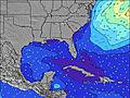 | 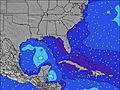 | 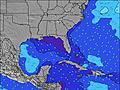 | 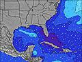 | ||||||||||||||
Wave Height (m) Direction Period (s) | ESE 8 | ESE 8 | ESE 8 | E 8 | ESE 8 | E 7 | E 7 | ESE 7 | ESE 7 | E 5 | E 5 | E 6 | E 7 | E 7 | E 8 | E 8 | E 8 | E 8 | E 8 | E 7 | E 7 |
Wave Graph | |||||||||||||||||||||
20 | 20 | 32 | 29 | 44 | 28 | 28 | 18 | 18 | 25 | 28 | 49 | 104 | 233 | 148 | 129 | 177 | 98 | 71 | 53 | 38 | |
Wind (km/h) | |||||||||||||||||||||
Wind State on-shore cross-onshore cross-shore cross-offshore off-shore glassy | cross-off | cross | cross-off | cross-off | cross | off | on | on | cross-on | on | on | on | on | on | on | cross-on | on | cross-on | cross-on | on | cross-on |
High Tide | 11:53AM1.05m | 00:05AM1.04m | 12:43PM1.10m | 00:52AM0.98m | 1:36PM1.15m | 1:42AM0.94m | 2:34PM1.19m | 2:40AM0.90m | 3:39PM1.24m | 3:47AM0.89m | 4:45PM1.30m | 4:53AM0.92m | 5:44PM1.35m | ||||||||
Low Tide | 5:55PM0.17m | 6:17AM0.02m | 6:55PM0.20m | 7:05AM-0.00m | 7:53PM0.21m | 7:55AM-0.02m | 8:57PM0.22m | 8:52AM-0.04m | 10:05PM0.20m | 9:54AM-0.06m | 11:09PM0.17m | 10:57AM-0.09m | 00:08AM0.12m | ||||||||
6:45 | — | — | 6:45 | — | — | 6:46 | — | — | 6:46 | — | — | 6:47 | — | — | 6:48 | — | — | 6:48 | — | — | |
— | 8:10 | — | — | 8:09 | — | — | 8:09 | — | — | 8:08 | — | — | 8:07 | — | — | 8:07 | — | — | 8:06 | — | |
mm | — | 1 | 5 | — | — | — | — | 1 | 1 | 1 | 1 | 2 | — | 2 | — | — | — | 3 | 1 | — | — |
Temp °C | 28 | 32 | 26 | 27 | 30 | 29 | 28 | 28 | 28 | 28 | 29 | 28 | 28 | 28 | 28 | 28 | 28 | 28 | 28 | 29 | 28 |
Feels °C | 30 | 33 | 25 | 30 | 31 | 31 | 32 | 31 | 31 | 30 | 32 | 31 | 29 | 29 | 30 | 32 | 31 | 31 | 32 | 32 | 32 |
Swell 1 Height (m) Direction Period (s) | ESE 8 | ESE 8 | ESE 8 | E 8 | ESE 8 | E 7 | E 7 | ESE 7 | ESE 7 | E 5 | E 7 | E 9 | NE 10 | E 7 | E 8 | E 8 | E 8 | E 8 | E 8 | E 7 | E 7 |
20 | 20 | 32 | 29 | 44 | 28 | 28 | 18 | 18 | 25 | 4 | 2 | 4 | 233 | 148 | 129 | 177 | 98 | 71 | 53 | 38 | |
Swell 2 Height (m) Direction Period (s) | — | — | — | — | — | — | — | — | — | E 10 | E 10 | NE 11 | — | NE 10 | SSE 5 | ENE 9 | NE 9 | NE 9 | ENE 9 | SSE 5 | NE 9 |
— | — | — | — | — | — | — | — | — | 2 | 2 | 5 | — | 4 | 5 | 9 | 3 | 3 | 9 | 2 | 3 | |
Swell 3 Height (m) Direction Period (s) | — | — | — | — | — | — | — | — | — | — | — | — | — | — | ENE 10 | — | — | — | — | ENE 9 | — |
— | — | — | — | — | — | — | — | — | — | — | — | — | — | 9 | — | — | — | — | 8 | — | |
Wind waves Height (m) Direction Period (s) | — | — | — | — | — | — | — | ESE 2 | ESE 4 | — | E 5 | E 6 | E 7 | E 7 | — | — | E 8 | SSE 5 | SSE 5 | — | SSE 4 |
— | — | — | — | — | — | — | 1 | 6 | — | 28 | 49 | 104 | 139 | — | — | 125 | 9 | 4 | — | 2 | |
Nearest Offshore or Glassy | |||||||||||||||||||||
Distance (km) | 164 | 116 | 967 | 48 | 74 | 48 | 164 | 100 | 1325 | 182 | 1857 | 1382 | 1145 | 494 | 668 | 574 | 574 | 40 | 74 | 1262 | 74 |
Best forecast wave conditions in North Florida | |||||||||||||||||||||
Best forecast wave conditions in United States | |||||||||||||||||||||
Header Global | |||||||||||||||||||||
- Map Icons:
 Break
Break Live Wave Height (m)
 Live Wind Speed (km/h)
 Surf Rating (10 Max)
 Ocean Swells (m)
- Wind Speed (km/h)
Latest Updates


FREE! Surf-Forecast.com widget for your website
The surf report / weather widget below is available to embed on third party websites free of charge and provides a summary of our Lori Wilson Park surf forecast. Simply grab the html code snippet that we provide and paste it into your own site. You can choose your preferred language and metric/imperial units for the surf forecast feed to suit users of your site. Click here to get the code.
Information about the Lori Wilson Park Surf forecast
The above surf forecast table for Lori Wilson Park provides essential information for determining whether the surfing conditions will be good over the next 16 days. A general guide to surfing at Lori Wilson Park can be found by selecting the local surf guide option on the grey menu. Our Lori Wilson Park surf forecast is unique since it includes wave energy (power) that defines the real feel of the surf rather than just the height or the period. If you surf the same spot (Lori Wilson Park) regularly then make a mental note of the wave energy from the surf forecast table each time you go. Very soon you may start to choose your surf days based on the wave energy alone combined with our forecast of favourable offshore wind conditions. Our star ratings will help here and of course you will also find the usual wave height and period predictions on our surf forecasts as well as a full break down of the swell components under our advanced users option (to reveal that, click the little Einstein character under the tide times).
Further information to help with frequently asked questions about our surf forecast for Lori Wilson Park may be found under the help tab on the top menu and also by moving your mouse over the question marks on the surf forecast table itself. Please always bear in mind that the forecast is for near-shore open water and local factors at each surf break influence the actual breaking wave height, such as the beach / reef profile, water depths offshore and shelter.
Lori Wilson Park is 12 km (7 miles) from Rockledge. If you plan a vacation in North Florida, look for hotels and other accommodation in Rockledge. Rockledge has rooms for a wide range of budgets as well as car hire and transport links.
 Nearest