

Surf Forecasts:

Gilgo surf forecast from 31 Jul 2026:
- Most powerful swell: Monday 3 Aug, 8PM (local time) - 6ft (1.9m), 8s period, S swell with 458 kJ wave energy.
Best Forecast Surf Conditions for Gilgo this week:
The most powerful waves expected at Gilgo in the next 16 days are 1.9m 8s and forecast to arrive on Monday (Aug 03) at 8PM. Winds are predicted to be cross-onshore at the time the swell arrives.
| Wave Type | Time (EDT) & Date | Wave Height & Period |
|---|---|---|
| Next good surf (1 star+) | - | - |
| Best Surf | - | - |
| Most Powerful | 8PM (Mon 3rd Aug) | 6ft (1.9m) 8s |
Table - best surf conditions forecast for Gilgo over the next 16 days.
The Lowdown
Alright, Rusty here. Let’s talk about Gilgo for the next couple of weeks.
Right off the bat, it’s a rough stretch. The water is a touch warmer than normal for this time of year, at 75°, but that’s about the only good news early on. The swell is small, the wind is mostly cross-onshore or onshore, and the wave comment keeps saying “poor surf conditions.” For the first ten days, from Friday, July 31st, all the way through to Monday, August 10th, there’s nothing worth paddling out for. The combined energy barely gets off the ground – most of it is under 100 (76, 40, 79… you get the picture) – and when it does bump up to 222 on Monday, August 3rd, it’s still paired with a storm risk and cross-onshore wind. The swell is short-period, around 7 to 8 seconds, which means weak, crumbly waves. Not our kind of session.
The surf quality stays poor through that whole first week and into the second. There’s a gap of about 11 days with no real recommendation. The only whisper of hope comes on Wednesday, August 12th, in the morning. The wind finally swings around to a cross-offshore from the NNE, and the wave comment says “surfable waves but very ordinary conditions.” The swell is still tiny, just 3 ft from the south, with a period of 6 seconds, and the combined energy is only 72. It’s clean, but it’s really small. For a beginner, it might be a fun little pop, but for anyone with a bit of experience, it’s barely a ripple.
Beyond that, it’s back to poor conditions. Thursday, August 13th, has a morning with near-glass conditions – light rain and a slight air from the ESE – but the swell is gone, only 1 ft. Friday, August 14th, morning is actually glassy, with a light SE breeze, but again, only 1 ft of weak south swell. If you’re desperate for a longboard and a sunrise, you could make something of it, but it’s not a standout.
The rest of the 16-day run into Saturday, August 15th, is more of the same: small, choppy, cross-onshore wind. The combined energy stays low, around 13 to 30. There are no true standouts here. No big swell, no perfect wind, no classic break pumping. If you’re a kitesurfer, the consistent cross-onshore wind and choppy conditions on the beach might look a bit more interesting than it does for a paddle surfer. For us, this is a flat spell.
Rusty.
Short Range ForecastModerate rain (total 16mm), heaviest on Sun night. Warm (max 26°C on Fri afternoon, min 23°C on Fri night). Wind will be generally light. | Days 5-7 Weather SummaryModerate rain (total 18mm), heaviest on Mon night. Warm (max 26°C on Wed afternoon, min 23°C on Mon night). Winds decreasing (fresh winds from the SSW on Mon night, light winds from the SSW by Tue afternoon). | |||||||||||||||||||
Fri 31 | Saturday 1 | Sunday 2 | Monday 3 | Tuesday 4 | Wednesday 5 | Thursday 6 | ||||||||||||||
PM | Night | AM | PM | Night | AM | PM | Night | AM | PM | Night | AM | PM | Night | AM | PM | Night | AM | PM | Night | |
Swell Height Map | 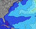 | 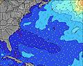 | 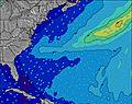 | 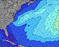 | 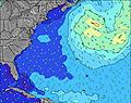 | 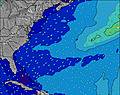 | 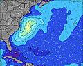 | |||||||||||||
Wave Height (m) Direction Period (s) | SSE 8 | S 8 | S 8 | S 8 | S 4 | SSE 7 | SSE 4 | SSE 5 | SSE 7 | S 8 | S 8 | S 7 | S 7 | S 7 | S 6 | S 6 | S 6 | S 6 | S 6 | S 6 |
Wave Graph | ||||||||||||||||||||
70 | 31 | 33 | 74 | 24 | 62 | 36 | 35 | 222 | 383 | 328 | 150 | 103 | 92 | 94 | 139 | 127 | 76 | 115 | 83 | |
Wind (km/h) | ||||||||||||||||||||
Wind State on-shore cross-onshore cross-shore cross-offshore off-shore glassy | cross-on | cross-on | cross-on | on | cross-on | on | on | cross-on | cross-on | cross-on | cross-on | cross-on | cross-on | cross-on | cross-on | cross-on | cross-on | cross-on | cross-on | cross |
High Tide | 9:14PM1.43m | 9:44AM1.26m | 9:50PM1.38m | 10:22AM1.30m | 10:31PM1.33m | 11:04AM1.33m | 11:17PM1.27m | 11:50AM1.36m | 00:09AM1.22m | 12:41PM1.39m | 1:06AM1.17m | 1:37PM1.41m | 2:09AM1.13m | |||||||
Low Tide | 3:09PM0.13m | 3:39AM-0.01m | 3:48PM0.14m | 4:11AM-0.00m | 4:26PM0.16m | 4:44AM0.02m | 5:09PM0.19m | 5:19AM0.05m | 5:59PM0.22m | 6:03AM0.09m | 7:06PM0.25m | 7:00AM0.14m | 8:23PM0.24m | |||||||
— | — | 5:50 | — | — | 5:50 | — | — | 5:50 | — | — | 5:52 | — | — | 5:52 | — | — | 5:54 | — | — | |
8:09 | — | — | 8:08 | — | — | 8:07 | — | — | 8:07 | — | — | 8:05 | — | — | 8:04 | — | — | 8:02 | — | |
mm | — | — | — | — | — | — | — | 13 | 3 | 2 | 14 | 1 | 1 | — | — | — | — | — | — | 2 |
Temp °C | 26 | 24 | 25 | 26 | 24 | 25 | 25 | 25 | 25 | 25 | 25 | 23 | 25 | 24 | 24 | 26 | 26 | 25 | 27 | 29 |
Feels °C | 26 | 23 | 25 | 25 | 23 | 25 | 25 | 27 | 27 | 26 | 23 | 25 | 25 | 26 | 24 | 26 | 26 | 26 | 27 | 30 |
Swell 1 Height (m) Direction Period (s) | E 6 | S 8 | S 8 | SE 9 | SE 7 | SE 7 | S 8 | SE 6 | — | — | SSE 8 | S 7 | — | — | E 12 | — | — | S 6 | — | E 11 |
3 | 31 | 33 | 3 | 7 | 19 | 1 | 10 | — | — | 202 | 150 | — | — | 3 | — | — | 76 | — | 2 | |
Swell 2 Height (m) Direction Period (s) | E 6 | ESE 9 | SE 9 | E 6 | ESE 8 | S 9 | SE 9 | S 6 | — | — | — | — | — | — | E 11 | E 10 | — | — | E 10 | E 11 |
3 | 8 | 3 | 1 | 7 | 2 | 3 | 7 | — | — | — | — | — | — | 2 | 2 | — | — | 2 | 2 | |
Swell 3 Height (m) Direction Period (s) | — | E 6 | E 6 | E 6 | E 6 | E 5 | — | — | — | — | — | — | — | — | — | — | — | — | — | — |
— | 1 | 1 | 1 | 1 | 1 | — | — | — | — | — | — | — | — | — | — | — | — | — | — | |
Wind waves Height (m) Direction Period (s) | SSE 8 | SSW 4 | S 4 | S 8 | S 4 | SSE 7 | SSE 4 | SSE 5 | SSE 7 | S 8 | S 8 | — | S 7 | S 7 | S 6 | S 6 | S 6 | — | S 6 | S 6 |
70 | 17 | 3 | 74 | 24 | 62 | 36 | 35 | 222 | 383 | 328 | — | 103 | 92 | 94 | 139 | 127 | — | 115 | 83 | |
Nearest Offshore or Glassy | ||||||||||||||||||||
Distance (km) | 137 | 59 | 137 | 831 | 374 | 927 | 1405 | 59 | 129 | 159 | 137 | 68 | 56 | 137 | 56 | 137 | 53 | 56 | 159 | 53 |
Best forecast wave conditions in Long Island New York | ||||||||||||||||||||
Best forecast wave conditions in United States | ||||||||||||||||||||
Header Global | ||||||||||||||||||||
- Map Icons:
 Break
Break Live Wave Height (m)
 Live Wind Speed (km/h)
 Surf Rating (10 Max)
 Ocean Swells (m)
- Wind Speed (km/h)
Latest Updates


FREE! Surf-Forecast.com widget for your website
The surf report / weather widget below is available to embed on third party websites free of charge and provides a summary of our Gilgo surf forecast. Simply grab the html code snippet that we provide and paste it into your own site. You can choose your preferred language and metric/imperial units for the surf forecast feed to suit users of your site. Click here to get the code.
Information about the Gilgo Surf forecast
The above surf forecast table for Gilgo provides essential information for determining whether the surfing conditions will be good over the next 16 days. A general guide to surfing at Gilgo can be found by selecting the local surf guide option on the grey menu. Our Gilgo surf forecast is unique since it includes wave energy (power) that defines the real feel of the surf rather than just the height or the period. If you surf the same spot (Gilgo) regularly then make a mental note of the wave energy from the surf forecast table each time you go. Very soon you may start to choose your surf days based on the wave energy alone combined with our forecast of favourable offshore wind conditions. Our star ratings will help here and of course you will also find the usual wave height and period predictions on our surf forecasts as well as a full break down of the swell components under our advanced users option (to reveal that, click the little Einstein character under the tide times).
Further information to help with frequently asked questions about our surf forecast for Gilgo may be found under the help tab on the top menu and also by moving your mouse over the question marks on the surf forecast table itself. Please always bear in mind that the forecast is for near-shore open water and local factors at each surf break influence the actual breaking wave height, such as the beach / reef profile, water depths offshore and shelter.
Gilgo is 7 km (4 miles) from Copiague. If you plan a vacation in Long Island New York, look for hotels and other accommodation in Copiague. Copiague has rooms for a wide range of budgets as well as car hire and transport links.
 Nearest