

Surf Forecasts:

Chia surf forecast from 3 Aug 2026:
- Most powerful swell: Wednesday 5 Aug, 8PM (local time) - 2.5ft (0.7m), 7s period, WSW swell with 48 kJ wave energy.
Best Forecast Surf Conditions for Chia this week:
The most powerful waves expected at Chia in the next 16 days are 0.7m 7s and forecast to arrive on Wednesday (Aug 05) at 8PM. Winds are predicted to be cross-offshore at the time the swell arrives. The largest open ocean swell (not directed at the beach) is 1.6m 6s period and expected on Friday (Aug 07) at 5PM.
| Wave Type | Time (CEST) & Date | Wave Height & Period |
|---|---|---|
| Next good surf (1 star+) | - | - |
| Best Surf | - | - |
| Most Powerful | 8PM (Wed 5th Aug) | 2.5ft (0.7m) 7s |
Table - best surf conditions forecast for Chia over the next 16 days.
The Lowdown
Alright folks, it’s Rusty here. Let’s be straight with you – this 16-day stretch for Chia is a bit of a write-off. We’ve got a long, flat spell ahead with barely a ripple to get excited about. The forecast shows a whole lot of days with no surf to speak of, so don't be holding your breath for a session.
The first few days, from August 3rd right through to the 5th, are just about dead. We’re talking tiny, weak swell – 1.0ft to 2ft at best – with periods of 3 to 5 seconds. That’s just wind chop, not surf. The wind is all over the shop, mostly cross or cross-onshore, keeping things messy. The combined energy is laughable, barely hitting 1 to 30 (1 to 30). It’s not worth paddling out for.
The middle of the first week is no better. The swell bumps up to a whopping 2ft on Thursday the 6th, but it’s still a short-period thing (6 seconds) and the energy is still weak (39). We get a few cleaner windows with offshore winds on the 7th and 8th, but the swell is either too small (1.0ft) or almost non-existent (0.3ft). It’s the kind of surf where you’d spend more time sitting on your board than actually riding.
Then we hit a proper dead zone. From the 9th of August right through to the 12th, there’s next to no swell. The energy is at zero or just a couple of points. The water is a balmy 82°F, which is a whopping 4°F warmer than normal for this time of year – that’s seriously warm, feels like a bath. But it’s a flat bath.
The second week limps along with the same story. A tiny pulse of 1ft shows up on the 13th, but it’s from the WNW with a period of 4 seconds – not enough to do anything. The rest of the days are filled with tiny, weak waves and periods under 6 seconds. The best of a bad bunch might be Tuesday the 18th, where we have a 2ft swell from the SE with a period of 7 seconds and a clean cross-offshore wind. The energy is still only moderate (27). But honestly, it’s a stretch to call it a recommendation.
If you’re a kite surfer, those days with stronger cross-offshore winds and a bit of chop might be more interesting than anything for a paddle board. For the rest of us, it’s a flat spell. That’s the way it goes sometimes.
Rusty.
Short Range ForecastMostly dry. Warm (max 31°C on Mon afternoon, min 26°C on Mon night). Wind will be generally light. | Days 5-7 Weather SummaryMostly dry. Warm (max 32°C on Fri afternoon, min 25°C on Fri night). Wind will be generally light. | |||||||||||||||||||
Mon 3 | Tuesday 4 | Wednesday 5 | Thursday 6 | Friday 7 | Saturday 8 | Sunday 9 | ||||||||||||||
PM | Night | AM | PM | Night | AM | PM | Night | AM | PM | Night | AM | PM | Night | AM | PM | Night | AM | PM | Night | |
Swell Height Map | 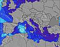 | 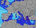 | 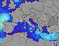 | 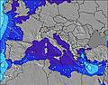 | 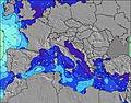 | 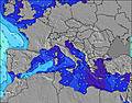 | 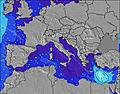 | |||||||||||||
Wave Height (m) Direction Period (s) | E 3 | SE 3 | ESE 4 | SE 4 | SE 4 | SE 5 | WSW 7 | WSW 6 | WSW 6 | W 7 | W 5 | WNW 5 | W 7 | W 6 | WNW 4 | W 7 | W 6 | W 3 | W 5 | ENE 3 |
Wave Graph | ||||||||||||||||||||
1 | 3 | 7 | 10 | 5 | 12 | 25 | 44 | 27 | 27 | 13 | 8 | 1 | 3 | 7 | 1 | 1 | 1 | 1 | 0 | |
Wind (km/h) | ||||||||||||||||||||
Wind State on-shore cross-onshore cross-shore cross-offshore off-shore glassy | cross-on | cross | cross | cross-on | cross-off | off | cross | cross-off | cross-off | cross-on | off | off | cross-off | off | off | cross-off | off | cross-off | on | glassy |
High Tide | 1:16AM0.25m | 1:46PM0.19m | 1:53AM0.23m | 2:49PM0.19m | 2:39AM0.21m | 4:08PM0.19m | 3:41AM0.19m | 5:39PM0.21m | 5:07AM0.18m | 7:00PM0.23m | 6:35AM0.18m | 8:03PM0.26m | ||||||||
Low Tide | 6:45PM0.05m | 7:49AM0.05m | 7:31PM0.07m | 8:33AM0.05m | 8:30PM0.10m | 9:26AM0.06m | 9:54PM0.11m | 10:34AM0.06m | 11:44PM0.12m | 11:49AM0.05m | 1:22AM0.10m | 12:58PM0.04m | 2:30AM0.09m | |||||||
— | — | 6:26 | — | — | 6:28 | — | — | 6:28 | — | — | 6:30 | — | — | 6:31 | — | — | 6:31 | — | — | |
8:34 | — | — | 8:32 | — | — | 8:31 | — | — | 8:30 | — | — | 8:29 | — | — | 8:28 | — | — | 8:27 | — | |
mm | — | — | — | — | — | — | — | — | — | — | — | — | — | — | — | — | — | — | — | — |
Temp °C | 31 | 29 | 30 | 31 | 29 | 29 | 31 | 30 | 29 | 30 | 29 | 31 | 32 | 30 | 31 | 32 | 31 | 30 | 30 | 28 |
Feels °C | 32 | 31 | 32 | 34 | 33 | 30 | 32 | 29 | 32 | 30 | 30 | 32 | 29 | 28 | 30 | 30 | 29 | 29 | 31 | 30 |
Swell 1 Height (m) Direction Period (s) | — | SE 3 | ESE 4 | SE 4 | SE 4 | SE 5 | SE 5 | WSW 6 | WSW 6 | W 7 | W 5 | WNW 5 | — | W 6 | WNW 4 | W 7 | W 6 | W 3 | — | ENE 3 |
— | 3 | 7 | 9 | 5 | 12 | 5 | 44 | 27 | 27 | 13 | 7 | — | 3 | 7 | 1 | 1 | 1 | — | 1 | |
Swell 2 Height (m) Direction Period (s) | — | — | — | — | W 8 | W 7 | — | W 9 | WSW 8 | — | NW 4 | WSW 6 | — | NW 8 | W 6 | — | — | W 6 | W 5 | — |
— | — | — | — | 1 | 4 | — | 2 | 12 | — | 3 | 8 | — | 2 | 1 | — | — | 1 | 1 | — | |
Swell 3 Height (m) Direction Period (s) | — | — | — | — | W 6 | — | — | W 9 | — | — | — | W 8 | W 7 | — | NE 4 | W 7 | — | W 6 | W 5 | — |
— | — | — | — | 1 | — | — | 2 | — | — | — | 1 | 1 | — | 1 | 1 | — | 1 | 1 | — | |
Wind waves Height (m) Direction Period (s) | E 3 | ESE 3 | — | ESE 4 | — | — | WSW 7 | ESE 4 | — | — | — | N 3 | WNW 5 | WNW 5 | NNW 4 | W 4 | WNW 4 | — | ENE 3 | — |
1 | 2 | — | 10 | — | — | 25 | 2 | — | — | — | 1 | 39 | 17 | 13 | 9 | 6 | — | 1 | — | |
Nearest Offshore or Glassy | ||||||||||||||||||||
Distance (km) | 1476 | 1010 | 1019 | 1457 | 958 | 1010 | 1139 | 1010 | 1010 | 1090 | 117 | 117 | 1183 | 117 | 117 | 133 | 1033 | 1010 | 1192 | 1025 |
Best forecast wave conditions in Sardinia | ||||||||||||||||||||
Best forecast wave conditions in Italy | ||||||||||||||||||||
Header Global | ||||||||||||||||||||
- Map Icons:
 Break
Break Live Wave Height (m)
 Live Wind Speed (km/h)
 Surf Rating (10 Max)
 Ocean Swells (m)
- Wind Speed (km/h)
Latest Updates


FREE! Surf-Forecast.com widget for your website
The surf report / weather widget below is available to embed on third party websites free of charge and provides a summary of our Chia surf forecast. Simply grab the html code snippet that we provide and paste it into your own site. You can choose your preferred language and metric/imperial units for the surf forecast feed to suit users of your site. Click here to get the code.
Information about the Chia Surf forecast
The above surf forecast table for Chia provides essential information for determining whether the surfing conditions will be good over the next 16 days. A general guide to surfing at Chia can be found by selecting the local surf guide option on the grey menu. Our Chia surf forecast is unique since it includes wave energy (power) that defines the real feel of the surf rather than just the height or the period. If you surf the same spot (Chia) regularly then make a mental note of the wave energy from the surf forecast table each time you go. Very soon you may start to choose your surf days based on the wave energy alone combined with our forecast of favourable offshore wind conditions. Our star ratings will help here and of course you will also find the usual wave height and period predictions on our surf forecasts as well as a full break down of the swell components under our advanced users option (to reveal that, click the little Einstein character under the tide times).
Further information to help with frequently asked questions about our surf forecast for Chia may be found under the help tab on the top menu and also by moving your mouse over the question marks on the surf forecast table itself. Please always bear in mind that the forecast is for near-shore open water and local factors at each surf break influence the actual breaking wave height, such as the beach / reef profile, water depths offshore and shelter.
Chia is 32 km (20 miles) from the city of Capoterra. If you plan a holiday in Sardinia, look for hotels and other accommodation in Capoterra. Capoterra has rooms for a wide range of budgets as well as car hire and transport links.
 Nearest