

Surf Forecasts:

Buggerru surf forecast from 3 Aug 2026:
- Most powerful swell: Friday 7 Aug, 11PM (local time) - 3ft (0.9m), 6s period, NW swell with 68 kJ wave energy.
Best Forecast Surf Conditions for Buggerru this week:
The most powerful waves expected at Buggerru in the next 16 days are 0.9m 6s and forecast to arrive on Friday (Aug 07) at 11PM. Winds are predicted to be cross-onshore at the time the swell arrives. The largest open ocean swell (not directed at the beach) is 0.5m 3s period and expected on Monday (Aug 03) at 5PM.
| Wave Type | Time (CEST) & Date | Wave Height & Period |
|---|---|---|
| Next good surf (1 star+) | - | - |
| Best Surf | - | - |
| Most Powerful | 11PM (Fri 7th Aug) | 3ft (0.9m) 6s |
Table - best surf conditions forecast for Buggerru over the next 16 days.
The Lowdown
G'day, it's Rusty here. I've been staring at the charts for this stretch of coast, and honestly, it's a bit of a tough watch. The forecast is a long, drawn-out affair with a lot of flat spells and very little to get excited about. The only real pulse of energy shows up about a week and a half from now, so we're looking at a long wait.
Let's break it down. For the first week, from the start of August right through to the 14th, it's a write-off. We're talking about tiny, weak waves—if any at all. The combined energy is almost non-existent, stuck in the single digits for most of it. The winds are a mixed bag, but the lack of any meaningful swell makes it all irrelevant. You'll see a few 0.7 ft to 1.3 ft days, but with periods of 4 to 7 seconds, it's just not going to deliver.
Now, things start to get interesting around the 15th of August. There's a spike in the swell, but it's not the cleanest. On the morning of the 15th, we get a NW swell pushing 5.6 ft, with a period of 7 seconds. The combined energy jumps to 294 (moderate), which is the most we've seen. The wind is a light cross-onshore from the north, so it's not perfect, but it's rideable. This is the pick of the bunch, but the afternoon gets a bit messy with a stronger onshore wind and bigger, lumpy 6.9 ft swell. That's expert territory and the onshore breeze will chop it up.
The following day, the 16th, still has some energy (105 combined), but it's dropping off fast with a 3.3 ft swell and a cross-onshore breeze. Buggerru is the only spot in the game here, and it's a beach/pier setup that's inconsistent and usually crowded. For this one day, it's your best bet. The swell direction is NW, which is the optimum for the spot, but the wind is just okay. The water is a whopping 82.2°, which is much warmer than normal for this time of year.
Beyond that, it fades back to nothing. If you're a beginner, the 5.6 ft swell on the 15th is a bit much, and the 6.9 ft is definitely expert-only. For the experienced crew, the 15th morning is the one window. The long wait for the only real pulse of energy is a bummer, but that's the way it goes sometimes.
Short Range ForecastMostly dry. Warm (max 33°C on Mon morning, min 26°C on Tue night). Wind will be generally light. | Days 4-6 Weather SummaryMostly dry. Warm (max 30°C on Thu afternoon, min 25°C on Thu night). Wind will be generally light. | ||||||||||||||||||||
Monday 3 | Tuesday 4 | Wednesday 5 | Thursday 6 | Friday 7 | Saturday 8 | Sunday 9 | |||||||||||||||
AM | PM | Night | AM | PM | Night | AM | PM | Night | AM | PM | Night | AM | PM | Night | AM | PM | Night | AM | PM | Night | |
Swell Height Map | 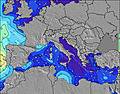 | 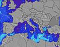 | 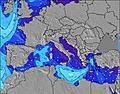 | 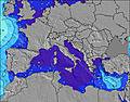 | 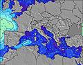 | 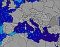 |  | ||||||||||||||
Wave Height (m) Direction Period (s) | NNW 4 | SW 2 | SSW 3 | — | — | W 8 | WSW 7 | WSW 6 | WSW 6 | WSW 6 | WSW 7 | WSW 6 | NW 7 | NW 6 | NW 6 | NW 6 | NW 6 | NNW 5 | NW 5 | NW 4 | — |
Wave Graph | |||||||||||||||||||||
2 | 1 | 1 | 0 | 0 | 1 | 9 | 8 | 16 | 12 | 19 | 8 | 30 | 39 | 68 | 46 | 27 | 23 | 6 | 3 | 0 | |
Wind (km/h) | |||||||||||||||||||||
Wind State on-shore cross-onshore cross-shore cross-offshore off-shore glassy | cross-off | cross | off | glassy | cross-on | glassy | glassy | on | cross-on | glassy | cross-on | cross-on | cross-on | cross-on | cross | cross | cross-on | cross | cross | cross-on | cross-off |
High Tide | 12:37PM0.18m | 1:03AM0.25m | 1:31PM0.18m | 1:37AM0.23m | 2:39PM0.18m | 2:21AM0.21m | 4:07PM0.18m | 3:21AM0.19m | 5:45PM0.20m | 7:03PM0.22m | 6:16AM0.17m | 8:02PM0.25m | |||||||||
Low Tide | 6:23PM0.06m | 7:42AM0.06m | 7:08PM0.08m | 8:26AM0.06m | 8:05PM0.10m | 9:21AM0.06m | 9:34PM0.12m | 10:29AM0.06m | 11:37PM0.13m | 11:43AM0.05m | 1:19AM0.12m | 12:49PM0.04m | 2:26AM0.10m | ||||||||
6:26 | — | — | 6:28 | — | — | 6:28 | — | — | 6:30 | — | — | 6:31 | — | — | 6:31 | — | — | 6:31 | — | — | |
— | 8:37 | — | — | 8:36 | — | — | 8:35 | — | — | 8:34 | — | — | 8:31 | — | — | 8:30 | — | — | 8:30 | — | |
mm | — | — | — | — | — | — | — | — | — | — | — | — | — | — | — | — | — | — | — | — | — |
Temp °C | 33 | 32 | 30 | 32 | 32 | 28 | 30 | 29 | 28 | 29 | 30 | 27 | 29 | 29 | 27 | 29 | 30 | 28 | 33 | 32 | 30 |
Feels °C | 34 | 32 | 33 | 33 | 33 | 33 | 32 | 31 | 29 | 31 | 32 | 29 | 31 | 30 | 28 | 29 | 30 | 30 | 31 | 31 | 30 |
Swell 1 Height (m) Direction Period (s) | NNW 4 | NW 4 | — | — | — | W 6 | WSW 7 | WSW 6 | WSW 6 | NNW 4 | WSW 7 | NW 4 | NW 7 | WSW 7 | NW 6 | NW 6 | W 6 | NNW 5 | NW 5 | NW 4 | — |
2 | 1 | — | — | — | 1 | 9 | 8 | 16 | 6 | 19 | 4 | 30 | 4 | 68 | 46 | 1 | 23 | 6 | 3 | — | |
Swell 2 Height (m) Direction Period (s) | — | — | — | — | — | W 8 | — | — | WSW 8 | WSW 6 | — | WSW 6 | WSW 7 | — | W 6 | W 6 | — | W 6 | — | — | — |
— | — | — | — | — | 1 | — | — | 6 | 12 | — | 8 | 4 | — | 3 | 1 | — | 1 | — | — | — | |
Swell 3 Height (m) Direction Period (s) | — | — | — | — | — | — | — | — | — | WSW 8 | — | NW 8 | — | — | — | W 7 | — | — | — | — | — |
— | — | — | — | — | — | — | — | — | 6 | — | 3 | — | — | — | 1 | — | — | — | — | — | |
Wind waves Height (m) Direction Period (s) | — | SW 2 | SSW 3 | — | — | — | — | — | NNW 4 | NNW 4 | NW 3 | N 4 | NW 4 | NW 6 | — | — | NW 6 | — | — | — | — |
— | 1 | 1 | — | — | — | — | — | 10 | 6 | 3 | 3 | 6 | 39 | — | — | 27 | — | — | — | — | |
Nearest Offshore or Glassy | |||||||||||||||||||||
Distance (km) | 926 | 1413 | 944 | 926 | 1464 | 944 | 944 | 1107 | 944 | 944 | 1025 | 142 | 55 | 1025 | 55 | 142 | 1479 | 523 | 1055 | 1373 | 959 |
Best forecast wave conditions in Sardinia | |||||||||||||||||||||
Best forecast wave conditions in Italy | |||||||||||||||||||||
Header Global | |||||||||||||||||||||
- Map Icons:
 Break
Break Live Wave Height (m)
 Live Wind Speed (km/h)
 Surf Rating (10 Max)
 Ocean Swells (m)
- Wind Speed (km/h)
Latest Updates


FREE! Surf-Forecast.com widget for your website
The surf report / weather widget below is available to embed on third party websites free of charge and provides a summary of our Buggerru surf forecast. Simply grab the html code snippet that we provide and paste it into your own site. You can choose your preferred language and metric/imperial units for the surf forecast feed to suit users of your site. Click here to get the code.
Information about the Buggerru Surf forecast
The above surf forecast table for Buggerru provides essential information for determining whether the surfing conditions will be good over the next 16 days. A general guide to surfing at Buggerru can be found by selecting the local surf guide option on the grey menu. Our Buggerru surf forecast is unique since it includes wave energy (power) that defines the real feel of the surf rather than just the height or the period. If you surf the same spot (Buggerru) regularly then make a mental note of the wave energy from the surf forecast table each time you go. Very soon you may start to choose your surf days based on the wave energy alone combined with our forecast of favourable offshore wind conditions. Our star ratings will help here and of course you will also find the usual wave height and period predictions on our surf forecasts as well as a full break down of the swell components under our advanced users option (to reveal that, click the little Einstein character under the tide times).
Further information to help with frequently asked questions about our surf forecast for Buggerru may be found under the help tab on the top menu and also by moving your mouse over the question marks on the surf forecast table itself. Please always bear in mind that the forecast is for near-shore open water and local factors at each surf break influence the actual breaking wave height, such as the beach / reef profile, water depths offshore and shelter.
Buggerru is 16 km (10 miles) from Iglesias. If you plan a holiday in Sardinia, look for hotels and other accommodation in Iglesias. Iglesias has rooms for a wide range of budgets as well as car hire and transport links.
 Nearest