

Surf Forecasts:

Mini Capo surf forecast from 3 Aug 2026:
- Best quality surf: Friday 7 Aug, 5AM (local time) - 3ft (0.9m), 7s period, NW swell with offshore winds.
- Most powerful swell: Friday 7 Aug, 5PM (local time) - 5ft (1.5m), 8s period, NW swell with 250 kJ wave energy.
- Next surfable swell (1★+): Friday 7 Aug, 5AM (local time) - 3ft (0.9m), 7s period with NW swell.
Best Forecast Surf Conditions for Mini Capo this week:
The surf forecast for Mini Capo over the next 16 days: The first swell (rated 1 star or higher) is forecast to arrive on Friday (Aug 07) at 5AM. The primary swell is predicted to be 0.9m and 7s period with a secondary swell of 0.3m and 6s. The wind is predicted to be offshore as the swell arrives.
The most powerful waves expected at Mini Capo in the next 16 days are 1.5m 8s and forecast to arrive on Friday (Aug 07) at 5PM. Winds are predicted to be cross-offshore at the time the swell arrives. The largest open ocean swell (not directed at the beach) is 0.9m 4s period and expected on Wednesday (Aug 05) at 8PM.
| Wave Type | Time (CEST) & Date | Wave Height & Period |
|---|---|---|
| Next good surf (1 star+) | 5AM (Fri 7th Aug) | 3ft (0.9m) 7s |
| Best Surf | 5AM (Fri 7th Aug) | 3ft (0.9m) 7s |
| Most Powerful | 5PM (Fri 7th Aug) | 5ft (1.5m) 8s |
Table - best surf conditions forecast for Mini Capo over the next 16 days.
The Lowdown
Alright, Rusty here again, giving you the same picture but in feet and Fahrenheit.
First thing you need to know – the water is cranked up right now. We’re talking 82°F, which is a solid 5°F warmer than usual for this time of year. It’s like swimming in a bath, so don’t expect that refreshing cool hit when you paddle out.
Right, the bad news first. The next week and a half is pretty much a write-off. From early August right through to the middle of the month, we’re looking at a long, dry stretch of tiny, weak slop. Most days have swell under 1ft and periods so short you could count the seconds on one hand. The combined energy is weak, barely registering. You’ll get a couple of mornings with glassy conditions, like Wednesday the 5th and Thursday the 6th, but there’s just no push to make it worthwhile. It’s a frustrating run of flatness.
Now, hold on to your board, because there’s a big change coming. The real standout window is the 17th and 18th of August. This is the one to circle on the calendar. A strong, long-period NW groundswell arrives, with a period of 10 to 11 seconds, which is a nice long groundswell. This is a reef break, and that long period stuff will wrap in beautifully here, giving you proper, well-shaped lines.
Monday the 17th afternoon sees a solid 15ft swell from the NW with very strong energy. The wind goes light and cross-offshore from the WNW. That’s a recipe for serious, clean, heavy waves. This is not for the faint of heart. Over 8ft, it’s expert territory only. Tuesday the 18th morning is even bigger, pushing 16ft from the NW, with massive energy. The wind is a light cross-shore from the East, which will keep it a little lined up, but again, this is a big, powerful, dangerous swell. Only for the experienced crew.
Bottom line: you’ve got a long, boring wait, but the payoff at the end is a proper, serious, expert-level swell. If you’ve got the skills, the 17th afternoon is the best on offer. For everyone else, maybe just enjoy the warm water from the beach until then.
Rusty.
Short Range ForecastMostly dry. Warm (max 33°C on Mon morning, min 25°C on Wed night). Wind will be generally light. | Days 4-6 Weather SummaryMostly dry. Warm (max 28°C on Thu morning, min 24°C on Fri night). Wind will be generally light. | ||||||||||||||||||||
Monday 3 | Tuesday 4 | Wednesday 5 | Thursday 6 | Friday 7 | Saturday 8 | Sunday 9 | |||||||||||||||
AM | PM | Night | AM | PM | Night | AM | PM | Night | AM | PM | Night | AM | PM | Night | AM | PM | Night | AM | PM | Night | |
Swell Height Map | 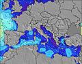 | 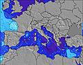 | 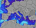 | 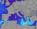 | 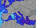 | 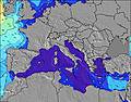 | 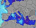 | ||||||||||||||
Wave Height (m) Direction Period (s) | NW 4 | NW 4 | SSW 4 | SSW 3 | — | SW 8 | WSW 7 | WSW 6 | WSW 7 | WSW 6 | WSW 7 | NW 8 | NW 7 | NW 7 | NW 7 | NW 7 | NW 6 | NW 5 | NW 5 | NW 4 | NW 4 |
Wave Graph | |||||||||||||||||||||
1 | 1 | 3 | 1 | 0 | 3 | 10 | 8 | 17 | 16 | 20 | 16 | 79 | 162 | 147 | 75 | 46 | 18 | 8 | 0 | 0 | |
Wind (km/h) | |||||||||||||||||||||
Wind State on-shore cross-onshore cross-shore cross-offshore off-shore glassy | cross-on | cross | cross-on | cross | cross-off | glassy | glassy | cross-off | off | glassy | cross-off | off | off | cross-off | off | glassy | cross-off | cross-off | cross-off | cross-off | cross |
High Tide | 12:33PM0.18m | 1:00AM0.25m | 1:27PM0.18m | 1:35AM0.23m | 2:34PM0.18m | 2:19AM0.21m | 4:02PM0.18m | 3:20AM0.19m | 5:40PM0.20m | 6:59PM0.22m | 6:15AM0.18m | 7:58PM0.25m | |||||||||
Low Tide | 6:21PM0.05m | 7:38AM0.06m | 7:05PM0.08m | 8:22AM0.06m | 8:02PM0.10m | 9:18AM0.06m | 9:30PM0.12m | 10:28AM0.06m | 11:31PM0.13m | 11:42AM0.05m | 1:13AM0.12m | 12:48PM0.03m | 2:20AM0.10m | ||||||||
6:24 | — | — | 6:26 | — | — | 6:26 | — | — | 6:28 | — | — | 6:28 | — | — | 6:30 | — | — | 6:31 | — | — | |
— | 8:37 | — | — | 8:37 | — | — | 8:36 | — | — | 8:35 | — | — | 8:34 | — | — | 8:32 | — | — | 8:30 | — | |
mm | — | — | — | — | — | — | — | — | — | — | — | — | — | — | — | — | — | — | — | — | — |
Temp °C | 33 | 32 | 30 | 32 | 32 | 28 | 29 | 29 | 28 | 28 | 28 | 26 | 27 | 27 | 25 | 27 | 28 | 27 | 29 | 29 | 29 |
Feels °C | 34 | 30 | 32 | 32 | 31 | 32 | 30 | 30 | 27 | 30 | 28 | 29 | 27 | 26 | 25 | 29 | 29 | 26 | 26 | 26 | 27 |
Swell 1 Height (m) Direction Period (s) | NW 4 | NW 4 | SSW 4 | SSW 3 | — | SW 8 | WSW 7 | WSW 6 | WSW 7 | WSW 6 | WSW 7 | NW 8 | NW 7 | WSW 7 | NW 7 | NW 7 | W 7 | NW 5 | NW 5 | — | NW 4 |
1 | 1 | 3 | 1 | — | 3 | 10 | 8 | 17 | 16 | 20 | 16 | 79 | 4 | 147 | 75 | 1 | 18 | 8 | — | 4 | |
Swell 2 Height (m) Direction Period (s) | — | — | — | — | — | — | — | — | WSW 9 | WSW 8 | — | WSW 6 | WSW 7 | — | WSW 6 | SW 6 | W 7 | W 6 | W 6 | — | — |
— | — | — | — | — | — | — | — | 8 | 12 | — | 8 | 10 | — | 3 | 1 | 1 | 1 | 1 | — | — | |
Swell 3 Height (m) Direction Period (s) | — | — | — | — | — | — | — | — | — | — | — | W 8 | — | — | — | — | — | — | — | — | — |
— | — | — | — | — | — | — | — | — | — | — | 1 | — | — | — | — | — | — | — | — | — | |
Wind waves Height (m) Direction Period (s) | — | — | — | — | — | — | — | — | NNW 4 | NW 4 | NW 4 | NW 4 | — | NW 7 | — | — | NW 6 | — | — | NW 4 | — |
— | — | — | — | — | — | — | — | 15 | 3 | 10 | 10 | — | 162 | — | — | 46 | — | — | 9 | — | |
Nearest Offshore or Glassy | |||||||||||||||||||||
Distance (km) | 910 | 1386 | 909 | 975 | 1337 | 908 | 908 | 1099 | 12 | 56 | 993 | 52 | 0 | 1063 | 0 | 0 | 382 | 935 | 284 | 921 | 921 |
Best forecast wave conditions in Sardinia | |||||||||||||||||||||
Best forecast wave conditions in Italy | |||||||||||||||||||||
Header Global | |||||||||||||||||||||
- Map Icons:
 Break
Break Live Wave Height (m)
 Live Wind Speed (km/h)
 Surf Rating (10 Max)
 Ocean Swells (m)
- Wind Speed (km/h)
Latest Updates


FREE! Surf-Forecast.com widget for your website
The surf report / weather widget below is available to embed on third party websites free of charge and provides a summary of our Mini Capo surf forecast. Simply grab the html code snippet that we provide and paste it into your own site. You can choose your preferred language and metric/imperial units for the surf forecast feed to suit users of your site. Click here to get the code.
Information about the Mini Capo Surf forecast
The above surf forecast table for Mini Capo provides essential information for determining whether the surfing conditions will be good over the next 16 days. A general guide to surfing at Mini Capo can be found by selecting the local surf guide option on the grey menu. Our Mini Capo surf forecast is unique since it includes wave energy (power) that defines the real feel of the surf rather than just the height or the period. If you surf the same spot (Mini Capo) regularly then make a mental note of the wave energy from the surf forecast table each time you go. Very soon you may start to choose your surf days based on the wave energy alone combined with our forecast of favourable offshore wind conditions. Our star ratings will help here and of course you will also find the usual wave height and period predictions on our surf forecasts as well as a full break down of the swell components under our advanced users option (to reveal that, click the little Einstein character under the tide times).
Further information to help with frequently asked questions about our surf forecast for Mini Capo may be found under the help tab on the top menu and also by moving your mouse over the question marks on the surf forecast table itself. Please always bear in mind that the forecast is for near-shore open water and local factors at each surf break influence the actual breaking wave height, such as the beach / reef profile, water depths offshore and shelter.
Are you planning a holiday in Sardinia? If you are looking for accommodation near Mini Capo, camping, hotels and holiday cottages in Sardinia, consider staying in Oristano which is 22 km (14 miles) away. Other places in and around Sardinia where you can find information about places to rent, and car hire include Alghero which is 59 km (37 miles) away, Sassari, Iglesias and Nuoro.
 Nearest