

Surf Forecasts:

Alassio surf forecast from 3 Aug 2026:
- Most powerful swell: Friday 7 Aug, 5PM (local time) - 1.5ft (0.5m), 5s period, S swell with 11 kJ wave energy.
Best Forecast Surf Conditions for Alassio this week:
The most powerful waves expected at Alassio in the next 16 days are 0.5m 5s and forecast to arrive on Friday (Aug 07) at 5PM. Winds are predicted to be cross-onshore at the time the swell arrives. The largest open ocean swell (not directed at the beach) is 0.2m 4s period and expected on Sunday (Aug 09) at 5PM.
| Wave Type | Time (CEST) & Date | Wave Height & Period |
|---|---|---|
| Next good surf (1 star+) | - | - |
| Best Surf | - | - |
| Most Powerful | 5PM (Fri 7th Aug) | 1.5ft (0.5m) 5s |
Table - best surf conditions forecast for Alassio over the next 16 days.
The Lowdown
Alright folks, Rusty here. Let's be straight with you – the situation at Alassio is looking pretty grim, and I'm not gonna sugarcoat it. The forecast for the next 16 days is a total wipeout for decent surf. There's genuinely nothing to get excited about.
We're looking at a long, dry spell with no real swell to speak of. The first few days are a complete bust, and the pattern just doesn't change. The only flicker of something is around the 12th and 13th of August, with a tiny bit of swell showing up, but it's barely a ripple. The water is weirdly warm, about 82° – that's a massive 7° warmer than usual for this time of year, which is very unusual and feels more like a bath than the ocean.
Let's break it down. For the first week, from August 3rd right through the 11th, we've got a whole lot of nothing. The combined energy of any swell is either zero or a pathetic 1 or 2 (0-2 units). Even when there is a tiny bump, the direction is all over the place – ESE, S, SW – and the periods are mostly short, around 4 to 7 seconds. It's just not going to break with any sort of shape.
Around the 12th and 13th, we get a tiny pulse. The swell height might push to 1ft or 1ft from the S or SSE, with a period of 5 seconds. The combined energy gets up to a paltry 12 (12 units) on the 12th afternoon. You'd need a magic board and a whole lot of hope to get a ride. The mornings are glassy, which is a positive, but there's just no wave to surf.
The second week continues the same story. From the 14th to the 18th of August, it’s back to almost nothing. Combined energy readings are down to 0, 1, 2, or 4. There are some glassy mornings and offshore winds from the NW, but it's a flat spell. The whole 16-day window is a blank run for Alassio, and honestly, for this sheltered spot, it's not that unusual. The wind is mostly light, which is good for the soul, but you need a wave to make it work.
If you're a kitesurfer, you might get a bit of action with the light cross-onshore breezes, but for us paddle surfers, it's a hard pass. Keep the board in the car, but don't bother driving down. The forecasts can change, but right now, there's nothing to chase.
Rusty.
Short Range ForecastMostly dry. Warm (max 29°C on Mon morning, min 25°C on Mon night). Wind will be generally light. | Days 4-6 Weather SummaryMostly dry. Warm (max 29°C on Thu afternoon, min 24°C on Thu night). Wind will be generally light. | ||||||||||||||||||||
Monday 3 | Tuesday 4 | Wednesday 5 | Thursday 6 | Friday 7 | Saturday 8 | Sunday 9 | |||||||||||||||
AM | PM | Night | AM | PM | Night | AM | PM | Night | AM | PM | Night | AM | PM | Night | AM | PM | Night | AM | PM | Night | |
Swell Height Map | 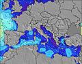 | 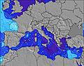 | 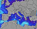 | 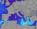 | 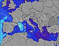 | 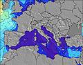 | 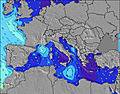 | ||||||||||||||
Wave Height (m) Direction Period (s) | — | — | — | ESE 3 | SE 4 | SE 4 | SE 4 | ESE 4 | — | SW 8 | SW 7 | S 6 | SW 7 | S 4 | SSE 4 | WSW 8 | SSE 4 | S 4 | SW 6 | SSE 4 | SW 4 |
Wave Graph | |||||||||||||||||||||
0 | 0 | 0 | 1 | 7 | 2 | 1 | 1 | 0 | 2 | 2 | 1 | 2 | 6 | 3 | 6 | 4 | 3 | 5 | 3 | 1 | |
Wind (km/h) | |||||||||||||||||||||
Wind State on-shore cross-onshore cross-shore cross-offshore off-shore glassy | cross-off | on | cross-off | cross-off | cross-on | off | cross-off | on | cross-off | glassy | on | cross-off | cross-off | cross-on | cross-off | cross-off | on | off | off | cross-on | cross-off |
High Tide | 12:20PM0.22m | 00:50AM0.28m | 1:12PM0.21m | 1:28AM0.26m | 2:17PM0.21m | 2:15AM0.24m | 3:43PM0.21m | 3:21AM0.22m | 5:20PM0.22m | 6:40PM0.25m | 6:12AM0.21m | 7:41PM0.28m | |||||||||
Low Tide | 6:13PM0.06m | 7:22AM0.08m | 6:58PM0.08m | 8:09AM0.07m | 7:56PM0.11m | 9:08AM0.08m | 9:22PM0.13m | 10:19AM0.07m | 11:15PM0.14m | 11:35AM0.06m | 00:51AM0.12m | 12:41PM0.04m | 1:58AM0.10m | ||||||||
6:16 | — | — | 6:16 | — | — | 6:18 | — | — | 6:20 | — | — | 6:20 | — | — | 6:22 | — | — | 6:22 | — | — | |
— | 8:49 | — | — | 8:47 | — | — | 8:45 | — | — | 8:45 | — | — | 8:44 | — | — | 8:42 | — | — | 8:40 | — | |
mm | — | — | — | — | — | — | — | — | — | — | — | — | — | — | — | — | — | — | — | — | — |
Temp °C | 29 | 29 | 28 | 27 | 28 | 27 | 28 | 28 | 28 | 28 | 29 | 27 | 27 | 28 | 27 | 28 | 28 | 27 | 27 | 30 | 29 |
Feels °C | 31 | 31 | 33 | 30 | 31 | 31 | 30 | 31 | 32 | 31 | 31 | 30 | 28 | 31 | 31 | 28 | 30 | 31 | 28 | 32 | 30 |
Swell 1 Height (m) Direction Period (s) | — | — | — | ESE 3 | SE 4 | SE 4 | SE 4 | — | — | — | SW 7 | — | SW 5 | S 4 | SSE 4 | S 4 | SSE 4 | S 4 | S 4 | SSE 4 | — |
— | — | — | 1 | 6 | 2 | 1 | — | — | — | 2 | — | 1 | 6 | 3 | 1 | 4 | 3 | 3 | 3 | — | |
Swell 2 Height (m) Direction Period (s) | — | — | — | — | — | — | — | — | — | SW 8 | SE 5 | S 6 | — | SW 7 | W 8 | WSW 8 | SW 5 | SW 6 | SW 6 | SW 5 | SW 4 |
— | — | — | — | — | — | — | — | — | 2 | 1 | 1 | — | 2 | 1 | 6 | 1 | 1 | 5 | 1 | 1 | |
Swell 3 Height (m) Direction Period (s) | — | — | — | — | — | — | — | — | — | — | — | S 5 | SW 7 | — | — | — | SW 7 | — | — | — | — |
— | — | — | — | — | — | — | — | — | — | — | 1 | 2 | — | — | — | 2 | — | — | — | — | |
Wind waves Height (m) Direction Period (s) | — | — | — | — | ESE 4 | — | — | ESE 4 | — | — | — | — | — | — | — | — | E 3 | — | — | — | — |
— | — | — | — | 7 | — | — | 1 | — | — | — | — | — | — | — | — | 1 | — | — | — | — | |
Nearest Offshore or Glassy | |||||||||||||||||||||
Distance (km) | 784 | 1226 | 752 | 752 | 1057 | 772 | 771 | 984 | 435 | 499 | 875 | 184 | 156 | 799 | 126 | 156 | 156 | 819 | 166 | 801 | 748 |
Best forecast wave conditions in West Coast of Italy | |||||||||||||||||||||
Best forecast wave conditions in Italy | |||||||||||||||||||||
Header Global | |||||||||||||||||||||
- Map Icons:
 Break
Break Live Wave Height (m)
 Live Wind Speed (km/h)
 Surf Rating (10 Max)
 Ocean Swells (m)
- Wind Speed (km/h)
Latest Updates


FREE! Surf-Forecast.com widget for your website
The surf report / weather widget below is available to embed on third party websites free of charge and provides a summary of our Alassio surf forecast. Simply grab the html code snippet that we provide and paste it into your own site. You can choose your preferred language and metric/imperial units for the surf forecast feed to suit users of your site. Click here to get the code.
Information about the Alassio Surf forecast
The above surf forecast table for Alassio provides essential information for determining whether the surfing conditions will be good over the next 16 days. A general guide to surfing at Alassio can be found by selecting the local surf guide option on the grey menu. Our Alassio surf forecast is unique since it includes wave energy (power) that defines the real feel of the surf rather than just the height or the period. If you surf the same spot (Alassio) regularly then make a mental note of the wave energy from the surf forecast table each time you go. Very soon you may start to choose your surf days based on the wave energy alone combined with our forecast of favourable offshore wind conditions. Our star ratings will help here and of course you will also find the usual wave height and period predictions on our surf forecasts as well as a full break down of the swell components under our advanced users option (to reveal that, click the little Einstein character under the tide times).
Further information to help with frequently asked questions about our surf forecast for Alassio may be found under the help tab on the top menu and also by moving your mouse over the question marks on the surf forecast table itself. Please always bear in mind that the forecast is for near-shore open water and local factors at each surf break influence the actual breaking wave height, such as the beach / reef profile, water depths offshore and shelter.
 Nearest