

Surf Forecasts:

Sebastian Inlet-Third Peak surf forecast from 2 Aug 2026:
- Best quality surf: Saturday 8 Aug, 8AM (local time) - 4.5ft (1.3m), 8s period, E swell with cross-offshore winds.
- Most powerful swell: Saturday 8 Aug, 8AM (local time) - 4.5ft (1.3m), 8s period, E swell with 223 kJ wave energy.
- Next surfable swell (1★+): Saturday 8 Aug, 8AM (local time) - 4.5ft (1.3m), 8s period with E swell.
Best Forecast Surf Conditions for Sebastian Inlet-Third Peak this week:
The surf forecast for Sebastian Inlet-Third Peak over the next 16 days: The first swell (rated 1 star or higher) is forecast to arrive on Saturday (Aug 08) at 8AM. The primary swell is predicted to be 1.3m and 8s period with a secondary swell of 0.3m and 9s. The wind is predicted to be cross-offshore as the swell arrives.
The most powerful waves expected at Sebastian Inlet-Third Peak in the next 16 days are 1.3m 8s and forecast to arrive on Saturday (Aug 08) at 8AM. Winds are predicted to be cross-offshore at the time the swell arrives. The largest open ocean swell (not directed at the beach) is 0.6m 4s period and expected on Sunday (Aug 02) at 11PM.
| Wave Type | Time (EDT) & Date | Wave Height & Period |
|---|---|---|
| Next good surf (1 star+) | 8AM (Sat 8th Aug) | 4.5ft (1.3m) 8s |
| Best Surf | 8AM (Sat 8th Aug) | 4.5ft (1.3m) 8s |
| Most Powerful | 8AM (Sat 8th Aug) | 4.5ft (1.3m) 8s |
Table - best surf conditions forecast for Sebastian Inlet-Third Peak over the next 16 days.
The Lowdown
Alright, let’s get into it. The next couple of weeks are looking pretty bleak for scoring waves here at Sebastian Inlet-Third Peak (beach/jetty). We’ve got a stretch of tiny, mostly messy surf ahead, so keep the board waxed but don’t get your hopes up too high.
The only half-decent window comes up this Sunday afternoon, August 2nd. We’re looking at ankle to knee-high lines, around 2ft, coming out of the ESE with a fairly short 8-second period. The energy behind it is pretty weak, only measuring 57. The water temp is sitting at 81°, which runs a bit colder than normal for this time of year, something to keep in mind. It’s glassy out there, which will make it look cleaner than it is, but the risk of thunderstorms is a real buzzkill. It’s honestly only worth a paddle if you’re desperate to get wet. After that, it’s a dry spell.
From Monday the 3rd through the 6th, the swell drops out entirely. We’re talking 1ft to 2ft junk with onshore or cross-shore winds messing with what little texture there is. Not worth the drive.
Friday the 7th sees a small bump in size, with waves reaching 4ft to 5ft, but it’s coming in short-period and chopped up by moderate east winds. The energy does climb into the moderate range (141-177), but the quality is just poor. Saturday the 8th holds similar size, around 3ft to 4ft, but it’s cross-shore and lumpy. This whole stretch is a pass.
The second week turns into a real drought. From the 9th all the way through the 17th, wave heights stay between 0.7ft and 3ft, with periods dropping off hard. The energy is mostly weak, often below 100. If there’s any highlight, it might be a couple of cleaner mornings on the 11th and 12th with light offshore winds, but the waves are just too small to do anything on.
Honestly, the setup here for the next couple of weeks looks more interesting for kite surfing than paddle surfing, especially when the breeze fills in. The long-range outlook is grim, but near-term, Sunday afternoon is your only real shot, and it’s a weak one.
Keep an eye on the charts, things can change, but for now, it’s a whole lot of nothing.
Rusty
Short Range ForecastHeavy rain (total 29mm), heaviest during Mon night. Warm (max 30°C on Mon afternoon, min 24°C on Sun night). Wind will be generally light. | Days 5-7 Weather SummaryModerate rain (total 17mm), heaviest on Thu night. Warm (max 29°C on Wed afternoon, min 26°C on Fri night). Wind will be generally light. | |||||||||||||||||||
Sun 2 | Monday 3 | Tuesday 4 | Wednesday 5 | Thursday 6 | Friday 7 | Saturday 8 | ||||||||||||||
PM | Night | AM | PM | Night | AM | PM | Night | AM | PM | Night | AM | PM | Night | AM | PM | Night | AM | PM | Night | |
Swell Height Map | 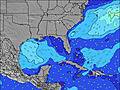 | 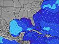 | 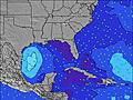 | 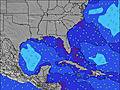 |  |  |  | |||||||||||||
Wave Height (m) Direction Period (s) | ESE 8 | E 8 | E 8 | E 8 | E 8 | E 8 | ESE 7 | E 7 | E 7 | E 7 | ESE 7 | ESE 5 | E 5 | E 6 | E 6 | E 7 | E 8 | E 8 | E 8 | E 8 |
Wave Graph | ||||||||||||||||||||
56 | 11 | 19 | 18 | 28 | 18 | 18 | 28 | 28 | 9 | 52 | 35 | 43 | 66 | 132 | 173 | 207 | 190 | 133 | 104 | |
Wind (km/h) | ||||||||||||||||||||
Wind State on-shore cross-onshore cross-shore cross-offshore off-shore glassy | glassy | cross-off | off | cross-on | cross-off | off | cross-on | off | cross-off | cross-on | cross-on | cross | cross-on | cross-on | cross-on | cross-on | cross-on | cross | cross | cross |
High Tide | 11:18PM0.31m | 11:58AM0.35m | 00:07AM0.28m | 12:55PM0.36m | 1:01AM0.25m | 1:55PM0.37m | 2:00AM0.23m | 2:59PM0.39m | 3:05AM0.22m | 4:02PM0.41m | 4:10AM0.23m | 5:02PM0.44m | ||||||||
Low Tide | 5:15PM-0.30m | 5:34AM-0.36m | 6:09PM-0.27m | 6:23AM-0.37m | 7:09PM-0.26m | 7:17AM-0.37m | 8:14PM-0.24m | 8:15AM-0.37m | 9:21PM-0.25m | 9:17AM-0.38m | 10:26PM-0.27m | 10:19AM-0.39m | 11:27PM-0.29m | |||||||
— | — | 6:45 | — | — | 6:46 | — | — | 6:46 | — | — | 6:47 | — | — | 6:47 | — | — | 6:48 | — | — | |
8:09 | — | — | 8:09 | — | — | 8:08 | — | — | 8:07 | — | — | 8:07 | — | — | 8:07 | — | — | 8:06 | — | |
mm | 6 | 2 | — | 2 | 15 | — | — | 2 | 2 | 3 | 3 | 1 | 3 | 5 | — | — | — | 2 | 2 | 5 |
Temp °C | 28 | 25 | 28 | 30 | 26 | 28 | 29 | 28 | 28 | 29 | 28 | 28 | 29 | 28 | 28 | 28 | 27 | 28 | 28 | 28 |
Feels °C | 30 | 26 | 31 | 33 | 27 | 31 | 33 | 30 | 31 | 31 | 31 | 30 | 32 | 31 | 29 | 29 | 28 | 31 | 30 | 31 |
Swell 1 Height (m) Direction Period (s) | — | ESE 5 | E 8 | E 8 | E 8 | E 8 | ESE 7 | E 7 | E 7 | ESE 4 | S 4 | E 7 | E 7 | E 11 | ENE 10 | NE 10 | NE 9 | NE 9 | E 8 | E 8 |
— | 6 | 19 | 18 | 28 | 18 | 18 | 28 | 28 | 6 | 1 | 9 | 1 | 2 | 9 | 4 | 14 | 13 | 133 | 104 | |
Swell 2 Height (m) Direction Period (s) | N 7 | E 8 | SSE 4 | E 10 | — | SSE 4 | S 4 | — | — | E 7 | E 9 | E 10 | E 10 | NE 11 | — | — | — | — | NE 9 | NE 9 |
1 | 11 | 1 | 2 | — | 2 | 1 | — | — | 9 | 2 | 2 | 2 | 5 | — | — | — | — | 13 | 13 | |
Swell 3 Height (m) Direction Period (s) | — | E 10 | E 10 | E 10 | — | — | — | — | — | SSE 4 | — | — | NE 10 | — | — | — | — | — | NE 9 | — |
— | 2 | 2 | 2 | — | — | — | — | — | 6 | — | — | 4 | — | — | — | — | — | 13 | — | |
Wind waves Height (m) Direction Period (s) | ESE 8 | SSE 4 | — | SE 2 | SSE 4 | — | — | — | SSE 4 | SSE 4 | ESE 7 | ESE 5 | E 5 | E 6 | E 6 | E 7 | E 8 | E 8 | SE 5 | SSE 5 |
56 | 8 | — | 1 | 7 | — | — | — | 3 | 2 | 52 | 35 | 43 | 66 | 132 | 173 | 207 | 190 | 6 | 7 | |
Nearest Offshore or Glassy | ||||||||||||||||||||
Distance (km) | 0 | 3 | 218 | 53 | 378 | 218 | 288 | 3 | 3 | 657 | 218 | 460 | 712 | 1090 | 942 | 450 | 729 | 41 | 622 | 24 |
Best forecast wave conditions in North Florida | ||||||||||||||||||||
Best forecast wave conditions in United States | ||||||||||||||||||||
Header Global | ||||||||||||||||||||
- Map Icons:
 Break
Break Live Wave Height (m)
 Live Wind Speed (km/h)
 Surf Rating (10 Max)
 Ocean Swells (m)
- Wind Speed (km/h)
Latest Updates


FREE! Surf-Forecast.com widget for your website
The surf report / weather widget below is available to embed on third party websites free of charge and provides a summary of our Sebastian Inlet-Third Peak surf forecast. Simply grab the html code snippet that we provide and paste it into your own site. You can choose your preferred language and metric/imperial units for the surf forecast feed to suit users of your site. Click here to get the code.
Information about the Sebastian Inlet-Third Peak Surf forecast
The above surf forecast table for Sebastian Inlet-Third Peak provides essential information for determining whether the surfing conditions will be good over the next 16 days. A general guide to surfing at Sebastian Inlet-Third Peak can be found by selecting the local surf guide option on the grey menu. Our Sebastian Inlet-Third Peak surf forecast is unique since it includes wave energy (power) that defines the real feel of the surf rather than just the height or the period. If you surf the same spot (Sebastian Inlet-Third Peak) regularly then make a mental note of the wave energy from the surf forecast table each time you go. Very soon you may start to choose your surf days based on the wave energy alone combined with our forecast of favourable offshore wind conditions. Our star ratings will help here and of course you will also find the usual wave height and period predictions on our surf forecasts as well as a full break down of the swell components under our advanced users option (to reveal that, click the little Einstein character under the tide times).
Further information to help with frequently asked questions about our surf forecast for Sebastian Inlet-Third Peak may be found under the help tab on the top menu and also by moving your mouse over the question marks on the surf forecast table itself. Please always bear in mind that the forecast is for near-shore open water and local factors at each surf break influence the actual breaking wave height, such as the beach / reef profile, water depths offshore and shelter.
Sebastian Inlet-Third Peak is 6 km (4 miles) from the city of Sebastian. If you plan a vacation in North Florida, look for hotels and other accommodation in Sebastian. Sebastian has rooms for a wide range of budgets as well as car hire and transport links.
 Nearest