

Surf Forecasts:

San Vincenzo surf forecast from 24 Jul 2026:
- Best quality surf: Monday 27 Jul, 5AM (local time) - 2.5ft (0.7m), 8s period, W swell with offshore winds.
- Most powerful swell: Sunday 26 Jul, 8AM (local time) - 4.5ft (1.4m), 6s period, S swell with 144 kJ wave energy.
- Next surfable swell (1★+): Monday 27 Jul, 5AM (local time) - 2.5ft (0.7m), 8s period with W swell.
Best Forecast Surf Conditions for San Vincenzo this week:
The surf forecast for San Vincenzo over the next 16 days: The first swell (rated 1 star or higher) is forecast to arrive on Monday (Jul 27) at 5AM. The primary swell is predicted to be 0.7m and 8s period with a secondary swell of 0.7m and 7s. The wind is predicted to be offshore as the swell arrives.
The most powerful waves expected at San Vincenzo in the next 16 days are 1.4m 6s and forecast to arrive on Sunday (Jul 26) at 8AM. Winds are predicted to be cross-offshore at the time the swell arrives. The largest open ocean swell (not directed at the beach) is 0.5m 6s period and expected on Sunday (Jul 26) at 8PM.
| Wave Type | Time (CEST) & Date | Wave Height & Period |
|---|---|---|
| Next good surf (1 star+) | 5AM (Mon 27th Jul) | 2.5ft (0.7m) 8s |
| Best Surf | 5AM (Mon 27th Jul) | 2.5ft (0.7m) 8s |
| Most Powerful | 8AM (Sun 26th Jul) | 4.5ft (1.4m) 6s |
Table - best surf conditions forecast for San Vincenzo over the next 16 days.
The Lowdown
Alright, listen up. For the next 16 days at San Vincenzo, it's gonna be a tough slog. A real flat spell. We've got a big gap of nothing before we even see a wave worth paddling for.
The first few days are a total loss. Friday the 24th and Saturday the 25th of July are tiny and choppy. The water is a freakish 84°, which is 8° warmer than normal for this time of year – that's very unusual, almost like bathwater. Not gonna help you catch a thing.
We finally get a pulse on Sunday the 26th of July. The morning shows a 5ft swell from the S, with a 6-second period. The combined energy is moderate (232). The wind is cross-offshore from the SE at 12 mph, keeping the surface clean. But the overall quality is still poor. The afternoon turns to junk with a risk of thunderstorms.
Monday the 27th of July is the only real bright spot in the near term. The morning has a 3ft W swell with a 7-second period, and the wind is offshore from the NE at 6 mph. The combined energy is moderate (116), and the conditions are clean. It's surfable but very ordinary. It's the best we've got for a while.
After that, it's back to tiny, weak, and choppy slop for the rest of the week and into the start of August. There are long gaps of several days with absolutely nothing. The morning of Thursday the 6th of August is glassy with a light ENE breeze, but the swell is only 1ft from the W with a 3-second period. The energy is barely a whisper. You'd be lucky to get a knee-high dribble.
Looking further out, the morning of Friday the 7th of August shows a 3ft W swell with an 8-second period and an offshore wind from the ENE. The combined energy is moderate (104). This is promising, but it's a week and a half away, so keep your fingers crossed. Right now, it's the best bet in a very sorry-looking forecast.
Keep the board waxed and the hopes low. It tends not to stay this poor for long, but this is a real flat spell.
Rusty.
Short Range ForecastLight rain (total 2mm), mostly falling on Sun morning. Warm (max 30°C on Fri afternoon, min 23°C on Sun night). Wind will be generally light. | Days 5-7 Weather SummaryMostly dry. Warm (max 32°C on Wed morning, min 24°C on Mon night). Wind will be generally light. | |||||||||||||||||||
Fri 24 | Saturday 25 | Sunday 26 | Monday 27 | Tuesday 28 | Wednesday 29 | Thursday 30 | ||||||||||||||
PM | Night | AM | PM | Night | AM | PM | Night | AM | PM | Night | AM | PM | Night | AM | PM | Night | AM | PM | Night | |
Swell Height Map | 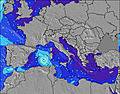 | 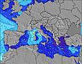 | 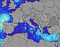 | 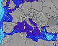 | 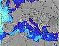 | 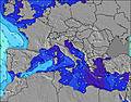 | 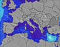 | |||||||||||||
Wave Height (m) Direction Period (s) | W 6 | W 5 | SSE 2 | SSE 4 | S 5 | S 6 | S 6 | S 7 | W 7 | S 7 | W 8 | W 7 | W 7 | NW 4 | S 7 | S 7 | S 7 | S 7 | S 6 | — |
Wave Graph | ||||||||||||||||||||
7 | 2 | 0 | 8 | 59 | 144 | 30 | 34 | 69 | 34 | 31 | 17 | 8 | 2 | 4 | 4 | 1 | 1 | 1 | 0 | |
Wind (km/h) | ||||||||||||||||||||
Wind State on-shore cross-onshore cross-shore cross-offshore off-shore glassy | cross-on | off | cross-off | cross-on | cross-off | cross-off | cross-on | cross-off | off | on | glassy | cross-off | cross-on | cross-off | cross-off | cross-on | cross-off | cross-off | cross-on | cross-off |
High Tide | 7:05PM0.27m | 6:50AM0.24m | 7:56PM0.29m | 7:43AM0.25m | 8:39PM0.31m | 8:26AM0.26m | 9:16PM0.33m | 9:04AM0.28m | 9:51PM0.34m | 9:39AM0.28m | 10:24PM0.35m | 10:13AM0.29m | 10:55PM0.36m | |||||||
Low Tide | 1:15AM0.15m | 1:11PM0.09m | 2:08AM0.13m | 1:58PM0.08m | 2:50AM0.12m | 2:38PM0.06m | 3:27AM0.11m | 3:15PM0.04m | 4:01AM0.10m | 3:49PM0.03m | 4:34AM0.09m | 4:21PM0.03m | ||||||||
— | — | 6:00 | — | — | 6:01 | — | — | 6:01 | — | — | 6:03 | — | — | 6:03 | — | — | 6:05 | — | — | |
8:47 | — | — | 8:46 | — | — | 8:45 | — | — | 8:45 | — | — | 8:44 | — | — | 8:43 | — | — | 8:42 | — | |
mm | — | — | — | — | — | 1 | 1 | — | — | — | — | — | — | — | — | — | — | — | — | — |
Temp °C | 30 | 28 | 26 | 28 | 27 | 27 | 28 | 27 | 29 | 28 | 28 | 31 | 31 | 31 | 32 | 30 | 29 | 30 | 31 | 28 |
Feels °C | 27 | 27 | 24 | 27 | 26 | 27 | 31 | 29 | 32 | 29 | 30 | 32 | 29 | 31 | 31 | 29 | 31 | 29 | 29 | 28 |
Swell 1 Height (m) Direction Period (s) | W 6 | — | — | — | — | S 6 | S 6 | S 7 | W 7 | S 7 | S 7 | S 7 | SSE 7 | NW 4 | S 7 | S 7 | S 7 | S 7 | S 6 | — |
7 | — | — | — | — | 88 | 30 | 34 | 69 | 34 | 26 | 25 | 16 | 2 | 4 | 4 | 1 | 1 | 1 | — | |
Swell 2 Height (m) Direction Period (s) | — | W 5 | — | — | — | — | — | W 8 | S 7 | W 7 | W 8 | W 7 | W 7 | W 5 | — | — | — | — | — | — |
— | 2 | — | — | — | — | — | 22 | 47 | 25 | 31 | 17 | 8 | 1 | — | — | — | — | — | — | |
Swell 3 Height (m) Direction Period (s) | W 6 | — | — | — | — | — | — | W 4 | — | — | — | — | — | — | — | — | — | — | — | — |
1 | — | — | — | — | — | — | 5 | — | — | — | — | — | — | — | — | — | — | — | — | |
Wind waves Height (m) Direction Period (s) | — | — | SSE 2 | SSE 4 | S 5 | S 6 | — | NW 3 | NE 3 | — | — | — | — | SSE 7 | — | W 2 | — | — | — | — |
— | — | 1 | 8 | 59 | 144 | — | 3 | 2 | — | — | — | — | 18 | — | 1 | — | — | — | — | |
Nearest Offshore or Glassy | ||||||||||||||||||||
Distance (km) | 1810 | 866 | 812 | 859 | 65 | 49 | 1595 | 42 | 0 | 206 | 49 | 193 | 969 | 436 | 970 | 1071 | 997 | 962 | 1071 | 960 |
Best forecast wave conditions in West Coast of Italy | ||||||||||||||||||||
Best forecast wave conditions in Italy | ||||||||||||||||||||
Header Global | ||||||||||||||||||||
- Map Icons:
 Break
Break Live Wave Height (m)
 Live Wind Speed (km/h)
 Surf Rating (10 Max)
 Ocean Swells (m)
- Wind Speed (km/h)


FREE! Surf-Forecast.com widget for your website
The surf report / weather widget below is available to embed on third party websites free of charge and provides a summary of our San Vincenzo surf forecast. Simply grab the html code snippet that we provide and paste it into your own site. You can choose your preferred language and metric/imperial units for the surf forecast feed to suit users of your site. Click here to get the code.
Information about the San Vincenzo Surf forecast
The above surf forecast table for San Vincenzo provides essential information for determining whether the surfing conditions will be good over the next 16 days. A general guide to surfing at San Vincenzo can be found by selecting the local surf guide option on the grey menu. Our San Vincenzo surf forecast is unique since it includes wave energy (power) that defines the real feel of the surf rather than just the height or the period. If you surf the same spot (San Vincenzo) regularly then make a mental note of the wave energy from the surf forecast table each time you go. Very soon you may start to choose your surf days based on the wave energy alone combined with our forecast of favourable offshore wind conditions. Our star ratings will help here and of course you will also find the usual wave height and period predictions on our surf forecasts as well as a full break down of the swell components under our advanced users option (to reveal that, click the little Einstein character under the tide times).
Further information to help with frequently asked questions about our surf forecast for San Vincenzo may be found under the help tab on the top menu and also by moving your mouse over the question marks on the surf forecast table itself. Please always bear in mind that the forecast is for near-shore open water and local factors at each surf break influence the actual breaking wave height, such as the beach / reef profile, water depths offshore and shelter.
 Nearest