

Surf Forecasts:

Rocchette (Castiglioni della Pescaia) surf forecast from 2 Aug 2026:
- Most powerful swell: Tuesday 4 Aug, 2PM (local time) - 1.5ft (0.4m), 4s period, S swell with 5 kJ wave energy.
Best Forecast Surf Conditions for Rocchette (Castiglioni della Pescaia) this week:
The most powerful waves expected at Rocchette (Castiglioni della Pescaia) in the next 16 days are 0.4m 4s and forecast to arrive on Tuesday (Aug 04) at 2PM. Winds are predicted to be onshore at the time the swell arrives. The largest open ocean swell (not directed at the beach) is 0.5m 3s period and expected on Sunday (Aug 02) at 5PM.
| Wave Type | Time (CEST) & Date | Wave Height & Period |
|---|---|---|
| Next good surf (1 star+) | - | - |
| Best Surf | - | - |
| Most Powerful | 2PM (Tue 4th Aug) | 1.5ft (0.4m) 4s |
Table - best surf conditions forecast for Rocchette (Castiglioni della Pescaia) over the next 16 days.
The Lowdown
G’day, Rusty here. Let’s be straight with you – this outlook for Rocchette (Castiglioni della Pescaia) is a tough one. The whole 16-day window is a real struggle. We’re looking at a long, dry stretch with barely a ripple worth talking about. The first solid recommendation doesn’t come until the morning of Sunday, August 2nd, and even then it’s a whisper.
Right from the get-go, the water is sitting at 83°, which is a whopping 6° warmer than usual for this time of year. That’s seriously unusual – like bathwater, but unfortunately, that’s the only standout feature.
Sunday morning, August 2nd, offers the first hint of surf. It’s tiny, with a 0.7ft swell from the WNW, and the period is a short 5 seconds. The combined energy is a measly 3 (weak energy). The wind is light and offshore from the N, so the surface is clean, but it’s just not enough to get excited about. The afternoon gets worse, with a strong 16 mph cross-offshore wind from the NW and no rideable swell.
From Monday, August 3rd, right through to the morning of Monday, August 11th, it’s a dismal run. For over a week, every session is rated as poor surf conditions. You’ll see tiny 0.7ft to 1ft slop, mostly from the S or SSW, with pathetic periods of 3 to 5 seconds and combined energy values that never crack double digits. The wind is a mix of cross, cross-on, and onshore, with a few lighter moments, but the swell is just too weak to make any of it worthwhile.
The first real flicker of hope comes late in the game. On the morning of Tuesday, August 12th, we see a 1.0ft swell from the WNW with a better 7-second period, and the combined energy bumps up to 11 (still weak, but it’s something). The wind is light and cross-off from the NE, keeping it clean. It’s the best the whole period has to offer, but it’s still only for the most desperate soul.
The rest of the outlook, from the afternoon of August 12th through to Monday, August 17th, is more of the same – tiny, weak swells, or no swell at all. There is a 1.0ft SSW swell on the afternoon of the 17th, but with a 5-second period and 12 mph cross-off wind, it’s not calling anyone’s name.
Honestly, mate, this is a blank run. For a sandbar that’s fairly consistent, this is a quiet spell. The forecasts can change, but right now, the only thing on offer is a swim. For a break of this type, it’s pretty normal to have these flat, quiet periods. If you really need to paddle, the morning of August 12th is your best – and only – bet.
Rusty.
Short Range ForecastMostly dry. Warm (max 28°C on Sun afternoon, min 25°C on Sun morning). Wind will be generally light. | Days 4-6 Weather SummaryMostly dry. Warm (max 29°C on Wed night, min 25°C on Thu night). Wind will be generally light. | ||||||||||||||||||||
Sunday 2 | Monday 3 | Tuesday 4 | Wednesday 5 | Thursday 6 | Friday 7 | Saturday 8 | |||||||||||||||
AM | PM | Night | AM | PM | Night | AM | PM | Night | AM | PM | Night | AM | PM | Night | AM | PM | Night | AM | PM | Night | |
Swell Height Map | 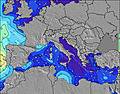 | 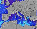 | 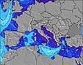 | 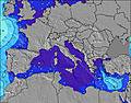 | 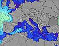 | 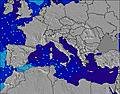 | 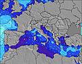 | ||||||||||||||
Wave Height (m) Direction Period (s) | WNW 5 | WNW 3 | — | — | — | SSE 3 | S 4 | S 4 | S 4 | S 5 | S 5 | S 5 | S 5 | S 5 | WNW 3 | — | W 6 | W 6 | SSW 4 | W 6 | WNW 3 |
Wave Graph | |||||||||||||||||||||
2 | 0 | 0 | 0 | 0 | 1 | 3 | 5 | 3 | 4 | 5 | 2 | 2 | 2 | 1 | 0 | 1 | 1 | 2 | 1 | 1 | |
Wind (km/h) | |||||||||||||||||||||
Wind State on-shore cross-onshore cross-shore cross-offshore off-shore glassy | off | cross-off | off | cross | cross-on | cross | cross | on | cross | cross | cross | off | cross-off | cross-off | off | off | cross-off | glassy | cross | cross | off |
High Tide | 11:58AM0.29m | 00:28AM0.35m | 12:38PM0.29m | 1:04AM0.34m | 1:25PM0.28m | 1:44AM0.32m | 2:23PM0.27m | 2:36AM0.30m | 3:36PM0.27m | 3:44AM0.28m | 5:05PM0.27m | 5:08AM0.27m | 6:30PM0.30m | ||||||||
Low Tide | 6:00PM0.04m | 6:47AM0.07m | 6:38PM0.06m | 7:27AM0.07m | 7:22PM0.08m | 8:14AM0.08m | 8:18PM0.11m | 9:12AM0.08m | 9:34PM0.13m | 10:25AM0.09m | 11:11PM0.13m | 11:44AM0.08m | 00:42AM0.12m | ||||||||
6:07 | — | — | 6:09 | — | — | 6:09 | — | — | 6:11 | — | — | 6:11 | — | — | 6:13 | — | — | 6:13 | — | — | |
— | 8:37 | — | — | 8:35 | — | — | 8:34 | — | — | 8:32 | — | — | 8:31 | — | — | 8:30 | — | — | 8:29 | — | |
mm | — | — | — | — | — | — | — | — | — | — | — | — | — | — | — | — | — | — | — | — | — |
Temp °C | 27 | 28 | 27 | 27 | 28 | 27 | 27 | 28 | 28 | 27 | 28 | 29 | 28 | 29 | 28 | 28 | 28 | 28 | 27 | 28 | 28 |
Feels °C | 28 | 28 | 31 | 29 | 30 | 30 | 28 | 31 | 31 | 29 | 29 | 32 | 28 | 28 | 28 | 28 | 28 | 29 | 28 | 31 | 30 |
Swell 1 Height (m) Direction Period (s) | WNW 5 | — | — | — | — | — | S 4 | — | S 4 | S 5 | S 5 | S 5 | S 5 | S 5 | WNW 3 | — | — | SW 4 | SSW 4 | W 6 | WNW 3 |
2 | — | — | — | — | — | 3 | — | 3 | 4 | 5 | 2 | 2 | 2 | 1 | — | — | 1 | 2 | 1 | 1 | |
Swell 2 Height (m) Direction Period (s) | SW 5 | — | — | — | — | — | — | — | — | — | — | — | — | — | — | — | — | — | W 6 | SW 4 | — |
1 | — | — | — | — | — | — | — | — | — | — | — | — | — | — | — | — | — | 1 | 1 | — | |
Swell 3 Height (m) Direction Period (s) | — | — | — | — | — | — | — | — | — | — | — | — | — | — | — | — | W 6 | W 6 | W 6 | — | W 5 |
— | — | — | — | — | — | — | — | — | — | — | — | — | — | — | — | 1 | 1 | 1 | — | 1 | |
Wind waves Height (m) Direction Period (s) | — | WNW 3 | — | — | — | SSE 3 | ESE 2 | S 4 | — | — | — | — | — | — | NW 3 | — | — | — | — | — | — |
— | 3 | — | — | — | 1 | 1 | 5 | — | — | — | — | — | — | 3 | — | — | — | — | — | — | |
Nearest Offshore or Glassy | |||||||||||||||||||||
Distance (km) | 142 | 1048 | 1026 | 1064 | 1356 | 988 | 988 | 1309 | 1048 | 1048 | 1206 | 998 | 991 | 1096 | 1074 | 354 | 1474 | 194 | 142 | 1365 | 1047 |
Best forecast wave conditions in West Coast of Italy | |||||||||||||||||||||
Best forecast wave conditions in Italy | |||||||||||||||||||||
Header Global | |||||||||||||||||||||
- Map Icons:
 Break
Break Live Wave Height (m)
 Live Wind Speed (km/h)
 Surf Rating (10 Max)
 Ocean Swells (m)
- Wind Speed (km/h)
Latest Updates


FREE! Surf-Forecast.com widget for your website
The surf report / weather widget below is available to embed on third party websites free of charge and provides a summary of our Rocchette (Castiglioni della Pescaia) surf forecast. Simply grab the html code snippet that we provide and paste it into your own site. You can choose your preferred language and metric/imperial units for the surf forecast feed to suit users of your site. Click here to get the code.
Information about the Rocchette (Castiglioni della Pescaia) Surf forecast
The above surf forecast table for Rocchette (Castiglioni della Pescaia) provides essential information for determining whether the surfing conditions will be good over the next 16 days. A general guide to surfing at Rocchette (Castiglioni della Pescaia) can be found by selecting the local surf guide option on the grey menu. Our Rocchette (Castiglioni della Pescaia) surf forecast is unique since it includes wave energy (power) that defines the real feel of the surf rather than just the height or the period. If you surf the same spot (Rocchette (Castiglioni della Pescaia)) regularly then make a mental note of the wave energy from the surf forecast table each time you go. Very soon you may start to choose your surf days based on the wave energy alone combined with our forecast of favourable offshore wind conditions. Our star ratings will help here and of course you will also find the usual wave height and period predictions on our surf forecasts as well as a full break down of the swell components under our advanced users option (to reveal that, click the little Einstein character under the tide times).
Further information to help with frequently asked questions about our surf forecast for Rocchette (Castiglioni della Pescaia) may be found under the help tab on the top menu and also by moving your mouse over the question marks on the surf forecast table itself. Please always bear in mind that the forecast is for near-shore open water and local factors at each surf break influence the actual breaking wave height, such as the beach / reef profile, water depths offshore and shelter.
Rocchette (Castiglioni della Pescaia) is 17 km (11 miles) from the city of Follonica. If you plan a holiday in West Coast of Italy, look for hotels and other accommodation in Follonica. Follonica has rooms for a wide range of budgets as well as car hire and transport links.
 Nearest