

Surf Forecasts:

Bajo el Medio surf forecast from 3 Aug 2026:
- Most powerful swell: Thursday 6 Aug, 1PM (local time) - 3.5ft (1.0m), 8s period, NE swell with 132 kJ wave energy.
Best Forecast Surf Conditions for Bajo el Medio this week:
The most powerful waves expected at Bajo el Medio in the next 16 days are 1.0m 8s and forecast to arrive on Thursday (Aug 06) at 1PM. Winds are predicted to be cross-onshore at the time the swell arrives. The largest open ocean swell (not directed at the beach) is 0.3m 10s period and expected on Monday (Aug 03) at 4AM.
| Wave Type | Time (WEST) & Date | Wave Height & Period |
|---|---|---|
| Next good surf (1 star+) | - | - |
| Best Surf | - | - |
| Most Powerful | 1PM (Thu 6th Aug) | 3.5ft (1.0m) 8s |
Table - best surf conditions forecast for Bajo el Medio over the next 16 days.
The Lowdown
G’day, Rusty here. Lookin’ at the next 16 days for Bajo el Medio, and I gotta be straight with ya – it’s a tough stretch. This spot’s a sheltered reef, usually needs a solid NW swell to really fire, but we’re not gettin’ that. The whole period is plagued by persistent cross-onshore winds from the north, so the ocean’s gonna be chopped up and messy. There’s no real standout session, no day where you’d drag yourself out of bed for it. The water’s sittin’ at 72.9°, which is about average for this time of year, small comfort.
The whole run is pretty much a write-off for decent surf. From Sunday, August 2nd, right through to Monday, August 17th, every single window is marked by poor surf conditions. Winds are mostly a moderate to fresh breeze from the north, blowin’ cross-onshore, which is a killer for this reef. Swell heights barely get above 3.3 ft, and when they do, like on the 15th of August afternoon with 4.6 ft, the wind is a fresh 30 km/h cross-onshore, making it lumpy and ugly. The combined energy spikes up to 361 (moderate) on that afternoon, but it’s wasted on the wind. Swell periods are short, mostly 7 to 8 seconds, so there’s no real power or shape. It’s just messy.
Even the 14th of August picks up a bit of energy – 3.9 ft from the NE on the afternoon with a combined energy of 256 (moderate) – but again, the wind ruins it. The 17th of August afternoon has a similar story: 4.3 ft from the NNE, 290 combined energy, yet still cross-onshore. For a reef that’s inconsistent and sheltered, you need the stars to align, and they’re not even close. For a beginner, any swell over 4.9 ft gets too big, but here it’s the wind that’s the real problem. Honestly, this setup looks more interesting for kite surfing than paddle surfing, with that steady north wind and some bumpy, short-period energy.
So, there’s no good surf on offer in this 16-day window. It’s a blank run, and for an area with a break as inconsistent as Bajo el Medio, that’s not unusual. Forecasts can change, but right now, I’d give the board a rest and check back later.
Short Range ForecastMostly dry. Warm (max 25°C on Sun afternoon, min 21°C on Mon night). Wind will be generally light. | Days 5-7 Weather SummaryMostly dry. Warm (max 24°C on Wed afternoon, min 20°C on Thu night). Mainly fresh winds. | |||||||||||||||||||
Sun 2 | Monday 3 | Tuesday 4 | Wednesday 5 | Thursday 6 | Friday 7 | Saturday 8 | ||||||||||||||
PM | Night | AM | PM | Night | AM | PM | Night | AM | PM | Night | AM | PM | Night | AM | PM | Night | AM | PM | Night | |
Swell Height Map |  |  |  |  | 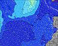 | 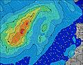 | 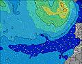 | |||||||||||||
Wave Height (m) Direction Period (s) | NE 7 | NNE 7 | NE 7 | NE 8 | NE 7 | ENE 7 | NE 7 | ENE 7 | NE 8 | NE 8 | NE 8 | NE 8 | NE 8 | NE 8 | NNE 7 | NNE 7 | NNE 6 | NE 8 | NE 8 | NE 7 |
Wave Graph | ||||||||||||||||||||
19 | 78 | 27 | 28 | 22 | 35 | 121 | 35 | 65 | 67 | 77 | 100 | 95 | 46 | 32 | 35 | 21 | 24 | 23 | 13 | |
Wind (km/h) | ||||||||||||||||||||
Wind State on-shore cross-onshore cross-shore cross-offshore off-shore glassy | cross-on | on | cross-on | cross-on | on | cross-on | cross-on | cross-on | on | on | cross-on | cross-on | cross-on | cross-on | cross-on | cross-on | cross-on | cross-on | cross-on | cross-on |
High Tide | 4:37PM2.33m | 5:00AM2.11m | 5:13PM2.24m | 5:39AM2.04m | 5:54PM2.12m | 6:25AM1.95m | 6:46PM1.97m | 7:24AM1.86m | 7:54PM1.84m | 8:41AM1.80m | 9:24PM1.77m | 10:10AM1.85m | 10:54PM1.83m | |||||||
Low Tide | 10:49PM0.24m | 10:56AM0.35m | 11:26PM0.31m | 11:36AM0.44m | 00:08AM0.42m | 12:26PM0.55m | 1:00AM0.54m | 1:30PM0.65m | 2:11AM0.65m | 2:57PM0.70m | 3:40AM0.68m | 4:33PM0.62m | ||||||||
— | — | 7:16 | — | — | 7:18 | — | — | 7:18 | — | — | 7:18 | — | — | 7:18 | — | — | 7:20 | — | — | |
8:45 | — | — | 8:45 | — | — | 8:44 | — | — | 8:43 | — | — | 8:43 | — | — | 8:42 | — | — | 8:40 | — | |
mm | — | — | — | — | — | — | — | — | — | — | — | — | — | — | — | — | — | — | — | — |
Temp °C | 25 | 23 | 24 | 25 | 22 | 25 | 25 | 22 | 23 | 24 | 22 | 22 | 22 | 21 | 22 | 23 | 21 | 23 | 23 | 21 |
Feels °C | 23 | 22 | 23 | 23 | 22 | 24 | 24 | 21 | 22 | 23 | 21 | 21 | 20 | 20 | 20 | 22 | 20 | 21 | 21 | 20 |
Swell 1 Height (m) Direction Period (s) | NE 7 | NE 7 | NE 7 | NE 8 | WNW 9 | ENE 7 | ENE 8 | ENE 7 | NE 8 | NE 8 | NE 8 | WNW 10 | WNW 10 | NE 8 | WNW 9 | WNW 9 | WNW 9 | NE 8 | NE 8 | NE 7 |
19 | 25 | 27 | 28 | 8 | 35 | 39 | 35 | 65 | 67 | 77 | 9 | 9 | 46 | 8 | 8 | 8 | 24 | 23 | 13 | |
Swell 2 Height (m) Direction Period (s) | NW 8 | WNW 10 | WNW 9 | WNW 9 | NW 5 | WNW 9 | WNW 9 | WNW 8 | WNW 8 | WNW 10 | WNW 10 | N 10 | N 10 | WNW 9 | N 8 | NW 9 | NNE 8 | WNW 9 | WNW 9 | WNW 8 |
18 | 18 | 17 | 8 | 1 | 8 | 8 | 7 | 6 | 11 | 10 | 2 | 2 | 9 | 1 | 3 | 7 | 8 | 7 | 7 | |
Swell 3 Height (m) Direction Period (s) | — | NNW 5 | — | NNW 5 | — | N 7 | NW 5 | — | WNW 10 | — | N 12 | — | N 10 | N 9 | — | N 10 | N 9 | — | — | N 8 |
— | 2 | — | 2 | — | 1 | 1 | — | 10 | — | 3 | — | 2 | 2 | — | 2 | 2 | — | — | 1 | |
Wind waves Height (m) Direction Period (s) | NNW 4 | NNE 7 | NNW 5 | — | NE 7 | NW 5 | NE 7 | NNW 3 | NNW 5 | NNW 6 | NNW 6 | NE 8 | NE 8 | NW 6 | NNE 7 | NNE 7 | NNE 6 | NNW 3 | NNW 3 | NNW 5 |
2 | 78 | 5 | — | 22 | 1 | 121 | 1 | 3 | 3 | 3 | 100 | 95 | 5 | 32 | 35 | 21 | 4 | 3 | 5 | |
Nearest Offshore or Glassy | ||||||||||||||||||||
Distance (km) | 14 | 14 | 14 | 285 | 14 | 223 | 14 | 223 | 223 | 291 | 223 | 223 | 223 | 223 | 223 | 183 | 437 | 438 | 223 | 297 |
Best forecast wave conditions in Fuerteventura | ||||||||||||||||||||
Best forecast wave conditions in Spain (Africa) | ||||||||||||||||||||
Header Global | ||||||||||||||||||||
- Map Icons:
 Break
Break Live Wave Height (m)
 Live Wind Speed (km/h)
 Surf Rating (10 Max)
 Ocean Swells (m)
- Wind Speed (km/h)
Latest Updates


FREE! Surf-Forecast.com widget for your website
The surf report / weather widget below is available to embed on third party websites free of charge and provides a summary of our Bajo el Medio surf forecast. Simply grab the html code snippet that we provide and paste it into your own site. You can choose your preferred language and metric/imperial units for the surf forecast feed to suit users of your site. Click here to get the code.
Information about the Bajo el Medio Surf forecast
The above surf forecast table for Bajo el Medio provides essential information for determining whether the surfing conditions will be good over the next 16 days. A general guide to surfing at Bajo el Medio can be found by selecting the local surf guide option on the grey menu. Our Bajo el Medio surf forecast is unique since it includes wave energy (power) that defines the real feel of the surf rather than just the height or the period. If you surf the same spot (Bajo el Medio) regularly then make a mental note of the wave energy from the surf forecast table each time you go. Very soon you may start to choose your surf days based on the wave energy alone combined with our forecast of favourable offshore wind conditions. Our star ratings will help here and of course you will also find the usual wave height and period predictions on our surf forecasts as well as a full break down of the swell components under our advanced users option (to reveal that, click the little Einstein character under the tide times).
Further information to help with frequently asked questions about our surf forecast for Bajo el Medio may be found under the help tab on the top menu and also by moving your mouse over the question marks on the surf forecast table itself. Please always bear in mind that the forecast is for near-shore open water and local factors at each surf break influence the actual breaking wave height, such as the beach / reef profile, water depths offshore and shelter.
Are you planning a holiday in Fuerteventura? If you are looking for accommodation near Bajo el Medio, camping, hotels and holiday cottages in Fuerteventura, consider staying in La Oliva which is 15 km (9 miles) away. Other places in and around Fuerteventura where you can find information about places to rent, and car hire include Puerto del Rosario which is 26 km (16 miles) away, Puerto del Carmen, Tias and Lanzarote.
 Nearest