

Surf Forecasts:

Main Street Pier surf forecast from 2 Aug 2026:
- Best quality surf: Sunday 9 Aug, 2AM (local time) - 5.5ft (1.7m), 7s period, ESE swell with cross-offshore winds.
- Most powerful swell: Saturday 8 Aug, 5AM (local time) - 5ft (1.6m), 8s period, E swell with 307 kJ wave energy.
- Next surfable swell (1★+): Sunday 9 Aug, 2AM (local time) - 5.5ft (1.7m), 7s period with ESE swell.
Best Forecast Surf Conditions for Main Street Pier this week:
The surf forecast for Main Street Pier over the next 16 days: The first swell (rated 1 star or higher) is forecast to arrive on Sunday (Aug 09) at 2AM. The primary swell is predicted to be 1.7m and 7s period with a secondary swell of 1.2m and 7s. The wind is predicted to be cross-offshore as the swell arrives.
The most powerful waves expected at Main Street Pier in the next 16 days are 1.6m 8s and forecast to arrive on Saturday (Aug 08) at 5AM. Winds are predicted to be cross-onshore at the time the swell arrives. The largest open ocean swell (not directed at the beach) is 0.8m 4s period and expected on Sunday (Aug 09) at 5AM.
| Wave Type | Time (EDT) & Date | Wave Height & Period |
|---|---|---|
| Next good surf (1 star+) | 2AM (Sun 9th Aug) | 5.5ft (1.7m) 7s |
| Best Surf | 2AM (Sun 9th Aug) | 5.5ft (1.7m) 7s |
| Most Powerful | 5AM (Sat 8th Aug) | 5ft (1.6m) 8s |
Table - best surf conditions forecast for Main Street Pier over the next 16 days.
The Lowdown
Alright folks, Rusty here. Let’s talk about Main Street Pier.
Well, I gotta be straight with you – this 16-day window is a tough one. The first week looks pretty flat and messy. We’ve got a long stretch of poor surf with tiny waves, mostly under 2 ft, and a lot of cross and cross-onshore winds. The water temp is sitting at 83°, which is pretty normal for this time of year, so no surprises there.
From Sunday the 2nd through to Saturday the 8th, it’s a real struggle. Swell is tiny, mostly from the ESE or E, with short periods around 7-8 seconds, meaning weak, disorganized waves. The combined energy is low, barely cracking 100 (21 to 100 range). Wind is all over the place – cross-off, cross, cross-on – so nothing clean or rideable for more than knee-high dribble. Tuesday morning the 4th and Thursday the 6th offer a bit of offshore wind, but the swell is just too small.
Now, there’s a little glimmer on Sunday the 9th. The morning shows a 4 ft swell from the ESE with a short period of 6 seconds and a light W cross-off breeze. The combined energy jumps to 243, which is moderate, and the wave comment says “expect good surf conditions.” That’s the standout window. It’s still not massive, but the wind is clean and the size is a step up from the rest. The swell direction is off the ESE, which isn’t the optimum NE for this spot, but it’s the best we’ll see. After that, it drops back to tiny, weak swell through the rest of the second week. Monday the 10th has a little energy (101) but the wind shifts cross, killing the quality.
Honestly, if you’re desperate for a paddle, Sunday morning the 9th is your only real shot. The rest of the forecast is a flat spell. For the area, with few consistent breaks, a blank run like this isn’t unusual. Keep an eye on the forecasts, but for now, it’s a waiting game.
Rusty.
Short Range ForecastLight rain (total 6mm), mostly falling on Sun morning. Warm (max 31°C on Mon afternoon, min 24°C on Sun night). Wind will be generally light. | Days 4-6 Weather SummaryModerate rain (total 10mm), heaviest on Wed night. Warm (max 30°C on Wed afternoon, min 25°C on Wed morning). Wind will be generally light. | ||||||||||||||||||||
Sunday 2 | Monday 3 | Tuesday 4 | Wednesday 5 | Thursday 6 | Friday 7 | Saturday 8 | |||||||||||||||
AM | PM | Night | AM | PM | Night | AM | PM | Night | AM | PM | Night | AM | PM | Night | AM | PM | Night | AM | PM | Night | |
Swell Height Map |  |  |  | 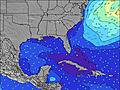 | 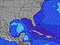 | 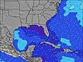 | 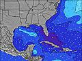 | ||||||||||||||
Wave Height (m) Direction Period (s) | ESE 8 | E 8 | E 8 | ESE 8 | ESE 8 | ESE 8 | E 7 | E 7 | E 7 | E 7 | E 7 | ESE 7 | ESE 7 | E 7 | E 6 | E 7 | E 7 | E 7 | E 8 | E 8 | ESE 7 |
Wave Graph | |||||||||||||||||||||
21 | 30 | 29 | 33 | 19 | 32 | 28 | 27 | 28 | 39 | 52 | 17 | 15 | 43 | 51 | 72 | 96 | 155 | 191 | 301 | 248 | |
Wind (km/h) | |||||||||||||||||||||
Wind State on-shore cross-onshore cross-shore cross-offshore off-shore glassy | cross-off | off | cross-off | off | cross-off | cross-off | off | cross-off | cross-off | cross | cross | cross | cross-on | cross-on | cross-on | cross-on | cross-on | cross-on | on | on | cross-off |
High Tide | 11:10AM1.19m | 11:20PM1.24m | 11:52AM1.24m | 00:00AM1.19m | 12:39PM1.29m | 00:46AM1.14m | 1:32PM1.34m | 1:38AM1.09m | 2:33PM1.37m | 2:40AM1.05m | 3:40PM1.41m | 3:50AM1.04m | 4:50PM1.46m | ||||||||
Low Tide | 5:11PM0.10m | 5:34AM0.03m | 6:00PM0.15m | 6:15AM0.03m | 6:55PM0.20m | 7:03AM0.04m | 7:58PM0.24m | 7:58AM0.05m | 9:05PM0.25m | 9:00AM0.04m | 10:13PM0.23m | 10:05AM0.01m | 11:19PM0.17m | ||||||||
6:43 | — | — | 6:45 | — | — | 6:45 | — | — | 6:46 | — | — | 6:47 | — | — | 6:47 | — | — | 6:48 | — | — | |
— | 8:15 | — | — | 8:14 | — | — | 8:13 | — | — | 8:12 | — | — | 8:12 | — | — | 8:10 | — | — | 8:09 | — | |
mm | 2 | — | 1 | — | 1 | 1 | — | 1 | — | — | — | 6 | — | 1 | — | 1 | 1 | 1 | — | 1 | — |
Temp °C | 26 | 27 | 25 | 28 | 31 | 27 | 26 | 27 | 27 | 28 | 30 | 29 | 29 | 29 | 29 | 29 | 29 | 28 | 29 | 29 | 27 |
Feels °C | 27 | 28 | 26 | 28 | 30 | 30 | 28 | 30 | 30 | 31 | 31 | 32 | 32 | 31 | 31 | 31 | 31 | 30 | 31 | 30 | 28 |
Swell 1 Height (m) Direction Period (s) | ESE 8 | E 8 | E 8 | ESE 8 | ESE 8 | ESE 8 | E 7 | E 7 | E 7 | E 7 | E 9 | ESE 7 | ESE 7 | E 10 | E 9 | NE 10 | NE 10 | — | E 8 | E 8 | E 7 |
21 | 30 | 29 | 33 | 19 | 32 | 28 | 27 | 28 | 39 | 2 | 17 | 15 | 2 | 2 | 4 | 4 | — | 191 | 190 | 150 | |
Swell 2 Height (m) Direction Period (s) | — | — | — | — | — | — | — | — | — | — | — | — | E 10 | — | E 11 | — | — | — | NE 10 | — | — |
— | — | — | — | — | — | — | — | — | — | — | — | 2 | — | 2 | — | — | — | 4 | — | — | |
Swell 3 Height (m) Direction Period (s) | — | — | — | — | — | — | — | — | — | — | — | — | — | — | — | — | — | — | — | — | — |
— | — | — | — | — | — | — | — | — | — | — | — | — | — | — | — | — | — | — | — | — | |
Wind waves Height (m) Direction Period (s) | — | S 3 | — | — | — | S 3 | — | — | — | — | E 7 | ESE 4 | E 5 | E 7 | E 6 | E 7 | E 7 | E 7 | — | E 8 | ESE 7 |
— | 2 | — | — | — | 5 | — | — | — | — | 52 | 15 | 11 | 43 | 51 | 72 | 96 | 155 | — | 301 | 248 | |
Nearest Offshore or Glassy | |||||||||||||||||||||
Distance (km) | 1245 | 1392 | 66 | 66 | 66 | 66 | 66 | 66 | 22 | 22 | 917 | 66 | 316 | 1589 | 1242 | 847 | 1587 | 581 | 415 | 466 | 0 |
Best forecast wave conditions in North Florida | |||||||||||||||||||||
Best forecast wave conditions in United States | |||||||||||||||||||||
Header Global | |||||||||||||||||||||
- Map Icons:
 Break
Break Live Wave Height (m)
 Live Wind Speed (km/h)
 Surf Rating (10 Max)
 Ocean Swells (m)
- Wind Speed (km/h)
Latest Updates


FREE! Surf-Forecast.com widget for your website
The surf report / weather widget below is available to embed on third party websites free of charge and provides a summary of our Main Street Pier surf forecast. Simply grab the html code snippet that we provide and paste it into your own site. You can choose your preferred language and metric/imperial units for the surf forecast feed to suit users of your site. Click here to get the code.
Information about the Main Street Pier Surf forecast
The above surf forecast table for Main Street Pier provides essential information for determining whether the surfing conditions will be good over the next 16 days. A general guide to surfing at Main Street Pier can be found by selecting the local surf guide option on the grey menu. Our Main Street Pier surf forecast is unique since it includes wave energy (power) that defines the real feel of the surf rather than just the height or the period. If you surf the same spot (Main Street Pier) regularly then make a mental note of the wave energy from the surf forecast table each time you go. Very soon you may start to choose your surf days based on the wave energy alone combined with our forecast of favourable offshore wind conditions. Our star ratings will help here and of course you will also find the usual wave height and period predictions on our surf forecasts as well as a full break down of the swell components under our advanced users option (to reveal that, click the little Einstein character under the tide times).
Further information to help with frequently asked questions about our surf forecast for Main Street Pier may be found under the help tab on the top menu and also by moving your mouse over the question marks on the surf forecast table itself. Please always bear in mind that the forecast is for near-shore open water and local factors at each surf break influence the actual breaking wave height, such as the beach / reef profile, water depths offshore and shelter.
Main Street Pier is 3 km (2 miles) from the city of Port Orange. If you plan a vacation in North Florida, look for hotels and other accommodation in Port Orange. Port Orange has rooms for a wide range of budgets as well as car hire and transport links.
 Nearest