

Surf Forecasts:

Las Piscinas surf forecast from 3 Aug 2026:
- Most powerful swell: Sunday 9 Aug, 7AM (local time) - 5ft (1.6m), 10s period, NNE swell with 482 kJ wave energy.
Best Forecast Surf Conditions for Las Piscinas this week:
The most powerful waves expected at Las Piscinas in the next 16 days are 1.6m 10s and forecast to arrive on Sunday (Aug 09) at 7AM. Winds are predicted to be onshore at the time the swell arrives. The largest open ocean swell (not directed at the beach) is 0.1m 12s period and expected on Monday (Aug 03) at 10PM.
| Wave Type | Time (WEST) & Date | Wave Height & Period |
|---|---|---|
| Next good surf (1 star+) | - | - |
| Best Surf | - | - |
| Most Powerful | 7AM (Sun 9th Aug) | 5ft (1.6m) 10s |
Table - best surf conditions forecast for Las Piscinas over the next 16 days.
The Lowdown
Alright folks, Rusty here. Gotta be straight with you – right now, it’s a tough stretch if you’re thinking about paddling out at Las Piscinas. The whole 16-day window is a bit of a bust, unfortunately. There’s not a single day where the stars align for a proper session, so I’ll walk you through it.
We start off with Monday morning, August 3rd. It’s clear skies, but we’ve got wind coming from the NNE at 9 mph, blowing onshore. The swell is a weak 4 ft from the NNE, with a short period of just 7 seconds. The combined energy is weak (209). It’s just poor surf conditions, and that’s the story for the whole first week.
The wind sticks around from the north or north-northeast, mostly onshore, and the swell is a messy mix of short-period, wind-driven junk. By Wednesday the 5th, the swell bumps up to 6 ft, but it’s still that short 7-second period, and the energy is only moderate (311). It’s cross-onshore and choppy, so it’s not going to be any fun. Thursday the 6th shows a bit more size at 7 ft, but the wind is still onshore, and the period is terrible. It’s just a washing machine out there.
We get a slight shift around Sunday the 9th, with the swell dropping to 3 ft, but the period stretching to 10 seconds. That’s a pulse of longer-period groundswell, but it’s tiny and the wind is still onshore from the north at 12 mph. The energy is moderate (263), but there’s just not enough push.
The whole second week, from August 10th through the 18th, is more of the same. The swell hangs around 4 ft to 6 ft, always from the NNE, with periods that rarely get above 8 seconds. The wind swings from the north to the north-northwest, but it’s always onshore. The combined energy stays in the moderate range (200–400), but it’s all wind-slop. The wave comment is “poor surf conditions” for every single time slot.
There’s simply no good option here. For a break like Las Piscinas, which is a consistent reef that needs a clean north swell, it’s just not happening. The conditions are blown out, the swell is short-period and messy, and the wind is never right. Honestly, this is a stretch where you’d be better off finding something else to do. If you’re desperate, maybe a kite would be more interesting than a paddle board in this chop, but for a surf, it’s a no-go.
Rusty, signing off.
Short Range ForecastMostly dry. Warm (max 27°C on Mon afternoon, min 22°C on Mon night). Wind will be generally light. | Days 4-6 Weather SummaryMostly dry. Warm (max 25°C on Sat afternoon, min 21°C on Thu night). Wind will be generally light. | ||||||||||||||||||||
Monday 3 | Tuesday 4 | Wednesday 5 | Thursday 6 | Friday 7 | Saturday 8 | Sunday 9 | |||||||||||||||
AM | PM | Night | AM | PM | Night | AM | PM | Night | AM | PM | Night | AM | PM | Night | AM | PM | Night | AM | PM | Night | |
Swell Height Map |  |  | 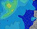 | 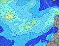 | 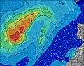 | 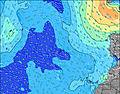 | 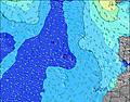 | ||||||||||||||
Wave Height (m) Direction Period (s) | NNE 7 | NNE 7 | NNE 6 | NE 7 | NNE 7 | NNE 7 | NE 7 | NE 7 | NE 7 | NNE 7 | NNE 7 | NNE 8 | NNE 8 | NNE 8 | NNE 8 | NNE 8 | NNE 8 | NNE 8 | N 10 | NNE 6 | NNE 6 |
Wave Graph | |||||||||||||||||||||
158 | 158 | 185 | 178 | 175 | 199 | 295 | 268 | 261 | 353 | 395 | 362 | 358 | 365 | 424 | 402 | 398 | 341 | 130 | 110 | 142 | |
Wind (km/h) | |||||||||||||||||||||
Wind State on-shore cross-onshore cross-shore cross-offshore off-shore glassy | on | cross-on | on | cross-on | cross-on | on | cross-on | cross-on | on | on | on | on | on | on | on | on | on | on | on | on | on |
High Tide | 4:54AM1.90m | 5:07PM2.03m | 5:33AM1.84m | 5:48PM1.92m | 6:19AM1.75m | 6:39PM1.78m | 7:18AM1.67m | 7:47PM1.65m | 8:35AM1.62m | 9:18PM1.59m | 10:05AM1.66m | 10:49PM1.65m | 11:22AM1.80m | 00:01AM1.78m | |||||||
Low Tide | 10:50AM0.32m | 11:20PM0.29m | 11:30AM0.41m | 00:02AM0.38m | 12:19PM0.50m | 00:55AM0.49m | 1:24PM0.60m | 2:05AM0.59m | 2:52PM0.64m | 3:35AM0.62m | 4:29PM0.57m | 5:01AM0.55m | 5:46PM0.41m | ||||||||
7:24 | — | — | 7:24 | — | — | 7:26 | — | — | 7:26 | — | — | 7:26 | — | — | 7:28 | — | — | 7:28 | — | — | |
— | 8:51 | — | — | 8:50 | — | — | 8:49 | — | — | 8:49 | — | — | 8:47 | — | — | 8:46 | — | — | 8:45 | — | |
mm | — | — | — | — | — | — | — | — | — | — | — | — | — | — | — | — | — | — | — | — | — |
Temp °C | 26 | 27 | 24 | 25 | 26 | 23 | 24 | 24 | 22 | 23 | 24 | 22 | 24 | 24 | 23 | 24 | 25 | 23 | 24 | 25 | 22 |
Feels °C | 26 | 27 | 24 | 25 | 27 | 24 | 24 | 24 | 23 | 23 | 24 | 22 | 23 | 23 | 23 | 24 | 24 | 23 | 24 | 25 | 22 |
Swell 1 Height (m) Direction Period (s) | N 9 | N 9 | NW 10 | N 8 | NNE 8 | NW 8 | NW 8 | NW 8 | NNW 11 | WNW 10 | WNW 9 | N 11 | WNW 9 | WNW 9 | WNW 8 | WNW 8 | WNW 8 | WNW 8 | N 10 | N 10 | WNW 7 |
26 | 26 | 14 | 22 | 23 | 10 | 10 | 16 | 24 | 9 | 9 | 36 | 8 | 8 | 7 | 7 | 7 | 6 | 130 | 92 | 5 | |
Swell 2 Height (m) Direction Period (s) | NW 9 | NW 9 | S 12 | NW 9 | NW 8 | WNW 10 | NW 11 | N 11 | WNW 10 | S 12 | S 12 | WNW 9 | S 11 | S 11 | S 11 | S 13 | S 12 | S 12 | WNW 8 | WNW 8 | N 11 |
20 | 13 | 3 | 12 | 11 | 10 | 4 | 2 | 10 | 3 | 3 | 8 | 2 | 2 | 2 | 3 | 3 | 3 | 6 | 6 | 2 | |
Swell 3 Height (m) Direction Period (s) | NW 11 | — | S 10 | SW 12 | NW 11 | S 12 | N 11 | N 12 | N 11 | — | S 12 | S 11 | — | S 13 | S 13 | S 13 | S 12 | S 10 | S 12 | S 12 | N 12 |
5 | — | 2 | 6 | 5 | 3 | 2 | 3 | 2 | — | 3 | 2 | — | 3 | 3 | 3 | 3 | 2 | 3 | 3 | 3 | |
Wind waves Height (m) Direction Period (s) | NNE 7 | NNE 7 | NNE 6 | NE 7 | NNE 7 | NNE 7 | NE 7 | NE 7 | NE 7 | NNE 7 | NNE 7 | NNE 8 | NNE 8 | NNE 8 | NNE 8 | NNE 8 | NNE 8 | NNE 8 | NNE 6 | NNE 6 | NNE 6 |
158 | 158 | 185 | 178 | 175 | 199 | 295 | 268 | 261 | 353 | 395 | 362 | 358 | 365 | 424 | 402 | 398 | 341 | 127 | 110 | 142 | |
Nearest Offshore or Glassy | |||||||||||||||||||||
Distance (km) | 70 | 108 | 73 | 70 | 113 | 88 | 70 | 70 | 70 | 70 | 70 | 70 | 38 | 38 | 525 | 115 | 70 | 525 | 124 | 70 | 189 |
Best forecast wave conditions in Gran Canaria | |||||||||||||||||||||
Best forecast wave conditions in Spain (Africa) | |||||||||||||||||||||
Header Global | |||||||||||||||||||||
- Map Icons:
 Break
Break Live Wave Height (m)
 Live Wind Speed (km/h)
 Surf Rating (10 Max)
 Ocean Swells (m)
- Wind Speed (km/h)
Latest Updates


FREE! Surf-Forecast.com widget for your website
The surf report / weather widget below is available to embed on third party websites free of charge and provides a summary of our Las Piscinas surf forecast. Simply grab the html code snippet that we provide and paste it into your own site. You can choose your preferred language and metric/imperial units for the surf forecast feed to suit users of your site. Click here to get the code.
Information about the Las Piscinas Surf forecast
The above surf forecast table for Las Piscinas provides essential information for determining whether the surfing conditions will be good over the next 16 days. A general guide to surfing at Las Piscinas can be found by selecting the local surf guide option on the grey menu. Our Las Piscinas surf forecast is unique since it includes wave energy (power) that defines the real feel of the surf rather than just the height or the period. If you surf the same spot (Las Piscinas) regularly then make a mental note of the wave energy from the surf forecast table each time you go. Very soon you may start to choose your surf days based on the wave energy alone combined with our forecast of favourable offshore wind conditions. Our star ratings will help here and of course you will also find the usual wave height and period predictions on our surf forecasts as well as a full break down of the swell components under our advanced users option (to reveal that, click the little Einstein character under the tide times).
Further information to help with frequently asked questions about our surf forecast for Las Piscinas may be found under the help tab on the top menu and also by moving your mouse over the question marks on the surf forecast table itself. Please always bear in mind that the forecast is for near-shore open water and local factors at each surf break influence the actual breaking wave height, such as the beach / reef profile, water depths offshore and shelter.
Are you planning a holiday in Gran Canaria? If you are looking for accommodation near Las Piscinas, camping, hotels and holiday cottages in Gran Canaria, consider staying in Arucas which is 5 km (3 miles) away. Other places in and around Gran Canaria where you can find information about places to rent, and car hire include Galdar which is 8 km (5 miles) away, Las Palmas, Santa Brigida and Telde.
 Nearest