

Surf Forecasts:

La Barra surf forecast from 3 Aug 2026:
- Most powerful swell: Saturday 8 Aug, 4PM (local time) - 6.5ft (2.0m), 9s period, NNE swell with 576 kJ wave energy.
Best Forecast Surf Conditions for La Barra this week:
The most powerful waves expected at La Barra in the next 16 days are 2.0m 9s and forecast to arrive on Saturday (Aug 08) at 4PM. Winds are predicted to be onshore at the time the swell arrives. The largest open ocean swell (not directed at the beach) is 1.9m 7s period and expected on Wednesday (Aug 05) at 10AM.
| Wave Type | Time (WEST) & Date | Wave Height & Period |
|---|---|---|
| Next good surf (1 star+) | - | - |
| Best Surf | - | - |
| Most Powerful | 4PM (Sat 8th Aug) | 6.5ft (2.0m) 9s |
Table - best surf conditions forecast for La Barra over the next 16 days.
The Lowdown
G'day, Rusty here. Look, I've got to be straight with you—this forecast is a tough one for our region. Over the next 16 days, there's basically nothing worth paddling out for. The whole run is a write-off, I'm afraid.
We're looking at La Barra, a beach and reef setup that's very consistent for swell, but the wind just won't play ball. The water temp is sitting at 73°, which is about normal for this time of year, so no surprises there.
From Monday the 3rd of August right through to Tuesday the 18th of August, it's a complete blank. Every single session is marked as "poor surf conditions." The swell is coming from the NNE, but the wind is stubbornly cross-onshore or onshore from the NNW or N, gusting between 9 and 16 mph. That's a recipe for choppy, messy waves. The swell heights vary from a tiny 1 ft up to 8 ft, with combined wave energy ranging from a weak 15 up to a strong 884 in the later part of the run, but it doesn't matter—the wind shreds any chance of a decent wave.
The closest we get to anything is on Tuesday the 18th of August in the afternoon, where the swell is 8 ft from the NNE at 9 seconds, with a moderate cross-shore wind. The combined energy is strong at 884, but it's only rated as "marginal surf forecast or questionable tide conditions." Even then, it's a 1 out of 10. For a spot that's very consistent, it's a rare and frustrating run of bad luck. With the swell size pushing over 8 ft later on and the constant wind, this setup honestly looks more interesting for kite surfing than paddle surfing.
That's the grim picture. Sometimes you get a run like this, and it's best to just wait for the next system. Forecasts can change, but for now, I'd save the wax.
Rusty.
Short Range ForecastMostly dry. Warm (max 25°C on Mon morning, min 21°C on Tue night). Wind will be generally light. | Days 4-6 Weather SummaryMostly dry. Warm (max 24°C on Sat morning, min 21°C on Thu night). Wind will be generally light. | ||||||||||||||||||||
Monday 3 | Tuesday 4 | Wednesday 5 | Thursday 6 | Friday 7 | Saturday 8 | Sunday 9 | |||||||||||||||
AM | PM | Night | AM | PM | Night | AM | PM | Night | AM | PM | Night | AM | PM | Night | AM | PM | Night | AM | PM | Night | |
Swell Height Map |  |  | 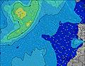 | 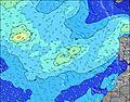 | 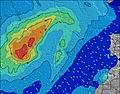 | 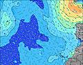 | 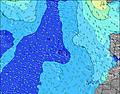 | ||||||||||||||
Wave Height (m) Direction Period (s) | NNE 7 | NNE 7 | NNE 6 | NW 9 | NNE 7 | NW 8 | NW 8 | NW 8 | N 11 | N 10 | NNE 7 | NNE 8 | NNE 7 | NNE 8 | NNE 8 | NNE 8 | NNE 9 | NNE 8 | NNE 8 | NNE 8 | NNE 7 |
Wave Graph | |||||||||||||||||||||
180 | 170 | 160 | 20 | 170 | 10 | 10 | 10 | 21 | 52 | 374 | 389 | 400 | 429 | 509 | 509 | 576 | 497 | 395 | 339 | 262 | |
Wind (km/h) | |||||||||||||||||||||
Wind State on-shore cross-onshore cross-shore cross-offshore off-shore glassy | cross-on | cross-on | cross-on | cross-on | cross-on | cross-on | cross-on | cross-on | cross-on | cross-on | cross-on | cross-on | cross-on | cross-on | on | on | on | on | cross-on | cross-on | cross-on |
High Tide | 5:04PM2.36m | 5:30AM2.15m | 5:47PM2.25m | 6:18AM2.08m | 6:39PM2.11m | 7:18AM2.00m | 7:47PM1.98m | 8:33AM1.97m | 9:14PM1.92m | 9:58AM2.03m | 10:42PM1.96m | 11:14AM2.17m | 11:54PM2.08m | ||||||||
Low Tide | 10:43AM0.58m | 11:15PM0.55m | 11:25AM0.66m | 11:58PM0.65m | 12:15PM0.76m | 00:51AM0.76m | 1:21PM0.87m | 2:01AM0.87m | 2:51PM0.92m | 3:30AM0.90m | 4:28PM0.84m | 4:54AM0.83m | 5:44PM0.67m | ||||||||
7:24 | — | — | 7:24 | — | — | 7:24 | — | — | 7:26 | — | — | 7:26 | — | — | 7:26 | — | — | 7:28 | — | — | |
— | 8:50 | — | — | 8:50 | — | — | 8:49 | — | — | 8:47 | — | — | 8:46 | — | — | 8:45 | — | — | 8:45 | — | |
mm | — | — | — | — | — | — | — | — | — | — | — | — | — | — | — | — | — | — | — | — | — |
Temp °C | 25 | 25 | 23 | 24 | 25 | 23 | 23 | 24 | 22 | 23 | 23 | 21 | 23 | 23 | 22 | 24 | 24 | 22 | 23 | 23 | 22 |
Feels °C | 26 | 25 | 23 | 25 | 26 | 24 | 23 | 24 | 22 | 24 | 22 | 20 | 22 | 22 | 21 | 23 | 23 | 21 | 23 | 22 | 22 |
Swell 1 Height (m) Direction Period (s) | NW 9 | N 9 | NW 10 | NW 9 | NW 8 | NW 8 | NW 8 | NW 8 | N 11 | N 10 | WNW 9 | WNW 9 | WNW 9 | WNW 9 | WNW 9 | WNW 9 | WNW 8 | WNW 8 | WNW 8 | WNW 8 | WNW 7 |
20 | 26 | 14 | 20 | 11 | 10 | 10 | 10 | 21 | 52 | 9 | 8 | 8 | 8 | 7 | 7 | 7 | 7 | 6 | 6 | 5 | |
Swell 2 Height (m) Direction Period (s) | NW 11 | NW 9 | S 12 | N 9 | NW 11 | NW 10 | NW 11 | N 11 | WNW 10 | WNW 10 | S 12 | S 11 | S 11 | S 11 | S 11 | S 13 | S 12 | S 12 | S 10 | — | N 12 |
5 | 21 | 3 | 13 | 5 | 4 | 4 | 2 | 10 | 9 | 3 | 2 | 2 | 2 | 2 | 3 | 3 | 3 | 2 | — | 3 | |
Swell 3 Height (m) Direction Period (s) | NW 11 | — | S 10 | NW 9 | — | S 12 | N 11 | N 12 | NW 7 | S 12 | S 12 | S 15 | — | S 13 | S 13 | — | — | — | S 12 | NW 8 | S 11 |
5 | — | 2 | 3 | — | 3 | 2 | 3 | 2 | 3 | 3 | 4 | — | 3 | 3 | — | — | — | 3 | 3 | 2 | |
Wind waves Height (m) Direction Period (s) | NNE 7 | NNE 7 | NNE 6 | NE 6 | NNE 7 | NNE 7 | NE 7 | NE 7 | NE 7 | NE 7 | NNE 7 | NNE 8 | NNE 7 | NNE 8 | NNE 8 | NNE 8 | NNE 9 | NNE 8 | NNE 8 | NNE 8 | NNE 7 |
180 | 170 | 160 | 186 | 170 | 237 | 342 | 296 | 244 | 303 | 374 | 389 | 400 | 429 | 509 | 509 | 576 | 497 | 395 | 339 | 262 | |
Nearest Offshore or Glassy | |||||||||||||||||||||
Distance (km) | 81 | 120 | 81 | 83 | 81 | 81 | 81 | 81 | 81 | 81 | 81 | 81 | 81 | 81 | 528 | 528 | 137 | 541 | 81 | 81 | 81 |
Best forecast wave conditions in Gran Canaria | |||||||||||||||||||||
Best forecast wave conditions in Spain (Africa) | |||||||||||||||||||||
Header Global | |||||||||||||||||||||
- Map Icons:
 Break
Break Live Wave Height (m)
 Live Wind Speed (km/h)
 Surf Rating (10 Max)
 Ocean Swells (m)
- Wind Speed (km/h)
Latest Updates


FREE! Surf-Forecast.com widget for your website
The surf report / weather widget below is available to embed on third party websites free of charge and provides a summary of our La Barra surf forecast. Simply grab the html code snippet that we provide and paste it into your own site. You can choose your preferred language and metric/imperial units for the surf forecast feed to suit users of your site. Click here to get the code.
Information about the La Barra Surf forecast
The above surf forecast table for La Barra provides essential information for determining whether the surfing conditions will be good over the next 16 days. A general guide to surfing at La Barra can be found by selecting the local surf guide option on the grey menu. Our La Barra surf forecast is unique since it includes wave energy (power) that defines the real feel of the surf rather than just the height or the period. If you surf the same spot (La Barra) regularly then make a mental note of the wave energy from the surf forecast table each time you go. Very soon you may start to choose your surf days based on the wave energy alone combined with our forecast of favourable offshore wind conditions. Our star ratings will help here and of course you will also find the usual wave height and period predictions on our surf forecasts as well as a full break down of the swell components under our advanced users option (to reveal that, click the little Einstein character under the tide times).
Further information to help with frequently asked questions about our surf forecast for La Barra may be found under the help tab on the top menu and also by moving your mouse over the question marks on the surf forecast table itself. Please always bear in mind that the forecast is for near-shore open water and local factors at each surf break influence the actual breaking wave height, such as the beach / reef profile, water depths offshore and shelter.
La Barra is 4 km (2 miles) from Las Palmas. If you plan a holiday in Gran Canaria, look for hotels and other accommodation in Las Palmas. Las Palmas has rooms for a wide range of budgets as well as car hire and transport links.
 Nearest