

Surf Forecasts:

Ingleses surf forecast from 3 Jul 2026:
- Best quality surf: Friday 3 Jul, 6PM (local time) - 2ft (0.6m), 8s period, ENE swell with cross-offshore winds.
- Most powerful swell: Monday 6 Jul, 6PM (local time) - 3.5ft (1.0m), 9s period, SE swell with 173 kJ wave energy.
- Next surfable swell (1★+): Friday 3 Jul, 6PM (local time) - 2ft (0.6m), 8s period with ENE swell.
Best Forecast Surf Conditions for Ingleses this week:
The surf forecast for Ingleses over the next 16 days: The first swell (rated 1 star or higher) is forecast to arrive on Friday (Jul 03) at 6PM. The primary swell is predicted to be 0.6m and 8s period. The wind is predicted to be cross-offshore as the swell arrives.
The most powerful waves expected at Ingleses in the next 16 days are 1.0m 9s and forecast to arrive on Monday (Jul 06) at 6PM. Winds are predicted to be cross-onshore at the time the swell arrives. The largest open ocean swell (not directed at the beach) is 3.0m 8s period and expected on Friday (Jul 03) at 9AM.
| Wave Type | Time (-03) & Date | Wave Height & Period |
|---|---|---|
| Next good surf (1 star+) | 6PM (Fri 3rd Jul) | 2ft (0.6m) 8s |
| Best Surf | 6PM (Fri 3rd Jul) | 2ft (0.6m) 8s |
| Most Powerful | 6PM (Mon 6th Jul) | 3.5ft (1.0m) 9s |
Table - best surf conditions forecast for Ingleses over the next 16 days.
Updates in hr min s Forecast update imminent
Alright folks, Rusty here. Let’s be straight with you—the next couple of weeks at Ingleses are looking pretty slim. We’ve got a long, quiet stretch ahead with hardly anything to get excited about. The first real chance of a wave doesn’t show up until Sunday the 5th, and even then it’s nothing to write home about.
For the first few days, from Friday the 3rd through Saturday the 4th, it’s all poor surf conditions. Tiny swell around 2-2ft from the ENE with short periods of 8-9 seconds. The wind is mostly cross-off, which keeps things clean, but there’s just no energy—weak combined swell energy in the 40s and 50s. Not worth paddling out.
Then we get a little glimpse on Sunday morning the 5th. Glassy conditions, wind is nil, and we’ve got 2ft of ENE swell at 10 seconds. It’s surfable, but very ordinary. The combined energy is only 54, so barely a ripple. If you’re desperate and just want to sit on a board, you could go out, but don’t expect much.
Monday the 6th and Tuesday the 7th are a write-off. Monday has moderate cross-onshore winds from the north at 12 mph, chopping up the 1ft swell. Tuesday morning shows a tiny 1ft, then Tuesday afternoon a slightly better 3ft from the SE, but the combined energy jumps to 141—still not enough to overcome the poor conditions.
Wednesday the 8th and Thursday the 9th stay weak. Wednesday morning has 2ft from the ESE at 10 seconds with a cross-off wind, but the energy is only 92. Still below par.
Now, the best we have on offer across the whole forecast comes on Friday the 10th. The morning has 2ft from the ESE with clean offshore SSW wind at just 3 mph. Combined swell energy sits at 99—moderate but on the low end. Then the afternoon gets even better: glassy conditions, the same 2ft ESE swell, and the energy bumps up to 105. It’s still small, but with glassy conditions and a little more push, this is your window if you’ve got a longboard or a foamie. It’s surfable and clean, but don’t expect perfection.
Saturday the 11th sees a size jump to 5ft from the SE, period 11 seconds, and combined energy rockets to 553—that’s strong wave energy. But the wind is a gentle cross-onshore from the north at 9 mph, creating fairly choppy conditions. The wave comment still says poor surf conditions. That size with that wind direction at a beach break like Ingleses means it’s going to be messy. Honestly, this setup looks more interesting for kite surfing than paddle surfing.
Sunday the 12th through to the end of the second week stays marginal at best. Sunday morning has 5ft from the ESE at 12 seconds (591 energy) with cross-off S wind—clean but marginal due to tide or other factors. Monday the 13th morning drops to 3ft but still 12-second period, clean cross-off wind. Tuesday the 14th is back to weak 2ft, and from the 15th onward it’s tiny again, 1-2ft, with periods of 5-8 seconds and poor conditions.
The standout pick, if you can call it that, is Friday the 10th. The glassy afternoon session with the 2ft ESE swell is the cleanest and most promising moment in this whole 16-day run. Everything else is either too small, too choppy, or just not worth the paddle.
Water temp is about average for this time of year, nothing unusual to report.
Stay patient, folks. It’s a flat spell, but forecasts can change.
Rusty.
Short Range ForecastLight rain (total 8mm), mostly falling on Thu night. Very mild (max 18°C on Thu night, min 11°C on Fri morning). Winds decreasing (fresh winds from the S on Thu night, calm by Sat night). | Days 5-7 Weather SummaryHeavy rain (total 26mm), heaviest during Mon night. Very mild (max 17°C on Tue afternoon, min 10°C on Tue night). Wind will be generally light. | ||||||||||||||||||||
Friday 3 | Saturday 4 | Sunday 5 | Monday 6 | Tuesday 7 | Wednesday 8 | Thu 9 | |||||||||||||||
Night | AM | PM | Night | AM | PM | Night | AM | PM | Night | AM | PM | Night | AM | PM | Night | AM | PM | Night | AM | PM | |
Swell Height Map |  |  |  |  |  |  |  | 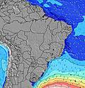 | |||||||||||||
Wave Height (m) Direction Period (s) | ENE 8 | ENE 8 | ENE 8 | ENE 8 | ENE 9 | ENE 9 | ENE 10 | ENE 10 | ENE 10 | E 9 | ENE 9 | ENE 9 | SE 9 | ENE 8 | SE 9 | SE 10 | ESE 10 | ESE 10 | ESE 10 | ESE 10 | ESE 10 |
Wave Graph | |||||||||||||||||||||
116 | 51 | 51 | 38 | 49 | 46 | 55 | 54 | 51 | 43 | 28 | 26 | 141 | 14 | 106 | 94 | 86 | 90 | 37 | 60 | 63 | |
Wind (km/h) | |||||||||||||||||||||
Wind State on-shore cross-onshore cross-shore cross-offshore off-shore glassy | cross-off | cross-off | cross-off | glassy | cross-off | cross-off | cross-off | glassy | cross-on | cross-on | cross-on | cross-on | cross-off | cross-off | cross-on | cross-off | cross-off | on | off | cross | cross-on |
High Tide | 3:24AM0.81m | 4:30PM0.79m | 4:02AM0.81m | 5:09PM0.77m | 4:45AM0.79m | 5:53PM0.73m | 5:34AM0.74m | 6:46PM0.68m | 6:35AM0.69m | 7:53PM0.63m | 8:05AM0.66m | 9:36PM0.59m | 10:36AM0.69m | ||||||||
Low Tide | 10:12PM0.38m | 10:24AM0.08m | 10:51PM0.39m | 11:10AM0.11m | 11:41PM0.41m | 12:04PM0.15m | 00:43AM0.42m | 1:10PM0.21m | 1:55AM0.41m | 2:28PM0.26m | 3:10AM0.38m | 3:55PM0.29m | 4:21AM0.33m | 5:22PM0.29m | |||||||
— | 7:03 | — | — | 7:03 | — | — | 7:03 | — | — | 7:03 | — | — | 7:03 | — | — | 7:03 | — | — | 7:03 | — | |
— | — | 5:30 | — | — | 5:30 | — | — | 5:31 | — | — | 5:31 | — | — | 5:31 | — | — | 5:32 | — | — | 5:32 | |
mm | 5 | 2 | 1 | — | — | — | — | — | — | — | — | 3 | 23 | — | — | — | — | — | — | — | — |
Temp °C | 18 | 11 | 12 | 13 | 14 | 14 | 13 | 13 | 14 | 14 | 16 | 16 | 16 | 15 | 17 | 14 | 14 | 16 | 15 | 16 | 18 |
Feels °C | 20 | 6 | 10 | 12 | 12 | 11 | 11 | 12 | 12 | 12 | 13 | 14 | 15 | 15 | 16 | 14 | 11 | 14 | 13 | 12 | 14 |
Swell 1 Height (m) Direction Period (s) | ENE 8 | ENE 8 | ENE 8 | S 10 | S 10 | S 12 | S 11 | SSE 11 | SSE 11 | SSE 10 | SSE 10 | SSE 9 | SE 9 | SSE 14 | SE 9 | S 8 | S 8 | S 9 | S 11 | S 10 | S 9 |
116 | 51 | 51 | 668 | 426 | 1117 | 953 | 792 | 698 | 424 | 253 | 217 | 141 | 65 | 106 | 148 | 171 | 201 | 317 | 255 | 148 | |
Swell 2 Height (m) Direction Period (s) | SSE 19 | — | SSE 15 | SSE 13 | SSE 12 | ENE 9 | ENE 10 | ENE 10 | ENE 10 | E 9 | SSE 18 | SSE 16 | NNE 4 | ENE 8 | SE 12 | SE 10 | ESE 10 | ESE 10 | ESE 10 | ESE 10 | ESE 10 |
35 | — | 87 | 178 | 244 | 46 | 55 | 54 | 51 | 43 | 178 | 104 | 5 | 14 | 35 | 94 | 86 | 90 | 37 | 60 | 63 | |
Swell 3 Height (m) Direction Period (s) | — | — | — | ENE 8 | ENE 9 | — | — | — | S 24 | SE 21 | ENE 9 | ENE 9 | SSE 15 | NE 4 | SSE 13 | SE 11 | ENE 8 | ENE 8 | ESE 11 | ENE 7 | ENE 7 |
— | — | — | 38 | 49 | — | — | — | 11 | 111 | 28 | 26 | 75 | 1 | 34 | 32 | 6 | 6 | 25 | 5 | 5 | |
Wind waves Height (m) Direction Period (s) | S 5 | S 8 | S 10 | S 10 | S 10 | — | — | — | — | N 2 | N 3 | N 4 | S 8 | SSE 7 | S 7 | — | — | — | — | — | — |
136 | 1330 | 1065 | 1070 | 1141 | — | — | — | — | 1 | 5 | 9 | 66 | 297 | 243 | — | — | — | — | — | — | |
Nearest Offshore or Glassy | |||||||||||||||||||||
Distance (km) | 5 | 5 | 5 | 3 | 3 | 5 | 0 | 0 | 7 | 7 | 41 | 41 | 0 | 5 | 5 | 0 | 0 | 5 | 0 | 7 | 41 |
Best forecast wave conditions in Florianópolis | |||||||||||||||||||||
Best forecast wave conditions in Brazil | |||||||||||||||||||||
Header Global | |||||||||||||||||||||
- Map Icons:
 Break
Break Live Wave Height (m)
 Live Wind Speed (km/h)
 Surf Rating (10 Max)
 Ocean Swells (m)
- Wind Speed (km/h)


FREE! Surf-Forecast.com widget for your website
The surf report / weather widget below is available to embed on third party websites free of charge and provides a summary of our Ingleses surf forecast. Simply grab the html code snippet that we provide and paste it into your own site. You can choose your preferred language and metric/imperial units for the surf forecast feed to suit users of your site. Click here to get the code.
Information about the Ingleses Surf forecast
The above surf forecast table for Ingleses provides essential information for determining whether the surfing conditions will be good over the next 16 days. A general guide to surfing at Ingleses can be found by selecting the local surf guide option on the grey menu. Our Ingleses surf forecast is unique since it includes wave energy (power) that defines the real feel of the surf rather than just the height or the period. If you surf the same spot (Ingleses) regularly then make a mental note of the wave energy from the surf forecast table each time you go. Very soon you may start to choose your surf days based on the wave energy alone combined with our forecast of favourable offshore wind conditions. Our star ratings will help here and of course you will also find the usual wave height and period predictions on our surf forecasts as well as a full break down of the swell components under our advanced users option (to reveal that, click the little Einstein character under the tide times).
Further information to help with frequently asked questions about our surf forecast for Ingleses may be found under the help tab on the top menu and also by moving your mouse over the question marks on the surf forecast table itself. Please always bear in mind that the forecast is for near-shore open water and local factors at each surf break influence the actual breaking wave height, such as the beach / reef profile, water depths offshore and shelter.
Ingleses is 21 km (13 miles) from the city of Florianopolis. If you plan a holiday in Florianópolis, look for hotels and other accommodation in Florianopolis. Florianopolis has rooms for a wide range of budgets as well as car hire and transport links.
 Nearest