

Surf Forecasts:

Short Range ForecastSome drizzle, heaviest during Mon night. Warm (max 22°C on Sun afternoon, min 18°C on Tue morning). Wind will be generally light. | |||||||||||||||||||||
Sun 2 | Monday 3 | Tuesday 4 | |||||||||||||||||||
11 AM | 2 PM | 5 PM | 8 PM | 11 PM | 2 AM | 5 AM | 8 AM | 11 AM | 2 PM | 5 PM | 8 PM | 11 PM | 2 AM | 5 AM | 8 AM | 11 AM | 2 PM | 5 PM | 8 PM | 11 PM | |
Swell Height Map |  |  |  | 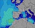 |  |  |  |  | |||||||||||||
Wave Height (m) Direction Period (s) | N 5 | N 5 | NNE 5 | N 6 | WNW 10 | WNW 10 | WNW 10 | WNW 10 | WNW 10 | WNW 10 | WNW 10 | WNW 9 | WNW 9 | WNW 9 | NW 9 | NW 9 | WNW 8 | WNW 8 | NW 9 | WNW 9 | NW 9 |
Wave Graph | |||||||||||||||||||||
0 | 0 | 0 | 0 | 10 | 10 | 10 | 9 | 9 | 9 | 9 | 9 | 8 | 8 | 21 | 20 | 28 | 28 | 20 | 16 | 12 | |
Wind (km/h) | |||||||||||||||||||||
Wind State on-shore cross-onshore cross-shore cross-offshore off-shore glassy | cross-off | cross-off | cross-off | cross-off | off | off | glassy | cross-off | glassy | cross | cross-on | glassy | glassy | glassy | glassy | cross-off | glassy | cross | cross | cross | glassy |
High Tide | 7:47PM4.00m | 7:59AM3.75m | 8:23PM3.91m | 8:37AM3.62m | 9:05PM3.77m | ||||||||||||||||
Low Tide | 1:35PM0.59m | 1:59AM0.74m | 2:10PM0.67m | 2:37AM0.86m | 2:50PM0.81m | ||||||||||||||||
— | — | — | — | — | — | 7:05 | — | — | — | — | — | — | — | 7:07 | — | — | — | — | — | — | |
— | — | — | 9:37 | — | — | — | — | — | — | — | 9:35 | — | — | — | — | — | — | — | 9:34 | — | |
mm | — | — | — | — | — | — | — | — | — | — | — | 1 | — | — | — | — | — | — | — | — | — |
Temp °C | 20 | 22 | 22 | 22 | 20 | 20 | 20 | 19 | 21 | 21 | 22 | 21 | 20 | 19 | 19 | 18 | 21 | 21 | 22 | 22 | 21 |
Feels °C | 21 | 22 | 21 | 22 | 20 | 21 | 22 | 20 | 23 | 21 | 23 | 23 | 23 | 21 | 21 | 19 | 22 | 21 | 22 | 23 | 23 |
Swell 1 Height (m) Direction Period (s) | N 5 | N 5 | NNE 5 | N 6 | N 6 | N 6 | N 6 | N 6 | NNW 5 | NNW 4 | NNW 6 | NNW 7 | NNW 8 | WNW 9 | NW 9 | NW 9 | WNW 8 | WNW 8 | NW 9 | WNW 9 | NW 9 |
15 | 13 | 9 | 15 | 32 | 33 | 24 | 17 | 7 | 4 | 8 | 5 | 6 | 8 | 21 | 20 | 28 | 28 | 20 | 16 | 12 | |
Swell 2 Height (m) Direction Period (s) | NNW 8 | NNW 7 | NNW 6 | NW 7 | WNW 10 | WNW 10 | WNW 10 | WNW 10 | NNW 6 | NNW 6 | WNW 10 | N 4 | WNW 9 | NNW 7 | NNW 7 | NNW 7 | NNW 7 | NNW 7 | NNW 7 | WNW 6 | NW 6 |
6 | 5 | 7 | 12 | 10 | 10 | 10 | 9 | 8 | 4 | 9 | 3 | 8 | 5 | 5 | 5 | 5 | 5 | 5 | 3 | 5 | |
Swell 3 Height (m) Direction Period (s) | N 7 | N 7 | N 7 | N 7 | WNW 10 | NNW 7 | NNW 7 | NE 5 | WNW 10 | WNW 10 | N 7 | WNW 9 | N 4 | N 4 | N 4 | — | — | N 7 | N 7 | NW 7 | — |
4 | 4 | 4 | 4 | 10 | 5 | 5 | 1 | 9 | 9 | 1 | 9 | 1 | 1 | 1 | — | — | 1 | 1 | 2 | — | |
Wind waves Height (m) Direction Period (s) | — | — | — | — | — | — | — | — | — | — | N 4 | — | — | — | — | — | — | — | — | — | — |
— | — | — | — | — | — | — | — | — | — | 3 | — | — | — | — | — | — | — | — | — | — | |
Nearest Offshore or Glassy | |||||||||||||||||||||
Distance (km) | 186 | 433 | 368 | 408 | 13 | 125 | 132 | 173 | 316 | 143 | 173 | 258 | 170 | 138 | 138 | 156 | 170 | 397 | 433 | 347 | 143 |
Best forecast wave conditions in Spain - Cantabria | |||||||||||||||||||||
Best forecast wave conditions in Spain (Europe) | |||||||||||||||||||||
Header Global | |||||||||||||||||||||
- Map Icons:
 Break
Break Live Wave Height (m)
 Live Wind Speed (km/h)
 Surf Rating (10 Max)
 Ocean Swells (m)
- Wind Speed (km/h)
Latest Updates


FREE! Surf-Forecast.com widget for your website
The surf report / weather widget below is available to embed on third party websites free of charge and provides a summary of our El Sardinero - Segunda surf forecast. Simply grab the html code snippet that we provide and paste it into your own site. You can choose your preferred language and metric/imperial units for the surf forecast feed to suit users of your site. Click here to get the code.
 Nearest