

Surf Forecasts:

Crescent surf forecast from 7 Jul 2026:
- Best quality surf: Sunday 12 Jul, 5AM (local time) - 3.5ft (1.0m), 10s period, W swell with glassy winds.
- Most powerful swell: Saturday 11 Jul, 8PM (local time) - 3.5ft (1.0m), 10s period, W swell with 194 kJ wave energy.
- Next surfable swell (1★+): Sunday 12 Jul, 5AM (local time) - 3.5ft (1.0m), 10s period with W swell.
Best Forecast Surf Conditions for Crescent this week:
The surf forecast for Crescent over the next 16 days: The first swell (rated 1 star or higher) is forecast to arrive on Sunday (Jul 12) at 5AM. The primary swell is predicted to be 1.0m and 10s period. The wind is predicted to be glassy as the swell arrives.
The most powerful waves expected at Crescent in the next 16 days are 1.0m 10s and forecast to arrive on Saturday (Jul 11) at 8PM. Winds are predicted to be cross-onshore at the time the swell arrives. The largest open ocean swell (not directed at the beach) is 0.6m 16s period and expected on Thursday (Jul 09) at 2PM.
| Wave Type | Time (PDT) & Date | Wave Height & Period |
|---|---|---|
| Next good surf (1 star+) | 5AM (Sun 12th Jul) | 3.5ft (1.0m) 10s |
| Best Surf | 5AM (Sun 12th Jul) | 3.5ft (1.0m) 10s |
| Most Powerful | 8PM (Sat 11th Jul) | 3.5ft (1.0m) 10s |
Table - best surf conditions forecast for Crescent over the next 16 days.
Updates in hr min s Forecast update imminent
Alright, Rusty here, checkin' in.
Look, straight up, Crescent is not showin' any love over this forecast period. The whole sixteen days is a real struggle. For the first week or more, it’s just poor conditions day after day. The wind is stuck in the WNW and it keeps blowin’ cross-onshore, making a mess of things. There are a few fleeting moments of glassy calm but the swell is tiny and weak when that happens. It’s a real tough sit.
Now, there is a couple of days that stand out, but only just. On the morning of Sunday the 12th, things get a little interesting. The wind swings around to the ENE at just 3 mph and goes glassy. There's a 3.3 ft swell from the West, but with a period of 9 seconds it's still a middling, weak swell with combined energy of 168. It's surfable, but it’s the definition of ordinary.
Then on the morning of Wednesday the 15th, the wind goes totally calm, glassy again. You get a tiny 2.3 ft West swell, period 9 seconds, but the energy is only moderate at 156. It’s clean but so small you'd be fighting for every bump.
The real potential, and I mean the only real standout, comes right at the end of the outlook. On the morning of Wednesday the 22nd of July, the WNW wind drops to just 3 mph and it's glassy. The swell is a more interesting 4.6 ft from the West, with a 9-second period, and the combined energy jumps up to 339 – that is solid, moderate wave energy. It’s still not a classic groundswell, but for this stretch of small, choppy junk, it’s the best board on the rack. If you can wait, that Wednesday morning is your one clear window for a clean, working wave. But don't expect perfection. The crowds at Crescent are sometimes an issue, so on that rare good day you might have some company.
That’s the story, mate. A whole lot of nothing, with one or two tiny glimmers. The water temp is about average right now but nothin' to write home about. Just keep your eyes on the 22nd.
Short Range ForecastMostly dry. Very mild (max 17°C on Mon night, min 12°C on Wed night). Mainly fresh winds. | Days 5-7 Weather SummaryMostly dry. Very mild (max 18°C on Sun afternoon, min 11°C on Sat night). Winds decreasing (fresh winds from the WNW on Sat night, calm by Sun afternoon). | ||||||||||||||||||||
Tuesday 7 | Wednesday 8 | Thursday 9 | Friday 10 | Saturday 11 | Sunday 12 | Mon 13 | |||||||||||||||
Night | AM | PM | Night | AM | PM | Night | AM | PM | Night | AM | PM | Night | AM | PM | Night | AM | PM | Night | AM | PM | |
Swell Height Map | 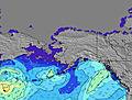 | 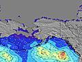 | 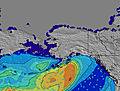 | 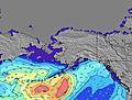 | 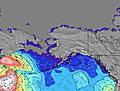 | 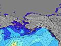 | 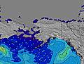 | 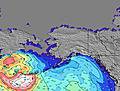 | |||||||||||||
Wave Height (m) Direction Period (s) | W 6 | W 9 | W 9 | W 9 | W 9 | W 9 | W 9 | W 9 | W 9 | W 8 | W 8 | W 9 | W 9 | W 10 | W 10 | W 10 | W 9 | W 9 | W 8 | W 14 | W 9 |
Wave Graph | |||||||||||||||||||||
31 | 42 | 76 | 99 | 119 | 150 | 57 | 125 | 94 | 51 | 58 | 103 | 103 | 145 | 161 | 190 | 164 | 122 | 66 | 34 | 55 | |
Wind (km/h) | |||||||||||||||||||||
Wind State on-shore cross-onshore cross-shore cross-offshore off-shore glassy | cross | cross-on | cross-on | cross-on | cross-on | cross-on | cross | cross-on | cross-on | cross | cross-on | cross-on | cross | cross-on | cross-on | cross | glassy | cross-on | cross | glassy | cross-on |
High Tide | 8:27PM1.93m | 6:59AM1.13m | 8:39PM2.05m | 10:32AM1.05m | 8:56PM2.19m | 12:48PM1.14m | 9:27PM2.34m | 10:11PM2.47m | 11:05PM2.56m | 00:02AM2.60m | |||||||||||
Low Tide | 3:17AM0.98m | 1:05PM0.68m | 4:26AM0.66m | 1:20PM0.93m | 5:25AM0.30m | 6:17AM-0.05m | 7:06AM-0.36m | 7:53AM-0.60m | 8:38AM-0.75m | ||||||||||||
— | 5:22 | — | — | 5:22 | — | — | 5:24 | — | — | 5:24 | — | — | 5:26 | — | — | 5:26 | — | — | 5:28 | — | |
9:15 | — | — | 9:15 | — | — | 9:15 | — | — | 9:15 | — | — | 9:14 | — | — | 9:13 | — | — | 9:13 | — | 9:12 | |
mm | — | — | — | — | — | — | — | — | — | — | — | — | — | — | — | — | — | — | — | — | — |
Temp °C | 17 | 17 | 17 | 17 | 15 | 16 | 15 | 15 | 15 | 15 | 15 | 16 | 15 | 14 | 15 | 14 | 15 | 18 | 15 | 19 | 21 |
Feels °C | 13 | 14 | 13 | 13 | 11 | 11 | 9 | 11 | 11 | 12 | 14 | 14 | 13 | 11 | 11 | 8 | 14 | 17 | 12 | 18 | 19 |
Swell 1 Height (m) Direction Period (s) | W 6 | W 9 | W 9 | W 9 | W 9 | SW 18 | W 6 | W 9 | W 9 | W 8 | W 8 | W 9 | W 9 | W 10 | W 10 | W 10 | W 9 | W 9 | W 8 | W 8 | W 9 |
31 | 42 | 76 | 99 | 119 | 111 | 52 | 125 | 94 | 51 | 58 | 103 | 103 | 145 | 161 | 190 | 164 | 122 | 66 | 33 | 55 | |
Swell 2 Height (m) Direction Period (s) | WNW 9 | W 5 | SW 16 | SW 16 | SW 18 | SW 15 | W 9 | SW 16 | SW 16 | SW 16 | SW 16 | SW 15 | SW 15 | SW 15 | SW 15 | SW 14 | SW 14 | SW 14 | SW 14 | SW 13 | SW 14 |
26 | 8 | 90 | 90 | 108 | 33 | 57 | 129 | 161 | 91 | 125 | 112 | 77 | 77 | 75 | 73 | 72 | 72 | 66 | 46 | 46 | |
Swell 3 Height (m) Direction Period (s) | SW 18 | SW 16 | SW 20 | SW 20 | — | — | SW 18 | — | — | SW 13 | — | — | — | W 18 | — | W 16 | W 15 | W 16 | W 16 | W 14 | W 15 |
48 | 91 | 60 | 60 | — | — | 111 | — | — | 28 | — | — | — | 6 | — | 5 | 4 | 19 | 19 | 34 | 38 | |
Wind waves Height (m) Direction Period (s) | — | — | WSW 3 | — | — | W 9 | — | — | — | — | — | — | — | — | — | — | — | — | — | — | — |
— | — | 1 | — | — | 150 | — | — | — | — | — | — | — | — | — | — | — | — | — | — | — | |
Nearest Offshore or Glassy | |||||||||||||||||||||
Distance (km) | 59 | 211 | 283 | 59 | 712 | 865 | 23 | 190 | 173 | 59 | 59 | 190 | 11 | 71 | 75 | 11 | 0 | 11 | 31 | 31 | 865 |
Best forecast wave conditions in Washington State | |||||||||||||||||||||
Best forecast wave conditions in United States | |||||||||||||||||||||
Header Global | |||||||||||||||||||||
- Map Icons:
 Break
Break Live Wave Height (m)
 Live Wind Speed (km/h)
 Surf Rating (10 Max)
 Ocean Swells (m)
- Wind Speed (km/h)


FREE! Surf-Forecast.com widget for your website
The surf report / weather widget below is available to embed on third party websites free of charge and provides a summary of our Crescent surf forecast. Simply grab the html code snippet that we provide and paste it into your own site. You can choose your preferred language and metric/imperial units for the surf forecast feed to suit users of your site. Click here to get the code.
Information about the Crescent Surf forecast
The above surf forecast table for Crescent provides essential information for determining whether the surfing conditions will be good over the next 16 days. A general guide to surfing at Crescent can be found by selecting the local surf guide option on the grey menu. Our Crescent surf forecast is unique since it includes wave energy (power) that defines the real feel of the surf rather than just the height or the period. If you surf the same spot (Crescent) regularly then make a mental note of the wave energy from the surf forecast table each time you go. Very soon you may start to choose your surf days based on the wave energy alone combined with our forecast of favourable offshore wind conditions. Our star ratings will help here and of course you will also find the usual wave height and period predictions on our surf forecasts as well as a full break down of the swell components under our advanced users option (to reveal that, click the little Einstein character under the tide times).
Further information to help with frequently asked questions about our surf forecast for Crescent may be found under the help tab on the top menu and also by moving your mouse over the question marks on the surf forecast table itself. Please always bear in mind that the forecast is for near-shore open water and local factors at each surf break influence the actual breaking wave height, such as the beach / reef profile, water depths offshore and shelter.
Crescent is 22 km (14 miles) from the city of Port Angeles. If you plan a vacation in Washington State, look for hotels and other accommodation in Port Angeles. Port Angeles has rooms for a wide range of budgets as well as car hire and transport links.
 Nearest