

Surf Forecasts:

Wickaninnish surf forecast from 15 Jul 2026:
- Best quality surf: Saturday 18 Jul, 11PM (local time) - 5.5ft (1.7m), 8s period, W swell with offshore winds.
- Most powerful swell: Friday 17 Jul, 11PM (local time) - 5ft (1.5m), 10s period, WNW swell with 416 kJ wave energy.
- Next surfable swell (1★+): Wednesday 15 Jul, 2AM (local time) - 2.5ft (0.7m), 10s period with W swell.
Best Forecast Surf Conditions for Wickaninnish this week:
The surf forecast for Wickaninnish over the next 16 days: The first swell (rated 1 star or higher) is forecast to arrive on Wednesday (Jul 15) at 2AM. The primary swell is predicted to be 0.5m and 13s period with a secondary swell of 0.7m and 10s. The wind is predicted to be glassy as the swell arrives.
The most powerful waves expected at Wickaninnish in the next 16 days are 1.5m 10s and forecast to arrive on Friday (Jul 17) at 11PM. Winds are predicted to be cross-onshore at the time the swell arrives. The largest open ocean swell (not directed at the beach) is 0.4m 3s period and expected on Thursday (Jul 16) at 5PM.
| Wave Type | Time (PDT) & Date | Wave Height & Period |
|---|---|---|
| Next good surf (1 star+) | 2AM (Wed 15th Jul) | 2.5ft (0.7m) 10s |
| Best Surf | 11PM (Sat 18th Jul) | 5.5ft (1.7m) 8s |
| Most Powerful | 11PM (Fri 17th Jul) | 5ft (1.5m) 10s |
Table - best surf conditions forecast for Wickaninnish over the next 16 days.
The Lowdown
Alright, Rusty here. Let's have a look at what's on the table for Wickaninnish over the next couple of weeks.
For a spot that's usually pretty consistent, this is a bit of a lean run. We've got patches of clean, ridable waves, but honestly, there's no single day you'd circle on the calendar and call a classic. A lot of the time the conditions are just a bit off.
The water temp is sitting at 57°F for now, which is pretty normal for the time of year, so you won't need the 5/4 unless you're out there for hours.
We kick off with a few rough days. Tuesday the 14th is a write-off. Wednesday the 15th tries to offer something in the morning with a tiny 3ft, but the wind is onshore and messy. Not worth wetting the suit.
The first real glimpse of something clean shows up Thursday the 16th, in the afternoon. The conditions look clean, the wind is cross-off, but it’s just ankle-snappers at 2ft. Nice to be out, but you won't be getting your hair wet.
That theme carries on. Saturday the 18th and Sunday the 19th we see the swell bump up to 4ft and 4ft, but the period is short, around 7-8 seconds, which means weak, crumbly waves. And the wind is mostly onshore or cross-onshore right through that weekend. It’s not inviting.
There's a pocket of moderate wave energy (466) on Monday the 20th in the morning, but the swell is tiny again at 2ft, and the wind is cross-onshore. A bit of a tease.
Honestly, for the first ten days, there’s nothing that really stands out. You'd be better off waiting for the end of the run.
Now, the final few days start to look a bit more interesting. The swell direction swings around to a longer-period SSW groundswell, and you can see the combined energy (combined energy of all swells directed here) jumping up into the 500-800 range from the 24th of July onwards, which is solid moderate to strong energy.
Our one true standout is Saturday the 25th of July, in the morning. We’ve got a clean swell coming from the SSW, with a very long period of 24 seconds. That's proper groundswell energy, and the wind is light and cross-offshore. The wave height is only 2ft, but with that kind of period and clean conditions, the sets will have push and shape. It’s a day for the log or a mid-length, and it’ll be glassy. Crowds can be an issue at Wickaninnish, so if there’s a peak to yourself, grab it.
There’s another window on Sunday the 26th, and Monday the 27th of July. The swell holds at 2ft to 3ft from the SSW, with long periods (19-21 seconds) and some of the strongest energy of the whole outlook (743 to 799). The catch is the wind, which is cross-onshore or onshore for a lot of those sessions. The morning of the 27th (Monday) looks the cleanest of that bunch, with light cross-onshore wind. Worth a look if you're keen.
So, bottom line: It's a long wait. The first week and a half is mostly a bust. Save your energy for around the 25th to the 27th of July. Saturday the 25th morning is the pick, with that long-period glassy SSW groundswell, but don't go expecting a big day. It's small, slow, and clean – a proper summer small-wave session.
Rusty.
Short Range ForecastLight rain (total 5mm), mostly falling on Thu night. Very mild (max 16°C on Tue night, min 13°C on Thu night). Wind will be generally light. | Days 5-7 Weather SummaryMostly dry. Warm (max 21°C on Mon afternoon, min 13°C on Fri night). Wind will be generally light. | ||||||||||||||||||||
Wednesday 15 | Thursday 16 | Friday 17 | Saturday 18 | Sunday 19 | Monday 20 | Tue 21 | |||||||||||||||
Night | AM | PM | Night | AM | PM | Night | AM | PM | Night | AM | PM | Night | AM | PM | Night | AM | PM | Night | AM | PM | |
Swell Height Map | 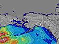 | 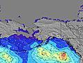 | 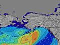 | 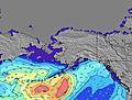 | 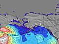 | 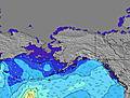 | 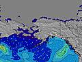 | 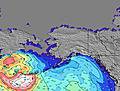 | |||||||||||||
Wave Height (m) Direction Period (s) | W 10 | W 9 | SW 18 | SW 17 | WSW 18 | W 17 | W 17 | W 16 | W 10 | W 10 | W 7 | WNW 7 | W 8 | W 8 | W 8 | W 9 | SW 18 | SSW 17 | SSW 16 | SW 16 | SW 16 |
Wave Graph | |||||||||||||||||||||
98 | 102 | 152 | 88 | 106 | 149 | 210 | 186 | 206 | 230 | 124 | 193 | 351 | 224 | 191 | 225 | 312 | 197 | 171 | 258 | 258 | |
Wind (km/h) | |||||||||||||||||||||
Wind State on-shore cross-onshore cross-shore cross-offshore off-shore glassy | glassy | cross-on | on | glassy | cross-off | cross | cross-off | cross-off | on | cross-on | cross | on | off | on | cross-on | glassy | on | on | cross-off | cross | on |
High Tide | 1:07AM3.73m | 2:31PM3.07m | 1:59AM3.66m | 3:14PM3.14m | 2:51AM3.49m | 3:56PM3.18m | 3:42AM3.25m | 4:37PM3.18m | 4:35AM2.96m | 5:18PM3.15m | 5:31AM2.67m | 6:00PM3.08m | 6:36AM2.43m | 6:45PM3.00m | |||||||
Low Tide | 8:01AM-0.13m | 7:59PM1.18m | 8:46AM-0.03m | 8:52PM1.09m | 9:28AM0.17m | 9:45PM1.05m | 10:10AM0.43m | 10:40PM1.03m | 10:50AM0.72m | 11:36PM1.04m | 11:31AM1.03m | 00:37AM1.05m | 12:14PM1.31m | ||||||||
— | 5:33 | — | — | 5:35 | — | — | 5:35 | — | — | 5:37 | — | — | 5:37 | — | — | 5:39 | — | — | 5:41 | — | |
9:22 | — | — | 9:22 | — | — | 9:21 | — | — | 9:20 | — | — | 9:19 | — | — | 9:17 | — | — | 9:16 | — | 9:15 | |
mm | — | — | — | — | — | 1 | 4 | — | — | — | — | — | — | — | — | — | — | — | — | — | — |
Temp °C | 16 | 16 | 16 | 16 | 16 | 15 | 14 | 14 | 15 | 15 | 15 | 16 | 15 | 15 | 17 | 18 | 19 | 21 | 19 | 18 | 17 |
Feels °C | 14 | 15 | 14 | 14 | 13 | 14 | 14 | 13 | 13 | 12 | 14 | 14 | 14 | 16 | 15 | 16 | 19 | 20 | 19 | 17 | 17 |
Swell 1 Height (m) Direction Period (s) | W 10 | W 9 | W 9 | W 8 | W 8 | W 8 | W 8 | W 8 | W 10 | W 10 | W 7 | W 7 | W 8 | W 8 | W 8 | W 9 | W 8 | W 8 | W 8 | W 8 | W 8 |
92 | 102 | 94 | 88 | 90 | 95 | 74 | 61 | 206 | 230 | 124 | 131 | 351 | 224 | 191 | 225 | 143 | 113 | 66 | 64 | 71 | |
Swell 2 Height (m) Direction Period (s) | SSW 13 | SSW 13 | SW 18 | SSW 12 | WSW 18 | W 17 | W 17 | W 16 | W 16 | W 16 | W 15 | W 15 | SW 18 | SW 19 | WSW 14 | SW 16 | SW 18 | SSW 17 | SSW 16 | SW 16 | SW 16 |
98 | 93 | 152 | 49 | 106 | 149 | 210 | 186 | 181 | 124 | 118 | 116 | 246 | 173 | 68 | 129 | 312 | 197 | 171 | 258 | 258 | |
Swell 3 Height (m) Direction Period (s) | SW 7 | SW 18 | SSW 12 | SW 17 | SW 16 | SW 16 | SW 16 | W 11 | SW 16 | SW 19 | W 10 | SW 15 | WSW 14 | WSW 14 | SW 16 | W 14 | W 13 | W 13 | W 13 | S 10 | S 10 |
11 | 80 | 59 | 77 | 93 | 90 | 89 | 60 | 62 | 94 | 30 | 104 | 70 | 68 | 68 | 33 | 14 | 14 | 3 | 2 | 2 | |
Wind waves Height (m) Direction Period (s) | — | — | — | — | — | SE 3 | SE 3 | SE 3 | — | WNW 5 | — | WNW 7 | — | — | — | — | — | — | — | — | — |
— | — | — | — | — | 2 | 1 | 2 | — | 41 | — | 193 | — | — | — | — | — | — | — | — | — | |
Nearest Offshore or Glassy | |||||||||||||||||||||
Distance (km) | 1008 | 0 | 127 | 1373 | 0 | 19 | 0 | 0 | 110 | 1374 | 3 | 106 | 169 | 0 | 102 | 118 | 0 | 102 | 127 | 0 | 106 |
Best forecast wave conditions in Vancouver Island | |||||||||||||||||||||
Best forecast wave conditions in Canada | |||||||||||||||||||||
Header Global | |||||||||||||||||||||
- Map Icons:
 Break
Break Live Wave Height (m)
 Live Wind Speed (km/h)
 Surf Rating (10 Max)
 Ocean Swells (m)
- Wind Speed (km/h)


FREE! Surf-Forecast.com widget for your website
The surf report / weather widget below is available to embed on third party websites free of charge and provides a summary of our Wickaninnish surf forecast. Simply grab the html code snippet that we provide and paste it into your own site. You can choose your preferred language and metric/imperial units for the surf forecast feed to suit users of your site. Click here to get the code.
Information about the Wickaninnish Surf forecast
The above surf forecast table for Wickaninnish provides essential information for determining whether the surfing conditions will be good over the next 16 days. A general guide to surfing at Wickaninnish can be found by selecting the local surf guide option on the grey menu. Our Wickaninnish surf forecast is unique since it includes wave energy (power) that defines the real feel of the surf rather than just the height or the period. If you surf the same spot (Wickaninnish) regularly then make a mental note of the wave energy from the surf forecast table each time you go. Very soon you may start to choose your surf days based on the wave energy alone combined with our forecast of favourable offshore wind conditions. Our star ratings will help here and of course you will also find the usual wave height and period predictions on our surf forecasts as well as a full break down of the swell components under our advanced users option (to reveal that, click the little Einstein character under the tide times).
Further information to help with frequently asked questions about our surf forecast for Wickaninnish may be found under the help tab on the top menu and also by moving your mouse over the question marks on the surf forecast table itself. Please always bear in mind that the forecast is for near-shore open water and local factors at each surf break influence the actual breaking wave height, such as the beach / reef profile, water depths offshore and shelter.
 Nearest