

Surf Forecasts:

Baie de Douarnenez surf forecast from 5 Jul 2026:
- Best quality surf: Sunday 5 Jul, 5AM (local time) - 2.5ft (0.8m), 10s period, W swell with cross-offshore winds.
- Most powerful swell: Saturday 11 Jul, 5PM (local time) - 4ft (1.2m), 10s period, NW swell with 286 kJ wave energy.
- Next surfable swell (1★+): Sunday 5 Jul, 5AM (local time) - 2.5ft (0.8m), 10s period with W swell.
Best Forecast Surf Conditions for Baie de Douarnenez this week:
The surf forecast for Baie de Douarnenez over the next 16 days: The first swell (rated 1 star or higher) is forecast to arrive on Sunday (Jul 05) at 5AM. The primary swell is predicted to be 0.8m and 10s period with a secondary swell of 0.4m and 10s. The wind is predicted to be cross-offshore as the swell arrives.
The most powerful waves expected at Baie de Douarnenez in the next 16 days are 1.2m 10s and forecast to arrive on Saturday (Jul 11) at 5PM. Winds are predicted to be cross-onshore at the time the swell arrives. The largest open ocean swell (not directed at the beach) is 0.4m 3s period and expected on Saturday (Jul 11) at 11PM.
| Wave Type | Time (CEST) & Date | Wave Height & Period |
|---|---|---|
| Next good surf (1 star+) | 5AM (Sun 5th Jul) | 2.5ft (0.8m) 10s |
| Best Surf | 5AM (Sun 5th Jul) | 2.5ft (0.8m) 10s |
| Most Powerful | 5PM (Sat 11th Jul) | 4ft (1.2m) 10s |
Table - best surf conditions forecast for Baie de Douarnenez over the next 16 days.
Updates in hr min s Forecast update imminent
Alright folks, Rusty here. Let’s talk about Baie de Douarnenez. Look, it’s going to be a quiet stretch. The next couple of weeks are going to be pretty slow, with only a few small windows of clean, surfable waves mixed in with long gaps where the conditions just aren’t worth paddling out.
Right now, for Sunday the 5th, we have small 2ft swell from the west with a 9-second period, and a light cross-offshore breeze. The water temp is about average for this time of year. The energy is weak (109). It's surfable but very ordinary. Honestly, that's the best description. By Sunday afternoon the wind swings onshore and it's done.
Monday the 6th is similar – a small 2ft west-northwest swell in the morning with clean conditions. Another one of those "go for a paddle but don't expect much" kind of days. The rest of Monday and Tuesday are weak and mostly blown out or flat.
We get a little reprieve Wednesday the 8th with a clean 2ft swell during the morning, but it's tiny. Then Thursday the 9th and Friday the 10th offer up some glassy conditions early with a clean 2ft and 3ft swell respectively. The energy on Friday morning is starting to show a bit of life at 115, but it’s still very modest. Friday afternoon gets messy again.
Now, the one standout in this whole period is Saturday the 11th. The morning session brings a clean 2ft swell from the west with a steady offshore breeze from the east-northeast. The energy is building to 130. It'll be clean with those offshores. Then the afternoon is a bit weird – a bigger pulse of 4ft from the northwest with a period of 10 seconds, combined energy jumps right up to 457, but it comes with a light cross-onshore wind. It's marginal. If you’re quick, the morning is your best bet.
After that, it gets grim. From Sunday the 12th all the way through to Saturday the 18th, it’s a long, flat, poor run. Strong onshore winds or strong offshores on tiny waves. There are maybe some clean 1ft waves on Monday the 13th afternoon, but that’s barely a ripple. Keep the board in the shed.
The very end of the outlook, Sunday the 19th and Monday the 20th, sees some bigger swell arrive. We’re talking 6ft to 8ft from the southwest on the 19th, and 5ft from the west on the 20th. But the winds are onshore or cross-onshore and the wave energy is strong (306 to 932), but the quality is described as poor. That combination of solid but messy swell and onshore wind makes this look more interesting for kite surfing than traditional paddle surfing. Not for us.
So, to sum it up. Saturday the 11th morning at Baie de Douarnenez is the only true standout you’ve got – small but clean with a little push. The rest of the 16-day run is a mix of onshore slop and flat spells. Keep an eye on it, but don’t hold your breath.
Stay tuned, Rusty.
Short Range ForecastMostly dry. Warm (max 32°C on Tue afternoon, min 17°C on Sat night). Wind will be generally light. | Days 5-7 Weather SummarySome drizzle, heaviest during Wed night. Warm (max 32°C on Tue night, min 18°C on Thu night). Wind will be generally light. | ||||||||||||||||||||
Sunday 5 | Monday 6 | Tuesday 7 | Wednesday 8 | Thursday 9 | Friday 10 | Sat 11 | |||||||||||||||
Night | AM | PM | Night | AM | PM | Night | AM | PM | Night | AM | PM | Night | AM | PM | Night | AM | PM | Night | AM | PM | |
Swell Height Map |  |  |  |  |  |  |  | 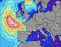 | |||||||||||||
Wave Height (m) Direction Period (s) | W 10 | W 9 | W 9 | WNW 9 | WNW 9 | W 8 | W 8 | W 9 | W 8 | WNW 8 | W 10 | W 10 | W 10 | W 9 | W 9 | WNW 9 | W 9 | WNW 9 | WNW 8 | W 8 | NW 10 |
Wave Graph | |||||||||||||||||||||
120 | 87 | 57 | 82 | 79 | 52 | 51 | 39 | 37 | 22 | 70 | 68 | 65 | 87 | 83 | 86 | 108 | 106 | 103 | 64 | 286 | |
Wind (km/h) | |||||||||||||||||||||
Wind State on-shore cross-onshore cross-shore cross-offshore off-shore glassy | cross-off | cross-off | cross-on | cross-off | cross-off | cross-on | off | glassy | cross-on | off | cross-off | on | glassy | glassy | on | cross | glassy | on | cross-off | off | cross-on |
High Tide | 8:09PM4.21m | 8:30AM3.95m | 8:48PM4.12m | 9:12AM3.87m | 9:31PM4.00m | 10:00AM3.77m | 10:22PM3.87m | 10:58AM3.69m | 11:25PM3.76m | 12:06PM3.68m | 00:38AM3.73m | 1:20PM3.76m | 1:54AM3.82m | 2:30PM3.97m | |||||||
Low Tide | 2:39AM0.77m | 2:50PM0.88m | 3:18AM0.85m | 3:31PM0.99m | 4:01AM0.94m | 4:20PM1.11m | 4:53AM1.03m | 5:18PM1.20m | 5:55AM1.10m | 6:28PM1.21m | 7:06AM1.09m | 7:45PM1.09m | 8:20AM0.97m | ||||||||
— | 6:22 | — | — | 6:24 | — | — | 6:24 | — | — | 6:24 | — | — | 6:26 | — | — | 6:26 | — | — | 6:28 | — | |
10:19 | — | — | 10:19 | — | — | 10:19 | — | — | 10:17 | — | — | 10:17 | — | — | 10:16 | — | — | 10:15 | — | 10:15 | |
mm | — | — | — | — | — | — | — | — | — | — | — | — | 1 | — | — | — | — | — | — | — | — |
Temp °C | 22 | 23 | 30 | 28 | 28 | 31 | 30 | 30 | 32 | 32 | 30 | 31 | 27 | 26 | 28 | 26 | 28 | 30 | 31 | 30 | 35 |
Feels °C | 20 | 22 | 26 | 24 | 26 | 28 | 29 | 28 | 29 | 28 | 27 | 27 | 24 | 25 | 26 | 24 | 28 | 28 | 30 | 28 | 33 |
Swell 1 Height (m) Direction Period (s) | W 10 | W 9 | W 9 | WNW 9 | WNW 9 | W 8 | W 8 | W 9 | W 8 | WNW 8 | W 10 | W 10 | W 10 | W 9 | W 9 | WNW 9 | W 9 | WNW 9 | WNW 8 | W 8 | WNW 10 |
120 | 87 | 57 | 82 | 79 | 52 | 51 | 39 | 37 | 22 | 70 | 68 | 65 | 87 | 83 | 86 | 108 | 106 | 103 | 64 | 171 | |
Swell 2 Height (m) Direction Period (s) | NW 10 | NW 9 | NW 9 | — | — | — | — | — | W 11 | WNW 10 | W 7 | — | SW 4 | SSW 4 | SSW 4 | — | NW 5 | — | WNW 12 | W 11 | — |
25 | 22 | 40 | — | — | — | — | — | 9 | 20 | 4 | — | 3 | 2 | 1 | — | 7 | — | 15 | 57 | — | |
Swell 3 Height (m) Direction Period (s) | — | — | — | — | — | — | — | — | — | — | — | — | — | — | — | — | — | — | — | — | — |
— | — | — | — | — | — | — | — | — | — | — | — | — | — | — | — | — | — | — | — | — | |
Wind waves Height (m) Direction Period (s) | NW 4 | — | — | — | ESE 4 | — | — | — | — | — | — | W 2 | — | — | NW 3 | NW 4 | — | N 3 | NW 5 | NNW 5 | NW 10 |
3 | — | — | — | 1 | — | — | — | — | — | — | 1 | — | — | 3 | 10 | — | 5 | 18 | 9 | 286 | |
Nearest Offshore or Glassy | |||||||||||||||||||||
Distance (km) | 0 | 0 | 236 | 0 | 0 | 22 | 7 | 19 | 30 | 19 | 0 | 5 | 0 | 0 | 24 | 19 | 0 | 5 | 0 | 0 | 3 |
Best forecast wave conditions in Finistere - Brittany | |||||||||||||||||||||
Best forecast wave conditions in France | |||||||||||||||||||||
Header Global | |||||||||||||||||||||
- Map Icons:
 Break
Break Live Wave Height (m)
 Live Wind Speed (km/h)
 Surf Rating (10 Max)
 Ocean Swells (m)
- Wind Speed (km/h)


FREE! Surf-Forecast.com widget for your website
The surf report / weather widget below is available to embed on third party websites free of charge and provides a summary of our Baie de Douarnenez surf forecast. Simply grab the html code snippet that we provide and paste it into your own site. You can choose your preferred language and metric/imperial units for the surf forecast feed to suit users of your site. Click here to get the code.
Information about the Baie de Douarnenez Surf forecast
The above surf forecast table for Baie de Douarnenez provides essential information for determining whether the surfing conditions will be good over the next 16 days. A general guide to surfing at Baie de Douarnenez can be found by selecting the local surf guide option on the grey menu. Our Baie de Douarnenez surf forecast is unique since it includes wave energy (power) that defines the real feel of the surf rather than just the height or the period. If you surf the same spot (Baie de Douarnenez) regularly then make a mental note of the wave energy from the surf forecast table each time you go. Very soon you may start to choose your surf days based on the wave energy alone combined with our forecast of favourable offshore wind conditions. Our star ratings will help here and of course you will also find the usual wave height and period predictions on our surf forecasts as well as a full break down of the swell components under our advanced users option (to reveal that, click the little Einstein character under the tide times).
Further information to help with frequently asked questions about our surf forecast for Baie de Douarnenez may be found under the help tab on the top menu and also by moving your mouse over the question marks on the surf forecast table itself. Please always bear in mind that the forecast is for near-shore open water and local factors at each surf break influence the actual breaking wave height, such as the beach / reef profile, water depths offshore and shelter.
Baie de Douarnenez is 3 km (2 miles) from the city of Douarnenez. If you plan a holiday in Finistere - Brittany, look for hotels and other accommodation in Douarnenez. Douarnenez has rooms for a wide range of budgets as well as car hire and transport links.
 Nearest