

Surf Forecasts:

How big are the waves at Xoxoline today (20 Jun):
- Afternoon surf: Afternoon surf (20 Jun, local time) - 4.5ft (1.4m), 10s period with ESE swell.
- Evening surf: Evening surf (20 Jun, local time) - 4.5ft (1.3m), 10s period with ESE swell.
The current surf forecast for Xoxoline at 10PM is: 1.3m 10s primary swell from a East-southeast direction and 0.3m 8s secondary swell from a North-northeast direction (forecast issued at 02:00pm June 20). An open ocean swell of 0.1m 8s is not directed at the surf break. The wind direction is predicted to be cross-shore.
| Time (-03) & Date | Wave Height | Wave Period |
|---|---|---|
| Morning (20 Jun) | - | - |
| Afternoon (20 Jun) | 4.5ft (1.4m) | 10s |
| Evening (20 Jun) | 4.5ft (1.3m) | 10s |
Table - waves today at Xoxoline. (Swell directed towards the surf break)
Updates in hr min s Forecast update imminent
Short Range ForecastLight rain (total 8mm), mostly falling on Sat afternoon. Warm (max 27°C on Mon morning, min 22°C on Sat night). Wind will be generally light. | ||||||||||||||||||||||||
Sat 20 | Sunday 21 | Monday 22 | Tue 23 | |||||||||||||||||||||
12 PM | 3 PM | 6 PM | 9 PM | 12 AM | 3 AM | 6 AM | 9 AM | 12 PM | 3 PM | 6 PM | 9 PM | 12 AM | 3 AM | 6 AM | 9 AM | 12 PM | 3 PM | 6 PM | 9 PM | 12 AM | 3 AM | 6 AM | 9 AM | |
Swell Height Map |  |  |  |  |  |  |  |  |  | 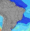 | ||||||||||||||
Wave Height (m) Direction Period (s) | ESE 10 | ESE 10 | ESE 10 | ESE 10 | ESE 10 | ESE 10 | ESE 10 | ESE 10 | ESE 10 | ESE 10 | ESE 10 | ESE 10 | ESE 10 | ESE 10 | ESE 10 | ESE 10 | ESE 10 | ESE 10 | ESE 10 | ESE 10 | ESE 10 | ESE 9 | ESE 9 | ESE 9 |
Wave Graph | ||||||||||||||||||||||||
380 | 380 | 380 | 325 | 346 | 314 | 255 | 255 | 327 | 302 | 281 | 263 | 173 | 307 | 169 | 137 | 258 | 137 | 135 | 107 | 105 | 100 | 248 | 119 | |
Wind (km/h) | ||||||||||||||||||||||||
Wind State on-shore cross-onshore cross-shore cross-offshore off-shore glassy | cross-on | cross-on | cross-on | cross-on | cross | cross | cross | cross | cross-on | cross-on | cross-on | cross-on | cross-on | cross-on | cross-on | cross-on | cross-on | cross-on | cross-on | cross-on | cross-on | cross-on | cross-on | cross-on |
High Tide | 8:51PM1.87m | 9:08AM1.97m | 9:50PM1.80m | 10:10AM1.85m | 10:50PM1.77m | |||||||||||||||||||
Low Tide | 2:37PM0.38m | 2:53AM0.58m | 3:35PM0.50m | 3:57AM0.65m | 4:35PM0.58m | 5:03AM0.67m | ||||||||||||||||||
— | — | — | — | — | 5:28 | — | — | — | — | — | — | — | 5:28 | — | — | — | — | — | — | — | 5:28 | — | — | |
— | 5:15 | — | — | — | — | — | — | — | 5:15 | — | — | — | — | — | — | — | 5:15 | — | — | — | — | — | 5:15 | |
mm | 1 | 1 | 2 | 1 | 1 | 1 | — | — | — | — | — | — | 1 | 1 | — | — | — | — | — | — | — | — | — | — |
Temp °C | 27 | 26 | 25 | 25 | 24 | 23 | 22 | 25 | 26 | 26 | 25 | 25 | 25 | 25 | 25 | 27 | 27 | 27 | 26 | 26 | 26 | 25 | 25 | 27 |
Feels °C | 28 | 27 | 26 | 26 | 25 | 24 | 23 | 25 | 26 | 26 | 26 | 27 | 27 | 27 | 27 | 27 | 27 | 27 | 27 | 27 | 27 | 26 | 26 | 27 |
Swell 1 Height (m) Direction Period (s) | ESE 10 | ESE 10 | ESE 10 | ESE 10 | ESE 10 | ESE 10 | ESE 10 | ESE 10 | NNE 8 | ESE 10 | ESE 10 | ESE 10 | ESE 10 | NNE 8 | ESE 10 | ESE 10 | NNE 8 | ESE 10 | ESE 10 | ESE 10 | ESE 10 | ESE 9 | NNE 8 | ESE 9 |
380 | 380 | 380 | 325 | 346 | 314 | 255 | 255 | 13 | 302 | 281 | 263 | 173 | 22 | 169 | 137 | 22 | 137 | 135 | 107 | 105 | 100 | 11 | 119 | |
Swell 2 Height (m) Direction Period (s) | NNE 8 | NNE 8 | NNE 8 | NNE 8 | NNE 8 | NNE 8 | NNE 8 | NNE 8 | N 11 | NNE 8 | NNE 8 | NNE 8 | NNE 8 | N 14 | NNE 8 | NNE 8 | N 13 | NNE 8 | NNE 8 | NNE 8 | NNE 8 | NNE 8 | N 12 | NNE 8 |
13 | 13 | 13 | 13 | 13 | 13 | 13 | 12 | 20 | 12 | 11 | 22 | 12 | 35 | 13 | 22 | 14 | 22 | 13 | 23 | 24 | 11 | 26 | 12 | |
Swell 3 Height (m) Direction Period (s) | N 10 | N 10 | N 10 | N 10 | N 10 | N 10 | N 10 | N 10 | SE 16 | N 12 | N 8 | SSE 7 | N 10 | S 7 | N 10 | N 11 | N 11 | N 13 | N 13 | N 13 | N 12 | N 12 | N 10 | N 12 |
8 | 8 | 8 | 8 | 8 | 8 | 8 | 8 | 10 | 11 | 6 | 5 | 7 | 1 | 9 | 9 | 9 | 14 | 30 | 29 | 27 | 26 | 8 | 25 | |
Wind waves Height (m) Direction Period (s) | — | SE 3 | — | S 9 | S 8 | S 4 | SSE 4 | SSE 4 | ESE 10 | SSE 7 | SSE 8 | ESE 4 | ESE 4 | ESE 10 | ESE 5 | ESE 5 | ESE 10 | ESE 5 | ESE 5 | ESE 5 | ESE 5 | ESE 6 | ESE 9 | ESE 6 |
— | 2 | — | 1 | 1 | 15 | 28 | 26 | 327 | 5 | 64 | 18 | 21 | 307 | 26 | 26 | 258 | 34 | 39 | 42 | 53 | 60 | 248 | 62 | |
Nearest Offshore or Glassy | ||||||||||||||||||||||||
Distance (km) | 523 | 453 | 98 | 98 | 42 | 42 | 25 | 846 | 1599 | 1599 | 1599 | 5 | 25 | 25 | 24 | 110 | 1599 | 1599 | 453 | 363 | 363 | 277 | 5 | 1011 |
Best forecast wave conditions in Rio Grande Do Norte | ||||||||||||||||||||||||
Best forecast wave conditions in Brazil | ||||||||||||||||||||||||
Header Global | ||||||||||||||||||||||||
- Map Icons:
 Break
Break Live Wave Height (m)
 Live Wind Speed (km/h)
 Surf Rating (10 Max)
 Ocean Swells (m)
- Wind Speed (km/h)


FREE! Surf-Forecast.com widget for your website
The surf report / weather widget below is available to embed on third party websites free of charge and provides a summary of our Xoxoline surf forecast. Simply grab the html code snippet that we provide and paste it into your own site. You can choose your preferred language and metric/imperial units for the surf forecast feed to suit users of your site. Click here to get the code.
 Nearest