

Surf Forecasts:

Corrente surf forecast from 10 Jul 2026:
- Best quality surf: Sunday 12 Jul, 3AM (local time) - 3.5ft (1.0m), 12s period, SE swell with cross-offshore winds.
- Most powerful swell: Friday 10 Jul, 9PM (local time) - 4.5ft (1.3m), 13s period, SSE swell with 590 kJ wave energy.
- Next surfable swell (1★+): Sunday 12 Jul, 3AM (local time) - 3.5ft (1.0m), 12s period with SE swell.
Best Forecast Surf Conditions for Corrente this week:
The surf forecast for Corrente over the next 16 days: The first swell (rated 1 star or higher) is forecast to arrive on Sunday (Jul 12) at 3AM. The primary swell is predicted to be 1.0m and 12s period with a secondary swell of 0.4m and 9s. Another secondary swell of 0.3m and 3s is also forecast. The wind is predicted to be cross-offshore as the swell arrives.
The most powerful waves expected at Corrente in the next 16 days are 1.3m 13s and forecast to arrive on Friday (Jul 10) at 9PM. Winds are predicted to be cross-onshore at the time the swell arrives. The largest open ocean swell (not directed at the beach) is 0.9m 6s period and expected on Tuesday (Jul 14) at 6AM.
| Wave Type | Time (-03) & Date | Wave Height & Period |
|---|---|---|
| Next good surf (1 star+) | 3AM (Sun 12th Jul) | 3.5ft (1.0m) 12s |
| Best Surf | 3AM (Sun 12th Jul) | 3.5ft (1.0m) 12s |
| Most Powerful | 9PM (Fri 10th Jul) | 4.5ft (1.3m) 13s |
Table - best surf conditions forecast for Corrente over the next 16 days.
Righto, Rusty here. Let's have a look at what's on the table for the coming days at Corrente.
Corrente is a reef break that needs a bit of love to get good, and to be honest, the next week and a half looks pretty grim. We've got a real drought on our hands. The swell is small and weak, with moderate wave energy (around 367 to 409) on Friday the 10th, but the wind is onshore and the conditions are just messy. Saturday the 11th isn't much better—a bit of a pulse, but the wind spoils it.
The one true standout in this whole outlook is Sunday morning, July 12th. The swell is a clean 4 ft from the SSE, with a solid 12-second period. The wind is a light, cross-offshore breeze from the NNE, which is rare and a major positive. This is the only session that scores a "good" wave comment. The combined energy is moderate (338), but it's the cleanest we'll see. The water temperature is about average for this time of year, so no surprises there.
After that, it's a slide into onshore slop. Monday the 13th has a small, cleanish morning but with tiny surf (3 ft). Then we hit a long, flat gap. From Tuesday the 14th to Thursday the 24th, it's a mix of onshore winds, short-period windswell (periods of 8 to 10 seconds), and mostly poor conditions. The swell size does bump up a bit from the 20th to the 22nd, hitting 5 ft to 6 ft, but it's coming from the E or ESE with a short, weak period and onshore wind. That's not good for a reef—it's just messy, blown-out chop. Honestly, for a stretch of almost two weeks, there's nothing worth paddling out for.
If you're an expert, there's a flicker of hope on Wednesday morning, July 22nd, where the swell is 6 ft from the ESE, but with a short 8-second period. The wind is light cross-onshore, so it's marginal, but for a big-wave specialist on a reef, it might offer a few heavy, lumpy ones. But for most of us, it's a hard pass.
So, bottom line: Sunday morning the 12th is your best bet by a long shot. After that, it's a waiting game and a hope that the forecasts change. This is a pretty typical blank run for this area, so don't get too down.
Rusty.
Short Range ForecastMostly dry. Warm (max 25°C on Fri morning, min 22°C on Sat night). Wind will be generally light. | Days 5-7 Weather SummaryModerate rain (total 16mm), heaviest on Tue night. Warm (max 26°C on Mon morning, min 21°C on Sun night). Winds increasing (light winds from the ENE on Mon morning, fresh winds from the SSE by Wed afternoon). | ||||||||||||||||||||
Friday 10 | Saturday 11 | Sunday 12 | Monday 13 | Tuesday 14 | Wednesday 15 | Thu 16 | |||||||||||||||
Night | AM | PM | Night | AM | PM | Night | AM | PM | Night | AM | PM | Night | AM | PM | Night | AM | PM | Night | AM | PM | |
Swell Height Map |  |  |  |  |  |  |  | 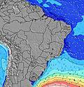 | |||||||||||||
Wave Height (m) Direction Period (s) | SSE 11 | SSE 11 | SSE 11 | SE 13 | SE 13 | SE 13 | SE 13 | SE 12 | SSE 12 | SSE 12 | SSE 11 | SE 11 | SSE 11 | ENE 6 | S 12 | S 7 | SSE 8 | SSE 7 | SSE 7 | SSE 11 | SSE 10 |
Wave Graph | |||||||||||||||||||||
335 | 335 | 238 | 569 | 444 | 437 | 311 | 336 | 251 | 239 | 157 | 123 | 78 | 51 | 49 | 239 | 514 | 366 | 223 | 415 | 331 | |
Wind (km/h) | |||||||||||||||||||||
Wind State on-shore cross-onshore cross-shore cross-offshore off-shore glassy | cross-on | on | on | cross-on | cross | cross-on | cross | cross-off | cross-on | cross-off | cross-off | cross-on | cross | cross-on | on | cross-on | on | on | on | cross-on | on |
High Tide | 10:56PM2.28m | 11:20AM2.33m | 11:37PM2.32m | 12:03PM2.32m | 00:16AM2.33m | 12:46PM2.28m | 00:55AM2.33m | 1:28PM2.21m | 1:36AM2.31m | 2:13PM2.12m | 2:22AM2.27m | 3:01PM2.02m | 3:13AM2.21m | 3:56PM1.94m | |||||||
Low Tide | 4:52AM-0.00m | 5:14PM0.03m | 5:34AM-0.09m | 5:54PM0.03m | 6:16AM-0.14m | 6:34PM0.05m | 6:59AM-0.13m | 7:15PM0.10m | 7:44AM-0.08m | 7:58PM0.17m | 8:32AM0.02m | 8:45PM0.26m | 9:24AM0.14m | ||||||||
— | 5:56 | — | — | 5:56 | — | — | 5:56 | — | — | 5:56 | — | — | 5:56 | — | — | 5:56 | — | — | 5:56 | — | |
— | — | 5:20 | — | — | 5:21 | — | — | 5:21 | — | — | 5:21 | — | — | 5:22 | — | — | 5:22 | — | — | 5:22 | |
mm | — | — | — | — | — | — | — | — | — | — | — | — | — | — | — | 9 | 6 | 1 | — | — | — |
Temp °C | 24 | 25 | 25 | 24 | 25 | 25 | 24 | 25 | 25 | 24 | 26 | 26 | 25 | 26 | 26 | 25 | 24 | 24 | 24 | 25 | 25 |
Feels °C | 24 | 26 | 26 | 25 | 27 | 25 | 24 | 27 | 25 | 24 | 28 | 26 | 28 | 28 | 28 | 25 | 23 | 21 | 21 | 22 | 22 |
Swell 1 Height (m) Direction Period (s) | SSE 11 | SSE 11 | SSE 11 | SE 13 | SE 13 | SE 13 | SE 13 | SE 12 | SSE 12 | SSE 12 | SSE 11 | SE 11 | SSE 11 | ENE 6 | ENE 7 | ENE 7 | ENE 7 | E 7 | SSE 12 | SSE 11 | SSE 10 |
335 | 335 | 238 | 569 | 444 | 437 | 311 | 336 | 251 | 239 | 157 | 123 | 78 | 42 | 45 | 36 | 28 | 26 | 137 | 415 | 331 | |
Swell 2 Height (m) Direction Period (s) | E 7 | E 7 | SE 13 | S 11 | S 10 | SSE 10 | SSE 10 | E 4 | — | ENE 7 | E 4 | S 20 | S 18 | SE 10 | SE 10 | S 11 | SSE 13 | SSE 13 | E 7 | E 7 | E 7 |
15 | 15 | 156 | 58 | 33 | 32 | 39 | 2 | — | 9 | 10 | 7 | 25 | 51 | 27 | 41 | 33 | 53 | 26 | 42 | 43 | |
Swell 3 Height (m) Direction Period (s) | SE 16 | E 7 | E 7 | E 7 | E 7 | ENE 7 | E 7 | ENE 7 | — | — | ENE 7 | S 16 | S 13 | ENE 7 | S 12 | SE 10 | — | S 10 | — | — | SE 6 |
11 | 15 | 15 | 8 | 8 | 10 | 4 | 9 | — | — | 10 | 5 | 3 | 19 | 49 | 25 | — | 16 | — | — | 1 | |
Wind waves Height (m) Direction Period (s) | — | ESE 3 | — | NE 6 | — | E 7 | ENE 7 | ENE 6 | ENE 6 | E 4 | — | ENE 7 | ENE 5 | ENE 6 | — | S 7 | SSE 8 | SSE 7 | SSE 7 | SE 5 | — |
— | 2 | — | 1 | — | 9 | 10 | 24 | 14 | 8 | — | 37 | 48 | 49 | — | 239 | 514 | 366 | 223 | 7 | — | |
Nearest Offshore or Glassy | |||||||||||||||||||||
Distance (km) | 160 | 161 | 758 | 1 | 1 | 758 | 164 | 0 | 758 | 163 | 0 | 844 | 183 | 1 | 1174 | 199 | 804 | 844 | 161 | 161 | 758 |
Best forecast wave conditions in Bahia - Norte | |||||||||||||||||||||
Best forecast wave conditions in Brazil | |||||||||||||||||||||
Header Global | |||||||||||||||||||||
- Map Icons:
 Break
Break Live Wave Height (m)
 Live Wind Speed (km/h)
 Surf Rating (10 Max)
 Ocean Swells (m)
- Wind Speed (km/h)


FREE! Surf-Forecast.com widget for your website
The surf report / weather widget below is available to embed on third party websites free of charge and provides a summary of our Corrente surf forecast. Simply grab the html code snippet that we provide and paste it into your own site. You can choose your preferred language and metric/imperial units for the surf forecast feed to suit users of your site. Click here to get the code.
Information about the Corrente Surf forecast
The above surf forecast table for Corrente provides essential information for determining whether the surfing conditions will be good over the next 16 days. A general guide to surfing at Corrente can be found by selecting the local surf guide option on the grey menu. Our Corrente surf forecast is unique since it includes wave energy (power) that defines the real feel of the surf rather than just the height or the period. If you surf the same spot (Corrente) regularly then make a mental note of the wave energy from the surf forecast table each time you go. Very soon you may start to choose your surf days based on the wave energy alone combined with our forecast of favourable offshore wind conditions. Our star ratings will help here and of course you will also find the usual wave height and period predictions on our surf forecasts as well as a full break down of the swell components under our advanced users option (to reveal that, click the little Einstein character under the tide times).
Further information to help with frequently asked questions about our surf forecast for Corrente may be found under the help tab on the top menu and also by moving your mouse over the question marks on the surf forecast table itself. Please always bear in mind that the forecast is for near-shore open water and local factors at each surf break influence the actual breaking wave height, such as the beach / reef profile, water depths offshore and shelter.
Corrente is 8 km (5 miles) from the very large city of Lauro de Freitas. If you plan a holiday in Bahia - Norte, look for hotels and other accommodation in Lauro de Freitas. Lauro de Freitas has rooms for a wide range of budgets as well as cheap car hire and transport links.
 Nearest