

Surf Forecasts:

Seacrest Drive surf forecast from 14 Jul 2026:
- Best quality surf: Thursday 16 Jul, 5PM (local time) - 2.5ft (0.7m), 5s period, S swell with cross-offshore winds.
- Most powerful swell: Sunday 19 Jul, 2AM (local time) - 5ft (1.5m), 6s period, S swell with 138 kJ wave energy.
- Next surfable swell (1★+): Thursday 16 Jul, 5PM (local time) - 2.5ft (0.7m), 5s period with S swell.
Best Forecast Surf Conditions for Seacrest Drive this week:
The surf forecast for Seacrest Drive over the next 16 days: The first swell (rated 1 star or higher) is forecast to arrive on Thursday (Jul 16) at 5PM. The primary swell is predicted to be 0.7m and 5s period with a secondary swell of 0.4m and 5s. Another secondary swell of 0.1m and 8s is also forecast. The wind is predicted to be cross-offshore as the swell arrives.
The most powerful waves expected at Seacrest Drive in the next 16 days are 1.5m 6s and forecast to arrive on Sunday (Jul 19) at 2AM. Winds are predicted to be cross-offshore at the time the swell arrives. The largest open ocean swell (not directed at the beach) is 0.7m 5s period and expected on Wednesday (Jul 15) at 2PM.
| Wave Type | Time (EDT) & Date | Wave Height & Period |
|---|---|---|
| Next good surf (1 star+) | 5PM (Thu 16th Jul) | 2.5ft (0.7m) 5s |
| Best Surf | 5PM (Thu 16th Jul) | 2.5ft (0.7m) 5s |
| Most Powerful | 2AM (Sun 19th Jul) | 5ft (1.5m) 6s |
Table - best surf conditions forecast for Seacrest Drive over the next 16 days.
The Lowdown
Alright folks, Rusty here. Let's have a look at Seacrest Drive over the next couple of weeks.
Honestly, it’s a pretty dry stretch. The waves are just not showing up with any real love. We’ve got a solid 16-day window to look at, but it’s a long, quiet one. The first real chance to even think about getting wet doesn’t come until the afternoon of Sunday the 19th, and even then, it’s nothing to write home about.
The water temps are sitting at about 73°, which is a touch warmer than usual for this time of year, nothing crazy.
So, starting with the only real mentionable surf: Sunday the 19th of July. The morning has some waist-high swell at 3ft from the SSE, with a weak period of 7 seconds and weak energy (66). The wind is cross-off from the WSW, which will keep things clean, but the quality is just ordinary. The afternoon is a little better with the same 3ft SSE swell, dropping to a 6-second period (57 energy), but the wind swings offshore from the WNW. That’ll give you a clean, glassy surface, but it’s still just "surfable waves but very ordinary conditions." It’s a beginner-friendly spot, fairly consistent, and crowds are sometimes around. For a spot that rarely gets any decent waves, this is your best bet, but don't expect any barrels.
The next notable pulse comes around a week later, on the morning of Sunday the 26th of July. We’ll see a jump in size to 5ft from the S, with a 7-second period and a solid 346 energy. That’s a moderate energy swell. The wind is a cross-shore from the NNE at 12 mph, which will put a bit of a chop on the face. It’s not clean, but it's the biggest wave in the whole forecast. It’s still a beginner-friendly height, but the blustery wind will make it messy.
Between the 19th and the 26th, there are a few days with waist-high, weak swell, but the wind is either onshore, cross-onshore, or just not lining up. The break is exposed to the swell, but the direction is almost never right for it. The optimum swell direction is SE, and we get a bit of that, but it’s just too small and weak to do anything. The whole period is a slow grind for a wave that just doesn't want to cooperate.
So, if you're desperate, Sunday the 19th afternoon is your cleanest option, and Sunday the 26th is your biggest option but choppier. Everything else is a flat, windy mess. The setup here, with the wind and small swell, would honestly be more interesting for a kite surfer than a paddle surfer on most of these days.
Rusty.
Short Range ForecastMostly dry. Warm (max 37°C on Wed afternoon, min 21°C on Mon night). Wind will be generally light. | Days 5-7 Weather SummaryModerate rain (total 11mm), heaviest on Thu night. Warm (max 32°C on Thu night, min 22°C on Sat afternoon). Wind will be generally light. | ||||||||||||||||||||
Tuesday 14 | Wednesday 15 | Thursday 16 | Friday 17 | Saturday 18 | Sunday 19 | Mon 20 | |||||||||||||||
Night | AM | PM | Night | AM | PM | Night | AM | PM | Night | AM | PM | Night | AM | PM | Night | AM | PM | Night | AM | PM | |
Swell Height Map |  |  |  |  | 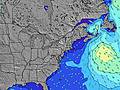 | 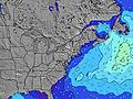 | 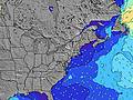 | 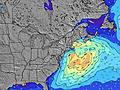 | |||||||||||||
Wave Height (m) Direction Period (s) | S 4 | ESE 9 | S 4 | SSW 5 | S 5 | S 5 | S 5 | S 6 | S 5 | S 5 | E 15 | SE 5 | S 5 | SSE 5 | SSE 4 | S 6 | S 6 | S 7 | SSE 8 | SSE 9 | SSE 9 |
Wave Graph | |||||||||||||||||||||
8 | 17 | 19 | 48 | 14 | 8 | 9 | 9 | 29 | 12 | 4 | 23 | 14 | 8 | 14 | 138 | 53 | 94 | 89 | 111 | 88 | |
Wind (km/h) | |||||||||||||||||||||
Wind State on-shore cross-onshore cross-shore cross-offshore off-shore glassy | cross-off | cross-off | cross-off | cross-off | cross-off | off | off | off | cross-off | cross-off | cross | cross-on | cross-off | off | cross-on | cross-off | off | cross-off | cross | cross | cross-on |
High Tide | 7:51AM1.43m | 8:09PM1.76m | 8:45AM1.47m | 9:00PM1.73m | 9:39AM1.49m | 9:52PM1.66m | 10:34AM1.49m | 10:45PM1.57m | 11:28AM1.48m | 11:37PM1.47m | 12:18PM1.47m | 00:28AM1.37m | 1:07PM1.44m | ||||||||
Low Tide | 1:57AM-0.10m | 1:55PM-0.05m | 2:49AM-0.15m | 2:51PM-0.05m | 3:38AM-0.17m | 3:43PM-0.02m | 4:24AM-0.15m | 4:33PM0.03m | 5:08AM-0.09m | 5:22PM0.11m | 5:52AM-0.00m | 6:15PM0.20m | 6:38AM0.09m | 7:12PM0.27m | |||||||
— | 5:39 | — | — | 5:39 | — | — | 5:39 | — | — | 5:41 | — | — | 5:41 | — | — | 5:41 | — | — | 5:43 | — | |
8:24 | — | 8:23 | — | — | 8:23 | — | — | 8:22 | — | — | 8:22 | — | — | 8:22 | — | — | 8:21 | — | — | 8:21 | |
mm | — | — | — | — | — | — | — | — | — | 3 | — | — | — | — | 5 | 3 | — | — | — | — | — |
Temp °C | 23 | 27 | 33 | 31 | 31 | 37 | 35 | 31 | 34 | 32 | 27 | 28 | 26 | 25 | 23 | 25 | 28 | 30 | 29 | 24 | 25 |
Feels °C | 20 | 25 | 31 | 29 | 31 | 35 | 34 | 29 | 32 | 31 | 27 | 27 | 24 | 27 | 25 | 26 | 25 | 26 | 28 | 22 | 23 |
Swell 1 Height (m) Direction Period (s) | ESE 9 | ESE 9 | ESE 9 | ESE 9 | S 5 | S 5 | S 5 | S 6 | S 5 | S 5 | S 5 | E 14 | SSE 5 | E 4 | E 13 | E 13 | E 13 | S 7 | SSE 8 | SSE 9 | SSE 9 |
8 | 17 | 17 | 8 | 14 | 8 | 9 | 9 | 9 | 12 | 4 | 4 | 9 | 1 | 3 | 3 | 3 | 94 | 89 | 111 | 88 | |
Swell 2 Height (m) Direction Period (s) | ESE 5 | SSE 5 | E 8 | E 7 | ESE 9 | ESE 9 | ESE 9 | ESE 8 | SE 8 | SE 9 | SE 9 | ESE 8 | E 5 | SE 8 | E 8 | E 8 | E 8 | E 6 | — | N 3 | E 12 |
3 | 2 | 1 | 1 | 8 | 8 | 7 | 7 | 3 | 3 | 3 | 7 | 2 | 3 | 1 | 1 | 1 | 3 | — | 1 | 3 | |
Swell 3 Height (m) Direction Period (s) | E 8 | E 8 | — | — | — | E 17 | — | — | E 15 | E 15 | E 15 | E 14 | SE 8 | E 14 | E 8 | — | — | E 13 | — | — | E 12 |
1 | 1 | — | — | — | 5 | — | — | 5 | 4 | 4 | 4 | 3 | 4 | 1 | — | — | 3 | — | — | 3 | |
Wind waves Height (m) Direction Period (s) | S 4 | SW 3 | S 4 | SSW 5 | W 3 | W 2 | NNW 3 | — | S 5 | NNW 3 | NNE 2 | SE 5 | S 5 | SSE 5 | SSE 4 | S 6 | S 6 | WSW 3 | NNW 3 | — | S 2 |
7 | 2 | 19 | 48 | 1 | 1 | 2 | — | 29 | 1 | 1 | 23 | 14 | 8 | 14 | 138 | 53 | 6 | 7 | — | 1 | |
Nearest Offshore or Glassy | |||||||||||||||||||||
Distance (km) | 1518 | 217 | 255 | 765 | 454 | 222 | 8 | 77 | 1328 | 266 | 90 | 197 | 890 | 888 | 1062 | 1558 | 561 | 38 | 2 | 70 | 88 |
Best forecast wave conditions in New Jersey | |||||||||||||||||||||
Best forecast wave conditions in United States | |||||||||||||||||||||
Header Global | |||||||||||||||||||||
- Map Icons:
 Break
Break Live Wave Height (m)
 Live Wind Speed (km/h)
 Surf Rating (10 Max)
 Ocean Swells (m)
- Wind Speed (km/h)


FREE! Surf-Forecast.com widget for your website
The surf report / weather widget below is available to embed on third party websites free of charge and provides a summary of our Seacrest Drive surf forecast. Simply grab the html code snippet that we provide and paste it into your own site. You can choose your preferred language and metric/imperial units for the surf forecast feed to suit users of your site. Click here to get the code.
Information about the Seacrest Drive Surf forecast
The above surf forecast table for Seacrest Drive provides essential information for determining whether the surfing conditions will be good over the next 16 days. A general guide to surfing at Seacrest Drive can be found by selecting the local surf guide option on the grey menu. Our Seacrest Drive surf forecast is unique since it includes wave energy (power) that defines the real feel of the surf rather than just the height or the period. If you surf the same spot (Seacrest Drive) regularly then make a mental note of the wave energy from the surf forecast table each time you go. Very soon you may start to choose your surf days based on the wave energy alone combined with our forecast of favourable offshore wind conditions. Our star ratings will help here and of course you will also find the usual wave height and period predictions on our surf forecasts as well as a full break down of the swell components under our advanced users option (to reveal that, click the little Einstein character under the tide times).
Further information to help with frequently asked questions about our surf forecast for Seacrest Drive may be found under the help tab on the top menu and also by moving your mouse over the question marks on the surf forecast table itself. Please always bear in mind that the forecast is for near-shore open water and local factors at each surf break influence the actual breaking wave height, such as the beach / reef profile, water depths offshore and shelter.
Are you planning a vacation in New Jersey? If you are looking for accommodation near Seacrest Drive, camping, hotels and condos and appartments in New Jersey, consider staying in Point Pleasant which is 11 km (7 miles) away. Other places in and around New Jersey where you can find information about places to rent, and car hire include Toms River which is 12 km (7 miles) away, Lakewood, Asbury Park and Ocean Acres.
 Nearest