

Surf Forecasts:

Pacific City/Cape Kiwanda surf forecast from 20 Jul 2026:
- Best quality surf: Saturday 25 Jul, 2AM (local time) - 2ft (0.6m), 24s period, SW swell with cross-offshore winds.
- Most powerful swell: Sunday 26 Jul, 5PM (local time) - 3ft (0.9m), 19s period, SW swell with 627 kJ wave energy.
- Next surfable swell (1★+): Tuesday 21 Jul, 5AM (local time) - 4.5ft (1.3m), 8s period with NW swell.
Best Forecast Surf Conditions for Pacific City/Cape Kiwanda this week:
The surf forecast for Pacific City/Cape Kiwanda over the next 16 days: The first swell (rated 1 star or higher) is forecast to arrive on Tuesday (Jul 21) at 5AM. The primary swell is predicted to be 1.3m and 8s period with a secondary swell of 0.6m and 16s. The wind is predicted to be glassy as the swell arrives.
The most powerful waves expected at Pacific City/Cape Kiwanda in the next 16 days are 0.9m 19s and forecast to arrive on Sunday (Jul 26) at 5PM. Winds are predicted to be onshore at the time the swell arrives.
| Wave Type | Time (PDT) & Date | Wave Height & Period |
|---|---|---|
| Next good surf (1 star+) | 5AM (Tue 21st Jul) | 4.5ft (1.3m) 8s |
| Best Surf | 2AM (Sat 25th Jul) | 2ft (0.6m) 24s |
| Most Powerful | 5PM (Sun 26th Jul) | 3ft (0.9m) 19s |
Table - best surf conditions forecast for Pacific City/Cape Kiwanda over the next 16 days.
The Lowdown
Alright folks, Rusty here. Let’s have a look at what’s on offer for Pacific City/Cape Kiwanda over the next couple of weeks.
Right off the bat, I gotta be honest with you – this is a tough outlook. The surf is mostly small and the conditions are fighting us. The best-looking window is actually the first day, but even that’s a bit of a compromise.
We kick things off Monday morning, the 20th of July. We’ve got a NW swell coming in at 5ft with a 8-second period. The wind is a light cross-on from the WNW at 6 mph, which is okay but not perfect. The water is sitting at 55°, which is a solid 4° colder than normal for this time of year – so you’ll want a good thick wetsuit. The combined wave energy is moderate at 637. It’s a surfable, punchy little wave, but it’s a bit lumpy. Honestly, the best pick of the whole forecast is Wednesday morning, the 22nd of July. The swell drops to 2ft from the SW, but the period stretches out to 14 seconds, which is a nice groundswell. The key here is the wind: glassy. Dead flat, clean conditions. That 2ft will be clean and fun on a longboard. The energy is moderate at 389. It’s not big, but it’s the cleanest it’s going to get.
After that, things get messy. The rest of the first week shows a mix of onshore and cross-onshore winds with swell heights bouncing between 4ft and 5ft, but the period is short and the wind is working against us. By Saturday the 25th, we see a very long period SW groundswell (22 seconds) but it’s tiny at 2ft and the wind is cross-onshore. That’s a tease – clean and lined up, but too small to really do anything.
Then we hit a real quiet and poor stretch. From Monday the 27th of July all the way through to the end of the forecast on Tuesday the 4th of August, nearly every day is marked as poor surf conditions. The wind picks up, mostly from the NNW at 9-16 mph, creating a lot of chop and cross-chop. The swell is small, mostly 2ft to 3ft, with a few days showing a bit more size (4ft to 6ft) but with a short, windswell period of 7-8 seconds. The combined energy drops off significantly, falling to 153 by the 1st of August – that’s weak energy. It’s not looking good for paddle surfing at all. Honestly, with those conditions and the beach-and-reef setup, it’d be more interesting for the kite surfers than us.
So, to sum it up: Wednesday morning the 22nd is your cleanest, glassiest shot for a little micro-session. The first Monday morning is your biggest, most powerful wave of the period, but it’s a bit lumpy. The rest is a write-off. Don’t hold your breath for the second week.
Rusty.
Short Range ForecastMostly dry. Very mild (max 19°C on Tue morning, min 14°C on Wed night). Wind will be generally light. | Days 4-6 Weather SummaryMostly dry. Very mild (max 17°C on Thu morning, min 13°C on Fri night). Wind will be generally light. | ||||||||||||||||||||
Monday 20 | Tuesday 21 | Wednesday 22 | Thursday 23 | Friday 24 | Saturday 25 | Sunday 26 | |||||||||||||||
AM | PM | Night | AM | PM | Night | AM | PM | Night | AM | PM | Night | AM | PM | Night | AM | PM | Night | AM | PM | Night | |
Swell Height Map | 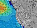 |  | 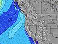 | 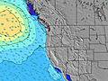 | 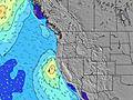 | 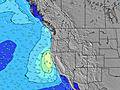 | 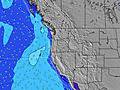 | ||||||||||||||
Wave Height (m) Direction Period (s) | NW 8 | NW 8 | NW 8 | SW 16 | SW 16 | SW 14 | NW 8 | SW 14 | NW 9 | NW 9 | NW 9 | NW 9 | NW 9 | NW 9 | SW 24 | SW 22 | SW 21 | SW 21 | SW 20 | SW 19 | SW 19 |
Wave Graph | |||||||||||||||||||||
306 | 266 | 211 | 248 | 196 | 167 | 164 | 167 | 266 | 281 | 281 | 393 | 376 | 402 | 347 | 235 | 548 | 287 | 537 | 627 | 365 | |
Wind (km/h) | |||||||||||||||||||||
Wind State on-shore cross-onshore cross-shore cross-offshore off-shore glassy | cross-on | cross | cross | cross-on | cross | glassy | glassy | cross-on | glassy | cross-on | on | cross-on | on | cross-on | cross-off | cross-on | cross-on | glassy | on | on | cross-off |
High Tide | 6:11PM2.23m | 6:51AM1.51m | 6:54PM2.21m | 8:23AM1.41m | 7:41PM2.18m | 9:58AM1.44m | 8:32PM2.17m | 11:13AM1.52m | 9:25PM2.18m | 12:05PM1.61m | 10:16PM2.22m | 12:44PM1.68m | 11:03PM2.26m | ||||||||
Low Tide | 11:48AM0.36m | 1:14AM0.38m | 12:31PM0.61m | 2:23AM0.31m | 1:20PM0.82m | 3:29AM0.23m | 2:22PM0.97m | 4:28AM0.15m | 3:31PM1.05m | 5:19AM0.06m | 4:35PM1.06m | 6:03AM-0.02m | 5:27PM1.02m | ||||||||
5:47 | — | — | 5:48 | — | — | 5:48 | — | — | 5:50 | — | — | 5:50 | — | — | 5:52 | — | — | 5:52 | — | — | |
— | 8:55 | — | — | 8:54 | — | — | 8:53 | — | — | 8:52 | — | — | 8:52 | — | — | 8:51 | — | — | 8:50 | — | |
mm | — | — | — | — | — | — | — | — | — | — | — | — | — | — | — | — | — | — | — | — | — |
Temp °C | 18 | 18 | 17 | 19 | 19 | 17 | 19 | 19 | 16 | 17 | 17 | 15 | 15 | 16 | 15 | 16 | 17 | 15 | 17 | 17 | 16 |
Feels °C | 18 | 18 | 17 | 18 | 18 | 16 | 19 | 18 | 15 | 17 | 16 | 15 | 14 | 15 | 14 | 15 | 16 | 15 | 16 | 16 | 17 |
Swell 1 Height (m) Direction Period (s) | NW 8 | NW 8 | NW 8 | NW 8 | NW 8 | NW 9 | NW 8 | NW 8 | NW 9 | NW 9 | NW 9 | NW 9 | NW 9 | NW 9 | NW 8 | NW 8 | NW 9 | NW 8 | NW 8 | NW 10 | NW 10 |
306 | 266 | 211 | 159 | 155 | 107 | 156 | 101 | 266 | 281 | 281 | 393 | 376 | 402 | 257 | 173 | 194 | 115 | 153 | 240 | 309 | |
Swell 2 Height (m) Direction Period (s) | SW 17 | SW 16 | SW 16 | SW 16 | SW 16 | NW 7 | SW 14 | WNW 10 | SW 14 | SW 13 | SW 14 | SSW 14 | SW 14 | SSW 13 | SW 24 | SW 22 | SW 21 | SW 21 | SW 20 | SW 19 | SW 19 |
230 | 163 | 155 | 248 | 196 | 75 | 164 | 115 | 99 | 88 | 92 | 134 | 96 | 69 | 347 | 235 | 548 | 287 | 537 | 627 | 365 | |
Swell 3 Height (m) Direction Period (s) | WNW 13 | WNW 13 | WNW 13 | WNW 13 | WNW 12 | SW 14 | WNW 10 | SW 14 | S 11 | S 10 | SSW 10 | SW 26 | SW 26 | SW 24 | SSW 13 | SSW 13 | SSW 13 | SSW 13 | SSW 12 | SW 12 | SSW 13 |
101 | 57 | 57 | 32 | 29 | 167 | 69 | 167 | 22 | 18 | 19 | 105 | 105 | 143 | 68 | 68 | 67 | 65 | 58 | 37 | 64 | |
Wind waves Height (m) Direction Period (s) | — | — | — | — | — | — | — | — | — | — | — | — | — | NNW 3 | — | — | — | — | — | — | — |
— | — | — | — | — | — | — | — | — | — | — | — | — | 2 | — | — | — | — | — | — | — | |
Nearest Offshore or Glassy | |||||||||||||||||||||
Distance (km) | 186 | 63 | 51 | 322 | 322 | 27 | 27 | 242 | 27 | 191 | 322 | 27 | 350 | 350 | 27 | 120 | 350 | 27 | 191 | 191 | 27 |
Best forecast wave conditions in North Oregon | |||||||||||||||||||||
Best forecast wave conditions in United States | |||||||||||||||||||||
Header Global | |||||||||||||||||||||
- Map Icons:
 Break
Break Live Wave Height (m)
 Live Wind Speed (km/h)
 Surf Rating (10 Max)
 Ocean Swells (m)
- Wind Speed (km/h)


FREE! Surf-Forecast.com widget for your website
The surf report / weather widget below is available to embed on third party websites free of charge and provides a summary of our Pacific City/Cape Kiwanda surf forecast. Simply grab the html code snippet that we provide and paste it into your own site. You can choose your preferred language and metric/imperial units for the surf forecast feed to suit users of your site. Click here to get the code.
Information about the Pacific City/Cape Kiwanda Surf forecast
The above surf forecast table for Pacific City/Cape Kiwanda provides essential information for determining whether the surfing conditions will be good over the next 16 days. A general guide to surfing at Pacific City/Cape Kiwanda can be found by selecting the local surf guide option on the grey menu. Our Pacific City/Cape Kiwanda surf forecast is unique since it includes wave energy (power) that defines the real feel of the surf rather than just the height or the period. If you surf the same spot (Pacific City/Cape Kiwanda) regularly then make a mental note of the wave energy from the surf forecast table each time you go. Very soon you may start to choose your surf days based on the wave energy alone combined with our forecast of favourable offshore wind conditions. Our star ratings will help here and of course you will also find the usual wave height and period predictions on our surf forecasts as well as a full break down of the swell components under our advanced users option (to reveal that, click the little Einstein character under the tide times).
Further information to help with frequently asked questions about our surf forecast for Pacific City/Cape Kiwanda may be found under the help tab on the top menu and also by moving your mouse over the question marks on the surf forecast table itself. Please always bear in mind that the forecast is for near-shore open water and local factors at each surf break influence the actual breaking wave height, such as the beach / reef profile, water depths offshore and shelter.
Pacific City/Cape Kiwanda is 61 km (38 miles) from McMinnville. If you plan a vacation in North Oregon, look for hotels and other accommodation in McMinnville. McMinnville has rooms for a wide range of budgets as well as car hire and transport links.
 Nearest