

Surf Forecasts:

Hooks surf forecast from 3 Aug 2026:
- Best quality surf: Monday 3 Aug, 2PM (local time) - 2.5ft (0.7m), 5s period, S swell with offshore winds.
- Most powerful swell: Saturday 8 Aug, 8AM (local time) - 3.5ft (1.1m), 8s period, ESE swell with 149 kJ wave energy.
- Next surfable swell (1★+): Monday 3 Aug, 2PM (local time) - 2.5ft (0.7m), 5s period with S swell.
Best Forecast Surf Conditions for Hooks this week:
The surf forecast for Hooks over the next 16 days: The first swell (rated 1 star or higher) is forecast to arrive on Monday (Aug 03) at 2PM. The primary swell is predicted to be 0.7m and 5s period with a secondary swell of 0.4m and 7s. The wind is predicted to be offshore as the swell arrives.
The most powerful waves expected at Hooks in the next 16 days are 1.1m 8s and forecast to arrive on Saturday (Aug 08) at 8AM. Winds are predicted to be onshore at the time the swell arrives. The largest open ocean swell (not directed at the beach) is 1.2m 5s period and expected on Monday (Aug 03) at 5PM.
| Wave Type | Time (EDT) & Date | Wave Height & Period |
|---|---|---|
| Next good surf (1 star+) | 2PM (Mon 3rd Aug) | 2.5ft (0.7m) 5s |
| Best Surf | 2PM (Mon 3rd Aug) | 2.5ft (0.7m) 5s |
| Most Powerful | 8AM (Sat 8th Aug) | 3.5ft (1.1m) 8s |
Table - best surf conditions forecast for Hooks over the next 16 days.
The Lowdown
Alright, folks. Rusty here. Let’s break down what’s going on at Hooks.
I’ll be honest, this stretch looks pretty weak. The first ten days are mostly a write-off. There’s just no size or energy to speak of, and the wind is all over the shop, mostly onshore or cross-shore. The combined swell energy is living in the low double-digits (weak), barely hitting triple-digits (moderate) a couple times. It’s a flat spell.
The first real chance to surf comes on Sunday, August 9th. It’s nothing special, but it’s the best we’ve got. The morning shows a tiny 3ft swell from the ESE, with a period of 7 seconds. The saving grace is the wind – it’s glassy, with a light S wind at 3 mph. That’ll keep the surface clean. The report says “surfable waves but very ordinary conditions,” which sums it up. It’s small, but it’s a chance to get a few longboard rides without fighting the wind. Water temp is a warm 84°, which is about 0.7° above normal, so pretty average for this time of year.
After that, it’s a long dry spell. Day after day of poor conditions, mostly onshore or cross-onshore winds, and tiny swell.
Into the second week, we get one more window. Tuesday, August 18th, the morning session looks promising again. The swell is still small, 2ft from the SE, but the period stretches to 8 seconds. The wind is a light WSW at 6 mph, giving us a clean, cross-off breeze. The energy is still low at 40 (weak), but it’s another clean, surfable morning.
So, to wrap it up: This is a longboarder’s stretch. The waves are small and inconsistent, but we’ve got two clean mornings – Sunday the 9th and Tuesday the 18th – where you can get a few clean, little ones. Don’t expect power, just enjoy the glide.
Rusty.
Short Range ForecastModerate rain (total 19mm), heaviest on Mon morning. Warm (max 32°C on Tue afternoon, min 24°C on Tue morning). Wind will be generally light. | Days 4-6 Weather SummaryModerate rain (total 14mm), heaviest on Thu morning. Warm (max 30°C on Fri morning, min 26°C on Thu morning). Wind will be generally light. | ||||||||||||||||||||
Monday 3 | Tuesday 4 | Wednesday 5 | Thursday 6 | Friday 7 | Saturday 8 | Sunday 9 | |||||||||||||||
AM | PM | Night | AM | PM | Night | AM | PM | Night | AM | PM | Night | AM | PM | Night | AM | PM | Night | AM | PM | Night | |
Swell Height Map |  |  |  | 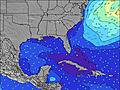 | 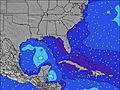 | 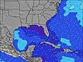 | 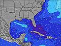 | ||||||||||||||
Wave Height (m) Direction Period (s) | ESE 6 | ESE 7 | ESE 7 | ESE 7 | SSE 4 | ESE 7 | ESE 7 | ESE 7 | ESE 7 | SE 5 | ESE 6 | ESE 7 | ESE 6 | ESE 7 | ESE 7 | ESE 8 | ESE 8 | ESE 8 | ESE 7 | ESE 7 | ESE 7 |
Wave Graph | |||||||||||||||||||||
27 | 10 | 21 | 21 | 28 | 29 | 35 | 47 | 18 | 24 | 44 | 56 | 57 | 91 | 134 | 142 | 119 | 120 | 62 | 76 | 44 | |
Wind (km/h) | |||||||||||||||||||||
Wind State on-shore cross-onshore cross-shore cross-offshore off-shore glassy | cross-off | cross-off | cross-off | cross-off | cross | cross-off | cross | cross-on | cross | glassy | on | cross-on | cross-on | cross-on | on | cross-on | on | cross | glassy | on | cross |
High Tide | 12:12PM1.76m | 00:26AM1.71m | 12:58PM1.80m | 1:13AM1.66m | 1:51PM1.84m | 2:07AM1.61m | 2:50PM1.87m | 3:09AM1.57m | 3:57PM1.91m | 4:18AM1.56m | 5:07PM1.98m | 5:28AM1.60m | 6:13PM2.05m | ||||||||
Low Tide | 6:38PM0.20m | 7:00AM0.04m | 7:35PM0.23m | 7:52AM0.04m | 8:39PM0.26m | 8:49AM0.04m | 9:45PM0.26m | 9:51AM0.02m | 10:51PM0.23m | 10:54AM-0.00m | 11:55PM0.18m | 11:58AM-0.04m | 00:56AM0.11m | ||||||||
6:43 | — | — | 6:45 | — | — | 6:45 | — | — | 6:46 | — | — | 6:46 | — | — | 6:47 | — | — | 6:48 | — | — | |
— | 8:17 | — | — | 8:17 | — | — | 8:16 | — | — | 8:15 | — | — | 8:15 | — | — | 8:14 | — | — | 8:13 | — | |
mm | 4 | 4 | 5 | — | — | 2 | — | — | 4 | 7 | 1 | 2 | 2 | — | — | — | — | 2 | 1 | — | 2 |
Temp °C | 29 | 29 | 28 | 28 | 32 | 30 | 29 | 30 | 28 | 26 | 29 | 29 | 30 | 30 | 29 | 28 | 29 | 28 | 28 | 29 | 29 |
Feels °C | 29 | 30 | 29 | 30 | 33 | 31 | 31 | 29 | 30 | 30 | 32 | 32 | 32 | 30 | 32 | 31 | 30 | 30 | 32 | 31 | 32 |
Swell 1 Height (m) Direction Period (s) | ESE 6 | ESE 7 | ESE 7 | ESE 7 | ESE 7 | ESE 7 | ESE 7 | ESE 7 | ESE 7 | SE 5 | — | E 11 | E 10 | E 10 | E 10 | E 10 | ESE 8 | E 9 | ESE 7 | ESE 7 | E 9 |
27 | 10 | 21 | 21 | 10 | 29 | 35 | 47 | 17 | 24 | — | 2 | 2 | 2 | 2 | 2 | 119 | 2 | 62 | 76 | 2 | |
Swell 2 Height (m) Direction Period (s) | — | — | — | — | — | — | — | — | — | ESE 7 | — | — | — | — | — | — | E 9 | — | — | E 9 | — |
— | — | — | — | — | — | — | — | — | 10 | — | — | — | — | — | — | 2 | — | — | 2 | — | |
Swell 3 Height (m) Direction Period (s) | — | — | — | — | — | — | — | — | — | — | — | — | — | — | — | — | — | — | — | — | — |
— | — | — | — | — | — | — | — | — | — | — | — | — | — | — | — | — | — | — | — | — | |
Wind waves Height (m) Direction Period (s) | SSW 5 | S 5 | S 4 | S 4 | SSE 4 | S 4 | — | — | SE 4 | — | ESE 6 | ESE 7 | ESE 6 | ESE 7 | ESE 7 | ESE 8 | — | ESE 8 | — | — | ESE 7 |
28 | 60 | 14 | 5 | 28 | 14 | — | — | 18 | — | 44 | 56 | 57 | 91 | 134 | 142 | — | 120 | — | — | 44 | |
Nearest Offshore or Glassy | |||||||||||||||||||||
Distance (km) | 92 | 389 | 795 | 321 | 111 | 111 | 111 | 154 | 1128 | 42 | 2065 | 1277 | 1104 | 736 | 484 | 365 | 365 | 42 | 29 | 1064 | 42 |
Best forecast wave conditions in North Florida | |||||||||||||||||||||
Best forecast wave conditions in United States | |||||||||||||||||||||
Header Global | |||||||||||||||||||||
- Map Icons:
 Break
Break Live Wave Height (m)
 Live Wind Speed (km/h)
 Surf Rating (10 Max)
 Ocean Swells (m)
- Wind Speed (km/h)
Latest Updates


FREE! Surf-Forecast.com widget for your website
The surf report / weather widget below is available to embed on third party websites free of charge and provides a summary of our Hooks surf forecast. Simply grab the html code snippet that we provide and paste it into your own site. You can choose your preferred language and metric/imperial units for the surf forecast feed to suit users of your site. Click here to get the code.
Information about the Hooks Surf forecast
The above surf forecast table for Hooks provides essential information for determining whether the surfing conditions will be good over the next 16 days. A general guide to surfing at Hooks can be found by selecting the local surf guide option on the grey menu. Our Hooks surf forecast is unique since it includes wave energy (power) that defines the real feel of the surf rather than just the height or the period. If you surf the same spot (Hooks) regularly then make a mental note of the wave energy from the surf forecast table each time you go. Very soon you may start to choose your surf days based on the wave energy alone combined with our forecast of favourable offshore wind conditions. Our star ratings will help here and of course you will also find the usual wave height and period predictions on our surf forecasts as well as a full break down of the swell components under our advanced users option (to reveal that, click the little Einstein character under the tide times).
Further information to help with frequently asked questions about our surf forecast for Hooks may be found under the help tab on the top menu and also by moving your mouse over the question marks on the surf forecast table itself. Please always bear in mind that the forecast is for near-shore open water and local factors at each surf break influence the actual breaking wave height, such as the beach / reef profile, water depths offshore and shelter.
Hooks is 3 km (2 miles) from Fernandina Beach. If you plan a vacation in North Florida, look for hotels and other accommodation in Fernandina Beach. Fernandina Beach has rooms for a wide range of budgets as well as car hire and transport links.
 Nearest