

Surf Forecasts:

Corino surf forecast from 15 Jul 2026:
- Most powerful swell: Wednesday 22 Jul, 11AM (local time) - 2.5ft (0.7m), 6s period, NNW swell with 34 kJ wave energy.
Best Forecast Surf Conditions for Corino this week:
The most powerful waves expected at Corino in the next 16 days are 0.7m 6s and forecast to arrive on Wednesday (Jul 22) at 11AM. Winds are predicted to be cross-onshore at the time the swell arrives. The largest open ocean swell (not directed at the beach) is 1.0m 6s period and expected on Wednesday (Jul 22) at 5PM.
| Wave Type | Time (CEST) & Date | Wave Height & Period |
|---|---|---|
| Next good surf (1 star+) | - | - |
| Best Surf | - | - |
| Most Powerful | 11AM (Wed 22nd Jul) | 2.5ft (0.7m) 6s |
Table - best surf conditions forecast for Corino over the next 16 days.
The Lowdown
Alright, Rusty here. Let's get real about what we've got on the table for the next couple of weeks. I've looked over the chart for Corino, and to be straight with you, it's a pretty grim picture. The first record we see isn't until Wednesday the 15th of July, and it's more of a heads-up that we're in for a long, dry spell.
The ocean is putting out basically nothing. For the first week and a half, the wave energy is a flat zero or just a few points. We're talking about days on end—from the 15th right through to the 24th of July—where the swell is absent or so tiny it's not worth paddling out for. A wave comment of "poor surf conditions" is stamped on every single entry. Swell heights only occasionally reach 2 ft, and the period is short and weak. Honestly, on days like the 18th of July when it's glassy but there's no swell, you might as well be staring at a lake.
When we do see the first real bump of pulse, it's around the 24th of July. A slight peak shows up on the Friday afternoon, with a 2 ft swell from the W, a period of 7 seconds, and a combined energy of (37). That's not exactly a groundswell, and the wind is a moderate onshore breeze out of the NNW, making it choppy. Not your friend.
Corino (a reef break) is a spot that can handle swell from the WNW, but with the wind turning moderate cross-onshore on that Friday the 24th, it’s rough. And with the swell being under 5 ft, it's safe for beginners but the quality won't be there. After that, a tiny 2 ft from the N on Saturday the 25th afternoon with a 4-second period is all that shows up before the whole system dies again, leaving us glassy but flat into the start of August.
The water temperature is running at 81°F with an anomaly of 5°F, which is much warmer than normal for the time of year. You won't be needing a wetsuit, but you will need a board and a lot of patience.
To be honest, there’s no standout day here. The whole 16-day window is quiet. If you're desperate, the tiny window on Friday the 24th afternoon has the most bump, but it’s short, weak, and messy. For the rest, it’s a flat, blank run. With the ocean this sleepy, the forecast can only get better, but right now, it’s a write-off.
Stay patient,
Rusty.
Short Range ForecastMostly dry. Warm (max 37°C on Fri afternoon, min 28°C on Wed night). Wind will be generally light. | Days 5-7 Weather SummaryMostly dry. Warm (max 35°C on Sun morning, min 29°C on Sat night). Wind will be generally light. | ||||||||||||||||||||
Wed 15 | Thursday 16 | Friday 17 | Saturday 18 | Sunday 19 | Monday 20 | Tuesday 21 | |||||||||||||||
PM | Night | AM | PM | Night | AM | PM | Night | AM | PM | Night | AM | PM | Night | AM | PM | Night | AM | PM | Night | AM | |
Swell Height Map | 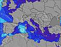 | 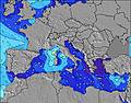 | 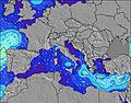 | 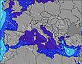 | 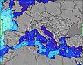 | 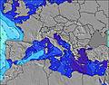 | 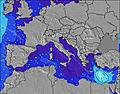 | 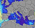 | |||||||||||||
Wave Height (m) Direction Period (s) | SW 5 | WNW 5 | W 5 | W 6 | — | — | — | — | — | — | W 4 | W 4 | W 4 | W 4 | W 4 | WNW 4 | W 4 | W 5 | W 5 | W 5 | W 6 |
Wave Graph | |||||||||||||||||||||
0 | 5 | 2 | 1 | 0 | 0 | 0 | 0 | 0 | 0 | 3 | 1 | 3 | 1 | 1 | 4 | 1 | 4 | 15 | 8 | 12 | |
Wind (km/h) | |||||||||||||||||||||
Wind State on-shore cross-onshore cross-shore cross-offshore off-shore glassy | cross | cross-on | cross-on | on | cross | cross-on | cross-on | cross-off | glassy | cross-on | cross | cross-off | on | glassy | cross | cross-off | cross-off | cross-off | on | cross-on | cross-on |
High Tide | 11:12PM0.39m | 11:09AM0.29m | 11:56PM0.38m | 11:55AM0.28m | 00:39AM0.37m | 12:42PM0.27m | 1:21AM0.35m | 1:32PM0.26m | 2:02AM0.32m | 2:27PM0.25m | 2:45AM0.29m | 3:31PM0.24m | 3:32AM0.26m | ||||||||
Low Tide | 4:32PM-0.02m | 5:30AM0.05m | 5:16PM-0.01m | 6:16AM0.06m | 6:00PM0.01m | 7:02AM0.06m | 6:43PM0.03m | 7:47AM0.07m | 7:28PM0.06m | 8:32AM0.08m | 8:18PM0.09m | 9:21AM0.09m | 9:17PM0.12m | 10:16AM0.10m | |||||||
— | — | 5:58 | — | — | 5:58 | — | — | 6:00 | — | — | 6:01 | — | — | 6:01 | — | — | 6:01 | — | — | 6:03 | |
8:31 | — | — | 8:30 | — | — | 8:30 | — | — | 8:30 | — | — | 8:29 | — | — | 8:29 | — | — | 8:28 | — | 8:27 | |
mm | — | — | — | — | — | — | — | — | — | — | — | — | — | — | — | — | — | — | — | — | — |
Temp °C | 30 | 30 | 34 | 33 | 33 | 34 | 37 | 35 | 33 | 34 | 33 | 35 | 35 | 33 | 35 | 35 | 32 | 31 | 32 | 31 | 30 |
Feels °C | 33 | 33 | 34 | 33 | 33 | 34 | 37 | 35 | 34 | 35 | 32 | 35 | 36 | 34 | 33 | 33 | 33 | 33 | 33 | 31 | 30 |
Swell 1 Height (m) Direction Period (s) | SW 5 | WNW 5 | W 5 | — | — | — | — | — | — | — | W 4 | W 4 | — | W 4 | W 4 | WNW 4 | W 4 | W 5 | W 5 | NNW 6 | NNW 6 |
4 | 5 | 2 | — | — | — | — | — | — | — | 3 | 1 | — | 1 | 1 | 4 | 1 | 4 | 15 | 25 | 25 | |
Swell 2 Height (m) Direction Period (s) | — | — | — | W 6 | — | — | — | — | — | — | — | N 5 | — | — | N 5 | — | — | — | — | W 5 | W 6 |
— | — | — | 1 | — | — | — | — | — | — | — | 1 | — | — | 1 | — | — | — | — | 8 | 12 | |
Swell 3 Height (m) Direction Period (s) | — | — | — | — | — | — | — | — | — | — | — | — | — | — | — | — | — | — | — | — | — |
— | — | — | — | — | — | — | — | — | — | — | — | — | — | — | — | — | — | — | — | — | |
Wind waves Height (m) Direction Period (s) | WSW 5 | — | — | — | — | — | — | — | — | — | — | — | W 4 | — | — | — | — | — | NNW 3 | — | — |
5 | — | — | — | — | — | — | — | — | — | — | — | 3 | — | — | — | — | — | 3 | — | — | |
Nearest Offshore or Glassy | |||||||||||||||||||||
Distance (km) | 1817 | 1179 | 1862 | 2212 | 1651 | 1687 | 1806 | 1013 | 1860 | 1704 | 1744 | 635 | 1790 | 1345 | 1336 | 1485 | 489 | 416 | 1917 | 49 | 49 |
Best forecast wave conditions in Sicily | |||||||||||||||||||||
Best forecast wave conditions in Italy | |||||||||||||||||||||
Header Global | |||||||||||||||||||||
- Map Icons:
 Break
Break Live Wave Height (m)
 Live Wind Speed (km/h)
 Surf Rating (10 Max)
 Ocean Swells (m)
- Wind Speed (km/h)


FREE! Surf-Forecast.com widget for your website
The surf report / weather widget below is available to embed on third party websites free of charge and provides a summary of our Corino surf forecast. Simply grab the html code snippet that we provide and paste it into your own site. You can choose your preferred language and metric/imperial units for the surf forecast feed to suit users of your site. Click here to get the code.
Information about the Corino Surf forecast
The above surf forecast table for Corino provides essential information for determining whether the surfing conditions will be good over the next 16 days. A general guide to surfing at Corino can be found by selecting the local surf guide option on the grey menu. Our Corino surf forecast is unique since it includes wave energy (power) that defines the real feel of the surf rather than just the height or the period. If you surf the same spot (Corino) regularly then make a mental note of the wave energy from the surf forecast table each time you go. Very soon you may start to choose your surf days based on the wave energy alone combined with our forecast of favourable offshore wind conditions. Our star ratings will help here and of course you will also find the usual wave height and period predictions on our surf forecasts as well as a full break down of the swell components under our advanced users option (to reveal that, click the little Einstein character under the tide times).
Further information to help with frequently asked questions about our surf forecast for Corino may be found under the help tab on the top menu and also by moving your mouse over the question marks on the surf forecast table itself. Please always bear in mind that the forecast is for near-shore open water and local factors at each surf break influence the actual breaking wave height, such as the beach / reef profile, water depths offshore and shelter.
Corino is 9 km (6 miles) from the city of Erice. If you plan a holiday in Sicily, look for hotels and other accommodation in Erice. Erice has rooms for a wide range of budgets as well as car hire and transport links.
 Nearest