

Surf Forecasts:

Panoramas surf forecast from 3 Aug 2026:
- Best quality surf: Tuesday 4 Aug, 10PM (local time) - 5.5ft (1.7m), 7s period, NNW swell with cross-offshore winds.
- Most powerful swell: Tuesday 4 Aug, 10PM (local time) - 5.5ft (1.7m), 7s period, NNW swell with 311 kJ wave energy.
- Next surfable swell (1★+): Monday 3 Aug, 10PM (local time) - 4ft (1.2m), 7s period with NNW swell.
Best Forecast Surf Conditions for Panoramas this week:
The surf forecast for Panoramas over the next 16 days: The first swell (rated 1 star or higher) is forecast to arrive on Monday (Aug 03) at 10PM. The primary swell is predicted to be 1.2m and 7s period with a secondary swell of 0.3m and 9s. The wind is predicted to be glassy as the swell arrives.
The most powerful waves expected at Panoramas in the next 16 days are 1.7m 7s and forecast to arrive on Tuesday (Aug 04) at 10PM. Winds are predicted to be cross-offshore at the time the swell arrives.
| Wave Type | Time (+01) & Date | Wave Height & Period |
|---|---|---|
| Next good surf (1 star+) | 10PM (Mon 3rd Aug) | 4ft (1.2m) 7s |
| Best Surf | 10PM (Tue 4th Aug) | 5.5ft (1.7m) 7s |
| Most Powerful | 10PM (Tue 4th Aug) | 5.5ft (1.7m) 7s |
Table - best surf conditions forecast for Panoramas over the next 16 days.
The Lowdown
Alright folks, Rusty here. Let’s take a look at what we’ve got coming up. It’s a bit of a mixed bag, but there are some windows to get wet.
The good news is that Panoramas is on the cards, but the bad news is the first few days are pretty weak. The water temp is sitting at 73°, which is a touch warmer than normal for this time of year, so you can leave the thick wetsuit at home.
We start things off on Monday morning, August 3rd. It’s small, with swell around 2ft from the NW. The period is short at 7 seconds, so the energy is pretty weak (80). But, the wind is glassy from the S, so if you’re desperate, you might find a little knee-high dribbler. The afternoon gets messy though, with a cross-shore wind picking up, so don't bother after lunch.
Tuesday the 4th is more of the same in the morning: 2ft, glassy, weak (79). It’s surfable but very ordinary. Tuesday afternoon is a write-off with strong cross-shore winds.
Wednesday morning, August 5th, is your first real chance. Glassy conditions, 3ft from the NW, period bumps up to 8 seconds. The combined energy is still low (99), but it’s clean and should offer a few fun ones for the longboard or a foamie.
Thursday the 6th and Friday the 7th look pretty average, with cross and cross-onshore winds messing up the surface. Friday afternoon does go glassy again, with a 4ft NW swell (184), so it’s worth a look for a sunset session.
The standout window looks like Saturday morning, August 8th. Glassy conditions, 4ft from the NW, and 149 energy. It’s not huge, but clean and consistent. For this spot, that’s about as good as it gets in this stretch.
After that, the forecast gets a bit grim. From Sunday the 9th all the way through to Tuesday the 18th, the swell stays small (2ft to 5ft) and the winds are mostly cross or cross-onshore. There’s a brief clean moment on Thursday morning, August 13th, with a cross-offshore wind from the SE, but it’s only 2ft. The 14th and 15th have some bigger energy readings (366 and 356) with 5ft and 6ft swells, but the wind is cross-onshore and fairly choppy, so the quality drops. At that size, it’s still ok for intermediates, but the chop will make it frustrating.
Honestly, for the second week, don't hold your breath. It’s small, mostly bumpy, and not worth planning around. Keep an eye on that Saturday morning, August 8th, because that’s the best we’ve got. The setup here is a beach and reef, and with the NW swell, it needs those clean windows to work.
Rusty.
Short Range ForecastMostly dry. Warm (max 39°C on Tue afternoon, min 23°C on Wed night). Winds increasing (calm on Mon night, fresh winds from the NNW by Tue afternoon). | Days 4-6 Weather SummaryMostly dry. Warm (max 31°C on Sat afternoon, min 21°C on Sat night). Wind will be generally light. | ||||||||||||||||||||
Monday 3 | Tuesday 4 | Wednesday 5 | Thursday 6 | Friday 7 | Saturday 8 | Sunday 9 | |||||||||||||||
AM | PM | Night | AM | PM | Night | AM | PM | Night | AM | PM | Night | AM | PM | Night | AM | PM | Night | AM | PM | Night | |
Swell Height Map | 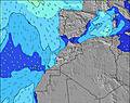 | 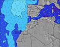 | 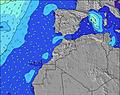 | 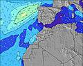 | 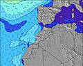 | 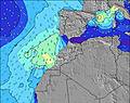 | 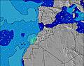 | ||||||||||||||
Wave Height (m) Direction Period (s) | NW 7 | NW 7 | NW 7 | NW 7 | NNW 7 | NW 8 | NW 8 | NW 8 | NW 8 | NW 8 | NW 8 | NW 9 | NW 9 | NW 8 | NW 8 | NW 8 | NW 8 | NW 8 | NW 7 | NW 7 | NW 7 |
Wave Graph | |||||||||||||||||||||
53 | 69 | 71 | 47 | 211 | 147 | 99 | 186 | 153 | 84 | 191 | 210 | 197 | 184 | 205 | 149 | 122 | 142 | 60 | 88 | 91 | |
Wind (km/h) | |||||||||||||||||||||
Wind State on-shore cross-onshore cross-shore cross-offshore off-shore glassy | glassy | cross | glassy | glassy | cross | cross-off | glassy | cross | glassy | cross | cross-on | glassy | cross | glassy | glassy | glassy | cross-on | glassy | glassy | cross-on | glassy |
High Tide | 5:36PM2.60m | 6:01AM2.39m | 6:18PM2.47m | 6:48AM2.29m | 7:10PM2.31m | 7:47AM2.19m | 8:18PM2.16m | 9:03AM2.13m | 9:46PM2.10m | 10:29AM2.18m | 11:14PM2.17m | 11:46AM2.36m | 00:25AM2.34m | ||||||||
Low Tide | 11:18AM0.41m | 11:47PM0.38m | 11:59AM0.51m | 00:30AM0.49m | 12:48PM0.63m | 1:22AM0.63m | 1:53PM0.75m | 2:32AM0.75m | 3:18PM0.80m | 4:00AM0.79m | 4:52PM0.71m | 5:24AM0.69m | 6:08PM0.51m | ||||||||
6:56 | — | — | 6:58 | — | — | 6:58 | — | — | 6:58 | — | — | 7:00 | — | — | 7:00 | — | — | 7:01 | — | — | |
— | 8:31 | — | — | 8:30 | — | — | 8:30 | — | — | 8:29 | — | — | 8:28 | — | — | 8:27 | — | — | 8:25 | — | |
mm | — | — | — | — | — | — | — | — | — | — | — | — | — | — | — | — | — | — | — | — | — |
Temp °C | 32 | 38 | 30 | 33 | 39 | 33 | 29 | 35 | 27 | 27 | 30 | 24 | 28 | 30 | 25 | 27 | 31 | 25 | 26 | 30 | 23 |
Feels °C | 31 | 34 | 31 | 32 | 33 | 33 | 30 | 35 | 28 | 29 | 32 | 25 | 29 | 32 | 27 | 28 | 32 | 27 | 28 | 32 | 24 |
Swell 1 Height (m) Direction Period (s) | NW 7 | WNW 9 | NW 7 | NW 7 | — | NW 8 | NW 8 | WNW 10 | NW 8 | NW 8 | NW 8 | NW 9 | NW 9 | NW 8 | NW 8 | NW 8 | NW 8 | NW 8 | NW 7 | WNW 8 | NW 7 |
53 | 29 | 71 | 47 | — | 147 | 99 | 20 | 153 | 84 | 191 | 210 | 197 | 184 | 205 | 149 | 122 | 142 | 60 | 13 | 91 | |
Swell 2 Height (m) Direction Period (s) | WNW 8 | — | WNW 9 | WNW 9 | — | — | — | — | — | WNW 10 | — | — | — | — | — | — | — | — | WNW 8 | — | — |
27 | — | 16 | 32 | — | — | — | — | — | 31 | — | — | — | — | — | — | — | — | 7 | — | — | |
Swell 3 Height (m) Direction Period (s) | — | — | — | — | — | — | — | — | — | WNW 10 | — | — | — | — | — | — | — | — | — | — | — |
— | — | — | — | — | — | — | — | — | 37 | — | — | — | — | — | — | — | — | — | — | — | |
Wind waves Height (m) Direction Period (s) | — | NW 7 | — | — | NNW 7 | — | — | NW 8 | — | — | — | — | — | — | — | — | — | — | — | NW 7 | — |
— | 69 | — | — | 211 | — | — | 186 | — | — | — | — | — | — | — | — | — | — | — | 88 | — | |
Nearest Offshore or Glassy | |||||||||||||||||||||
Distance (km) | 0 | 439 | 0 | 0 | 439 | 0 | 0 | 1 | 0 | 3 | 661 | 0 | 3 | 0 | 0 | 0 | 734 | 0 | 0 | 661 | 0 |
Best forecast wave conditions in Central Morocco | |||||||||||||||||||||
Best forecast wave conditions in Morocco | |||||||||||||||||||||
Header Global | |||||||||||||||||||||
- Map Icons:
 Break
Break Live Wave Height (m)
 Live Wind Speed (km/h)
 Surf Rating (10 Max)
 Ocean Swells (m)
- Wind Speed (km/h)
Latest Updates


FREE! Surf-Forecast.com widget for your website
The surf report / weather widget below is available to embed on third party websites free of charge and provides a summary of our Panoramas surf forecast. Simply grab the html code snippet that we provide and paste it into your own site. You can choose your preferred language and metric/imperial units for the surf forecast feed to suit users of your site. Click here to get the code.
Information about the Panoramas Surf forecast
The above surf forecast table for Panoramas provides essential information for determining whether the surfing conditions will be good over the next 16 days. A general guide to surfing at Panoramas can be found by selecting the local surf guide option on the grey menu. Our Panoramas surf forecast is unique since it includes wave energy (power) that defines the real feel of the surf rather than just the height or the period. If you surf the same spot (Panoramas) regularly then make a mental note of the wave energy from the surf forecast table each time you go. Very soon you may start to choose your surf days based on the wave energy alone combined with our forecast of favourable offshore wind conditions. Our star ratings will help here and of course you will also find the usual wave height and period predictions on our surf forecasts as well as a full break down of the swell components under our advanced users option (to reveal that, click the little Einstein character under the tide times).
Further information to help with frequently asked questions about our surf forecast for Panoramas may be found under the help tab on the top menu and also by moving your mouse over the question marks on the surf forecast table itself. Please always bear in mind that the forecast is for near-shore open water and local factors at each surf break influence the actual breaking wave height, such as the beach / reef profile, water depths offshore and shelter.
Panoramas is 6 km (4 miles) from the city of Agadir. If you plan a holiday in Central Morocco, look for hotels and other accommodation in Agadir. Agadir has rooms for a wide range of budgets as well as car hire and transport links.
 Nearest