

Surf Forecasts:

Pointe d'Imessouane surf forecast from 3 Aug 2026:
- Best quality surf: Thursday 6 Aug, 1AM (local time) - 7.5ft (2.3m), 7s period, NNW swell with cross-offshore winds.
- Most powerful swell: Saturday 8 Aug, 7PM (local time) - 10ft (3.0m), 8s period, NNW swell with 998 kJ wave energy.
- Next surfable swell (1★+): Monday 3 Aug, 7AM (local time) - 5ft (1.5m), 6s period with N swell.
Best Forecast Surf Conditions for Pointe d'Imessouane this week:
The surf forecast for Pointe d'Imessouane over the next 16 days: The first swell (rated 1 star or higher) is forecast to arrive on Monday (Aug 03) at 7AM. The primary swell is predicted to be 1.5m and 6s period with a secondary swell of 0.4m and 8s. Another secondary swell of 0.3m and 10s is also forecast. The wind is predicted to be cross-offshore as the swell arrives.
The most powerful waves expected at Pointe d'Imessouane in the next 16 days are 3.0m 8s and forecast to arrive on Saturday (Aug 08) at 7PM. Winds are predicted to be cross-offshore at the time the swell arrives.
| Wave Type | Time (+01) & Date | Wave Height & Period |
|---|---|---|
| Next good surf (1 star+) | 7AM (Mon 3rd Aug) | 5ft (1.5m) 6s |
| Best Surf | 1AM (Thu 6th Aug) | 7.5ft (2.3m) 7s |
| Most Powerful | 7PM (Sat 8th Aug) | 10ft (3.0m) 8s |
Table - best surf conditions forecast for Pointe d'Imessouane over the next 16 days.
The Lowdown
Alright, Rusty here. Let’s have a look at what’s cookin’ over the next couple of weeks.
The first real chance to get wet comes Monday morning, August 3rd. It’s not a classic, though. We’ve got a 5ft swell from the NNW, but the period is a short, weak 6 seconds, and the energy is low (268). The wind is a light cross-shore, so it’s not blown out, but the waves are gonna be pretty crumbly and won’t hold much shape. The afternoon gets worse with the wind picking up, so don’t hold your breath for the first day.
Tuesday morning, August 4th, is a bit better. The wind turns cross-offshore, cleaning things up nicely. Still 5ft from the NNW, but with that clean surface, it’ll be more fun than the day before. The energy is still moderate (255). The afternoon, however, is a write-off with a strong cross-shore wind and a lumpy 8ft mess.
The standout… and I mean the real standout… is Friday morning, August 7th. The swell holds at 7ft from the NNW, but the period stretches to 8 seconds, giving it a bit more juice (505 energy). The magic is in the wind: glassy, dead calm. That’s a recipe for clean, lined-up waves at Pointe d'Imessouane. The offshore wind direction for this spot is ENE, and we’re getting glass, so expect some silky runners. This is the best session on offer. The afternoon blows out again, so get it while you can.
Saturday the 8th is a write-off, but we get a little reprieve on Tuesday the 11th and Wednesday the 12th mornings. Both mornings have glassy conditions with a 5ft NNW swell, but the energy is only moderate (235-280). It’s clean, but small. Worth a paddle if you’re itching, but not a highlight.
After that, from the 13th to the 18th, the waves get bigger—pushing 8ft to 8ft—but the wind is never ideal. It’s mostly cross or cross-off, and the period stays short at 6-7 seconds. The energy climbs into the high hundreds (over 900 on the 6th afternoon, and 735 on the 15th afternoon), but the short period and messy wind mean these are blown-out, lumpy, and only really for the experienced crew. The 8ft days are too big for beginners, and the short period makes it dumpy at a point break like this.
The final day, Tuesday morning August 18th, sees the swell drop right back to 4ft with weak energy (110). It’s clean, but barely surfable. A fizzle to end the run.
The water temperature? No data on that in the readout, so I can’t tell you if it’s warm or cold relative to normal. But the air is clear most days, so it’ll be a good session on that Friday.
Bottom line: Friday morning, August 7th, is your golden ticket. Glassy, clean, 7ft from the NNW. Get there early. The rest of the window is a mix of small clean windows and bigger, wind-affected slop.
Rusty.
Short Range ForecastMostly dry. Warm (max 36°C on Mon morning, min 25°C on Tue night). Winds increasing (light winds from the NNW on Mon morning, fresh winds from the N by Wed afternoon). | Days 4-6 Weather SummaryMostly dry. Warm (max 32°C on Sat afternoon, min 20°C on Thu night). Winds increasing (calm on Thu night, strong winds from the N by Sat afternoon). | ||||||||||||||||||||
Monday 3 | Tuesday 4 | Wednesday 5 | Thursday 6 | Friday 7 | Saturday 8 | Sunday 9 | |||||||||||||||
AM | PM | Night | AM | PM | Night | AM | PM | Night | AM | PM | Night | AM | PM | Night | AM | PM | Night | AM | PM | Night | |
Swell Height Map | 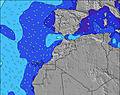 | 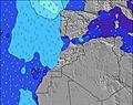 | 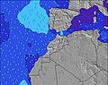 | 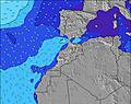 | 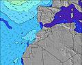 | 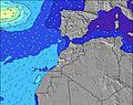 | 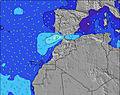 | ||||||||||||||
Wave Height (m) Direction Period (s) | NNW 6 | NNW 6 | N 6 | N 6 | NNW 7 | NNW 7 | NNW 7 | NNW 7 | NNW 7 | NNW 7 | NNW 8 | NNW 8 | NNW 8 | NNW 8 | NNW 8 | NNW 7 | NNW 7 | NNW 7 | NNW 7 | NNW 7 | NNW 7 |
Wave Graph | |||||||||||||||||||||
200 | 237 | 251 | 206 | 458 | 423 | 307 | 648 | 503 | 383 | 760 | 725 | 474 | 450 | 494 | 365 | 685 | 461 | 239 | 374 | 345 | |
Wind (km/h) | |||||||||||||||||||||
Wind State on-shore cross-onshore cross-shore cross-offshore off-shore glassy | cross | cross | cross-off | cross-off | cross | cross-off | cross-off | cross-off | cross-off | cross-off | cross | glassy | glassy | cross | cross-off | cross-on | cross-off | cross-off | cross | cross | glassy |
High Tide | 5:24AM2.49m | 5:39PM2.64m | 6:04AM2.42m | 6:21PM2.50m | 6:51AM2.32m | 7:12PM2.34m | 7:49AM2.22m | 8:21PM2.19m | 9:05AM2.16m | 9:48PM2.12m | 10:31AM2.22m | 11:15PM2.20m | 11:48AM2.39m | 00:27AM2.37m | |||||||
Low Tide | 11:20AM0.42m | 11:49PM0.39m | 12:00PM0.52m | 00:31AM0.50m | 12:50PM0.64m | 1:24AM0.64m | 1:55PM0.76m | 2:35AM0.77m | 3:21PM0.81m | 4:03AM0.80m | 4:55PM0.72m | 5:26AM0.70m | 6:11PM0.52m | ||||||||
6:56 | — | — | 6:58 | — | — | 6:58 | — | — | 6:58 | — | — | 7:00 | — | — | 7:00 | — | — | 7:01 | — | — | |
— | 8:31 | — | — | 8:31 | — | — | 8:30 | — | — | 8:30 | — | — | 8:29 | — | — | 8:28 | — | — | 8:27 | — | |
mm | — | — | — | — | — | — | — | — | — | — | — | — | — | — | — | — | — | — | — | — | — |
Temp °C | 36 | 32 | 30 | 33 | 31 | 28 | 32 | 32 | 28 | 31 | 31 | 26 | 26 | 30 | 27 | 29 | 32 | 27 | 28 | 28 | 24 |
Feels °C | 33 | 29 | 26 | 31 | 28 | 26 | 30 | 29 | 26 | 31 | 30 | 26 | 27 | 28 | 27 | 29 | 27 | 25 | 28 | 27 | 24 |
Swell 1 Height (m) Direction Period (s) | WNW 10 | WNW 10 | WNW 9 | WNW 9 | — | WNW 11 | NW 8 | — | NW 8 | NNW 10 | NW 8 | NNW 8 | NNW 8 | WNW 9 | WNW 9 | WNW 9 | WNW 9 | NW 9 | N 10 | — | NNW 7 |
52 | 18 | 16 | 32 | — | 12 | 82 | — | 131 | 38 | 138 | 725 | 474 | 34 | 17 | 16 | 15 | 19 | 48 | — | 345 | |
Swell 2 Height (m) Direction Period (s) | N 9 | — | WNW 9 | WNW 9 | — | — | — | — | — | WNW 10 | WNW 10 | — | WNW 10 | — | WNW 10 | WNW 9 | NW 11 | — | WNW 8 | — | — |
6 | — | 15 | 17 | — | — | — | — | — | 39 | 20 | — | 31 | — | 18 | 16 | 5 | — | 13 | — | — | |
Swell 3 Height (m) Direction Period (s) | WNW 10 | — | — | — | — | — | — | — | — | — | — | — | — | — | — | — | — | — | N 10 | — | — |
10 | — | — | — | — | — | — | — | — | — | — | — | — | — | — | — | — | — | 2 | — | — | |
Wind waves Height (m) Direction Period (s) | NNW 6 | NNW 6 | N 6 | N 6 | NNW 7 | NNW 7 | NNW 7 | NNW 7 | NNW 7 | NNW 7 | NNW 8 | — | — | NNW 8 | NNW 8 | NNW 7 | NNW 7 | NNW 7 | NNW 7 | NNW 7 | — |
200 | 237 | 251 | 206 | 458 | 423 | 307 | 648 | 503 | 383 | 760 | — | — | 450 | 494 | 365 | 685 | 461 | 239 | 374 | — | |
Nearest Offshore or Glassy | |||||||||||||||||||||
Distance (km) | 31 | 444 | 31 | 0 | 444 | 31 | 0 | 662 | 0 | 0 | 662 | 0 | 0 | 638 | 0 | 24 | 34 | 0 | 24 | 662 | 0 |
Best forecast wave conditions in Central Morocco | |||||||||||||||||||||
Best forecast wave conditions in Morocco | |||||||||||||||||||||
Header Global | |||||||||||||||||||||
- Map Icons:
 Break
Break Live Wave Height (m)
 Live Wind Speed (km/h)
 Surf Rating (10 Max)
 Ocean Swells (m)
- Wind Speed (km/h)
Latest Updates


FREE! Surf-Forecast.com widget for your website
The surf report / weather widget below is available to embed on third party websites free of charge and provides a summary of our Pointe d'Imessouane surf forecast. Simply grab the html code snippet that we provide and paste it into your own site. You can choose your preferred language and metric/imperial units for the surf forecast feed to suit users of your site. Click here to get the code.
Information about the Pointe d'Imessouane Surf forecast
The above surf forecast table for Pointe d'Imessouane provides essential information for determining whether the surfing conditions will be good over the next 16 days. A general guide to surfing at Pointe d'Imessouane can be found by selecting the local surf guide option on the grey menu. Our Pointe d'Imessouane surf forecast is unique since it includes wave energy (power) that defines the real feel of the surf rather than just the height or the period. If you surf the same spot (Pointe d'Imessouane) regularly then make a mental note of the wave energy from the surf forecast table each time you go. Very soon you may start to choose your surf days based on the wave energy alone combined with our forecast of favourable offshore wind conditions. Our star ratings will help here and of course you will also find the usual wave height and period predictions on our surf forecasts as well as a full break down of the swell components under our advanced users option (to reveal that, click the little Einstein character under the tide times).
Further information to help with frequently asked questions about our surf forecast for Pointe d'Imessouane may be found under the help tab on the top menu and also by moving your mouse over the question marks on the surf forecast table itself. Please always bear in mind that the forecast is for near-shore open water and local factors at each surf break influence the actual breaking wave height, such as the beach / reef profile, water depths offshore and shelter.
Pointe d'Imessouane is 42 km (26 miles) from the city of Agadir. If you plan a holiday in Central Morocco, look for hotels and other accommodation in Agadir. Agadir has rooms for a wide range of budgets as well as car hire and transport links.
 Nearest