

Surf Forecasts:

Sidi Bouzid Point and Beach surf forecast from 30 Jul 2026:
- Most powerful swell: Friday 31 Jul, 1PM (local time) - 4.5ft (1.3m), 6s period, N swell with 139 kJ wave energy.
Best Forecast Surf Conditions for Sidi Bouzid Point and Beach this week:
The most powerful waves expected at Sidi Bouzid Point and Beach in the next 16 days are 1.3m 6s and forecast to arrive on Friday (Jul 31) at 1PM. Winds are predicted to be cross-shore at the time the swell arrives.
| Wave Type | Time (+01) & Date | Wave Height & Period |
|---|---|---|
| Next good surf (1 star+) | - | - |
| Best Surf | - | - |
| Most Powerful | 1PM (Fri 31st Jul) | 4.5ft (1.3m) 6s |
Table - best surf conditions forecast for Sidi Bouzid Point and Beach over the next 16 days.
The Lowdown
Alright folks, Rusty here. Let’s have a look at what’s on offer for Sidi Bouzid Point and Beach over the next couple of weeks.
Honestly, it’s a pretty grim run for the first week and a half. We’ve got a long stretch from Thursday the 30th of July all the way through to the 8th of August where the wind is just a constant problem. The swell is small and weak – mostly under 3 ft – and the wind is cross or cross-onshore from the north and north-northeast, blowing at 12 to 18 mph. That’s kicking up a lumpy, choppy mess. The water temperature is a notable 68°, which is 4° colder than normal for this time of year, so you’ll be wanting a good thick wetsuit.
The wave energy during this period is weak, with the combined energy of all swells directed here sitting mostly between 89 and 115. It’s just not worth paddling out.
Things start to look a little more promising as we get into the second week. On Sunday the 9th of August, the swell picks up a bit with a 4 ft to 5 ft wave coming from the NNW, and the combined energy jumps to 302. That’s moderate energy, a real step up. But the wind is still cross-onshore from the NNE and NNW, so it’s going to be choppy and not as clean as we’d hope.
The best bet in this window is likely the morning of Wednesday the 12th of August. The swell is 5 ft from the NNW, with a period of 8 seconds. The combined energy is 294, which is moderate. The wind is still cross-shore from the NNE, but at 15 mph, it’s not as messy as the afternoons. It’s not glassy, but it’s about as good as it gets here. This size is still manageable for intermediates, but anything over 5 ft starts to push it for beginners.
Later in the week, on Thursday the 13th and Friday the 14th, the swell holds at 5 ft to 6 ft from the NNW, with the combined energy getting up to 440. That’s solid, moderate wave energy. But the wind remains cross-onshore, so the quality is still poor. The swell is getting a bit bigger, but it’s not lining up with the optimum direction from the NW, and the wind just won’t get out of the way.
Overall, there’s no true standout in this forecast. The Sidi Bouzid Point and Beach setup is a beach and point break, and with that persistent cross-onshore wind, it’s looking more like a day for the kite surfers than a good paddle session. The point might offer a little shelter on the bigger days, but it’s a stretch.
Keep an eye on the forecasts, because it tends not to stay this poor for long, but for now, I’d save the wax.
Rusty.
Short Range ForecastMostly dry. Warm (max 27°C on Sat morning, min 20°C on Thu morning). Winds decreasing (fresh winds from the NE on Fri morning, light winds from the NNE by Sat night). | Days 4-6 Weather SummaryMostly dry. Warm (max 24°C on Sun morning, min 21°C on Mon night). Mainly fresh winds. | ||||||||||||||||||||
Thursday 30 | Friday 31 | Saturday 1 | Sunday 2 | Monday 3 | Tuesday 4 | Wednesday 5 | |||||||||||||||
AM | PM | Night | AM | PM | Night | AM | PM | Night | AM | PM | Night | AM | PM | Night | AM | PM | Night | AM | PM | Night | |
Swell Height Map | 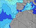 | 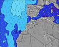 | 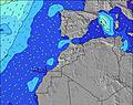 | 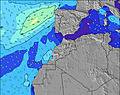 | 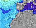 | 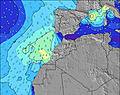 | 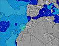 | ||||||||||||||
Wave Height (m) Direction Period (s) | NW 9 | N 6 | NNW 6 | NNW 6 | N 6 | NNW 6 | NNW 6 | N 6 | NNW 6 | NNW 6 | N 6 | NNW 6 | N 6 | N 6 | WNW 9 | WNW 9 | WNW 9 | NW 8 | NW 8 | WNW 8 | NW 10 |
Wave Graph | |||||||||||||||||||||
49 | 66 | 103 | 115 | 139 | 85 | 64 | 81 | 72 | 55 | 78 | 50 | 37 | 42 | 32 | 33 | 50 | 54 | 78 | 44 | 27 | |
Wind (km/h) | |||||||||||||||||||||
Wind State on-shore cross-onshore cross-shore cross-offshore off-shore glassy | cross | cross-on | cross | cross | cross | cross | cross | cross-on | cross-on | cross | cross-on | cross | cross | cross-on | cross | cross | cross-on | cross | cross-on | cross-on | cross-on |
High Tide | 3:41PM2.80m | 3:59AM2.57m | 4:13PM2.84m | 4:32AM2.58m | 4:45PM2.83m | 5:05AM2.57m | 5:18PM2.78m | 5:40AM2.53m | 5:54PM2.68m | 6:20AM2.45m | 6:36PM2.54m | 7:06AM2.36m | 7:28PM2.38m | ||||||||
Low Tide | 9:52PM0.27m | 9:55AM0.31m | 10:24PM0.25m | 10:27AM0.31m | 10:56PM0.25m | 11:00AM0.34m | 11:29PM0.30m | 11:37AM0.41m | 00:06AM0.38m | 12:17PM0.51m | 00:48AM0.50m | 1:07PM0.63m | 1:41AM0.64m | ||||||||
6:45 | — | — | 6:45 | — | — | 6:46 | — | — | 6:47 | — | — | 6:48 | — | — | 6:48 | — | — | 6:48 | — | — | |
— | 8:35 | — | — | 8:34 | — | — | 8:34 | — | — | 8:32 | — | — | 8:31 | — | — | 8:30 | — | — | 8:30 | — | |
mm | — | — | — | — | — | — | — | — | — | — | — | — | — | — | — | — | — | — | — | — | — |
Temp °C | 21 | 21 | 21 | 24 | 24 | 26 | 27 | 27 | 24 | 24 | 23 | 22 | 23 | 23 | 22 | 22 | 22 | 21 | 22 | 22 | 21 |
Feels °C | 19 | 19 | 21 | 21 | 22 | 26 | 24 | 24 | 25 | 23 | 21 | 21 | 21 | 20 | 22 | 21 | 21 | 21 | 22 | 21 | 21 |
Swell 1 Height (m) Direction Period (s) | NW 9 | NNW 8 | NNW 6 | — | W 13 | NNW 6 | NNW 6 | WNW 9 | NNW 6 | NNW 6 | WNW 9 | NNW 6 | WNW 10 | WNW 9 | WNW 9 | WNW 9 | WNW 9 | NW 8 | NW 8 | WNW 8 | NW 8 |
40 | 14 | 103 | — | 3 | 85 | 64 | 48 | 72 | 55 | 30 | 50 | 37 | 35 | 32 | 33 | 50 | 54 | 78 | 44 | 16 | |
Swell 2 Height (m) Direction Period (s) | — | NW 10 | WNW 10 | — | — | WNW 11 | WNW 10 | — | WNW 9 | WNW 9 | NNW 9 | WNW 8 | NNW 8 | NNW 8 | NNW 8 | N 7 | — | — | N 11 | NNW 11 | WNW 6 |
— | 15 | 10 | — | — | 12 | 36 | — | 44 | 45 | 7 | 28 | 6 | 6 | 6 | 4 | — | — | 2 | 11 | 7 | |
Swell 3 Height (m) Direction Period (s) | — | — | — | — | — | — | — | — | N 11 | NW 10 | — | NW 8 | — | — | — | — | — | — | — | NW 12 | NW 10 |
— | — | — | — | — | — | — | — | 2 | 4 | — | 3 | — | — | — | — | — | — | — | 5 | 27 | |
Wind waves Height (m) Direction Period (s) | NNW 5 | N 6 | — | NNW 6 | N 6 | — | — | N 6 | — | — | N 6 | — | N 6 | N 6 | N 5 | N 4 | N 4 | N 4 | N 5 | N 5 | N 5 |
49 | 66 | — | 115 | 139 | — | — | 81 | — | — | 78 | — | 34 | 42 | 17 | 8 | 19 | 13 | 11 | 28 | 25 | |
Nearest Offshore or Glassy | |||||||||||||||||||||
Distance (km) | 147 | 812 | 112 | 180 | 788 | 112 | 123 | 793 | 73 | 306 | 320 | 73 | 147 | 499 | 294 | 147 | 423 | 147 | 319 | 423 | 180 |
Best forecast wave conditions in Central Morocco | |||||||||||||||||||||
Best forecast wave conditions in Morocco | |||||||||||||||||||||
Header Global | |||||||||||||||||||||
- Map Icons:
 Break
Break Live Wave Height (m)
 Live Wind Speed (km/h)
 Surf Rating (10 Max)
 Ocean Swells (m)
- Wind Speed (km/h)
Latest Updates


FREE! Surf-Forecast.com widget for your website
The surf report / weather widget below is available to embed on third party websites free of charge and provides a summary of our Sidi Bouzid Point and Beach surf forecast. Simply grab the html code snippet that we provide and paste it into your own site. You can choose your preferred language and metric/imperial units for the surf forecast feed to suit users of your site. Click here to get the code.
Information about the Sidi Bouzid Point and Beach Surf forecast
The above surf forecast table for Sidi Bouzid Point and Beach provides essential information for determining whether the surfing conditions will be good over the next 16 days. A general guide to surfing at Sidi Bouzid Point and Beach can be found by selecting the local surf guide option on the grey menu. Our Sidi Bouzid Point and Beach surf forecast is unique since it includes wave energy (power) that defines the real feel of the surf rather than just the height or the period. If you surf the same spot (Sidi Bouzid Point and Beach) regularly then make a mental note of the wave energy from the surf forecast table each time you go. Very soon you may start to choose your surf days based on the wave energy alone combined with our forecast of favourable offshore wind conditions. Our star ratings will help here and of course you will also find the usual wave height and period predictions on our surf forecasts as well as a full break down of the swell components under our advanced users option (to reveal that, click the little Einstein character under the tide times).
Further information to help with frequently asked questions about our surf forecast for Sidi Bouzid Point and Beach may be found under the help tab on the top menu and also by moving your mouse over the question marks on the surf forecast table itself. Please always bear in mind that the forecast is for near-shore open water and local factors at each surf break influence the actual breaking wave height, such as the beach / reef profile, water depths offshore and shelter.
Sidi Bouzid Point and Beach is 6 km (4 miles) from El Jadida. If you plan a holiday in Central Morocco, look for hotels and other accommodation in El Jadida. El Jadida has rooms for a wide range of budgets as well as car hire and transport links.
 Nearest