

Surf Forecasts:

Pont Blondin surf forecast from 3 Aug 2026:
- Best quality surf: Friday 7 Aug, 4AM (local time) - 4.5ft (1.3m), 8s period, NNW swell with glassy winds.
- Most powerful swell: Friday 7 Aug, 1PM (local time) - 5.5ft (1.7m), 8s period, NW swell with 400 kJ wave energy.
- Next surfable swell (1★+): Wednesday 5 Aug, 10AM (local time) - 2.5ft (0.8m), 8s period with NW swell.
Best Forecast Surf Conditions for Pont Blondin this week:
The surf forecast for Pont Blondin over the next 16 days: The first swell (rated 1 star or higher) is forecast to arrive on Wednesday (Aug 05) at 10AM. The primary swell is predicted to be 0.8m and 8s period with a secondary swell of 0.1m and 12s. The wind is predicted to be cross-offshore as the swell arrives.
The most powerful waves expected at Pont Blondin in the next 16 days are 1.7m 8s and forecast to arrive on Friday (Aug 07) at 1PM. Winds are predicted to be cross-shore at the time the swell arrives.
| Wave Type | Time (+01) & Date | Wave Height & Period |
|---|---|---|
| Next good surf (1 star+) | 10AM (Wed 5th Aug) | 2.5ft (0.8m) 8s |
| Best Surf | 4AM (Fri 7th Aug) | 4.5ft (1.3m) 8s |
| Most Powerful | 1PM (Fri 7th Aug) | 5.5ft (1.7m) 8s |
Table - best surf conditions forecast for Pont Blondin over the next 16 days.
The Lowdown
Alright, let’s get into it. Pont Blondin's looking at a pretty lackluster stretch ahead, if I’m being honest. We’ve got a bit of a wait on our hands here, because the first few days aren't really offering anything you'd want to paddle out for.
The outlook starts on Sunday the 2nd of August with pretty poor surf. It picks up slightly on Wednesday the 5th. The morning of Wednesday the 5th you’ll find some small, surfable waves at around 3 ft from the NW, period short at 8 seconds. The combined energy is weak at 108, but the wind is a light cross-off from the NNE, making it clean. It's nothing to write home about, just ordinary. Thursday the 6th morning is more of the same: 3 ft from the NNW, period a weak 6 seconds, with light cross-off winds keeping it clean. Again, just ordinary.
The waves get a little bump in size on Friday the 7th morning, with 5 ft swell from the NW, period still short at 8 seconds. The combined energy is moderate at 355, but the wind is cross-shore, creating a light chop. The conditions are described as marginal, so it’s not the cleanest. Saturday the 8th morning drops a bit to 5 ft from the NNW, period still short at 8 seconds. Energy is 229, still moderate, but again we’ve got cross-shore wind that's not helping things out.
We get a bit of a reprieve on Sunday the 9th morning with clean conditions – light cross-off winds from the N – and 4 ft waves from the NNW. The period is short at 7 seconds, and the wave energy is moderate at 162. The surf is still just ordinary, so nothing to get excited about. The pattern continues through the second week: small, short-period swell, mostly from the NNW, with cross or cross-off winds, keeping it in that "ordinary" or "poor" category.
The water temperature on the 2nd of August is 71°, which is a bit colder than normal for this time of year, about 3° below average. Not massively unusual, but you'll feel it without a good suit.
Honestly, for the whole 16-day window, there isn't one standout day or a session that jumps out as "go time." The best you can hope for are the cleaner morning windows from Wednesday the 5th onward, but even then the waves are small and weak. If you’re jonesing for a paddle, the mornings with that light cross-off wind are your best bet for at least some clean, rideable lines, but don't expect any power. This is a stretch where you’re going to be scratching for anything worthwhile.
-Rusty
Short Range ForecastMostly dry. Warm (max 25°C on Sun afternoon, min 21°C on Mon night). Wind will be generally light. | Days 5-7 Weather SummaryMostly dry. Warm (max 24°C on Thu morning, min 21°C on Wed night). Wind will be generally light. | |||||||||||||||||||
Sun 2 | Monday 3 | Tuesday 4 | Wednesday 5 | Thursday 6 | Friday 7 | Saturday 8 | ||||||||||||||
PM | Night | AM | PM | Night | AM | PM | Night | AM | PM | Night | AM | PM | Night | AM | PM | Night | AM | PM | Night | |
Swell Height Map | 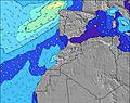 | 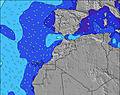 | 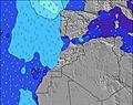 | 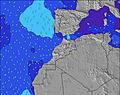 | 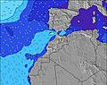 | 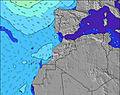 | 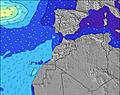 | |||||||||||||
Wave Height (m) Direction Period (s) | NNW 6 | NNW 6 | WNW 10 | WNW 10 | WNW 9 | WNW 9 | WNW 9 | WNW 8 | NW 8 | WNW 8 | NW 5 | NNW 6 | NNW 6 | NNW 8 | NW 8 | NW 8 | NNW 7 | NNW 8 | NNW 7 | NW 7 |
Wave Graph | ||||||||||||||||||||
51 | 40 | 37 | 36 | 33 | 34 | 54 | 64 | 97 | 59 | 41 | 38 | 71 | 193 | 355 | 330 | 183 | 213 | 164 | 106 | |
Wind (km/h) | ||||||||||||||||||||
Wind State on-shore cross-onshore cross-shore cross-offshore off-shore glassy | cross | cross-off | cross-off | cross | cross-off | cross-off | cross | cross-off | cross-off | cross | cross-off | cross-off | cross-off | cross | cross | cross | cross | cross | cross | cross |
High Tide | 5:20PM2.82m | 5:41AM2.58m | 5:56PM2.72m | 6:20AM2.51m | 6:38PM2.59m | 7:06AM2.40m | 7:29PM2.43m | 8:04AM2.30m | 8:36PM2.28m | 9:19AM2.23m | 10:03PM2.20m | 10:46AM2.28m | 11:32PM2.27m | |||||||
Low Tide | 11:36PM0.31m | 11:44AM0.42m | 00:12AM0.39m | 12:25PM0.52m | 00:55AM0.51m | 1:14PM0.65m | 1:48AM0.66m | 2:18PM0.77m | 2:57AM0.78m | 3:41PM0.82m | 4:23AM0.82m | 5:12PM0.74m | ||||||||
— | — | 6:41 | — | — | 6:43 | — | — | 6:43 | — | — | 6:43 | — | — | 6:45 | — | — | 6:45 | — | — | |
8:29 | — | — | 8:28 | — | — | 8:27 | — | — | 8:25 | — | — | 8:24 | — | — | 8:23 | — | — | 8:22 | — | |
mm | — | — | — | — | — | — | — | — | — | — | — | — | — | — | — | — | — | — | — | — |
Temp °C | 25 | 22 | 24 | 24 | 22 | 24 | 24 | 22 | 23 | 23 | 22 | 24 | 24 | 22 | 24 | 24 | 23 | 24 | 24 | 23 |
Feels °C | 24 | 23 | 24 | 23 | 23 | 24 | 24 | 24 | 24 | 23 | 24 | 24 | 23 | 22 | 26 | 24 | 25 | 26 | 23 | 25 |
Swell 1 Height (m) Direction Period (s) | NNW 6 | NNW 6 | NNW 6 | WNW 10 | NNW 5 | WNW 9 | WNW 9 | WNW 8 | NW 8 | WNW 8 | NW 5 | NNW 6 | NNW 9 | NNW 8 | NW 8 | NW 8 | NNW 7 | NNW 8 | NNW 7 | NW 7 |
51 | 33 | 18 | 36 | 13 | 34 | 54 | 64 | 97 | 59 | 38 | 38 | 49 | 193 | 355 | 330 | 183 | 213 | 164 | 106 | |
Swell 2 Height (m) Direction Period (s) | WNW 9 | WNW 8 | WNW 10 | N 8 | WNW 9 | NNW 4 | — | — | NW 12 | NNW 12 | NNW 10 | WNW 7 | WNW 10 | NW 9 | — | — | WNW 8 | WNW 9 | WNW 9 | WNW 9 |
44 | 40 | 37 | 1 | 33 | 6 | — | — | 6 | 13 | 41 | 30 | 38 | 23 | — | — | 28 | 16 | 15 | 15 | |
Swell 3 Height (m) Direction Period (s) | NNW 8 | NNW 8 | NNW 8 | — | N 7 | N 7 | — | — | NW 11 | — | WNW 10 | NNW 9 | WNW 7 | — | — | — | — | — | — | — |
7 | 7 | 6 | — | 1 | 1 | — | — | 5 | — | 20 | 33 | 9 | — | — | — | — | — | — | — | |
Wind waves Height (m) Direction Period (s) | — | — | — | NNW 6 | — | — | N 3 | N 4 | — | N 5 | — | — | NNW 6 | — | — | — | — | — | — | — |
— | — | — | 25 | — | — | 8 | 9 | — | 29 | — | — | 71 | — | — | — | — | — | — | — | |
Nearest Offshore or Glassy | ||||||||||||||||||||
Distance (km) | 58 | 10 | 24 | 429 | 24 | 24 | 394 | 24 | 0 | 429 | 24 | 0 | 299 | 58 | 152 | 915 | 57 | 237 | 418 | 57 |
Best forecast wave conditions in Rabat to Casblanca | ||||||||||||||||||||
Best forecast wave conditions in Morocco | ||||||||||||||||||||
Header Global | ||||||||||||||||||||
- Map Icons:
 Break
Break Live Wave Height (m)
 Live Wind Speed (km/h)
 Surf Rating (10 Max)
 Ocean Swells (m)
- Wind Speed (km/h)
Latest Updates


FREE! Surf-Forecast.com widget for your website
The surf report / weather widget below is available to embed on third party websites free of charge and provides a summary of our Pont Blondin surf forecast. Simply grab the html code snippet that we provide and paste it into your own site. You can choose your preferred language and metric/imperial units for the surf forecast feed to suit users of your site. Click here to get the code.
Information about the Pont Blondin Surf forecast
The above surf forecast table for Pont Blondin provides essential information for determining whether the surfing conditions will be good over the next 16 days. A general guide to surfing at Pont Blondin can be found by selecting the local surf guide option on the grey menu. Our Pont Blondin surf forecast is unique since it includes wave energy (power) that defines the real feel of the surf rather than just the height or the period. If you surf the same spot (Pont Blondin) regularly then make a mental note of the wave energy from the surf forecast table each time you go. Very soon you may start to choose your surf days based on the wave energy alone combined with our forecast of favourable offshore wind conditions. Our star ratings will help here and of course you will also find the usual wave height and period predictions on our surf forecasts as well as a full break down of the swell components under our advanced users option (to reveal that, click the little Einstein character under the tide times).
Further information to help with frequently asked questions about our surf forecast for Pont Blondin may be found under the help tab on the top menu and also by moving your mouse over the question marks on the surf forecast table itself. Please always bear in mind that the forecast is for near-shore open water and local factors at each surf break influence the actual breaking wave height, such as the beach / reef profile, water depths offshore and shelter.
Pont Blondin is 2 km (1 miles) from Mohammedia. If you plan a holiday in Rabat to Casblanca, look for hotels and other accommodation in Mohammedia. Mohammedia has rooms for a wide range of budgets as well as car hire and transport links.
 Nearest