

Surf Forecasts:

Monica beach surf forecast from 3 Aug 2026:
- Best quality surf: Saturday 8 Aug, 10PM (local time) - 4.5ft (1.3m), 7s period, NNW swell with glassy winds.
- Most powerful swell: Friday 7 Aug, 1PM (local time) - 5.5ft (1.7m), 8s period, NNW swell with 403 kJ wave energy.
- Next surfable swell (1★+): Saturday 8 Aug, 10PM (local time) - 4.5ft (1.3m), 7s period with NNW swell.
Best Forecast Surf Conditions for Monica beach this week:
The surf forecast for Monica beach over the next 16 days: The first swell (rated 1 star or higher) is forecast to arrive on Saturday (Aug 08) at 10PM. The primary swell is predicted to be 1.3m and 7s period with a secondary swell of 0.3m and 9s. The wind is predicted to be glassy as the swell arrives.
The most powerful waves expected at Monica beach in the next 16 days are 1.7m 8s and forecast to arrive on Friday (Aug 07) at 1PM. Winds are predicted to be onshore at the time the swell arrives.
| Wave Type | Time (+01) & Date | Wave Height & Period |
|---|---|---|
| Next good surf (1 star+) | 10PM (Sat 8th Aug) | 4.5ft (1.3m) 7s |
| Best Surf | 10PM (Sat 8th Aug) | 4.5ft (1.3m) 7s |
| Most Powerful | 1PM (Fri 7th Aug) | 5.5ft (1.7m) 8s |
Table - best surf conditions forecast for Monica beach over the next 16 days.
The Lowdown
Alright folks, Rusty here. Let’s get straight into it for Monica beach. We’ve got a 16-day window to look at, and I’ll be honest, it’s a bit of a slow starter. The first recommended surf doesn’t show up until the morning of the 8th of August. Before that, it’s all small, weak, and onshore – not worth paddling out for.
We’re looking at a reef break for advanced surfers only. It’s consistent, but it’s exposed to the swell, and the best direction for it is from the NW. The water temp is sitting at 72°, which is about normal for this time of year, so a springy shorty will do for the first few days.
The first real chance to get wet comes on the morning of Saturday, the 8th of August. We’ve got some clouds rolling in, a light onshore breeze from the north at 6 mph, and a 5 ft swell from the NNW. The swell period is a middling 8 seconds, and the combined energy is moderate at (293). It’s a marginal call – the tide might be playing tricks, and the wind isn’t perfect. Still, it’s your best early option if you’re desperate for a paddle.
The surf then drops off again for a few days with poor conditions, small swell, and onshore winds. We see a bit of a pulse picking up around the 12th of August, but it’s still a messy, cross-onshore affair with a 4 ft swell from the NNW and a combined energy of (182). Not great.
The standout window, and I mean the only real standout here, is the morning of Monday, the 17th of August. This is the one to circle. We’ve got some clouds, a light cross-shore wind from the WNW at 6 mph, which is a major positive – it’ll keep the surface clean. The swell size is 6 ft from the NNW, with a period of 8 seconds and a combined energy that’s strong at (345). It’s a solid, powerful wave for advanced surfers. The wind direction is shifting to give you that rare bit of clean texture. This is the best bet on offer.
The next morning, Tuesday the 18th of August, is also worth a mention. The swell is a bit bigger at 6 ft from the NNW, with a combined energy of (504) – that’s strong. The wind is onshore from the NNW at 6 mph, so it’ll be a bit lumpy, but for the experienced crew, there’s plenty of power to play with. It’s marginal for the tide again, so keep an eye on it.
So, overall, it’s a long wait. The first week is a write-off. The second week has a couple of pulses, but it’s the 17th and 18th of August that offer the real potential. The early part of the forecast is a bit of a letdown, but things can always change. For now, bring your patience and a big quiver.
Rusty.
Short Range ForecastMostly dry. Warm (max 25°C on Mon morning, min 21°C on Mon night). Wind will be generally light. | Days 4-6 Weather SummaryMostly dry. Warm (max 26°C on Sat morning, min 21°C on Thu night). Wind will be generally light. | ||||||||||||||||||||
Monday 3 | Tuesday 4 | Wednesday 5 | Thursday 6 | Friday 7 | Saturday 8 | Sunday 9 | |||||||||||||||
AM | PM | Night | AM | PM | Night | AM | PM | Night | AM | PM | Night | AM | PM | Night | AM | PM | Night | AM | PM | Night | |
Swell Height Map | 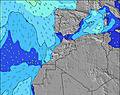 | 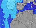 | 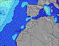 | 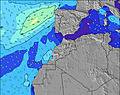 | 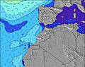 | 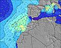 | 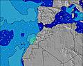 | ||||||||||||||
Wave Height (m) Direction Period (s) | WNW 10 | WNW 10 | WNW 9 | WNW 9 | WNW 9 | WNW 8 | NW 8 | WNW 8 | NNW 10 | NNW 6 | NNW 10 | NNW 7 | NNW 8 | NW 8 | NNW 8 | NNW 8 | NNW 7 | NNW 7 | NNW 7 | NNW 6 | NNW 6 |
Wave Graph | |||||||||||||||||||||
38 | 36 | 34 | 33 | 53 | 64 | 70 | 44 | 39 | 82 | 104 | 202 | 356 | 330 | 271 | 277 | 193 | 123 | 132 | 87 | 51 | |
Wind (km/h) | |||||||||||||||||||||
Wind State on-shore cross-onshore cross-shore cross-offshore off-shore glassy | cross-on | on | cross-on | cross-on | on | on | on | on | on | cross-on | on | on | on | on | cross-on | on | on | on | on | on | on |
High Tide | 6:06PM3.37m | 6:31AM3.14m | 6:49PM3.23m | 7:18AM3.04m | 7:41PM3.07m | 8:17AM2.94m | 8:49PM2.90m | 9:34AM2.89m | 10:16PM2.82m | 11:00AM2.94m | 11:45PM2.89m | 12:16PM3.12m | 00:56AM3.05m | ||||||||
Low Tide | 11:53AM1.01m | 00:23AM1.00m | 12:35PM1.12m | 1:07AM1.13m | 1:26PM1.26m | 2:01AM1.27m | 2:32PM1.38m | 3:10AM1.40m | 3:57PM1.44m | 4:35AM1.44m | 5:27PM1.35m | 5:56AM1.35m | 6:42PM1.15m | ||||||||
6:43 | — | — | 6:43 | — | — | 6:45 | — | — | 6:46 | — | — | 6:46 | — | — | 6:47 | — | — | 6:48 | — | — | |
— | 8:29 | — | — | 8:28 | — | — | 8:27 | — | — | 8:25 | — | — | 8:24 | — | — | 8:23 | — | — | 8:22 | — | |
mm | — | — | — | — | — | — | — | — | — | — | — | — | — | — | — | — | — | — | — | — | — |
Temp °C | 25 | 25 | 22 | 24 | 24 | 22 | 24 | 24 | 22 | 24 | 24 | 22 | 25 | 25 | 23 | 26 | 26 | 24 | 25 | 25 | 23 |
Feels °C | 25 | 25 | 23 | 24 | 24 | 23 | 24 | 24 | 23 | 24 | 23 | 22 | 24 | 24 | 23 | 26 | 25 | 25 | 25 | 25 | 25 |
Swell 1 Height (m) Direction Period (s) | NNW 6 | WNW 10 | N 5 | WNW 9 | WNW 9 | WNW 8 | NW 8 | WNW 8 | WNW 8 | NNW 6 | NNW 10 | NNW 7 | NNW 8 | NW 8 | NNW 8 | NNW 8 | NNW 7 | NNW 7 | NNW 7 | WNW 8 | NNW 6 |
18 | 36 | 11 | 33 | 53 | 64 | 70 | 44 | 37 | 82 | 81 | 202 | 356 | 330 | 271 | 277 | 193 | 123 | 132 | 13 | 51 | |
Swell 2 Height (m) Direction Period (s) | WNW 10 | N 8 | WNW 9 | NNW 4 | N 7 | N 8 | NW 12 | NNW 11 | NW 5 | WNW 10 | WNW 10 | WNW 9 | — | — | — | WNW 9 | WNW 9 | WNW 9 | WNW 8 | NW 12 | WNW 7 |
38 | 1 | 34 | 6 | 1 | 1 | 6 | 24 | 12 | 33 | 32 | 34 | — | — | — | 16 | 16 | 15 | 13 | 6 | 21 | |
Swell 3 Height (m) Direction Period (s) | NNW 8 | — | N 8 | N 7 | — | — | N 8 | WNW 10 | NNW 10 | NW 9 | — | — | — | — | — | — | — | — | N 13 | NW 12 | NNW 11 |
6 | — | 1 | 1 | — | — | 1 | 18 | 39 | 20 | — | — | — | — | — | — | — | — | 3 | 6 | 23 | |
Wind waves Height (m) Direction Period (s) | — | NNW 6 | — | — | N 5 | N 4 | N 5 | N 5 | N 4 | — | NNW 6 | — | — | — | — | — | — | — | — | NNW 6 | — |
— | 25 | — | — | 12 | 8 | 7 | 25 | 10 | — | 104 | — | — | — | — | — | — | — | — | 87 | — | |
Nearest Offshore or Glassy | |||||||||||||||||||||
Distance (km) | 56 | 788 | 391 | 56 | 398 | 56 | 56 | 392 | 32 | 32 | 887 | 32 | 32 | 884 | 32 | 90 | 391 | 90 | 207 | 871 | 369 |
Best forecast wave conditions in Rabat to Casblanca | |||||||||||||||||||||
Best forecast wave conditions in Morocco | |||||||||||||||||||||
Header Global | |||||||||||||||||||||
- Map Icons:
 Break
Break Live Wave Height (m)
 Live Wind Speed (km/h)
 Surf Rating (10 Max)
 Ocean Swells (m)
- Wind Speed (km/h)
Latest Updates


FREE! Surf-Forecast.com widget for your website
The surf report / weather widget below is available to embed on third party websites free of charge and provides a summary of our Monica beach surf forecast. Simply grab the html code snippet that we provide and paste it into your own site. You can choose your preferred language and metric/imperial units for the surf forecast feed to suit users of your site. Click here to get the code.
Information about the Monica beach Surf forecast
The above surf forecast table for Monica beach provides essential information for determining whether the surfing conditions will be good over the next 16 days. A general guide to surfing at Monica beach can be found by selecting the local surf guide option on the grey menu. Our Monica beach surf forecast is unique since it includes wave energy (power) that defines the real feel of the surf rather than just the height or the period. If you surf the same spot (Monica beach) regularly then make a mental note of the wave energy from the surf forecast table each time you go. Very soon you may start to choose your surf days based on the wave energy alone combined with our forecast of favourable offshore wind conditions. Our star ratings will help here and of course you will also find the usual wave height and period predictions on our surf forecasts as well as a full break down of the swell components under our advanced users option (to reveal that, click the little Einstein character under the tide times).
Further information to help with frequently asked questions about our surf forecast for Monica beach may be found under the help tab on the top menu and also by moving your mouse over the question marks on the surf forecast table itself. Please always bear in mind that the forecast is for near-shore open water and local factors at each surf break influence the actual breaking wave height, such as the beach / reef profile, water depths offshore and shelter.
Monica beach is 8 km (5 miles) from the city of Casablanca. If you plan a holiday in Rabat to Casblanca, look for hotels and other accommodation in Casablanca. Casablanca has rooms for a wide range of budgets as well as car hire and transport links.
 Nearest