

Surf Forecasts:

Hash Point surf forecast from 3 Aug 2026:
- Best quality surf: Monday 3 Aug, 10PM (local time) - 4.5ft (1.3m), 7s period, NNW swell with cross-offshore winds.
- Most powerful swell: Tuesday 4 Aug, 7PM (local time) - 5.5ft (1.7m), 7s period, NNW swell with 269 kJ wave energy.
- Next surfable swell (1★+): Monday 3 Aug, 10PM (local time) - 4.5ft (1.3m), 7s period with NNW swell.
Best Forecast Surf Conditions for Hash Point this week:
The surf forecast for Hash Point over the next 16 days: The first swell (rated 1 star or higher) is forecast to arrive on Monday (Aug 03) at 10PM. The primary swell is predicted to be 1.3m and 7s period with a secondary swell of 0.3m and 9s. The wind is predicted to be cross-offshore as the swell arrives.
The most powerful waves expected at Hash Point in the next 16 days are 1.7m 7s and forecast to arrive on Tuesday (Aug 04) at 7PM. Winds are predicted to be cross-offshore at the time the swell arrives.
| Wave Type | Time (+01) & Date | Wave Height & Period |
|---|---|---|
| Next good surf (1 star+) | 10PM (Mon 3rd Aug) | 4.5ft (1.3m) 7s |
| Best Surf | 10PM (Mon 3rd Aug) | 4.5ft (1.3m) 7s |
| Most Powerful | 7PM (Tue 4th Aug) | 5.5ft (1.7m) 7s |
Table - best surf conditions forecast for Hash Point over the next 16 days.
The Lowdown
Alright folks, Rusty here. Let’s be straight with you. We’ve got a 16-day window on the table, but to be honest, it’s a pretty flat stretch for the region. The only spot on the radar is Hash Point, and even that’s a tough sell. We’re looking at a long dry spell with almost no real surf to speak of.
The Overall Picture
The whole 16 days is a struggle. The swell is tiny, weak, and short-period. The combined energy of all swells directed here barely breaks 100 (72) for the first few days, and only gets a little bit of a pulse on the 4th of August afternoon with a reading of 194. But even then, the wave comment is "poor surf conditions" across the board. There’s a gap from the start with no real recommendations, and honestly, it’s a blank run that’s pretty normal for this area when the conditions aren't cooperating.
The Only Option: Hash Point
Hash Point is a sheltered point break, intermediate level, and fairly consistent in terms of being a spot, but the swell just isn't showing up. It wants a NW swell, and that’s what we’re getting, but it’s tiny. For the first few days, from Monday 3 August morning, we’ve got glassy conditions with a 2ft NW swell at 7 seconds. That’s a weak, gutless wave. The wind is glassy, which is a major positive for clean conditions, but the energy is just too low (72) to do anything with.
The afternoon of the 4th of August is the only time things get a little interesting. The swell bumps up to 5ft from the NW, still a short 7 second period, but the combined energy jumps to 194. The wind is a cross-off from the NNW at 30 km/h, which cleans it up nicely. This is the best on offer, but it’s still not a standout. It’s a "poor surf conditions" call, so don’t get your hopes up. The water temperature is about average for the time of year, nothing unusual.
The Long Slow Grind
From the 5th of August right through to the 18th of August, it’s the same sad story. Swell heights hover between 2ft and 4ft, periods are short (6-9 seconds), and the combined energy is weak, mostly in the double digits or low triple digits. There are a few mornings with glassy conditions, like the 5th, 12th, and 15th, but that tiny swell just isn't enough to push through. The wave comment is always "poor surf conditions." The afternoon of the 8th of August gets a 3ft swell and a "surfable waves but very ordinary conditions" comment, but it’s still a far cry from a good session.
The Verdict
Honestly, there’s no one standout session here. The best you can hope for is a tiny, clean wave on the afternoon of the 4th of August, and even that’s a stretch. This is a period to leave the boards in the car and do something else. The swell is too small, the period is too short, and the energy is too weak to make anything worthwhile.
Stay patient, the ocean will wake up eventually.
Rusty.
Short Range ForecastMostly dry. Warm (max 38°C on Tue afternoon, min 24°C on Tue night). Mainly fresh winds. | Days 4-6 Weather SummaryMostly dry. Warm (max 35°C on Sat afternoon, min 20°C on Thu night). Wind will be generally light. | ||||||||||||||||||||
Monday 3 | Tuesday 4 | Wednesday 5 | Thursday 6 | Friday 7 | Saturday 8 | Sunday 9 | |||||||||||||||
AM | PM | Night | AM | PM | Night | AM | PM | Night | AM | PM | Night | AM | PM | Night | AM | PM | Night | AM | PM | Night | |
Swell Height Map | 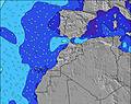 | 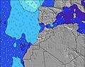 | 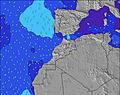 | 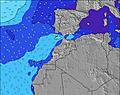 | 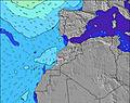 | 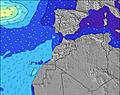 | 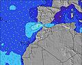 | ||||||||||||||
Wave Height (m) Direction Period (s) | NW 7 | NW 7 | NW 7 | NW 7 | NW 7 | NW 8 | NW 8 | NW 8 | NW 8 | NW 8 | NW 8 | NW 9 | NW 9 | NW 8 | NW 8 | NW 8 | NW 7 | NW 8 | NW 7 | NW 7 | NW 8 |
Wave Graph | |||||||||||||||||||||
49 | 46 | 71 | 60 | 194 | 149 | 82 | 210 | 131 | 99 | 138 | 210 | 145 | 91 | 116 | 82 | 102 | 128 | 57 | 82 | 94 | |
Wind (km/h) | |||||||||||||||||||||
Wind State on-shore cross-onshore cross-shore cross-offshore off-shore glassy | glassy | cross | glassy | glassy | cross-off | glassy | glassy | cross | cross | cross-on | cross-on | cross | cross | cross | glassy | on | cross-off | cross | cross-on | cross | glassy |
High Tide | 5:22AM2.46m | 5:36PM2.60m | 6:01AM2.39m | 6:18PM2.47m | 6:48AM2.29m | 7:10PM2.31m | 7:47AM2.19m | 8:18PM2.16m | 9:03AM2.13m | 9:46PM2.10m | 10:29AM2.18m | 11:14PM2.17m | 11:46AM2.36m | 00:25AM2.34m | |||||||
Low Tide | 11:18AM0.41m | 11:47PM0.38m | 11:59AM0.51m | 00:30AM0.49m | 12:48PM0.63m | 1:22AM0.63m | 1:53PM0.75m | 2:32AM0.75m | 3:18PM0.80m | 4:00AM0.79m | 4:52PM0.71m | 5:24AM0.69m | 6:08PM0.51m | ||||||||
6:56 | — | — | 6:58 | — | — | 6:58 | — | — | 6:58 | — | — | 7:00 | — | — | 7:00 | — | — | 7:01 | — | — | |
— | 8:31 | — | — | 8:30 | — | — | 8:30 | — | — | 8:29 | — | — | 8:28 | — | — | 8:27 | — | — | 8:27 | — | |
mm | — | — | — | — | — | — | — | — | — | — | — | — | — | — | — | — | — | — | — | — | — |
Temp °C | 33 | 37 | 34 | 34 | 38 | 31 | 28 | 32 | 25 | 27 | 28 | 23 | 27 | 31 | 25 | 28 | 35 | 25 | 26 | 29 | 23 |
Feels °C | 32 | 30 | 32 | 32 | 33 | 31 | 30 | 33 | 27 | 29 | 30 | 23 | 28 | 32 | 26 | 28 | 35 | 27 | 28 | 30 | 24 |
Swell 1 Height (m) Direction Period (s) | NW 7 | WNW 9 | NW 7 | NW 7 | — | NW 8 | NW 8 | NW 8 | NW 8 | NW 8 | NW 8 | NW 9 | NW 9 | NW 9 | NW 8 | NW 8 | WNW 9 | NW 8 | NW 7 | — | NW 8 |
49 | 35 | 71 | 60 | — | 149 | 82 | 210 | 131 | 99 | 138 | 210 | 145 | 23 | 116 | 82 | 15 | 128 | 57 | — | 94 | |
Swell 2 Height (m) Direction Period (s) | WNW 8 | — | WNW 9 | WNW 9 | — | — | — | WNW 10 | — | WNW 10 | WNW 10 | — | — | WNW 9 | WNW 10 | WNW 9 | NW 11 | — | WNW 8 | — | — |
13 | — | 15 | 17 | — | — | — | 20 | — | 19 | 20 | — | — | 17 | 18 | 16 | 5 | — | 13 | — | — | |
Swell 3 Height (m) Direction Period (s) | WNW 10 | — | — | — | — | — | — | — | — | — | — | — | — | — | — | — | — | — | N 10 | — | — |
10 | — | — | — | — | — | — | — | — | — | — | — | — | — | — | — | — | — | 2 | — | — | |
Wind waves Height (m) Direction Period (s) | — | NW 7 | — | — | NW 7 | — | — | NW 8 | — | — | — | — | — | NW 8 | — | — | NW 7 | — | — | NW 7 | — |
— | 46 | — | — | 194 | — | — | 147 | — | — | — | — | — | 91 | — | — | 102 | — | — | 82 | — | |
Nearest Offshore or Glassy | |||||||||||||||||||||
Distance (km) | 1 | 439 | 1 | 1 | 439 | 0 | 1 | 661 | 1 | 3 | 661 | 17 | 3 | 631 | 0 | 17 | 0 | 3 | 2 | 661 | 1 |
Best forecast wave conditions in Central Morocco | |||||||||||||||||||||
Best forecast wave conditions in Morocco | |||||||||||||||||||||
Header Global | |||||||||||||||||||||
- Map Icons:
 Break
Break Live Wave Height (m)
 Live Wind Speed (km/h)
 Surf Rating (10 Max)
 Ocean Swells (m)
- Wind Speed (km/h)
Latest Updates


FREE! Surf-Forecast.com widget for your website
The surf report / weather widget below is available to embed on third party websites free of charge and provides a summary of our Hash Point surf forecast. Simply grab the html code snippet that we provide and paste it into your own site. You can choose your preferred language and metric/imperial units for the surf forecast feed to suit users of your site. Click here to get the code.
Information about the Hash Point Surf forecast
The above surf forecast table for Hash Point provides essential information for determining whether the surfing conditions will be good over the next 16 days. A general guide to surfing at Hash Point can be found by selecting the local surf guide option on the grey menu. Our Hash Point surf forecast is unique since it includes wave energy (power) that defines the real feel of the surf rather than just the height or the period. If you surf the same spot (Hash Point) regularly then make a mental note of the wave energy from the surf forecast table each time you go. Very soon you may start to choose your surf days based on the wave energy alone combined with our forecast of favourable offshore wind conditions. Our star ratings will help here and of course you will also find the usual wave height and period predictions on our surf forecasts as well as a full break down of the swell components under our advanced users option (to reveal that, click the little Einstein character under the tide times).
Further information to help with frequently asked questions about our surf forecast for Hash Point may be found under the help tab on the top menu and also by moving your mouse over the question marks on the surf forecast table itself. Please always bear in mind that the forecast is for near-shore open water and local factors at each surf break influence the actual breaking wave height, such as the beach / reef profile, water depths offshore and shelter.
Hash Point is 7 km (4 miles) from the city of Agadir. If you plan a holiday in Central Morocco, look for hotels and other accommodation in Agadir. Agadir has rooms for a wide range of budgets as well as car hire and transport links.
 Nearest