

Surf Forecasts:

Les Sablettes surf forecast from 2 Aug 2026:
- Best quality surf: Friday 7 Aug, 4AM (local time) - 4.5ft (1.3m), 8s period, NNW swell with glassy winds.
- Most powerful swell: Friday 7 Aug, 1PM (local time) - 5.5ft (1.7m), 8s period, NW swell with 400 kJ wave energy.
- Next surfable swell (1★+): Friday 7 Aug, 4AM (local time) - 4.5ft (1.3m), 8s period with NNW swell.
Best Forecast Surf Conditions for Les Sablettes this week:
The surf forecast for Les Sablettes over the next 16 days: The first swell (rated 1 star or higher) is forecast to arrive on Friday (Aug 07) at 4AM. The primary swell is predicted to be 1.3m and 8s period with a secondary swell of 0.4m and 9s. The wind is predicted to be glassy as the swell arrives.
The most powerful waves expected at Les Sablettes in the next 16 days are 1.7m 8s and forecast to arrive on Friday (Aug 07) at 1PM. Winds are predicted to be onshore at the time the swell arrives.
| Wave Type | Time (+01) & Date | Wave Height & Period |
|---|---|---|
| Next good surf (1 star+) | 4AM (Fri 7th Aug) | 4.5ft (1.3m) 8s |
| Best Surf | 4AM (Fri 7th Aug) | 4.5ft (1.3m) 8s |
| Most Powerful | 1PM (Fri 7th Aug) | 5.5ft (1.7m) 8s |
Table - best surf conditions forecast for Les Sablettes over the next 16 days.
The Lowdown
Alright folks, Rusty here. Let’s be straight with you – this forecast for Les Sablettes is a tough one. We’re looking at a solid 16-day window, but there’s a big dry spell right at the start. Don’t get your hopes up for the first few days; the surf is pretty much a no-go until things start to show a little life around Friday the 7th of August.
The water’s a bit colder than usual for this time of year, sitting at 71°F with a 3°F anomaly. You’ll feel that chill if you’re paddling out in just boardshorts.
The first real chance to even get a little wet comes on Friday morning, the 7th of August. The swell bumps up to 6ft from the NNW, with a combined energy of (365) – that’s a proper push of energy. But the wind is a light cross-onshore from the N at 10 km/h. It’s a marginal call, and the period is a short 8 seconds, so it’ll be a bit crumby. This is really only for the die-hards who don’t mind a bit of chop and a messy lineup.
Saturday the 8th of August morning is a similar story. Swell is still 5ft from the NW, with 268 energy, and a light cross-onshore from the WNW. Again, it’s only just rideable, not clean. The wind is always a bit of a problem here, with that consistent northerly component. For the rest of the first week and into the second, it’s a long stretch of poor conditions. The swell stays small, mostly under 3ft, and the wind is either cross-onshore or onshore, making everything choppy and messy.
Honestly, looking at the whole 16 days, there’s nothing that really stands out as a good session. The wind is never truly offshore, and the swell direction never matches the optimum NW that this reef and point break would love. The best you can hope for is a morning with light winds on the 7th or 8th of August, but even then, it’s a marginal, short-period mess. For the rest of the time, you’re looking at flat or choppy scraps. If you’ve got a kite, it might be more interesting than a surfboard, but for a paddle surfer, this is a blank run.
Stay patient, lads. The forecasts can change, but right now, it’s not looking pretty.
Rusty.
Short Range ForecastMostly dry. Warm (max 25°C on Sun afternoon, min 21°C on Mon night). Wind will be generally light. | Days 5-7 Weather SummaryMostly dry. Warm (max 24°C on Thu morning, min 21°C on Wed night). Wind will be generally light. | |||||||||||||||||||
Sun 2 | Monday 3 | Tuesday 4 | Wednesday 5 | Thursday 6 | Friday 7 | Saturday 8 | ||||||||||||||
PM | Night | AM | PM | Night | AM | PM | Night | AM | PM | Night | AM | PM | Night | AM | PM | Night | AM | PM | Night | |
Swell Height Map | 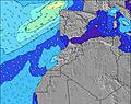 | 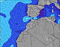 | 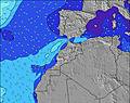 | 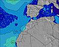 | 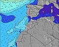 | 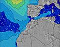 | 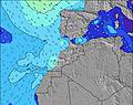 | |||||||||||||
Wave Height (m) Direction Period (s) | NNW 6 | NNW 6 | WNW 10 | WNW 10 | WNW 9 | WNW 9 | WNW 9 | WNW 8 | NW 8 | WNW 8 | NW 5 | NNW 6 | NNW 6 | NNW 8 | NW 8 | NW 8 | NNW 7 | NNW 8 | NNW 7 | NW 7 |
Wave Graph | ||||||||||||||||||||
51 | 40 | 37 | 36 | 33 | 34 | 54 | 64 | 97 | 59 | 41 | 38 | 71 | 193 | 355 | 330 | 183 | 213 | 164 | 106 | |
Wind (km/h) | ||||||||||||||||||||
Wind State on-shore cross-onshore cross-shore cross-offshore off-shore glassy | cross-on | cross-on | cross-on | cross-on | cross-on | cross-on | cross-on | cross-on | cross-on | on | cross-on | cross-on | cross-on | cross-on | on | on | on | on | on | on |
High Tide | 5:20PM2.82m | 5:41AM2.58m | 5:56PM2.72m | 6:20AM2.51m | 6:38PM2.59m | 7:06AM2.40m | 7:29PM2.43m | 8:04AM2.30m | 8:36PM2.28m | 9:19AM2.23m | 10:03PM2.20m | 10:46AM2.28m | 11:32PM2.27m | |||||||
Low Tide | 11:36PM0.31m | 11:44AM0.42m | 00:12AM0.39m | 12:25PM0.52m | 00:55AM0.51m | 1:14PM0.65m | 1:48AM0.66m | 2:18PM0.77m | 2:57AM0.78m | 3:41PM0.82m | 4:23AM0.82m | 5:12PM0.74m | ||||||||
— | — | 6:41 | — | — | 6:43 | — | — | 6:43 | — | — | 6:43 | — | — | 6:45 | — | — | 6:45 | — | — | |
8:29 | — | — | 8:28 | — | — | 8:27 | — | — | 8:25 | — | — | 8:24 | — | — | 8:23 | — | — | 8:22 | — | |
mm | — | — | — | — | — | — | — | — | — | — | — | — | — | — | — | — | — | — | — | — |
Temp °C | 25 | 22 | 24 | 24 | 22 | 24 | 24 | 22 | 23 | 23 | 22 | 24 | 24 | 22 | 24 | 24 | 23 | 24 | 24 | 23 |
Feels °C | 24 | 23 | 24 | 23 | 23 | 24 | 24 | 24 | 24 | 23 | 24 | 24 | 23 | 22 | 26 | 24 | 25 | 26 | 23 | 25 |
Swell 1 Height (m) Direction Period (s) | NNW 6 | NNW 6 | NNW 6 | WNW 10 | NNW 5 | WNW 9 | WNW 9 | WNW 8 | NW 8 | WNW 8 | NW 5 | NNW 6 | NNW 9 | NNW 8 | NW 8 | NW 8 | NNW 7 | NNW 8 | NNW 7 | NW 7 |
51 | 33 | 18 | 36 | 13 | 34 | 54 | 64 | 97 | 59 | 38 | 38 | 49 | 193 | 355 | 330 | 183 | 213 | 164 | 106 | |
Swell 2 Height (m) Direction Period (s) | WNW 9 | WNW 8 | WNW 10 | N 8 | WNW 9 | NNW 4 | — | — | NW 12 | NNW 12 | NNW 10 | WNW 7 | WNW 10 | NW 9 | — | — | WNW 8 | WNW 9 | WNW 9 | WNW 9 |
44 | 40 | 37 | 1 | 33 | 6 | — | — | 6 | 13 | 41 | 30 | 38 | 23 | — | — | 28 | 16 | 15 | 15 | |
Swell 3 Height (m) Direction Period (s) | NNW 8 | NNW 8 | NNW 8 | — | N 7 | N 7 | — | — | NW 11 | — | WNW 10 | NNW 9 | WNW 7 | — | — | — | — | — | — | — |
7 | 7 | 6 | — | 1 | 1 | — | — | 5 | — | 20 | 33 | 9 | — | — | — | — | — | — | — | |
Wind waves Height (m) Direction Period (s) | — | — | — | NNW 6 | — | — | N 3 | N 4 | — | N 5 | — | — | NNW 6 | — | — | — | — | — | — | — |
— | — | — | 25 | — | — | 8 | 9 | — | 29 | — | — | 71 | — | — | — | — | — | — | — | |
Nearest Offshore or Glassy | ||||||||||||||||||||
Distance (km) | 25 | 430 | 25 | 25 | 430 | 25 | 25 | 307 | 25 | 25 | 341 | 1 | 1 | 300 | 1 | 38 | 417 | 59 | 237 | 907 |
Best forecast wave conditions in Rabat to Casblanca | ||||||||||||||||||||
Best forecast wave conditions in Morocco | ||||||||||||||||||||
Header Global | ||||||||||||||||||||
- Map Icons:
 Break
Break Live Wave Height (m)
 Live Wind Speed (km/h)
 Surf Rating (10 Max)
 Ocean Swells (m)
- Wind Speed (km/h)
Latest Updates


FREE! Surf-Forecast.com widget for your website
The surf report / weather widget below is available to embed on third party websites free of charge and provides a summary of our Les Sablettes surf forecast. Simply grab the html code snippet that we provide and paste it into your own site. You can choose your preferred language and metric/imperial units for the surf forecast feed to suit users of your site. Click here to get the code.
Information about the Les Sablettes Surf forecast
The above surf forecast table for Les Sablettes provides essential information for determining whether the surfing conditions will be good over the next 16 days. A general guide to surfing at Les Sablettes can be found by selecting the local surf guide option on the grey menu. Our Les Sablettes surf forecast is unique since it includes wave energy (power) that defines the real feel of the surf rather than just the height or the period. If you surf the same spot (Les Sablettes) regularly then make a mental note of the wave energy from the surf forecast table each time you go. Very soon you may start to choose your surf days based on the wave energy alone combined with our forecast of favourable offshore wind conditions. Our star ratings will help here and of course you will also find the usual wave height and period predictions on our surf forecasts as well as a full break down of the swell components under our advanced users option (to reveal that, click the little Einstein character under the tide times).
Further information to help with frequently asked questions about our surf forecast for Les Sablettes may be found under the help tab on the top menu and also by moving your mouse over the question marks on the surf forecast table itself. Please always bear in mind that the forecast is for near-shore open water and local factors at each surf break influence the actual breaking wave height, such as the beach / reef profile, water depths offshore and shelter.
Les Sablettes is 2 km (1 miles) from Mohammedia. If you plan a holiday in Rabat to Casblanca, look for hotels and other accommodation in Mohammedia. Mohammedia has rooms for a wide range of budgets as well as car hire and transport links.
 Nearest