

Surf Forecasts:

Cap Sim surf forecast from 3 Aug 2026:
- Most powerful swell: Friday 7 Aug, 1AM (local time) - 8ft (2.5m), 7s period, N swell with 653 kJ wave energy.
Best Forecast Surf Conditions for Cap Sim this week:
The most powerful waves expected at Cap Sim in the next 16 days are 2.5m 7s and forecast to arrive on Friday (Aug 07) at 1AM. Winds are predicted to be cross-offshore at the time the swell arrives. The largest open ocean swell (not directed at the beach) is 1.9m 6s period and expected on Wednesday (Aug 05) at 4PM.
| Wave Type | Time (+01) & Date | Wave Height & Period |
|---|---|---|
| Next good surf (1 star+) | - | - |
| Best Surf | - | - |
| Most Powerful | 1AM (Fri 7th Aug) | 8ft (2.5m) 7s |
Table - best surf conditions forecast for Cap Sim over the next 16 days.
The Lowdown
Yo, what's up, this is Rusty. Let's get into it.
Alright, looking at the 16-day window here, it's a bit of a slow burn. We've got a big gap of nothing good to start, then a solid pulse of energy arrives, but it comes with a side of strong wind that messes up the quality. The best windows are going to be a few specific mornings where the wind plays nice.
For the first week, from Monday, August 3rd, right through to Tuesday, August 11th, it's a total write-off. The swell is tiny, all under 2 feet, and when it does start to pick up, the wind is howling from the north at 25 mph, making it a mess. The combined energy is weak, sitting at just 37 to 57 (weak energy). You're better off doing something else. The water is a frigid 65°, which is a whopping 5° colder than normal – that's very unusual and will feel freezing.
The first real sniff of something decent doesn't come until Wednesday, August 12th. The morning at Cap Sim (Morocco) is where it's at. We've got a solid 7-foot swell from the north, with a period of 7 seconds. The wind is offshore from the NE at 12 mph, which will keep it clean. The combined energy hits 513 (strong to very strong wave energy), so there's plenty of power. This is the standout. Expect good surf conditions. The afternoon gets a bit cross-off, so stick to the morning.
Saturday, August 15th, is another one to circle. The morning has a 6-foot north swell with a light breeze from the NNE at 6 mph. That's practically glassy. The combined energy is 340 (moderate wave energy). Expect good surf conditions. It's a bit smaller than the 12th, but the wind is way better, so the waves will be cleaner and more fun for a wider range of surfers.
Looking further out, Monday, August 17th, has potential. The morning looks good with a 7-foot north swell at 9 mph cross-off wind. The combined energy is 425 (moderate wave energy). Expect good surf conditions. The afternoon gets bigger but the wind gets stronger too, so it's a trade-off. Tuesday, August 18th, the morning has a solid 7-foot north swell and a stiff 22 mph offshore wind. That's a lot of wind, but it's offshore, so it will be clean for the experienced crew. The energy is huge at 643 (strong to very strong wave energy). This one is for advanced surfers only.
All in all, the best bets are the mornings of Wednesday, August 12th, and Saturday, August 15th. The swell is well over 5 feet, so it's not for beginners, but the winds are right. Keep an eye on the long-range stuff for the 17th and 18th, but it's still a way off.
Rusty.
Short Range ForecastMostly dry. Warm (max 30°C on Mon morning, min 21°C on Wed night). Mainly strong winds. | Days 4-6 Weather SummaryMostly dry. Warm (max 26°C on Thu morning, min 20°C on Thu night). Mainly strong winds. | ||||||||||||||||||||
Monday 3 | Tuesday 4 | Wednesday 5 | Thursday 6 | Friday 7 | Saturday 8 | Sunday 9 | |||||||||||||||
AM | PM | Night | AM | PM | Night | AM | PM | Night | AM | PM | Night | AM | PM | Night | AM | PM | Night | AM | PM | Night | |
Swell Height Map | 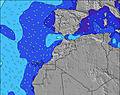 | 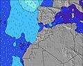 | 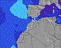 | 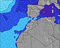 | 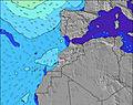 | 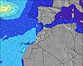 | 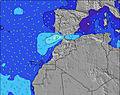 | ||||||||||||||
Wave Height (m) Direction Period (s) | WNW 10 | WNW 9 | WNW 9 | WNW 9 | WNW 9 | WNW 9 | WNW 8 | WNW 8 | NNE 6 | WNW 10 | N 7 | N 7 | N 8 | N 8 | N 8 | N 8 | N 8 | N 7 | N 7 | WNW 8 | NW 8 |
Wave Graph | |||||||||||||||||||||
37 | 34 | 32 | 34 | 32 | 49 | 46 | 26 | 275 | 57 | 466 | 653 | 458 | 609 | 558 | 381 | 403 | 340 | 199 | 13 | 15 | |
Wind (km/h) | |||||||||||||||||||||
Wind State on-shore cross-onshore cross-shore cross-offshore off-shore glassy | cross-off | cross-off | cross-off | cross-off | cross-off | cross-off | off | cross-off | off | off | cross-off | cross-off | cross-off | cross-off | cross-off | cross-off | cross-off | cross-off | cross-off | cross-off | cross-off |
High Tide | 5:42PM2.64m | 6:08AM2.42m | 6:24PM2.50m | 6:54AM2.32m | 7:16PM2.34m | 7:53AM2.22m | 8:25PM2.19m | 9:09AM2.16m | 9:52PM2.13m | 10:35AM2.22m | 11:19PM2.20m | 11:51AM2.40m | 00:30AM2.37m | ||||||||
Low Tide | 11:25AM0.42m | 11:54PM0.38m | 12:06PM0.52m | 00:36AM0.50m | 12:55PM0.64m | 1:29AM0.64m | 1:59PM0.75m | 2:39AM0.76m | 3:25PM0.80m | 4:06AM0.79m | 4:58PM0.72m | 5:29AM0.70m | 6:14PM0.51m | ||||||||
6:56 | — | — | 6:56 | — | — | 6:58 | — | — | 6:58 | — | — | 6:58 | — | — | 6:58 | — | — | 7:00 | — | — | |
— | 8:34 | — | — | 8:32 | — | — | 8:31 | — | — | 8:30 | — | — | 8:30 | — | — | 8:29 | — | — | 8:28 | — | |
mm | — | — | — | — | — | — | — | — | — | — | — | — | — | — | — | — | — | — | — | — | — |
Temp °C | 30 | 25 | 24 | 28 | 25 | 23 | 27 | 25 | 22 | 26 | 25 | 22 | 26 | 25 | 22 | 26 | 24 | 22 | 25 | 24 | 22 |
Feels °C | 24 | 21 | 20 | 23 | 21 | 19 | 21 | 19 | 17 | 20 | 19 | 17 | 21 | 20 | 17 | 22 | 20 | 18 | 22 | 20 | 18 |
Swell 1 Height (m) Direction Period (s) | WNW 10 | WNW 9 | WNW 9 | WNW 9 | WNW 9 | WNW 9 | WNW 8 | WNW 8 | WNW 10 | WNW 10 | WNW 10 | WNW 10 | WNW 9 | WNW 9 | WNW 9 | WNW 9 | WNW 9 | WNW 9 | WNW 8 | WNW 8 | NW 8 |
37 | 34 | 32 | 34 | 32 | 49 | 46 | 26 | 35 | 57 | 38 | 36 | 34 | 16 | 16 | 16 | 16 | 15 | 13 | 13 | 15 | |
Swell 2 Height (m) Direction Period (s) | — | — | — | — | — | WNW 11 | N 12 | WNW 10 | NNW 10 | — | — | — | — | — | — | — | — | — | — | N 13 | NNW 11 |
— | — | — | — | — | 12 | 3 | 20 | 42 | — | — | — | — | — | — | — | — | — | — | 3 | 13 | |
Swell 3 Height (m) Direction Period (s) | — | — | — | — | — | — | — | — | — | — | — | — | — | — | — | — | — | — | — | — | — |
— | — | — | — | — | — | — | — | — | — | — | — | — | — | — | — | — | — | — | — | — | |
Wind waves Height (m) Direction Period (s) | N 6 | N 6 | N 5 | N 5 | N 6 | NNE 6 | NNE 6 | N 6 | NNE 6 | N 6 | N 7 | N 7 | N 8 | N 8 | N 8 | N 8 | N 8 | N 7 | N 7 | N 6 | N 6 |
117 | 133 | 106 | 110 | 134 | 167 | 143 | 247 | 275 | 261 | 466 | 653 | 458 | 609 | 558 | 381 | 403 | 340 | 199 | 198 | 205 | |
Nearest Offshore or Glassy | |||||||||||||||||||||
Distance (km) | 62 | 475 | 92 | 62 | 475 | 92 | 92 | 94 | 62 | 62 | 684 | 62 | 85 | 684 | 61 | 62 | 92 | 62 | 86 | 684 | 61 |
Best forecast wave conditions in Central Morocco | |||||||||||||||||||||
Best forecast wave conditions in Morocco | |||||||||||||||||||||
Header Global | |||||||||||||||||||||
- Map Icons:
 Break
Break Live Wave Height (m)
 Live Wind Speed (km/h)
 Surf Rating (10 Max)
 Ocean Swells (m)
- Wind Speed (km/h)
Latest Updates


FREE! Surf-Forecast.com widget for your website
The surf report / weather widget below is available to embed on third party websites free of charge and provides a summary of our Cap Sim surf forecast. Simply grab the html code snippet that we provide and paste it into your own site. You can choose your preferred language and metric/imperial units for the surf forecast feed to suit users of your site. Click here to get the code.
Information about the Cap Sim Surf forecast
The above surf forecast table for Cap Sim provides essential information for determining whether the surfing conditions will be good over the next 16 days. A general guide to surfing at Cap Sim can be found by selecting the local surf guide option on the grey menu. Our Cap Sim surf forecast is unique since it includes wave energy (power) that defines the real feel of the surf rather than just the height or the period. If you surf the same spot (Cap Sim) regularly then make a mental note of the wave energy from the surf forecast table each time you go. Very soon you may start to choose your surf days based on the wave energy alone combined with our forecast of favourable offshore wind conditions. Our star ratings will help here and of course you will also find the usual wave height and period predictions on our surf forecasts as well as a full break down of the swell components under our advanced users option (to reveal that, click the little Einstein character under the tide times).
Further information to help with frequently asked questions about our surf forecast for Cap Sim may be found under the help tab on the top menu and also by moving your mouse over the question marks on the surf forecast table itself. Please always bear in mind that the forecast is for near-shore open water and local factors at each surf break influence the actual breaking wave height, such as the beach / reef profile, water depths offshore and shelter.
Cap Sim is 16 km (10 miles) from the city of Essaouira. If you plan a holiday in Central Morocco, look for hotels and other accommodation in Essaouira. Essaouira has rooms for a wide range of budgets as well as car hire and transport links.
 Nearest