

Surf Forecasts:

Bouznika Point surf forecast from 1 Aug 2026:
- Best quality surf: Sunday 2 Aug, 1AM (local time) - 2ft (0.6m), 9s period, WNW swell with glassy winds.
- Most powerful swell: Thursday 6 Aug, 1AM (local time) - 3ft (0.9m), 8s period, NW swell with 109 kJ wave energy.
- Next surfable swell (1★+): Sunday 2 Aug, 1AM (local time) - 2ft (0.6m), 9s period with WNW swell.
Best Forecast Surf Conditions for Bouznika Point this week:
The surf forecast for Bouznika Point over the next 16 days: The first swell (rated 1 star or higher) is forecast to arrive on Sunday (Aug 02) at 1AM. The primary swell is predicted to be 0.6m and 9s period with a secondary swell of 0.7m and 6s. The wind is predicted to be glassy as the swell arrives.
The most powerful waves expected at Bouznika Point in the next 16 days are 0.9m 8s and forecast to arrive on Thursday (Aug 06) at 1AM. Winds are predicted to be cross-onshore at the time the swell arrives.
| Wave Type | Time (+01) & Date | Wave Height & Period |
|---|---|---|
| Next good surf (1 star+) | 1AM (Sun 2nd Aug) | 2ft (0.6m) 9s |
| Best Surf | 1AM (Sun 2nd Aug) | 2ft (0.6m) 9s |
| Most Powerful | 1AM (Thu 6th Aug) | 3ft (0.9m) 8s |
Table - best surf conditions forecast for Bouznika Point over the next 16 days.
The Lowdown
Alright folks, Rusty here. Let’s get straight into it for Bouznika. Looking at the whole 16-day window, I gotta be honest with you – it’s a tough stretch. The wave energy is there at times, but the wind just won’t play ball. The setup is consistently cross-onshore, which is gonna leave things choppy and messy. This isn’t a time for a smooth, glassy session, it’s more about getting wet if you’re desperate.
We’re kickin’ off on Saturday morning, the 1st of August, at Bouznika Point. The swell is tiny, just 1 ft from the WNW with a period of 10 seconds. The combined energy is weak, only (75). The wind is a light cross-onshore from the N at 6 mph, just messing with the surface. This is poor surf, plain and simple. It stays similar through the weekend; Sunday the 2nd sees a bit more height at 3 ft from the NW, but the period drops to a short 6 seconds, and the wind picks up to 12 mph in the arvo. The energy is a bit more moderate at (124) in the morning, but the chop is real.
Monday the 3rd through to the end of the first week is a grind. Swell stays small, mostly under 3 ft, with that persistent cross-shore or cross-onshore wind. The wave energy builds through the week, hitting moderate levels like (127) on Thursday the 6th and (142) on Friday the 7th, but the quality is just “poor” every session. On Friday morning the 7th, we get a 3 ft NW swell with a 7-second period and the wind actually goes offshore from the NW, but it’s only 6 mph. That’s the closest we get to clean, but the period is short, so it’s not lighting the world on fire.
The second week rolls in with a bit more size but the same story. Sunday the 9th of August has a 3 ft WNW swell in the morning, energy at (177), and the wind is barely a whisper from the N at 3 mph. That’s a promising window, but the wave comment is still “poor surf conditions.” By Wednesday the 12th, the combined energy is pushing into strong territory at (203) in the afternoon, with a 3 ft swell from the NW, but the wind is a moderate cross-onshore at 12 mph, making it a choppy mess.
The biggest swell of the period shows up on Friday the 14th of August, with 5 ft from the NW in the afternoon, energy at a strong (226), but again, the wind is a moderate cross-onshore at 15 mph. At that size, it’s getting too big for beginners, but with the chop, it’s only for the hardcore. The period is a short 8 seconds, so it won’t have that classic groundswell punch.
Honestly, there’s no standout day here. The wind is always putting a lid on it. If you’re a kitesurfer, this setup with the cross-onshore wind and consistent swell energy might look interesting, but for a paddle surfer, it’s a tough call. The water temp is about average for the time of year, so no surprises there.
Hang in there, it’s a dry spell, but forecasts can change.
Rusty.
Short Range ForecastMostly dry. Warm (max 33°C on Fri night, min 21°C on Sat night). Wind will be generally light. | Days 4-6 Weather SummaryMostly dry. Warm (max 25°C on Thu morning, min 20°C on Mon night). Wind will be generally light. | ||||||||||||||||||||
Saturday 1 | Sunday 2 | Monday 3 | Tuesday 4 | Wednesday 5 | Thursday 6 | Friday 7 | |||||||||||||||
AM | PM | Night | AM | PM | Night | AM | PM | Night | AM | PM | Night | AM | PM | Night | AM | PM | Night | AM | PM | Night | |
Swell Height Map | 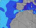 | 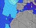 | 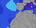 | 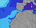 | 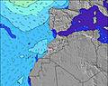 | 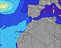 | 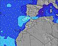 | ||||||||||||||
Wave Height (m) Direction Period (s) | NNW 6 | WNW 9 | WNW 9 | NW 6 | NNW 6 | NNW 6 | WNW 10 | WNW 10 | WNW 9 | WNW 9 | WNW 9 | WNW 9 | WNW 6 | WNW 8 | NW 8 | WNW 7 | NNW 6 | NW 6 | NW 7 | NW 6 | NW 6 |
Wave Graph | |||||||||||||||||||||
38 | 50 | 62 | 61 | 49 | 40 | 38 | 37 | 34 | 48 | 54 | 49 | 39 | 78 | 109 | 62 | 47 | 66 | 85 | 78 | 46 | |
Wind (km/h) | |||||||||||||||||||||
Wind State on-shore cross-onshore cross-shore cross-offshore off-shore glassy | cross-on | cross-on | glassy | cross-on | cross-on | cross-on | cross | cross-on | cross-on | cross | cross-on | cross-on | cross-on | cross-on | cross-on | cross-on | cross-on | glassy | on | cross-on | cross |
High Tide | 4:34AM2.62m | 4:47PM2.86m | 5:07AM2.61m | 5:20PM2.81m | 5:42AM2.57m | 5:56PM2.71m | 6:21AM2.49m | 6:38PM2.58m | 7:07AM2.39m | 7:29PM2.42m | 8:04AM2.29m | 8:36PM2.27m | 9:19AM2.22m | 10:03PM2.19m | |||||||
Low Tide | 10:35AM0.31m | 11:02PM0.25m | 11:08AM0.34m | 11:36PM0.30m | 11:44AM0.41m | 00:13AM0.38m | 12:25PM0.51m | 00:56AM0.51m | 1:14PM0.64m | 1:48AM0.65m | 2:18PM0.76m | 2:58AM0.78m | 3:41PM0.81m | ||||||||
6:39 | — | — | 6:39 | — | — | 6:41 | — | — | 6:41 | — | — | 6:41 | — | — | 6:43 | — | — | 6:43 | — | — | |
— | 8:29 | — | — | 8:28 | — | — | 8:27 | — | — | 8:25 | — | — | 8:25 | — | — | 8:24 | — | — | 8:23 | — | |
mm | — | — | — | — | — | — | — | — | — | — | — | — | — | — | — | — | — | — | — | — | — |
Temp °C | 30 | 27 | 25 | 26 | 25 | 22 | 25 | 25 | 22 | 24 | 24 | 22 | 24 | 24 | 21 | 25 | 25 | 23 | 25 | 25 | 22 |
Feels °C | 30 | 27 | 26 | 25 | 24 | 24 | 24 | 24 | 23 | 24 | 24 | 23 | 24 | 24 | 23 | 26 | 25 | 25 | 26 | 25 | 23 |
Swell 1 Height (m) Direction Period (s) | NNW 6 | WNW 9 | NW 6 | NW 6 | WNW 9 | NNW 6 | NNW 6 | WNW 10 | NNW 4 | WNW 9 | WNW 9 | WNW 9 | WNW 6 | WNW 8 | NW 8 | WNW 7 | NNW 6 | NW 6 | NW 7 | NW 6 | NW 6 |
37 | 50 | 40 | 61 | 45 | 31 | 21 | 37 | 12 | 48 | 54 | 49 | 31 | 78 | 109 | 62 | 47 | 66 | 85 | 78 | 46 | |
Swell 2 Height (m) Direction Period (s) | WNW 10 | — | WNW 9 | WNW 9 | NNW 8 | WNW 8 | WNW 10 | N 8 | WNW 9 | NNW 4 | — | NW 7 | WNW 8 | NNW 11 | NNW 10 | NNW 6 | WNW 7 | WNW 10 | WNW 10 | WNW 9 | WNW 9 |
38 | — | 62 | 61 | 7 | 40 | 38 | 1 | 34 | 6 | — | 11 | 39 | 12 | 20 | 30 | 42 | 38 | 31 | 29 | 28 | |
Swell 3 Height (m) Direction Period (s) | — | — | N 9 | N 9 | — | NW 8 | NW 8 | — | N 7 | N 7 | — | — | N 6 | — | WNW 10 | WNW 10 | WNW 10 | NW 8 | NNW 8 | NNW 10 | NNW 8 |
— | — | 2 | 2 | — | 3 | 2 | — | 1 | 1 | — | — | 18 | — | 20 | 35 | 33 | 18 | 26 | 9 | 7 | |
Wind waves Height (m) Direction Period (s) | — | NNW 6 | — | — | NNW 6 | — | — | NNW 6 | — | — | N 5 | NW 6 | — | N 5 | — | — | — | — | — | — | — |
— | 35 | — | — | 49 | — | — | 24 | — | — | 11 | 34 | — | 15 | — | — | — | — | — | — | — | |
Nearest Offshore or Glassy | |||||||||||||||||||||
Distance (km) | 56 | 281 | 0 | 38 | 840 | 3 | 3 | 410 | 3 | 375 | 298 | 3 | 370 | 438 | 10 | 17 | 281 | 0 | 243 | 281 | 3 |
Best forecast wave conditions in Central Morocco | |||||||||||||||||||||
Best forecast wave conditions in Morocco | |||||||||||||||||||||
Header Global | |||||||||||||||||||||
- Map Icons:
 Break
Break Live Wave Height (m)
 Live Wind Speed (km/h)
 Surf Rating (10 Max)
 Ocean Swells (m)
- Wind Speed (km/h)
Latest Updates


FREE! Surf-Forecast.com widget for your website
The surf report / weather widget below is available to embed on third party websites free of charge and provides a summary of our Bouznika Point surf forecast. Simply grab the html code snippet that we provide and paste it into your own site. You can choose your preferred language and metric/imperial units for the surf forecast feed to suit users of your site. Click here to get the code.
Information about the Bouznika Point Surf forecast
The above surf forecast table for Bouznika Point provides essential information for determining whether the surfing conditions will be good over the next 16 days. A general guide to surfing at Bouznika Point can be found by selecting the local surf guide option on the grey menu. Our Bouznika Point surf forecast is unique since it includes wave energy (power) that defines the real feel of the surf rather than just the height or the period. If you surf the same spot (Bouznika Point) regularly then make a mental note of the wave energy from the surf forecast table each time you go. Very soon you may start to choose your surf days based on the wave energy alone combined with our forecast of favourable offshore wind conditions. Our star ratings will help here and of course you will also find the usual wave height and period predictions on our surf forecasts as well as a full break down of the swell components under our advanced users option (to reveal that, click the little Einstein character under the tide times).
Further information to help with frequently asked questions about our surf forecast for Bouznika Point may be found under the help tab on the top menu and also by moving your mouse over the question marks on the surf forecast table itself. Please always bear in mind that the forecast is for near-shore open water and local factors at each surf break influence the actual breaking wave height, such as the beach / reef profile, water depths offshore and shelter.
 Nearest