

Surf Forecasts:

Conde surf forecast from 15 Jul 2026:
- Best quality surf: Wednesday 22 Jul, 3AM (local time) - 5ft (1.5m), 8s period, ESE swell with glassy winds.
- Most powerful swell: Friday 17 Jul, 3AM (local time) - 6.5ft (2.0m), 11s period, SSE swell with 991 kJ wave energy.
- Next surfable swell (1★+): Wednesday 22 Jul, 3AM (local time) - 5ft (1.5m), 8s period with ESE swell.
Best Forecast Surf Conditions for Conde this week:
The surf forecast for Conde over the next 16 days: The first swell (rated 1 star or higher) is forecast to arrive on Wednesday (Jul 22) at 3AM. The primary swell is predicted to be 1.5m and 8s period with a secondary swell of 0.1m and 13s. The wind is predicted to be glassy as the swell arrives.
The most powerful waves expected at Conde in the next 16 days are 2.0m 11s and forecast to arrive on Friday (Jul 17) at 3AM. Winds are predicted to be cross-onshore at the time the swell arrives. The largest open ocean swell (not directed at the beach) is 1.0m 8s period and expected on Monday (Jul 20) at 12AM.
| Wave Type | Time (-03) & Date | Wave Height & Period |
|---|---|---|
| Next good surf (1 star+) | 3AM (Wed 22nd Jul) | 5ft (1.5m) 8s |
| Best Surf | 3AM (Wed 22nd Jul) | 5ft (1.5m) 8s |
| Most Powerful | 3AM (Fri 17th Jul) | 6.5ft (2.0m) 11s |
Table - best surf conditions forecast for Conde over the next 16 days.
The Lowdown
Alright folks, Rusty here. Let's have a look at what's on the cards for Conde over the next couple of weeks.
To be straight with you, this is a tough outlook. The whole 16-day window is a bit of a grind. We've got a solid stretch of poor surf conditions with cross-onshore winds and lumpy, choppy waves. From Wednesday the 15th right through until Monday the 21st, it's pretty much all messy. The swell is there, coming from the SSE and SE, but the wind is just ruining it. The wave energy peaks on the 16th with a reading of (1341) and then again on the 19th with (583), but the quality just isn't there for a proper paddle session. For a beginner-friendly reef like Conde, this setup with significant swell over 7 ft and strong cross-shore wind actually looks more interesting for kite surfing than paddle surfing.
Now, hold onto your board, because there is a tiny window that looks promising. On Wednesday the 22nd, the stars nearly align. The morning is looking super clean with glassy conditions and a light breeze, with a 5 ft swell rolling in from the ESE. The wave energy is still a modest (250), but that glassy surface is a major positive. It'll be chest-to-shoulder high, clean, and perfect for a long session on the reef. Just keep in mind, crowds are possible here. The water temperature is sitting at about 79°, which is pretty normal for this time of year – no surprises there.
After that little taste of glory, it's back to the struggle. From the 23rd through to the 30th, we're looking at mostly cross-on winds again with small, weak swells. The wave energy drops right down, hitting (75) on the morning of the 28th, which is barely a ripple. There’s a pulse of swell returning on the 29th with a 7 ft wave from the SSE and a reading of (746), but the wind is onshore and the conditions are described as "unknown", so it’s a gamble. The last day of the month, the 30th of July, gives us a marginal call in the afternoon with a 6 ft swell, but again, the wind is on.
So, your best bet in this whole window is that Wednesday 22nd morning. It's the only real standout, but it's a beauty. Get on it if you can, because the rest of the forecast is a bit of a write-off.
Rusty.
Short Range ForecastModerate rain (total 16mm), heaviest on Wed morning. Warm (max 25°C on Wed morning, min 23°C on Wed night). Mainly fresh winds. | Days 4-6 Weather SummaryModerate rain (total 10mm), heaviest on Sat morning. Warm (max 26°C on Sun morning, min 23°C on Sun night). Wind will be generally light. | ||||||||||||||||||||
Wednesday 15 | Thursday 16 | Friday 17 | Saturday 18 | Sunday 19 | Monday 20 | Tuesday 21 | |||||||||||||||
AM | PM | Night | AM | PM | Night | AM | PM | Night | AM | PM | Night | AM | PM | Night | AM | PM | Night | AM | PM | Night | |
Swell Height Map |  |  |  |  |  |  | 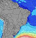 | ||||||||||||||
Wave Height (m) Direction Period (s) | S 9 | SSE 8 | SSE 8 | SSE 8 | SSE 11 | SSE 11 | SSE 8 | SE 8 | SE 8 | SE 8 | SE 8 | SE 8 | ESE 8 | SE 9 | SE 8 | SSE 9 | SE 9 | ESE 8 | ESE 8 | ESE 8 | ESE 8 |
Wave Graph | |||||||||||||||||||||
264 | 784 | 672 | 441 | 750 | 785 | 383 | 692 | 701 | 746 | 765 | 639 | 382 | 390 | 449 | 207 | 351 | 400 | 331 | 370 | 344 | |
Wind (km/h) | |||||||||||||||||||||
Wind State on-shore cross-onshore cross-shore cross-offshore off-shore glassy | cross-on | cross-on | cross-on | cross-on | cross-on | cross-on | cross-on | cross-on | cross-on | cross-on | cross-on | on | on | on | on | cross-on | on | on | on | on | on |
High Tide | 4:38PM2.03m | 4:46AM2.16m | 5:22PM1.99m | 5:30AM2.13m | 6:04PM1.91m | 6:14AM2.04m | 6:46PM1.81m | 6:58AM1.91m | 7:29PM1.70m | 7:45AM1.75m | 8:16PM1.59m | 8:39AM1.59m | 9:10PM1.49m | ||||||||
Low Tide | 10:25AM-0.06m | 10:39PM0.21m | 11:10AM-0.03m | 11:21PM0.24m | 11:54AM0.07m | 00:04AM0.31m | 12:38PM0.20m | 00:47AM0.41m | 1:22PM0.35m | 1:34AM0.51m | 2:09PM0.50m | 2:27AM0.60m | 3:04PM0.63m | ||||||||
5:48 | — | — | 5:48 | — | — | 5:48 | — | — | 5:48 | — | — | 5:48 | — | — | 5:48 | — | — | 5:48 | — | — | |
— | 5:20 | — | — | 5:20 | — | — | 5:21 | — | — | 5:21 | — | — | 5:21 | — | — | 5:21 | — | — | 5:22 | — | |
mm | 9 | 1 | — | — | — | — | — | 1 | 5 | 3 | 1 | — | — | — | 4 | 2 | — | — | — | — | — |
Temp °C | 25 | 24 | 24 | 24 | 25 | 24 | 25 | 25 | 24 | 24 | 24 | 25 | 26 | 25 | 24 | 25 | 25 | 25 | 25 | 25 | 25 |
Feels °C | 25 | 21 | 21 | 21 | 22 | 22 | 23 | 24 | 23 | 23 | 22 | 24 | 25 | 24 | 25 | 24 | 24 | 26 | 26 | 26 | 27 |
Swell 1 Height (m) Direction Period (s) | E 7 | ENE 7 | S 12 | S 12 | SSE 11 | E 7 | SSE 11 | — | — | S 13 | — | S 18 | SSE 10 | SE 9 | SE 8 | SSE 9 | SE 9 | ESE 8 | ESE 8 | ESE 8 | ESE 8 |
39 | 17 | 239 | 279 | 750 | 74 | 263 | — | — | 4 | — | 6 | 196 | 390 | 449 | 207 | 351 | 400 | 331 | 370 | 344 | |
Swell 2 Height (m) Direction Period (s) | SE 10 | S 14 | — | — | ESE 7 | — | E 7 | — | — | — | — | — | S 16 | E 8 | S 15 | ESE 9 | E 8 | S 14 | S 15 | S 13 | S 13 |
23 | 35 | — | — | 96 | — | 100 | — | — | — | — | — | 5 | 117 | 4 | 129 | 127 | 4 | 4 | 3 | 3 | |
Swell 3 Height (m) Direction Period (s) | — | — | — | — | — | — | — | — | — | — | — | — | — | S 16 | S 15 | S 14 | S 16 | — | — | — | — |
— | — | — | — | — | — | — | — | — | — | — | — | — | 5 | 4 | 4 | 5 | — | — | — | — | |
Wind waves Height (m) Direction Period (s) | S 9 | SSE 8 | SSE 8 | SSE 8 | SSE 7 | SSE 11 | SSE 8 | SE 8 | SE 8 | SE 8 | SE 8 | SE 8 | ESE 8 | — | E 8 | E 8 | — | — | — | — | — |
264 | 784 | 672 | 441 | 495 | 785 | 383 | 692 | 701 | 746 | 765 | 639 | 382 | — | 115 | 133 | — | — | — | — | — | |
Nearest Offshore or Glassy | |||||||||||||||||||||
Distance (km) | 1007 | 1042 | 960 | 960 | 960 | 981 | 960 | 960 | 713 | 960 | 960 | 960 | 372 | 960 | 960 | 873 | 960 | 380 | 380 | 960 | 93 |
Best forecast wave conditions in Bahia - Norte | |||||||||||||||||||||
Best forecast wave conditions in Brazil | |||||||||||||||||||||
Header Global | |||||||||||||||||||||
- Map Icons:
 Break
Break Live Wave Height (m)
 Live Wind Speed (km/h)
 Surf Rating (10 Max)
 Ocean Swells (m)
- Wind Speed (km/h)


FREE! Surf-Forecast.com widget for your website
The surf report / weather widget below is available to embed on third party websites free of charge and provides a summary of our Conde surf forecast. Simply grab the html code snippet that we provide and paste it into your own site. You can choose your preferred language and metric/imperial units for the surf forecast feed to suit users of your site. Click here to get the code.
Information about the Conde Surf forecast
The above surf forecast table for Conde provides essential information for determining whether the surfing conditions will be good over the next 16 days. A general guide to surfing at Conde can be found by selecting the local surf guide option on the grey menu. Our Conde surf forecast is unique since it includes wave energy (power) that defines the real feel of the surf rather than just the height or the period. If you surf the same spot (Conde) regularly then make a mental note of the wave energy from the surf forecast table each time you go. Very soon you may start to choose your surf days based on the wave energy alone combined with our forecast of favourable offshore wind conditions. Our star ratings will help here and of course you will also find the usual wave height and period predictions on our surf forecasts as well as a full break down of the swell components under our advanced users option (to reveal that, click the little Einstein character under the tide times).
Further information to help with frequently asked questions about our surf forecast for Conde may be found under the help tab on the top menu and also by moving your mouse over the question marks on the surf forecast table itself. Please always bear in mind that the forecast is for near-shore open water and local factors at each surf break influence the actual breaking wave height, such as the beach / reef profile, water depths offshore and shelter.
Conde is 17 km (11 miles) from the city of Estancia. If you plan a holiday in Bahia - Norte, look for hotels and other accommodation in Estancia. Estancia has rooms for a wide range of budgets as well as car hire and transport links.
 Nearest