

Surf Forecasts:

Zippers-Costa Azul surf forecast from 2 Aug 2026:
- Best quality surf: Thursday 6 Aug, 11PM (local time) - 2.5ft (0.7m), 18s period, SSW swell with cross-offshore winds.
- Most powerful swell: Saturday 8 Aug, 5AM (local time) - 3.5ft (1.1m), 16s period, SSW swell with 582 kJ wave energy.
- Next surfable swell (1★+): Sunday 2 Aug, 8PM (local time) - 2ft (0.6m), 13s period with SW swell.
Best Forecast Surf Conditions for Zippers-Costa Azul this week:
The surf forecast for Zippers-Costa Azul over the next 16 days: The first swell (rated 1 star or higher) is forecast to arrive on Sunday (Aug 02) at 8PM. The primary swell is predicted to be 0.6m and 13s period with a secondary swell of 0.5m and 11s. The wind is predicted to be offshore as the swell arrives.
The most powerful waves expected at Zippers-Costa Azul in the next 16 days are 1.1m 16s and forecast to arrive on Saturday (Aug 08) at 5AM. Winds are predicted to be offshore at the time the swell arrives. The largest open ocean swell (not directed at the beach) is 0.8m 4s period and expected on Sunday (Aug 02) at 8PM.
| Wave Type | Time (MST) & Date | Wave Height & Period |
|---|---|---|
| Next good surf (1 star+) | 8PM (Sun 2nd Aug) | 2ft (0.6m) 13s |
| Best Surf | 11PM (Thu 6th Aug) | 2.5ft (0.7m) 18s |
| Most Powerful | 5AM (Sat 8th Aug) | 3.5ft (1.1m) 16s |
Table - best surf conditions forecast for Zippers-Costa Azul over the next 16 days.
The Lowdown
Alright, Rusty here. Let’s talk about what’s shaping up at your local stretch.
We’ve got a bit of a slow start for the next few days at Zippers-Costa Azul. The surf is small and pretty weak, with wave heights barely pushing 3ft and the swell energy is sitting under 300, so don’t get your hopes up for anything meaty. Sunday morning has some small 3ft SSW swell, but it’s coming in from the SSE wind, making it onshore and messy. Water temp is a balmy 86°, which is much warmer than usual for this time of year – you’ll be surfing in boardies for sure.
Monday through Wednesday stays small, with waves hanging around 2ft to 2ft. Monday morning looks the best of this quiet patch with a glassy 2ft SW swell, clean, but it’s really just ankle-biters. The swell energy is weak, around 140-170, so you’re not missing much if you skip it.
Then things start to wake up from Thursday 6 August. The swell builds slowly, but it’s still marginal. Thursday afternoon shows a 2ft SSW swell with a nice long 18-second period, and the energy jumps to 493 – moderate, finally. The wind is cross-off, keeping it clean, but the tide might mess with it a bit. Friday 7 August afternoon is where I’d point you first: 3ft SSW groundswell, 17-second period, cross-off wind, and the energy is up at 586. That’s a decent window for a fun session.
The standout for the whole forecast comes on Thursday 13 August into Friday 14 August. Thursday afternoon sees a solid 3ft SSW swell with a 19-second period, energy hitting 881. But Friday 14 August is the real gem: 5ft SW swell with 17-second period, glassy conditions in the morning, and cross-off in the afternoon. The combined energy is over 1000, so there’s proper power in the water. That’s excellent for experienced surfers – the 5ft height means it’s too much for beginners, but for the rest of you, it’s going to be clean and punchy. This long-period groundswell will really love the reef setup here, so expect well-shaped, powerful lines.
Saturday 15 August keeps the fun going with 4ft SW swell, glassy all day, and energy still strong around 935-956. That’s another top session for those who missed Friday. Sunday 16 August morning is also glassy with similar 4ft SSW swell, but the afternoon gets a bit choppy.
After that, the swell hangs around 4ft through Monday 17 August, but winds turn cross-onshore and the quality drops back to marginal.
Overall, the best windows are the afternoon of Friday 7 August, and the standout is definitely Friday 14 August through Saturday 15 August. Don’t sleep on those. Zippers can get crowded, and with these conditions, it’ll be worth paddling out early.
Stay stoked,
Rusty.
Short Range ForecastModerate rain (total 14mm), heaviest on Mon afternoon. Warm (max 32°C on Sun afternoon, min 27°C on Mon night). Wind will be generally light. | Days 4-6 Weather SummaryLight rain (total 3mm), mostly falling on Fri night. Warm (max 31°C on Fri morning, min 27°C on Wed night). Wind will be generally light. | ||||||||||||||||||||
Sunday 2 | Monday 3 | Tuesday 4 | Wednesday 5 | Thursday 6 | Friday 7 | Saturday 8 | |||||||||||||||
AM | PM | Night | AM | PM | Night | AM | PM | Night | AM | PM | Night | AM | PM | Night | AM | PM | Night | AM | PM | Night | |
Swell Height Map | 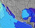 |  | 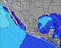 | 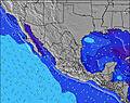 | 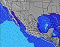 | 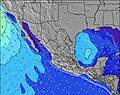 | 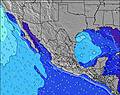 | ||||||||||||||
Wave Height (m) Direction Period (s) | SSW 13 | SW 13 | SW 13 | SW 13 | SW 12 | SW 16 | SW 15 | SW 15 | SW 14 | SW 14 | SW 14 | SW 20 | SW 13 | SSW 18 | SSW 18 | SSW 17 | SSW 17 | SSW 16 | SSW 16 | SSW 15 | SSW 14 |
Wave Graph | |||||||||||||||||||||
195 | 140 | 83 | 79 | 73 | 90 | 69 | 54 | 103 | 127 | 102 | 144 | 140 | 286 | 216 | 475 | 448 | 487 | 561 | 417 | 400 | |
Wind (km/h) | |||||||||||||||||||||
Wind State on-shore cross-onshore cross-shore cross-offshore off-shore glassy | on | cross-off | off | cross | cross-off | cross-off | cross | cross-off | cross-off | cross | cross-off | cross-off | on | cross-off | off | on | cross-off | off | cross | cross-off | off |
High Tide | 10:45AM1.45m | 10:26PM1.40m | 11:11AM1.48m | 11:08PM1.23m | 11:43AM1.49m | 00:06AM1.05m | 12:27PM1.49m | 2:20AM0.89m | 1:33PM1.47m | 3:13PM1.48m | 7:44AM1.11m | 4:46PM1.57m | |||||||||
Low Tide | 4:36PM0.62m | 4:42AM0.45m | 5:24PM0.62m | 5:03AM0.58m | 6:29PM0.64m | 5:22AM0.71m | 8:11PM0.62m | 5:23AM0.84m | 10:30PM0.51m | 11:51PM0.32m | 10:21AM1.07m | 00:42AM0.15m | |||||||||
5:50 | — | — | 5:50 | — | — | 5:50 | — | — | 5:50 | — | — | 5:52 | — | — | 5:52 | — | — | 5:52 | — | — | |
— | 7:00 | — | — | 6:59 | — | — | 6:59 | — | — | 6:58 | — | — | 6:57 | — | — | 6:57 | — | — | 6:55 | — | |
mm | — | — | 6 | 1 | 7 | — | — | — | — | — | — | — | — | — | — | — | — | 3 | — | 1 | 2 |
Temp °C | 30 | 32 | 29 | 31 | 30 | 28 | 30 | 30 | 28 | 30 | 30 | 28 | 30 | 30 | 28 | 31 | 31 | 29 | 31 | 31 | 29 |
Feels °C | 33 | 33 | 30 | 35 | 34 | 31 | 32 | 31 | 30 | 33 | 32 | 30 | 34 | 34 | 31 | 35 | 34 | 32 | 35 | 33 | 33 |
Swell 1 Height (m) Direction Period (s) | SSW 13 | SW 13 | SW 13 | SW 13 | SW 12 | SW 12 | SW 12 | SW 12 | SW 14 | SW 14 | S 8 | SW 13 | SW 13 | S 9 | SW 13 | SSW 17 | SSW 17 | SSW 16 | SSW 16 | SSW 15 | SSW 14 |
195 | 140 | 83 | 79 | 73 | 51 | 69 | 50 | 103 | 127 | 36 | 144 | 140 | 71 | 170 | 475 | 448 | 487 | 561 | 417 | 400 | |
Swell 2 Height (m) Direction Period (s) | W 4 | S 11 | S 11 | S 9 | S 11 | SW 16 | SW 15 | SW 15 | S 11 | SSE 8 | SW 14 | S 9 | SSE 8 | SSW 18 | SSW 18 | SW 12 | S 9 | SW 12 | SW 12 | S 8 | WSW 11 |
9 | 66 | 57 | 24 | 58 | 90 | 57 | 54 | 59 | 24 | 102 | 54 | 54 | 286 | 216 | 124 | 54 | 114 | 114 | 50 | 81 | |
Swell 3 Height (m) Direction Period (s) | WSW 8 | WSW 18 | SSW 18 | SSW 14 | SSW 13 | S 9 | SSW 13 | SSW 13 | SW 11 | SW 11 | SW 11 | SW 20 | SSW 18 | SW 13 | SSE 8 | S 8 | SW 12 | SSE 9 | S 8 | SW 11 | SSE 11 |
22 | 31 | 30 | 37 | 35 | 23 | 33 | 32 | 31 | 31 | 32 | 97 | 127 | 138 | 39 | 52 | 87 | 42 | 36 | 59 | 23 | |
Wind waves Height (m) Direction Period (s) | WNW 4 | W 4 | W 4 | W 4 | W 4 | W 4 | W 4 | W 3 | W 3 | W 3 | WSW 3 | WNW 3 | NW 3 | NW 9 | WNW 3 | NW 4 | WNW 3 | WNW 4 | WNW 4 | WNW 4 | S 8 |
24 | 13 | 14 | 11 | 18 | 9 | 4 | 8 | 3 | 1 | 3 | 2 | 2 | 21 | 7 | 5 | 5 | 10 | 11 | 10 | 50 | |
Nearest Offshore or Glassy | |||||||||||||||||||||
Distance (km) | 0 | 312 | 0 | 0 | 0 | 0 | 0 | 455 | 0 | 13 | 455 | 0 | 8 | 501 | 0 | 8 | 0 | 0 | 3 | 0 | 0 |
Best forecast wave conditions in Baja Sur | |||||||||||||||||||||
Best forecast wave conditions in Mexico | |||||||||||||||||||||
Header Global | |||||||||||||||||||||
- Map Icons:
 Break
Break Live Wave Height (m)
 Live Wind Speed (km/h)
 Surf Rating (10 Max)
 Ocean Swells (m)
- Wind Speed (km/h)
Latest Updates


FREE! Surf-Forecast.com widget for your website
The surf report / weather widget below is available to embed on third party websites free of charge and provides a summary of our Zippers-Costa Azul surf forecast. Simply grab the html code snippet that we provide and paste it into your own site. You can choose your preferred language and metric/imperial units for the surf forecast feed to suit users of your site. Click here to get the code.
Information about the Zippers-Costa Azul Surf forecast
The above surf forecast table for Zippers-Costa Azul provides essential information for determining whether the surfing conditions will be good over the next 16 days. A general guide to surfing at Zippers-Costa Azul can be found by selecting the local surf guide option on the grey menu. Our Zippers-Costa Azul surf forecast is unique since it includes wave energy (power) that defines the real feel of the surf rather than just the height or the period. If you surf the same spot (Zippers-Costa Azul) regularly then make a mental note of the wave energy from the surf forecast table each time you go. Very soon you may start to choose your surf days based on the wave energy alone combined with our forecast of favourable offshore wind conditions. Our star ratings will help here and of course you will also find the usual wave height and period predictions on our surf forecasts as well as a full break down of the swell components under our advanced users option (to reveal that, click the little Einstein character under the tide times).
Further information to help with frequently asked questions about our surf forecast for Zippers-Costa Azul may be found under the help tab on the top menu and also by moving your mouse over the question marks on the surf forecast table itself. Please always bear in mind that the forecast is for near-shore open water and local factors at each surf break influence the actual breaking wave height, such as the beach / reef profile, water depths offshore and shelter.
Zippers-Costa Azul is 14 km (9 miles) from Cabo San Lucas. If you plan a holiday in Baja Sur, look for hotels and other accommodation in Cabo San Lucas. Cabo San Lucas has rooms for a wide range of budgets as well as car hire and transport links.
 Nearest