

Surf Forecasts:

Costa Azul surf forecast from 2 Aug 2026:
- Best quality surf: Thursday 6 Aug, 11PM (local time) - 2.5ft (0.7m), 18s period, SSW swell with offshore winds.
- Most powerful swell: Saturday 8 Aug, 5AM (local time) - 3.5ft (1.1m), 16s period, SSW swell with 582 kJ wave energy.
- Next surfable swell (1★+): Saturday 1 Aug, 11PM (local time) - 2ft (0.6m), 14s period with SW swell.
Best Forecast Surf Conditions for Costa Azul this week:
The surf forecast for Costa Azul over the next 16 days: The first swell (rated 1 star or higher) is forecast to arrive on Saturday (Aug 01) at 11PM. The primary swell is predicted to be 0.6m and 14s period with a secondary swell of 0.6m and 12s. The wind is predicted to be offshore as the swell arrives.
The most powerful waves expected at Costa Azul in the next 16 days are 1.1m 16s and forecast to arrive on Saturday (Aug 08) at 5AM. Winds are predicted to be cross-offshore at the time the swell arrives. The largest open ocean swell (not directed at the beach) is 1.0m 4s period and expected on Sunday (Aug 02) at 8AM.
| Wave Type | Time (MST) & Date | Wave Height & Period |
|---|---|---|
| Next good surf (1 star+) | 11PM (Sat 1st Aug) | 2ft (0.6m) 14s |
| Best Surf | 11PM (Thu 6th Aug) | 2.5ft (0.7m) 18s |
| Most Powerful | 5AM (Sat 8th Aug) | 3.5ft (1.1m) 16s |
Table - best surf conditions forecast for Costa Azul over the next 16 days.
The Lowdown
Alright, Rusty here, talkin' waves.
The only game in town for this whole 16-day stretch is Costa Azul – a consistent, exposed spot that loves a south-southeast push.
The first few days are a total bust. Saturday the 1st and Sunday the 2nd are flat and messy, not even worth waxing up. The water is a warm 85°, which is a good 4° above normal – feels like bathwater.
Monday the 3rd is tiny, maybe 2ft, but goes glassy in the morning. Weak energy (140 combined), so only a log will do.
Then it goes dead. Tuesday the 4th through Thursday the 6th is poor or marginal. Small waves, bad wind. A real drag.
On Thursday the 6th afternoon, things flicker. The swell hits 2ft from the south-southwest with a long 18-second period, and the energy climbs to 482. Still small, but it’s a promise.
Friday the 7th is better. 3ft of SSW groundswell at 17 seconds, 652 energy. The mornings are a little bumpy, but the afternoons clean up.
Saturday the 8th of August is the standout. 4ft in the morning, 16 seconds, 711 energy, and a light offshore wind from the southeast. The afternoon drops to 3ft, clean, cross-off. This is the best balance of size, clean conditions, and consistency for the whole two weeks. Get on it.
Sunday the 9th is okay, similar but smaller.
The second week is up and down. There’s a bit of a lull, but Wednesday the 12th afternoon looks clean with 3ft. Then Thursday the 13th afternoon pumps out a 19-second period, clean cross-off, and 739 energy. That’s beautiful, long lines.
Friday the 14th morning is the biggest swell of the whole run – 5ft from the SW, 17 seconds, and a strong 1134 combined energy. The wind is a light cross-onshore, so it’s not perfect, but the power is there. This is only for experts; it will be heavy and shifty. Friday afternoon and Saturday the 15th stay solid at 4-4ft, clean, with good energy.
Sunday the 16th ends with a clean 3ft afternoon and 618 energy. A solid finish.
The pick: Saturday the 8th of August for the all-rounder. Friday the 14th morning for the biggest, heaviest waves – if you’re good enough. Thursday the 13th afternoon for the cleanest, longest period surf.
Rusty out.
Short Range ForecastModerate rain (total 11mm), heaviest on Sat night. Warm (max 32°C on Sat afternoon, min 27°C on Sun night). Wind will be generally light. | Days 5-7 Weather SummaryMostly dry. Warm (max 31°C on Tue afternoon, min 27°C on Tue night). Wind will be generally light. | |||||||||||||||||||
Sat 1 | Sunday 2 | Monday 3 | Tuesday 4 | Wednesday 5 | Thursday 6 | Friday 7 | ||||||||||||||
PM | Night | AM | PM | Night | AM | PM | Night | AM | PM | Night | AM | PM | Night | AM | PM | Night | AM | PM | Night | |
Swell Height Map |  |  |  | 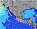 | 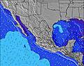 | 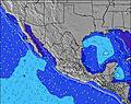 | 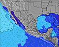 | |||||||||||||
Wave Height (m) Direction Period (s) | SW 14 | S 12 | SSW 13 | SW 13 | SW 13 | SW 13 | SW 12 | SW 16 | SW 15 | SW 15 | SW 14 | SW 14 | SW 14 | SW 20 | SW 13 | SSW 18 | SSW 18 | SSW 17 | SSW 17 | SSW 16 |
Wave Graph | ||||||||||||||||||||
152 | 103 | 195 | 140 | 83 | 79 | 73 | 90 | 69 | 54 | 103 | 99 | 102 | 144 | 140 | 286 | 216 | 475 | 448 | 487 | |
Wind (km/h) | ||||||||||||||||||||
Wind State on-shore cross-onshore cross-shore cross-offshore off-shore glassy | cross-off | off | glassy | cross-off | off | cross | glassy | off | cross | cross-off | cross-off | cross-on | cross | cross-off | cross | cross-off | off | cross-on | cross | off |
High Tide | 9:51PM1.54m | 10:45AM1.45m | 10:26PM1.40m | 11:11AM1.48m | 11:08PM1.23m | 11:43AM1.49m | 00:06AM1.05m | 12:27PM1.49m | 2:20AM0.89m | 1:33PM1.47m | 3:13PM1.48m | |||||||||
Low Tide | 3:55PM0.64m | 4:20AM0.33m | 4:36PM0.62m | 4:42AM0.45m | 5:24PM0.62m | 5:03AM0.58m | 6:29PM0.64m | 5:22AM0.71m | 8:11PM0.62m | 5:23AM0.84m | 10:30PM0.51m | 11:51PM0.32m | ||||||||
— | — | 5:50 | — | — | 5:50 | — | — | 5:50 | — | — | 5:50 | — | — | 5:52 | — | — | 5:52 | — | — | |
7:00 | — | — | 7:00 | — | — | 6:59 | — | — | 6:59 | — | — | 6:58 | — | — | 6:57 | — | — | 6:57 | — | |
mm | 1 | 4 | — | — | 5 | — | 1 | — | — | — | — | — | — | — | — | — | — | — | — | 2 |
Temp °C | 32 | 29 | 31 | 31 | 29 | 31 | 30 | 29 | 31 | 31 | 28 | 30 | 30 | 28 | 30 | 30 | 28 | 31 | 31 | 28 |
Feels °C | 34 | 30 | 35 | 34 | 31 | 35 | 33 | 32 | 33 | 32 | 30 | 33 | 32 | 31 | 32 | 31 | 30 | 35 | 34 | 31 |
Swell 1 Height (m) Direction Period (s) | SSW 12 | S 12 | SSW 13 | SW 13 | SW 13 | SW 13 | SW 12 | SW 12 | SW 12 | SW 12 | SW 14 | SW 14 | S 8 | SW 13 | SW 13 | SSW 18 | SW 13 | SSW 17 | SSW 17 | SSW 16 |
152 | 103 | 195 | 140 | 83 | 79 | 73 | 51 | 69 | 50 | 103 | 99 | 36 | 144 | 140 | 286 | 172 | 475 | 448 | 487 | |
Swell 2 Height (m) Direction Period (s) | SW 14 | SW 14 | WNW 5 | S 11 | S 11 | S 9 | S 11 | SW 16 | SW 15 | SW 15 | S 11 | S 8 | SW 14 | S 9 | S 9 | SW 13 | SSE 8 | SW 12 | S 8 | SW 12 |
127 | 92 | 22 | 66 | 57 | 24 | 58 | 90 | 57 | 54 | 59 | 37 | 102 | 39 | 55 | 138 | 54 | 126 | 50 | 114 | |
Swell 3 Height (m) Direction Period (s) | W 9 | W 8 | WSW 8 | WSW 18 | SSW 18 | SSW 14 | SSW 13 | SSE 9 | SSW 13 | SSW 13 | SW 11 | SW 11 | SW 11 | SW 20 | SSW 18 | SSE 8 | SSW 18 | S 8 | SW 12 | SSE 8 |
41 | 35 | 22 | 31 | 30 | 37 | 35 | 25 | 33 | 32 | 31 | 31 | 32 | 97 | 127 | 57 | 216 | 51 | 87 | 40 | |
Wind waves Height (m) Direction Period (s) | W 4 | WNW 4 | WNW 5 | W 8 | WNW 4 | WNW 4 | W 4 | W 4 | W 3 | W 4 | W 3 | W 3 | WSW 3 | W 3 | WNW 9 | WSW 3 | WNW 3 | NW 4 | WNW 3 | WNW 4 |
10 | 19 | 42 | 44 | 24 | 14 | 12 | 9 | 5 | 9 | 2 | 1 | 2 | 1 | 16 | 3 | 5 | 3 | 4 | 8 | |
Nearest Offshore or Glassy | ||||||||||||||||||||
Distance (km) | 7 | 455 | 0 | 3 | 313 | 0 | 0 | 0 | 0 | 1 | 455 | 0 | 10 | 455 | 0 | 10 | 76 | 0 | 7 | 455 |
Best forecast wave conditions in Baja Sur | ||||||||||||||||||||
Best forecast wave conditions in Mexico | ||||||||||||||||||||
Header Global | ||||||||||||||||||||
- Map Icons:
 Break
Break Live Wave Height (m)
 Live Wind Speed (km/h)
 Surf Rating (10 Max)
 Ocean Swells (m)
- Wind Speed (km/h)
Latest Updates


FREE! Surf-Forecast.com widget for your website
The surf report / weather widget below is available to embed on third party websites free of charge and provides a summary of our Costa Azul surf forecast. Simply grab the html code snippet that we provide and paste it into your own site. You can choose your preferred language and metric/imperial units for the surf forecast feed to suit users of your site. Click here to get the code.
Information about the Costa Azul Surf forecast
The above surf forecast table for Costa Azul provides essential information for determining whether the surfing conditions will be good over the next 16 days. A general guide to surfing at Costa Azul can be found by selecting the local surf guide option on the grey menu. Our Costa Azul surf forecast is unique since it includes wave energy (power) that defines the real feel of the surf rather than just the height or the period. If you surf the same spot (Costa Azul) regularly then make a mental note of the wave energy from the surf forecast table each time you go. Very soon you may start to choose your surf days based on the wave energy alone combined with our forecast of favourable offshore wind conditions. Our star ratings will help here and of course you will also find the usual wave height and period predictions on our surf forecasts as well as a full break down of the swell components under our advanced users option (to reveal that, click the little Einstein character under the tide times).
Further information to help with frequently asked questions about our surf forecast for Costa Azul may be found under the help tab on the top menu and also by moving your mouse over the question marks on the surf forecast table itself. Please always bear in mind that the forecast is for near-shore open water and local factors at each surf break influence the actual breaking wave height, such as the beach / reef profile, water depths offshore and shelter.
Costa Azul is 13 km (8 miles) from Cabo San Lucas. If you plan a holiday in Baja Sur, look for hotels and other accommodation in Cabo San Lucas. Cabo San Lucas has rooms for a wide range of budgets as well as car hire and transport links.
 Nearest