

Surf Forecasts:

Acapulquito-Costa Azul surf forecast from 3 Aug 2026:
- Best quality surf: Thursday 6 Aug, 11PM (local time) - 2.5ft (0.7m), 18s period, SSW swell with cross-offshore winds.
- Most powerful swell: Saturday 8 Aug, 5AM (local time) - 3.5ft (1.1m), 16s period, SSW swell with 582 kJ wave energy.
- Next surfable swell (1★+): Monday 3 Aug, 2AM (local time) - 1.5ft (0.5m), 13s period with SW swell.
Best Forecast Surf Conditions for Acapulquito-Costa Azul this week:
The surf forecast for Acapulquito-Costa Azul over the next 16 days: The first swell (rated 1 star or higher) is forecast to arrive on Monday (Aug 03) at 2AM. The primary swell is predicted to be 0.5m and 13s period with a secondary swell of 0.5m and 11s. The wind is predicted to be cross-offshore as the swell arrives.
The most powerful waves expected at Acapulquito-Costa Azul in the next 16 days are 1.1m 16s and forecast to arrive on Saturday (Aug 08) at 5AM. Winds are predicted to be cross-offshore at the time the swell arrives. The largest open ocean swell (not directed at the beach) is 0.8m 4s period and expected on Monday (Aug 03) at 2AM.
| Wave Type | Time (MST) & Date | Wave Height & Period |
|---|---|---|
| Next good surf (1 star+) | 2AM (Mon 3rd Aug) | 1.5ft (0.5m) 13s |
| Best Surf | 11PM (Thu 6th Aug) | 2.5ft (0.7m) 18s |
| Most Powerful | 5AM (Sat 8th Aug) | 3.5ft (1.1m) 16s |
Table - best surf conditions forecast for Acapulquito-Costa Azul over the next 16 days.
The Lowdown
Alright, this is Rusty comin' at you from the coast. Let's get real about the surf.
First off, I gotta be honest with you. The next few days are a bit of a grind. The swell is tiny, mostly around 1ft to 2ft. There's some energy moving through, but it's pretty weak. The water temp is sitting at 86°, which is a wild 5° warmer than usual for this time of year—that's a bath, folks. For the first few days, it's all about very small, weak surf and a lot of cross-onshore breezes. Not much to write home about.
We do have a glimmer on Monday, August 3rd. The morning session at Acapulquito-Costa Azul is looking clean with a zephyr of a south wind and glassy conditions. The swell is only 2ft from the SW with a long 13s period, and the combined energy is a moderate 140. It's not a standout by any means, but it's the best we've got for a few days. The water is still that crazy warm 86°.
The run of small, poor surf continues through the first week. There's a lot of cross and onshore wind, and the swell barely ticks up. It's a tough stretch.
Now, look ahead to Thursday, August 13th. That's the real standout here. The forecast is calling for a solid morning with glassy, offshore winds from the SSW at just 3 mph. Swell is 3ft from the SW with a long 15s period, and the combined energy is a strong 588. It's going to be clean, with very good surf conditions. The afternoon session looks even better with the same glassy wind and a 2ft SW swell but with a super long 19s period, pushing the energy up to 635. This is the one to circle on the calendar if you can get out there.
The following morning, Friday, August 14th, sees a bigger bump in size, hitting 4ft from the SSW with a period of 18s. The energy spikes to a strong 1107, but it's coming with a light onshore wind. It's a trade-off. That's a lot of juice, but it won't be as clean as the day before.
The weekend of the 16th and 17th looks like a return to smaller, more marginal conditions. The glassy morning on Sunday, August 16th, with 3ft SSW swell and a 15s period, offers a final clean, small-wave window, but the energy is back down to 509.
Honestly, for the first week, you're mostly waiting for a winner. The best bet is the glassy, clean conditions on Thursday, August 13th. That's your standout. After that, it's a bit of a mixed bag again.
Later, Rusty.
Short Range ForecastLight rain (total 9mm), mostly falling on Sun night. Warm (max 31°C on Sun afternoon, min 27°C on Mon night). Wind will be generally light. | Days 5-7 Weather SummaryMostly dry. Warm (max 31°C on Fri morning, min 27°C on Wed night). Wind will be generally light. | |||||||||||||||||||
Sun 2 | Monday 3 | Tuesday 4 | Wednesday 5 | Thursday 6 | Friday 7 | Saturday 8 | ||||||||||||||
PM | Night | AM | PM | Night | AM | PM | Night | AM | PM | Night | AM | PM | Night | AM | PM | Night | AM | PM | Night | |
Swell Height Map |  |  |  | 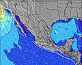 | 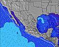 | 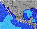 | 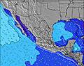 | |||||||||||||
Wave Height (m) Direction Period (s) | SW 13 | SW 13 | SW 13 | SW 12 | SW 16 | SW 15 | SW 15 | SW 14 | SW 14 | SW 14 | SW 20 | SW 13 | SSW 18 | SSW 18 | SSW 17 | SSW 17 | SSW 16 | SSW 16 | SSW 15 | SSW 14 |
Wave Graph | ||||||||||||||||||||
140 | 83 | 79 | 73 | 90 | 69 | 54 | 103 | 127 | 102 | 144 | 140 | 286 | 216 | 475 | 448 | 487 | 561 | 417 | 400 | |
Wind (km/h) | ||||||||||||||||||||
Wind State on-shore cross-onshore cross-shore cross-offshore off-shore glassy | cross-off | cross-off | glassy | glassy | cross-off | cross-on | cross | cross-off | on | cross | cross-off | on | cross | cross-off | on | cross | off | on | cross | cross-off |
High Tide | 10:26PM1.40m | 11:11AM1.48m | 11:08PM1.23m | 11:43AM1.49m | 00:06AM1.05m | 12:27PM1.49m | 2:20AM0.89m | 1:33PM1.47m | 3:13PM1.48m | 7:44AM1.11m | 4:46PM1.57m | |||||||||
Low Tide | 4:36PM0.62m | 4:42AM0.45m | 5:24PM0.62m | 5:03AM0.58m | 6:29PM0.64m | 5:22AM0.71m | 8:11PM0.62m | 5:23AM0.84m | 10:30PM0.51m | 11:51PM0.32m | 10:21AM1.07m | 00:42AM0.15m | ||||||||
— | — | 5:50 | — | — | 5:50 | — | — | 5:50 | — | — | 5:52 | — | — | 5:52 | — | — | 5:52 | — | — | |
7:00 | — | — | 6:59 | — | — | 6:59 | — | — | 6:58 | — | — | 6:57 | — | — | 6:57 | — | — | 6:55 | — | |
mm | — | 5 | 1 | 3 | — | — | — | — | — | — | — | — | — | — | — | — | — | — | 1 | 2 |
Temp °C | 31 | 29 | 31 | 31 | 29 | 30 | 30 | 28 | 30 | 30 | 28 | 30 | 30 | 28 | 31 | 31 | 29 | 31 | 31 | 28 |
Feels °C | 33 | 31 | 35 | 35 | 34 | 33 | 32 | 30 | 33 | 34 | 31 | 33 | 35 | 31 | 35 | 33 | 31 | 35 | 33 | 31 |
Swell 1 Height (m) Direction Period (s) | SW 13 | SW 13 | SW 13 | SW 12 | SW 12 | SW 12 | SW 12 | SW 14 | SW 14 | SW 14 | SW 13 | SW 13 | SSW 18 | SW 13 | SSW 17 | SSW 17 | SSW 16 | SSW 16 | SSW 15 | SSW 14 |
140 | 83 | 79 | 73 | 51 | 69 | 50 | 103 | 127 | 102 | 144 | 140 | 286 | 170 | 475 | 448 | 487 | 561 | 417 | 400 | |
Swell 2 Height (m) Direction Period (s) | S 11 | S 11 | S 9 | S 11 | SW 16 | SW 15 | SW 15 | S 11 | SSE 8 | S 8 | S 9 | S 8 | SW 13 | SSW 18 | SW 12 | S 9 | SW 12 | SW 12 | SSE 8 | WSW 11 |
66 | 57 | 24 | 58 | 90 | 57 | 54 | 59 | 24 | 36 | 54 | 50 | 138 | 216 | 151 | 52 | 114 | 69 | 28 | 81 | |
Swell 3 Height (m) Direction Period (s) | WSW 18 | SSW 18 | SSW 14 | SSW 13 | S 9 | SSW 13 | SSW 13 | SW 11 | SW 11 | SW 11 | SW 20 | SSW 18 | SSE 8 | SSE 8 | S 9 | SW 12 | SSE 9 | SSE 8 | SW 11 | SSE 11 |
31 | 30 | 37 | 35 | 23 | 33 | 32 | 31 | 31 | 32 | 97 | 127 | 57 | 39 | 54 | 87 | 42 | 40 | 43 | 23 | |
Wind waves Height (m) Direction Period (s) | W 4 | W 4 | WNW 4 | W 4 | W 4 | W 4 | W 3 | W 3 | W 3 | WSW 3 | WNW 3 | NW 3 | WSW 3 | WNW 3 | NW 4 | WNW 3 | WNW 4 | WNW 4 | WNW 4 | S 8 |
14 | 21 | 17 | 22 | 13 | 4 | 8 | 3 | 2 | 3 | 1 | 3 | 1 | 7 | 4 | 5 | 8 | 15 | 6 | 51 | |
Nearest Offshore or Glassy | ||||||||||||||||||||
Distance (km) | 2 | 0 | 0 | 0 | 0 | 8 | 455 | 0 | 13 | 455 | 0 | 8 | 455 | 0 | 10 | 329 | 0 | 0 | 0 | 0 |
Best forecast wave conditions in Baja Sur | ||||||||||||||||||||
Best forecast wave conditions in Mexico | ||||||||||||||||||||
Header Global | ||||||||||||||||||||
- Map Icons:
 Break
Break Live Wave Height (m)
 Live Wind Speed (km/h)
 Surf Rating (10 Max)
 Ocean Swells (m)
- Wind Speed (km/h)
Latest Updates


FREE! Surf-Forecast.com widget for your website
The surf report / weather widget below is available to embed on third party websites free of charge and provides a summary of our Acapulquito-Costa Azul surf forecast. Simply grab the html code snippet that we provide and paste it into your own site. You can choose your preferred language and metric/imperial units for the surf forecast feed to suit users of your site. Click here to get the code.
Information about the Acapulquito-Costa Azul Surf forecast
The above surf forecast table for Acapulquito-Costa Azul provides essential information for determining whether the surfing conditions will be good over the next 16 days. A general guide to surfing at Acapulquito-Costa Azul can be found by selecting the local surf guide option on the grey menu. Our Acapulquito-Costa Azul surf forecast is unique since it includes wave energy (power) that defines the real feel of the surf rather than just the height or the period. If you surf the same spot (Acapulquito-Costa Azul) regularly then make a mental note of the wave energy from the surf forecast table each time you go. Very soon you may start to choose your surf days based on the wave energy alone combined with our forecast of favourable offshore wind conditions. Our star ratings will help here and of course you will also find the usual wave height and period predictions on our surf forecasts as well as a full break down of the swell components under our advanced users option (to reveal that, click the little Einstein character under the tide times).
Further information to help with frequently asked questions about our surf forecast for Acapulquito-Costa Azul may be found under the help tab on the top menu and also by moving your mouse over the question marks on the surf forecast table itself. Please always bear in mind that the forecast is for near-shore open water and local factors at each surf break influence the actual breaking wave height, such as the beach / reef profile, water depths offshore and shelter.
Acapulquito-Costa Azul is 13 km (8 miles) from Cabo San Lucas. If you plan a holiday in Baja Sur, look for hotels and other accommodation in Cabo San Lucas. Cabo San Lucas has rooms for a wide range of budgets as well as car hire and transport links.
 Nearest