

Surf Forecasts:

The Rock-Costa Azul surf forecast from 3 Aug 2026:
- Best quality surf: Thursday 6 Aug, 11PM (local time) - 2.5ft (0.7m), 18s period, SSW swell with offshore winds.
- Most powerful swell: Saturday 8 Aug, 5AM (local time) - 3.5ft (1.1m), 16s period, SSW swell with 582 kJ wave energy.
- Next surfable swell (1★+): Monday 3 Aug, 5AM (local time) - 1.5ft (0.5m), 13s period with SW swell.
Best Forecast Surf Conditions for The Rock-Costa Azul this week:
The surf forecast for The Rock-Costa Azul over the next 16 days: The first swell (rated 1 star or higher) is forecast to arrive on Monday (Aug 03) at 5AM. The primary swell is predicted to be 0.5m and 13s period with a secondary swell of 0.5m and 11s. The wind is predicted to be offshore as the swell arrives.
The most powerful waves expected at The Rock-Costa Azul in the next 16 days are 1.1m 16s and forecast to arrive on Saturday (Aug 08) at 5AM. Winds are predicted to be offshore at the time the swell arrives. The largest open ocean swell (not directed at the beach) is 0.9m 4s period and expected on Monday (Aug 03) at 5AM.
| Wave Type | Time (MST) & Date | Wave Height & Period |
|---|---|---|
| Next good surf (1 star+) | 5AM (Mon 3rd Aug) | 1.5ft (0.5m) 13s |
| Best Surf | 11PM (Thu 6th Aug) | 2.5ft (0.7m) 18s |
| Most Powerful | 5AM (Sat 8th Aug) | 3.5ft (1.1m) 16s |
Table - best surf conditions forecast for The Rock-Costa Azul over the next 16 days.
The Lowdown
G'day, Rusty here, and I've been staring at the charts for The Rock out at Costa Azul. Right, let's be straight with you, this isn't one of those weeks where you're gonna be paddling for bombs all day. It's a reef, and it's exposed, so it'll pick up whatever's around, but the size is staying small. The combined wave energy is moderate for most of the run, but it mostly sits in the hundreds rather than the thousands, so it's not a powerhouse.
The standout window is actually a few days out. For the first few days, it's tiny and ordinary. Monday the 3rd of August, you've got a glassy 2ft swell from the SW with a period of 13 seconds, but the energy is weak (140). It's surfable, but only just. Not worth getting excited about. That kind of limp start carries through to Wednesday.
Now, things start to wake up a bit on Thursday the 6th. The swell picks up to 2ft and the period jumps to 18 seconds, giving it a bit more push. The combined energy is getting stronger (482). It's still marginal, but the afternoons are clean with a cross-offshore breeze. That's a pattern you'll see: mornings are a bit messy with cross-onshore breezes, but most afternoons turn clean.
The real pick of the week is the afternoon of Tuesday the 11th of August. You've got a 2ft SW swell at 18 seconds, and the wind is a gentle cross-offshore breeze. The combined energy is moderate (537), and the conditions are set up for very good surf. This is a reef, so that long period groundswell will wrap in nicely. It's a small wave, but clean and lined up. It's a consistent spot, and with that quality, you'll want to be on it. Don't expect a crowd, but it's a spot that can get busy, so keep an eye out.
The best call for size and quality though, is the afternoon of Friday the 14th of August. Swell jumps to 4ft from the SSW with a long 17-second period, and again, a clean cross-offshore breeze. The combined energy is strong (862). This is the biggest, cleanest swell of the period. Still a small wave for this reef, but it's the best on offer. It's a consistent spot, so you can trust it'll be working.
The following weekend, Saturday the 15th of August, is another good one. The afternoon has 4ft SSW swell with a 16-second period and a clean cross-offshore breeze. The energy is still strong (686). It's a solid backup.
The end of the run, Sunday the 17th of August, is glassy in the morning and flat calm in the afternoon. The swell is only 2ft, but it's clean and glassy. It's a nice way to finish the run, but it's a small wave.
The water temperature anomaly is about average for the time of year, so nothing to write home about. Look, it's a small run, but there are some clean, long-period windows in the second week. The real standout is the 14th. Get on it.
Rusty.
Short Range ForecastModerate rain (total 10mm), heaviest on Mon afternoon. Warm (max 32°C on Mon morning, min 27°C on Sun night). Wind will be generally light. | Days 5-7 Weather SummaryLight rain (total 3mm), mostly falling on Fri afternoon. Warm (max 31°C on Thu morning, min 28°C on Wed night). Wind will be generally light. | ||||||||||||||||||
Monday 3 | Tuesday 4 | Wednesday 5 | Thursday 6 | Friday 7 | Saturday 8 | ||||||||||||||
Night | AM | PM | Night | AM | PM | Night | AM | PM | Night | AM | PM | Night | AM | PM | Night | AM | PM | Night | |
Swell Height Map |  |  |  | 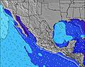 | 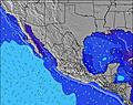 | 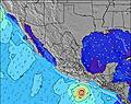 | 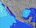 | ||||||||||||
Wave Height (m) Direction Period (s) | SW 13 | SW 13 | SW 12 | SW 16 | SW 15 | SW 15 | SW 14 | SW 14 | SW 14 | SW 20 | SW 13 | SSW 18 | SSW 18 | SSW 17 | SSW 17 | SSW 16 | SSW 16 | SSW 15 | SSW 14 |
Wave Graph | |||||||||||||||||||
83 | 79 | 73 | 90 | 69 | 54 | 103 | 99 | 102 | 144 | 140 | 286 | 216 | 475 | 448 | 487 | 561 | 344 | 400 | |
Wind (km/h) | |||||||||||||||||||
Wind State on-shore cross-onshore cross-shore cross-offshore off-shore glassy | off | glassy | glassy | off | cross | cross-off | off | cross | cross-off | off | cross-on | cross-off | off | cross-on | cross-off | glassy | cross-on | cross-off | off |
High Tide | 10:26PM1.40m | 11:11AM1.48m | 11:08PM1.23m | 11:43AM1.49m | 00:06AM1.05m | 12:27PM1.49m | 2:20AM0.89m | 1:33PM1.47m | 3:13PM1.48m | 7:44AM1.11m | 4:46PM1.57m | ||||||||
Low Tide | 4:42AM0.45m | 5:24PM0.62m | 5:03AM0.58m | 6:29PM0.64m | 5:22AM0.71m | 8:11PM0.62m | 5:23AM0.84m | 10:30PM0.51m | 11:51PM0.32m | 10:21AM1.07m | 00:42AM0.15m | ||||||||
— | 5:50 | — | — | 5:50 | — | — | 5:50 | — | — | 5:52 | — | — | 5:52 | — | — | 5:52 | — | — | |
— | — | 6:59 | — | — | 6:59 | — | — | 6:58 | — | — | 6:57 | — | — | 6:57 | — | — | 6:55 | — | |
mm | 4 | — | 3 | 3 | — | — | — | — | — | — | — | — | — | — | 1 | 2 | — | — | 3 |
Temp °C | 29 | 32 | 31 | 28 | 30 | 30 | 27 | 30 | 30 | 28 | 31 | 30 | 29 | 31 | 31 | 29 | 31 | 31 | 29 |
Feels °C | 31 | 36 | 35 | 32 | 33 | 31 | 29 | 33 | 32 | 30 | 35 | 34 | 32 | 35 | 34 | 33 | 35 | 35 | 33 |
Swell 1 Height (m) Direction Period (s) | SW 13 | SW 13 | SW 12 | SW 12 | SW 12 | SW 12 | SW 14 | SW 14 | SW 14 | SW 13 | SW 13 | SSW 18 | SW 13 | SSW 17 | SSW 17 | SSW 16 | SSW 16 | SSW 15 | SSW 14 |
83 | 79 | 73 | 51 | 69 | 50 | 103 | 99 | 102 | 144 | 140 | 286 | 170 | 475 | 448 | 487 | 561 | 344 | 400 | |
Swell 2 Height (m) Direction Period (s) | S 11 | S 9 | S 11 | SW 16 | SW 15 | SW 15 | S 11 | SSE 8 | S 8 | S 9 | S 9 | SW 13 | SSW 18 | SW 12 | S 9 | SW 12 | SW 12 | SW 12 | S 8 |
57 | 24 | 58 | 90 | 57 | 54 | 59 | 24 | 36 | 54 | 54 | 138 | 216 | 151 | 52 | 114 | 69 | 68 | 51 | |
Swell 3 Height (m) Direction Period (s) | SSW 18 | SSW 14 | SSW 13 | S 9 | SSW 13 | SSW 13 | SW 11 | SW 11 | SW 11 | SW 20 | SSW 18 | SSE 9 | SSE 8 | S 9 | SW 12 | SSE 9 | SSE 8 | SSE 8 | SW 11 |
30 | 37 | 35 | 23 | 33 | 32 | 31 | 31 | 32 | 97 | 127 | 58 | 39 | 54 | 87 | 42 | 40 | 28 | 76 | |
Wind waves Height (m) Direction Period (s) | W 4 | WNW 4 | W 4 | W 4 | W 4 | W 3 | W 3 | WNW 9 | WSW 3 | WNW 3 | WNW 4 | W 3 | WNW 4 | — | WNW 4 | WNW 4 | WNW 4 | WNW 4 | WNW 4 |
20 | 19 | 13 | 9 | 4 | 5 | 5 | 58 | 3 | 6 | 5 | 5 | 10 | — | 7 | 7 | 16 | 11 | 8 | |
Nearest Offshore or Glassy | |||||||||||||||||||
Distance (km) | 0 | 0 | 0 | 0 | 8 | 455 | 0 | 10 | 455 | 0 | 8 | 455 | 0 | 8 | 455 | 0 | 2 | 0 | 0 |
Best forecast wave conditions in Baja Sur | |||||||||||||||||||
Best forecast wave conditions in Mexico | |||||||||||||||||||
Header Global | |||||||||||||||||||
- Map Icons:
 Break
Break Live Wave Height (m)
 Live Wind Speed (km/h)
 Surf Rating (10 Max)
 Ocean Swells (m)
- Wind Speed (km/h)
Latest Updates


FREE! Surf-Forecast.com widget for your website
The surf report / weather widget below is available to embed on third party websites free of charge and provides a summary of our The Rock-Costa Azul surf forecast. Simply grab the html code snippet that we provide and paste it into your own site. You can choose your preferred language and metric/imperial units for the surf forecast feed to suit users of your site. Click here to get the code.
Information about the The Rock-Costa Azul Surf forecast
The above surf forecast table for The Rock-Costa Azul provides essential information for determining whether the surfing conditions will be good over the next 16 days. A general guide to surfing at The Rock-Costa Azul can be found by selecting the local surf guide option on the grey menu. Our The Rock-Costa Azul surf forecast is unique since it includes wave energy (power) that defines the real feel of the surf rather than just the height or the period. If you surf the same spot (The Rock-Costa Azul) regularly then make a mental note of the wave energy from the surf forecast table each time you go. Very soon you may start to choose your surf days based on the wave energy alone combined with our forecast of favourable offshore wind conditions. Our star ratings will help here and of course you will also find the usual wave height and period predictions on our surf forecasts as well as a full break down of the swell components under our advanced users option (to reveal that, click the little Einstein character under the tide times).
Further information to help with frequently asked questions about our surf forecast for The Rock-Costa Azul may be found under the help tab on the top menu and also by moving your mouse over the question marks on the surf forecast table itself. Please always bear in mind that the forecast is for near-shore open water and local factors at each surf break influence the actual breaking wave height, such as the beach / reef profile, water depths offshore and shelter.
The Rock-Costa Azul is 13 km (8 miles) from Cabo San Lucas. If you plan a holiday in Baja Sur, look for hotels and other accommodation in Cabo San Lucas. Cabo San Lucas has rooms for a wide range of budgets as well as car hire and transport links.
 Nearest