

Surf Forecasts:

Punta Palmilla surf forecast from 1 Aug 2026:
- Best quality surf: Friday 7 Aug, 8AM (local time) - 2.5ft (0.8m), 18s period, SSW swell with cross-offshore winds.
- Most powerful swell: Friday 7 Aug, 2PM (local time) - 3.5ft (1.0m), 17s period, SSW swell with 569 kJ wave energy.
- Next surfable swell (1★+): Friday 31 Jul, 11PM (local time) - 3ft (0.9m), 13s period with SSW swell.
Best Forecast Surf Conditions for Punta Palmilla this week:
The surf forecast for Punta Palmilla over the next 16 days: The first swell (rated 1 star or higher) is forecast to arrive on Friday (Jul 31) at 11PM. The primary swell is predicted to be 0.9m and 13s period with a secondary swell of 0.4m and 8s. The wind is predicted to be cross-offshore as the swell arrives.
The most powerful waves expected at Punta Palmilla in the next 16 days are 1.0m 17s and forecast to arrive on Friday (Aug 07) at 2PM. Winds are predicted to be cross-offshore at the time the swell arrives. The largest open ocean swell (not directed at the beach) is 1.0m 5s period and expected on Sunday (Aug 02) at 8PM.
| Wave Type | Time (MST) & Date | Wave Height & Period |
|---|---|---|
| Next good surf (1 star+) | 11PM (Fri 31st Jul) | 3ft (0.9m) 13s |
| Best Surf | 8AM (Fri 7th Aug) | 2.5ft (0.8m) 18s |
| Most Powerful | 2PM (Fri 7th Aug) | 3.5ft (1.0m) 17s |
Table - best surf conditions forecast for Punta Palmilla over the next 16 days.
The Lowdown
Alright, let’s get stuck into this one. It’s a tricky stretch ahead for Punta Palmilla, so let’s be real about it.
The start of this run is a write-off. Friday afternoon and all through the weekend, we’re looking at ankle-biters and messy winds. The swell’s just not there, and even though it’s clean, there’s nothing to ride. It’s a flat spell, so don’t even think about paddling out. This quiet, poor run actually carries through the first few days of August. We’re staring down a gap of a few days with no real surf to speak of. The energy is weak, with combined swell numbers around 140-270, which tells you everything you need to know. It’s a dead ocean.
Then things start to stir a little into the middle of next week. Tuesday the 4th might give you a tiny, glassy ankle-high slop. It’s surfable, but only just, and you’ll be scratching for anything. The energy ticks up slightly, to around 160, but it’s still pretty weak. There’s a period jump to 15 seconds on Tuesday afternoon, but the height is just so small it doesn’t translate into anything you can really sink your fins into.
The real story starts to build from Thursday the 6th into the weekend. The swell is still small, but there’s a noticeable increase in energy, moving from moderate up to strong. Thursday morning has 2ft of SSW swell with a 13-second period, and the energy reads 322, a big jump. It’s still messy with onshore winds, so the quality is poor, but the ocean is waking up.
Friday the 7th is where it gets interesting. The morning is still a bit cross-onshore, but the afternoon looks cleaner with a cross-offshore breeze. The swell has bumped up to 3ft from the SSW. The energy is cranking at 585-651, which is strong. This is the first real sign of life. This is your first proper window, and it looks promising.
Saturday the 8th and Sunday the 9th follow suit. The swell holds around 3ft, mostly from the SSW. The afternoons are looking best. Saturday afternoon has a lovely light cross-offshore wind and clean conditions, with energy at 511. Sunday afternoon is also clean, with a gentle cross-offshore breeze and energy at 444. These are good, clean, fun waves for a point break. They won’t be huge, but they’ll be well-shaped and the consistency is picking up.
There’s a bit of a lull again on Monday, with cross-shore winds messing up the surface, but don’t worry, the ocean is recharging. The energy remains high, but the wind is a bit of a factor.
The standout period is definitely the second half of the second week. We’re looking at August 12th and 13th. The swell is around 3ft from the SW, with longer periods of 15-16 seconds. This is proper groundswell, the kind that gives you push and shape. The kicker is the wind. Wednesday afternoon and all day Thursday are showing glassy or near-glass conditions with barely a breath of air. The energy is strong, reading around 500-600. This feels like the pick of the entire period. The water is well above average for this time of year, 4° warmer than usual, so you can probably ditch the booties.
After that, it starts to fade again. Friday the 14th and Saturday the 15th have a bit more size, up to 4ft, but the winds turn onshore or cross-shore, putting a chop on the surface. The magic is gone. The energy is still strong, but the quality just isn’t there.
So, in a nutshell, there’s not much to get excited about until late next week. The waves won’t be big, but for Punta Palmilla, the quality will be there. Keep your eyes on the 7th for the first clean one, but hold out for the 12th and 13th. That’s the gold.
Rusty.
Short Range ForecastModerate rain (total 10mm), heaviest on Sat night. Warm (max 32°C on Sat morning, min 27°C on Sun night). Wind will be generally light. | Days 5-7 Weather SummaryLight rain (total 5mm), mostly falling on Mon afternoon. Warm (max 31°C on Mon afternoon, min 26°C on Wed night). Wind will be generally light. | |||||||||||||||||||
Fri 31 | Saturday 1 | Sunday 2 | Monday 3 | Tuesday 4 | Wednesday 5 | Thursday 6 | ||||||||||||||
PM | Night | AM | PM | Night | AM | PM | Night | AM | PM | Night | AM | PM | Night | AM | PM | Night | AM | PM | Night | |
Swell Height Map |  |  |  | 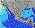 | 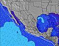 | 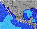 | 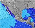 | |||||||||||||
Wave Height (m) Direction Period (s) | SSW 13 | SSW 13 | SSW 12 | SW 14 | S 12 | SSW 13 | SW 13 | SW 13 | SW 13 | SW 12 | SW 16 | SW 15 | SW 15 | SW 14 | SW 14 | SW 14 | SW 20 | SW 13 | SSW 18 | SSW 18 |
Wave Graph | ||||||||||||||||||||
396 | 321 | 155 | 152 | 103 | 195 | 140 | 83 | 79 | 73 | 90 | 69 | 54 | 103 | 99 | 102 | 144 | 140 | 289 | 216 | |
Wind (km/h) | ||||||||||||||||||||
Wind State on-shore cross-onshore cross-shore cross-offshore off-shore glassy | cross-off | off | cross | cross-off | off | cross-on | cross-off | off | cross | off | cross-off | glassy | cross-off | cross-off | cross-on | cross | cross-off | cross-on | cross | off |
High Tide | 9:18PM1.64m | 10:22AM1.41m | 9:51PM1.54m | 10:45AM1.45m | 10:26PM1.40m | 11:11AM1.48m | 11:08PM1.23m | 11:43AM1.49m | 00:06AM1.05m | 12:27PM1.49m | 2:20AM0.89m | 1:33PM1.47m | ||||||||
Low Tide | 3:19PM0.66m | 3:58AM0.23m | 3:55PM0.64m | 4:20AM0.33m | 4:36PM0.62m | 4:42AM0.45m | 5:24PM0.62m | 5:03AM0.58m | 6:29PM0.64m | 5:22AM0.71m | 8:11PM0.62m | 5:23AM0.84m | 10:30PM0.51m | |||||||
— | — | 5:50 | — | — | 5:50 | — | — | 5:50 | — | — | 5:50 | — | — | 5:50 | — | — | 5:52 | — | — | |
7:00 | — | — | 7:00 | — | — | 7:00 | — | — | 6:59 | — | — | 6:59 | — | — | 6:58 | — | — | 6:57 | — | |
mm | — | — | — | 1 | 7 | — | — | 2 | — | 2 | 1 | — | 2 | — | — | — | — | — | — | — |
Temp °C | 31 | 29 | 32 | 32 | 29 | 31 | 31 | 29 | 30 | 31 | 29 | 30 | 30 | 28 | 30 | 29 | 27 | 30 | 30 | 27 |
Feels °C | 32 | 31 | 36 | 33 | 30 | 34 | 32 | 30 | 33 | 33 | 33 | 34 | 33 | 31 | 33 | 31 | 29 | 33 | 32 | 29 |
Swell 1 Height (m) Direction Period (s) | SSW 13 | SSW 13 | SSW 12 | SSW 12 | S 12 | SSW 13 | SW 13 | SW 13 | SW 13 | SW 12 | SW 12 | SW 12 | SW 12 | SW 14 | SW 14 | S 8 | SW 13 | S 9 | SSW 18 | SW 13 |
396 | 321 | 155 | 152 | 103 | 195 | 140 | 83 | 79 | 73 | 51 | 69 | 50 | 103 | 99 | 36 | 144 | 55 | 289 | 172 | |
Swell 2 Height (m) Direction Period (s) | WSW 8 | WSW 8 | SW 14 | SW 14 | SW 14 | W 5 | S 11 | S 11 | S 9 | S 11 | SW 16 | SW 15 | SW 15 | S 11 | S 8 | SW 14 | S 9 | SW 13 | SW 13 | SSW 18 |
45 | 23 | 102 | 127 | 92 | 11 | 66 | 55 | 24 | 58 | 90 | 57 | 54 | 59 | 37 | 102 | 56 | 140 | 138 | 216 | |
Swell 3 Height (m) Direction Period (s) | SSW 16 | SSW 16 | WSW 8 | SSE 7 | W 8 | WSW 8 | WSW 18 | SSW 18 | SSW 14 | SSW 13 | S 9 | SSW 13 | SSW 13 | SW 11 | SW 11 | SW 11 | SW 20 | SSW 18 | SSE 9 | SSE 9 |
26 | 25 | 19 | 5 | 35 | 22 | 31 | 30 | 37 | 35 | 24 | 33 | 32 | 31 | 30 | 32 | 97 | 127 | 59 | 59 | |
Wind waves Height (m) Direction Period (s) | W 5 | WNW 3 | WNW 3 | W 9 | WNW 4 | WNW 5 | W 4 | WNW 5 | WNW 4 | W 4 | W 3 | W 4 | W 4 | W 3 | — | WSW 6 | — | NW 9 | WSW 3 | WNW 3 |
7 | 5 | 2 | 130 | 19 | 28 | 27 | 22 | 14 | 13 | 8 | 7 | 9 | 2 | — | 3 | — | 21 | 2 | 3 | |
Nearest Offshore or Glassy | ||||||||||||||||||||
Distance (km) | 78 | 0 | 1 | 3 | 0 | 8 | 3 | 0 | 1 | 0 | 0 | 0 | 0 | 0 | 8 | 1 | 0 | 11 | 500 | 0 |
Best forecast wave conditions in Baja Sur | ||||||||||||||||||||
Best forecast wave conditions in Mexico | ||||||||||||||||||||
Header Global | ||||||||||||||||||||
- Map Icons:
 Break
Break Live Wave Height (m)
 Live Wind Speed (km/h)
 Surf Rating (10 Max)
 Ocean Swells (m)
- Wind Speed (km/h)
Latest Updates


FREE! Surf-Forecast.com widget for your website
The surf report / weather widget below is available to embed on third party websites free of charge and provides a summary of our Punta Palmilla surf forecast. Simply grab the html code snippet that we provide and paste it into your own site. You can choose your preferred language and metric/imperial units for the surf forecast feed to suit users of your site. Click here to get the code.
Information about the Punta Palmilla Surf forecast
The above surf forecast table for Punta Palmilla provides essential information for determining whether the surfing conditions will be good over the next 16 days. A general guide to surfing at Punta Palmilla can be found by selecting the local surf guide option on the grey menu. Our Punta Palmilla surf forecast is unique since it includes wave energy (power) that defines the real feel of the surf rather than just the height or the period. If you surf the same spot (Punta Palmilla) regularly then make a mental note of the wave energy from the surf forecast table each time you go. Very soon you may start to choose your surf days based on the wave energy alone combined with our forecast of favourable offshore wind conditions. Our star ratings will help here and of course you will also find the usual wave height and period predictions on our surf forecasts as well as a full break down of the swell components under our advanced users option (to reveal that, click the little Einstein character under the tide times).
Further information to help with frequently asked questions about our surf forecast for Punta Palmilla may be found under the help tab on the top menu and also by moving your mouse over the question marks on the surf forecast table itself. Please always bear in mind that the forecast is for near-shore open water and local factors at each surf break influence the actual breaking wave height, such as the beach / reef profile, water depths offshore and shelter.
Punta Palmilla is 12 km (7 miles) from Cabo San Lucas. If you plan a holiday in Baja Sur, look for hotels and other accommodation in Cabo San Lucas. Cabo San Lucas has rooms for a wide range of budgets as well as car hire and transport links.
 Nearest